| Home | City Bus | Maps | Villages | Cities | Rail | Tourist Places | School | College | Pin Codes | Corona Cases Count |
| Distance Calculator Bus Services IFSC Codes Trace Mobile Number Weather Search Place Trace IP Available Cash ATM/Banks Locate Polling Booth Report an Error contact People |
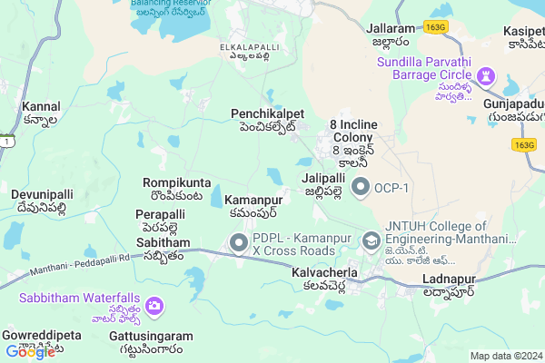
Konaraopet
Konaraopet Map
EDIT Map
Add Your House
 ..
..
Current Corona Virus Infected Patients Count in Karimnagar District
| City Name | District Name | Total Covid cases |
|---|---|---|
| Karimnagar District | Karimnagar | 16 |
| Rajanna Sircilla District | Rajanna Sircilla | 3 |
| Karimnagar | Karimnagar | 3 |
| Peddapalli District | Peddapalli | 2 |
| Siddipet District | Siddipet | 1 |
Locality Name :
Konaraopet
( కోనరావుపేట )
Mandal Name : Julapalli
District : Karimnagar
State : Telangana
Region : Telangana
Language : Telugu and Urdu
Current Time 01:56 PM
Date: Monday , Apr 28,2025 (IST)
Time zone: IST (UTC+5:30)
Elevation / Altitude: 241 meters. Above Seal level
Telephone Code / Std Code: 08728
Assembly constituency : Manthani assembly constituency
Assembly MLA : Duddilla Sridhar Babu
Lok Sabha constituency : Peddapalli parliamentary constituency
Parliament MP : Venkatesh Netha Borlakunta
Serpanch Name :
Pin Code : 505525
Post Office Name : Eligaid
Main Village Name : Julapally
Commodities Prices : Peddapalli Market / Mandi
Edit below overview about Konaraopet
Edit below overview about Konaraopet
OverView of Konaraopet
you know reach konaraopet so please follow our guide lance Karimnagar to Peddapally stop other wise going to Peddapalli Janda Chowrasta ( Nagarapanchaith office ) Julpalli Autos and Jeeps available here. so going to Julapalli stop other wise You have reach Kanaraopet Village Happy Journey.Edit below overview about Konaraopet
Rivers Near Konaraopet
Are Vagu
Godavari :गोदावरी :ಗೋದಾವರಿ :गोदावरी :கோதாவரி :గోదావరి
Are Vagu
Godavari :गोदावरी :ಗೋದಾವರಿ :गोदावरी :கோதாவரி :గోదావరి
About Konaraopet
Konaraopet is a small Village/hamlet in Julapalli Mandal in Karimnagar District of Telangana State, India. It comes under Julapally Panchayath. It belongs to Telangana region . It is located 56 KM towards East from District head quarters Karimnagar. 31 KM from Julapally.
Konaraopet Pin code is 505525 and postal head office is Eligaid .
Konaraopet is surrounded by Ramagundam Mandal towards North , Peddapalli Mandal towards west , Manthani Mandal towards East , Mutharam (Manthani) Mandal towards South .
Ramagundam , Mancherial , Mandamarri , Bellampalle are the near by Cities to Konaraopet.
Demographics of Konaraopet
Telugu is the Local Language here. Total population of Konaraopet is 6007 .Males are 2952 and Females are 3,055 living in 1450 Houses. Total area of Konaraopet is 1117 hectares.Politics in Konaraopet
TDP , TRS , PRAP , INC are the major political parties in this area.Polling Stations /Booths near Konaraopet
1)Jeelapalli2)Julapalli
3)Julapalli
4)Kamanpur
5)Kalvacherla
HOW TO REACH Konaraopet
By Road
Ramagundam is the Nearest Town to Konaraopet. Ramagundam is 24 km from Konaraopet. Road connectivity is there from Ramagundam to Konaraopet.By Rail
There is no railway station near to Konaraopet in less than 10 km. How ever there are railway Stations from Near By town Ramagundam. are the railway Stations near to Ramagundam. You can reach from Ramagundam to Konaraopet by road after .Colleges near Konaraopet
Tsmsc
Address :
Jawaharlal Nehru Jr College Julapally
Address : Jawaharlal Nehru Jr College Julapally
Schools in Konaraopet
Nalanda Vidyalayam High School
Address : near manthota
Sadhana Vidyalayam High School
Address :
Govt Health Centers near Konaraopet
1) Primary Health Centre, Julapalli , , mainroad , school2) SubCentre Julapally , Jan-54 , MALLIKARJUN NAGAR , NEAR:UPS
3) SubCentre Kamanpur , , AMBEDKAR NAGAR , OPPOSITE: SBH BANK
Petrol Bunks in Konaraopet,Julapalli
RATNAPUR FUEL CENTRE
Begumpet X raod - Gandhi Nagar(NRS) Rd; Rangapur X Road; Nagepally; Telangana 505188; India
7.7 KM distance Detail
Indian Oil Petrol Pump
Ram Nagar; Jawahar Nagar; Godavarikhani; Ramagundam; Telangana 505211; India
10.3 KM distance Detail
more ..
Colleges in Konaraopet,Julapalli
Government Junior College Kamanpur
Peddapalli - Kamanpur Rd; Kamanpur; Telangana 505188; India
2.1 KM distance Detail
more ..
Super Markets in Konaraopet,Julapalli
YOGINI KIRANAM
505209; Dwaraka Nagar; Godavarikhani; Ramagundam; Telangana; India
0.6 KM distance Detail
Local Parks in Konaraopet,Julapalli
KV School Playing Grounds
Fertilizer Coroporation Of India; Godavarikhani; Ramagundam; Telangana 505210; India
7.8 KM distance Detail
Police Stations near Konaraopet,Julapalli
GDK Sub Division
Manthani Road; GDK To 8 Incline Colony Rd; Bhaskar Rao Nagar; 8 Incline Colony; Telangana 505188; India
4.7 KM distance Detail
2 Town Police Station - 8 Incline Colony
8 Incline Colony; Telangana 505211; India
4.7 KM distance Detail
About Konaraopet &
History
How to reach Konaraopet
Tourist Places Near By Konaraopet
Schools in Konaraopet
Colleges in Konaraopet
Temperature & weather of Konaraopet
places in Konaraopet
Konaraopet photos
More Information
How to reach Konaraopet
Tourist Places Near By Konaraopet
Schools in Konaraopet
Colleges in Konaraopet
Temperature & weather of Konaraopet
places in Konaraopet
Konaraopet photos
More Information
Village Talk
Post News or Events about this Village
Near Cities
Ramagundam 12 KM near
Mancherial 25 KM near
Mandamarri 39 KM near
Bellampalle 48 KM near
Ramagundam 12 KM near
Mancherial 25 KM near
Mandamarri 39 KM near
Bellampalle 48 KM near
Near By Taluks
Kamanpur 2 KM near
Ramagundam 15 KM near
Peddapalli 16 KM near
Manthani 18 KM near
Kamanpur 2 KM near
Ramagundam 15 KM near
Peddapalli 16 KM near
Manthani 18 KM near
Near By Air Ports
Rajiv Gandhi International Airport 219 KM near
Nanded Airport 266 KM near
Sonegaon Airport 306 KM near
Vijayawada Airport 307 KM near
Rajiv Gandhi International Airport 219 KM near
Nanded Airport 266 KM near
Sonegaon Airport 306 KM near
Vijayawada Airport 307 KM near
Near By Tourist Places
Warangal 84 KM near
Medaram 96 KM near
Sirpur 100 KM near
Bhamragarh Wildlife Sanctuary 157 KM near
Chandrapur 161 KM near
Warangal 84 KM near
Medaram 96 KM near
Sirpur 100 KM near
Bhamragarh Wildlife Sanctuary 157 KM near
Chandrapur 161 KM near
Near By Districts
Karimnagar 53 KM near
Warangal 85 KM near
Bijapur 154 KM near
Chandrapur 161 KM near
Karimnagar 53 KM near
Warangal 85 KM near
Bijapur 154 KM near
Chandrapur 161 KM near
Near By RailWay Station
Ramagundam Rail Way Station 14 KM near
Peddapalli Junction Rail Way Station 15 KM near
Ramagundam Rail Way Station 14 KM near
Peddapalli Junction Rail Way Station 15 KM near