| Home | City Bus | Maps | Villages | Cities | Rail | Tourist Places | School | College | Pin Codes | Corona Cases Count |
| Distance Calculator Bus Services IFSC Codes Trace Mobile Number Weather Search Place Trace IP Available Cash ATM/Banks Locate Polling Booth Report an Error contact People |
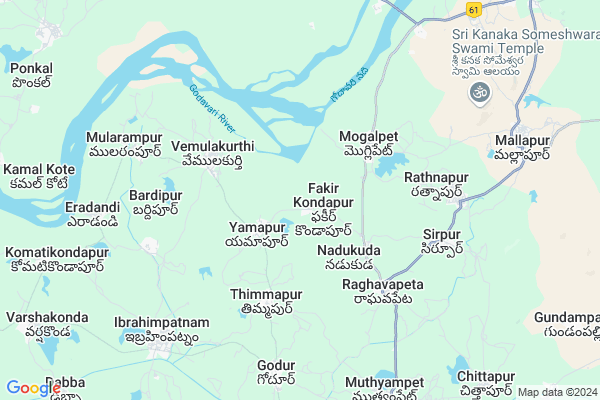
Fakir Kondapur
Fakir Kondapur Map
EDIT Map
Add Your House
 ..
..
Current Corona Virus Infected Patients Count in Karimnagar District
| City Name | District Name | Total Covid cases |
|---|---|---|
| Karimnagar District | Karimnagar | 16 |
| Karimnagar | Karimnagar | 3 |
| Rajanna Sircilla District | Rajanna Sircilla | 3 |
| Peddapalli District | Peddapalli | 2 |
| Siddipet District | Siddipet | 1 |
Locality Name :
Fakir Kondapur
( ఫకీర్ కొండాపూర్ )
Mandal Name : Ibrahimpatnam
District : Karimnagar
State : Telangana
Region : Telangana
Language : Telugu and Urdu
Current Time 12:45 PM
Date: Thursday , Apr 24,2025 (IST)
Time zone: IST (UTC+5:30)
Elevation / Altitude: 293 meters. Above Seal level
Telephone Code / Std Code: 08725
Assembly constituency : Koratla assembly constituency
Assembly MLA : Kalvakuntla Sanjay
Lok Sabha constituency : Nizamabad parliamentary constituency
Parliament MP : ARVIND DHARMAPURI
Serpanch Name :
Pin Code : 505450
Post Office Name : Ibrahimpatnam (Karim Nagar)
Alternate Village Name : Fakir Kondapoor
Commodities Prices : Ibrahimpatnam Market / Mandi
Fakir Kondapur Live Weather
Temperature: 42.4 °C
clear sky
Humidity: 10%
Wind : 3.12 mt/sec towards NE
StationName : "Koratla"
observed on Now
Temperature: 42.4 °C
clear sky
Humidity: 10%
Wind : 3.12 mt/sec towards NE
StationName : "Koratla"
observed on Now
Fakir Kondapur Weather Forecast for Next 5 days
25-04-2025
32.7°C to 44.1°C
clear sky, few clouds
32.7°C to 44.1°C
clear sky, few clouds
26-04-2025
31.2°C to 43.8°C
scattered clouds, few clouds, clear sky, broken clouds
31.2°C to 43.8°C
scattered clouds, few clouds, clear sky, broken clouds
27-04-2025
30.2°C to 41.6°C
broken clouds, overcast clouds, few clouds, light rain
30.2°C to 41.6°C
broken clouds, overcast clouds, few clouds, light rain
28-04-2025
28.1°C to 38.6°C
broken clouds, overcast clouds, light rain, scattered clouds, clear sky
28.1°C to 38.6°C
broken clouds, overcast clouds, light rain, scattered clouds, clear sky
29-04-2025
27.1°C to 42.7°C
clear sky, few clouds
27.1°C to 42.7°C
clear sky, few clouds
Edit below overview about Fakir Kondapur
Edit below overview about Fakir Kondapur
OverView of Fakir Kondapur
Fakir Kondapur has fertile land irregated by Ganganala project,will get 2 crops of paddy each year,without lift irrigation.The name is given to the village during the period of Nizam,still there is durga which is worshiped by Hindus.Godavari water falls in the middle of forest is tourist attraction,best seen in rainy season,is just 1 kilometer awayEdit below overview about Fakir Kondapur
Rivers Near Fakir Kondapur
Peddayya VAgu
Godavari :ગોદાવરી :गोदावरी :ಗೋದಾವರೀ :गोदावरी :గోదావరి
Peddayya VAgu
Godavari :ગોદાવરી :गोदावरी :ಗೋದಾವರೀ :गोदावरी :గోదావరి
About Fakir Kondapur
Fakir Kondapur is a Village in Ibrahimpatnam Mandal in Karimnagar District of Telangana State, India. It belongs to Telangana region . It is located 91 KM towards North from District head quarters Karimnagar. 7 KM from Ibrahimpatnam.
Fakir Kondapur Pin code is 505450 and postal head office is Ibrahimpatnam (Karim Nagar).
Nadikuda ( 2 KM ) , Moglipet ( 3 KM ) , Raghavapet ( 4 KM ) , Vemulakurthy ( 4 KM ) , Rathnapur ( 5 KM ) are the nearby Villages to Fakir Kondapur. Fakir Kondapur is surrounded by Ibrahimpatnam Mandal towards west , Korutla Mandal towards South , Metpalli Mandal towards South , Khanapur Mandal towards North .
Koratla , Jagtial , Nirmal , Sircilla are the near by Cities to Fakir Kondapur.
This Place is in the border of the Karimnagar District and Nizamabad District. Nizamabad District Kammarapalle is South towards this place . Also it is in the Border of other district Adilabad .
Demographics of Fakir Kondapur
Telugu is the Local Language here. Total population of Fakir Kondapur is 635 .Males are 306 and Females are 329 living in 152 Houses. Total area of Fakir Kondapur is 507 hectares.Politics in Fakir Kondapur
TRS , INC are the major political parties in this area.Polling Stations /Booths near Fakir Kondapur
1)Errapur2)Yakeenpur
3)Yamapur
4)Muthyasmpet
5)Mogilipet
HOW TO REACH Fakir Kondapur
By Road
Koratla is the Nearest Town to Fakir Kondapur. Koratla is 22 km from Fakir Kondapur. Road connectivity is there from Koratla to Fakir Kondapur.By Rail
There is no railway station near to Fakir Kondapur in less than 10 km.Colleges near Fakir Kondapur
Govt Colleage
Address : Near Zphs School
Schools in Fakir Kondapur
Mpups Fakirkondapur
Address : fakir kondapur , ibrahimpatnam , karimnagar , Andhra Pradesh . PIN- 505450 , Post - Ibrahimpatnam (Karim Nagar)
Govt Health Centers near Fakir Kondapur
1) Subcentre Mogilipeta , 13-Feb , Main Road , Grama Panchayithi2) Subcentre Raghavapeta , Feb-63 , Main Road , Bus Stand Area
3) Subcentre Vemulakurthy , 2-51, , Grama Pnachayithi , Banjarudoddi
Petrol Bunks in Fakir Kondapur,Ibrahimpatnam
HP PETROL PUMP - SRI MALLIKARJUNA FS
Survey NO 439 Ibrahim Patnam TS; Ibrahimpatnam; Telangana 505450; India
9.5 KM distance Detail
more ..
Colleges in Fakir Kondapur,Ibrahimpatnam
Government Junior College
Gonekapu Wada; Ibrahimpatnam; Telangana 505450; India
8.1 KM distance Detail
Govt Junior College.Ibrahimpatnam 505450
Ibrahimpatnam; Telangana 505450; India
8.8 KM distance Detail
more ..
Electronic Shops in Fakir Kondapur,Ibrahimpatnam
SRI RAJA RAJESHWARA ENGINEERING & ELECTRICAL. SIRPUR
Sirpoor; Telangana 505331; India
6.2 KM distance Detail
Super Markets in Fakir Kondapur,Ibrahimpatnam
Prasad Goud General Store
New Bus Stand Main Road; Ibrahimpatnam; Telangana 505450; India
8.5 KM distance Detail
About Fakir Kondapur &
History
How to reach Fakir Kondapur
Tourist Places Near By Fakir Kondapur
Schools in Fakir Kondapur
Colleges in Fakir Kondapur
Temperature & weather of Fakir Kondapur
places in Fakir Kondapur
Fakir Kondapur photos
More Information
How to reach Fakir Kondapur
Tourist Places Near By Fakir Kondapur
Schools in Fakir Kondapur
Colleges in Fakir Kondapur
Temperature & weather of Fakir Kondapur
places in Fakir Kondapur
Fakir Kondapur photos
More Information
Village Talk
Post News or Events about this Village
Near Cities
Koratla 19 KM near
Jagtial 38 KM near
Nirmal 38 KM near
Sircilla 72 KM near
Koratla 19 KM near
Jagtial 38 KM near
Nirmal 38 KM near
Sircilla 72 KM near
Near By Taluks
Ibrahimpatnam 6 KM near
Mallapur 6 KM near
Korutla 17 KM near
Metpalli 18 KM near
Ibrahimpatnam 6 KM near
Mallapur 6 KM near
Korutla 17 KM near
Metpalli 18 KM near
Near By Air Ports
Nanded Airport 157 KM near
Rajiv Gandhi International Airport 214 KM near
Latur Airport 263 KM near
Sonegaon Airport 271 KM near
Nanded Airport 157 KM near
Rajiv Gandhi International Airport 214 KM near
Latur Airport 263 KM near
Sonegaon Airport 271 KM near
Near By Tourist Places
Medak 120 KM near
Sirpur 129 KM near
Chandrapur 147 KM near
Warangal 165 KM near
Bidar 182 KM near
Medak 120 KM near
Sirpur 129 KM near
Chandrapur 147 KM near
Warangal 165 KM near
Bidar 182 KM near
Near By Districts
Nizamabad 72 KM near
Karimnagar 87 KM near
Adilabad 91 KM near
Chandrapur 149 KM near
Nizamabad 72 KM near
Karimnagar 87 KM near
Adilabad 91 KM near
Chandrapur 149 KM near
Near By RailWay Station
Nizamabad Junction Rail Way Station 70 KM near
Basar Rail Way Station 82 KM near
Nizamabad Junction Rail Way Station 70 KM near
Basar Rail Way Station 82 KM near