| Home | City Bus | Maps | Villages | Cities | Rail | Tourist Places | School | College | Pin Codes | Corona Cases Count |
| Distance Calculator Bus Services IFSC Codes Trace Mobile Number Weather Search Place Trace IP Available Cash ATM/Banks Locate Polling Booth Report an Error contact People |
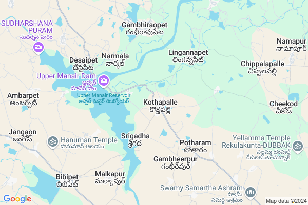
Kothapally
Kothapally Map
EDIT Map
Add Your House
 ..
..
Current Corona Virus Infected Patients Count in Karimnagar District
| City Name | District Name | Total Covid cases |
|---|---|---|
| Karimnagar District | Karimnagar | 16 |
| Karimnagar | Karimnagar | 3 |
| Rajanna Sircilla District | Rajanna Sircilla | 3 |
| Peddapalli District | Peddapalli | 2 |
| Siddipet District | Siddipet | 1 |
Locality Name :
Kothapally
( కొత్తపల్లి )
Mandal Name : Gambhiraopet
District : Karimnagar
State : Telangana
Region : Telangana
Language : Telugu and Urdu
Current Time 01:03 PM
Date: Sunday , Apr 27,2025 (IST)
Time zone: IST (UTC+5:30)
Elevation / Altitude: 549 meters. Above Seal level
Telephone Code / Std Code: 08468
Assembly constituency : Sircilla assembly constituency
Assembly MLA : Kalvakuntla Taraka Rama Rao (K.T.R)
Lok Sabha constituency : Karimnagar parliamentary constituency
Parliament MP : BANDI SANJAY KUMAR
Serpanch Name :
Pin Code : 505304
Post Office Name : Gambhiraopet
Commodities Prices : Pothgal Market / Mandi
Kothapally Live Weather
Temperature: 38.2 °C
few clouds
Humidity: 24%
Wind : 5.25 mt/sec towards SE
StationName : "Sirsilla"
observed on Now
Temperature: 38.2 °C
few clouds
Humidity: 24%
Wind : 5.25 mt/sec towards SE
StationName : "Sirsilla"
observed on Now
Kothapally Weather Forecast for Next 5 days
28-04-2025
26.7°C to 35.8°C
light rain, scattered clouds
26.7°C to 35.8°C
light rain, scattered clouds
29-04-2025
25.8°C to 39.9°C
few clouds, clear sky, scattered clouds
25.8°C to 39.9°C
few clouds, clear sky, scattered clouds
30-04-2025
27.5°C to 40.8°C
few clouds, clear sky, broken clouds, scattered clouds
27.5°C to 40.8°C
few clouds, clear sky, broken clouds, scattered clouds
01-05-2025
28.4°C to 42.2°C
few clouds, scattered clouds
28.4°C to 42.2°C
few clouds, scattered clouds
02-05-2025
28.2°C to 42.8°C
scattered clouds, clear sky, few clouds
28.2°C to 42.8°C
scattered clouds, clear sky, few clouds
Edit below overview about Kothapally
Edit below overview about Kothapally
OverView of Kothapally
Upper Manair overflow dam is very near (about 5 km) from Kothapally. It is a beautiful scene when the dam is full of water and overflows. It is a popular attraction and picnic spot during those times.Edit below overview about Kothapally
Rivers Near Kothapally
Kurel Vagu
Maneru :మానేరు
Kurel Vagu
Maneru :మానేరు
About Kothapally
Kothapally is a Village in Gambhiraopet Mandal in Karimnagar District of Telangana State, India. It belongs to Telangana region . It is located 71 KM towards west from District head quarters Karimnagar. 6 KM from Gambhiraopet.
Kothapally Pin code is 505304 and postal head office is Gambhiraopet .
Srigadha ( 3 KM ) , Lingannapet ( 4 KM ) , Mucherla ( 4 KM ) , Narmal ( 5 KM ) , Gambhiraopet ( 6 KM ) are the nearby Villages to Kothapally. Kothapally is surrounded by Mustabad Mandal towards East , Dubbak Mandal towards South , Machareddy Mandal towards North , Domakonda Mandal towards west .
Kamareddy , Sircilla , Siddipet , Medak are the near by Cities to Kothapally.
This Place is in the border of the Karimnagar District and Nizamabad District. Nizamabad District Machareddy is North towards this place .
Demographics of Kothapally
Telugu is the Local Language here. Total population of Kothapally is 4767 .Males are 2354 and Females are 2,413 living in 993 Houses. Total area of Kothapally is 1529 hectares.Politics in Kothapally
TDP , TRS , INC are the major political parties in this area.Polling Stations /Booths near Kothapally
1)Kothapalli2)Kothapalli
3)Korutlapet
4)Kothapalli
5)Rajannapet
HOW TO REACH Kothapally
By Road
Kamareddy is the Nearest Town to Kothapally. Kamareddy is 37 km from Kothapally. Road connectivity is there from Kamareddy to Kothapally.By Rail
There is no railway station near to Kothapally in less than 10 km. How ever there are railway Stations from Near By town Kamareddy. are the railway Stations near to Kamareddy. You can reach from Kamareddy to Kothapally by road after .Colleges near Kothapally
Sri Rama Jr College
Address :
Schools near Kothapally
Kasturiba Gandhi Balika Vid
Address : gambhiraopet , gambhiraopet , karimnagar , Andhra Pradesh . PIN- 505304 , Post - Gambhiraopet
Zphs Dammannapeta
Address : dammannapeta , gambhiraopet , karimnagar , Andhra Pradesh . PIN- 505304 , Post - Gambhiraopet
Vivekananda Hs,g.pet
Address : gambhiraopet , gambhiraopet , karimnagar , Andhra Pradesh . PIN- 505304 , Post - Gambhiraopet
Zphs Gambhiraopet
Address : gambhiraopet , gambhiraopet , karimnagar , Andhra Pradesh . PIN- 505304 , Post - Gambhiraopet
Govt Health Centers near Kothapally
1) SubCentre, Kotapally , , , Near Primary School2) SubCentre, Kothapally , , Samskar , Samskar
3) Subcentre Kothapally , 25-Feb , Bc Colony ,
Hospitals in Kothapally,Gambhiraopet
Sairam dental hospital
Gambhiraopet - Siddipet Rd; Gambhiraopet; Telangana 505304; India
6.3 KM distance Detail
more ..
Petrol Bunks in Kothapally,Gambhiraopet
Indian Oil Petrol Pump Cheekode
Dubbak To Kamareddy Rd; Dubbak; Telangana 502108; India
10.6 KM distance Detail
more ..
Schools in Kothapally,Gambhiraopet
AWC Center 3
AWC Center 3 ; Room no 101 ; Kothapally ; Gambhiraopet ; Rajanna Siricilla; Pin : 505304; Dubbak - Kanteshwar Road; Kothapally; Telangana 505304; India
0.7 KM distance Detail
Ravindra Library
Kothapally; Near Hanuman temple; Gambhiraopet; Telangana 505304; India
0.8 KM distance Detail
Electronic Shops in Kothapally,Gambhiraopet
LG Electronics
Sri Vedic Electronics; survey 57; MCK Block 2; Opp Sangamitra School; Hydernagar; Nizampet Road; Kukatpalli; Hyderabad; TG 500072; India
5.5 KM distance Detail
Sri Ramanjaneya Auto Mobils
Dubbak To Kamareddy Rd; Kothapally; Telangana 502108; India
15.0 KM distance Detail
Super Markets in Kothapally,Gambhiraopet
Lachapet Kiranam
4/1; 8-83; Dubbak - Lachapet Rd; Lachapet; Telangana 502108; India
13.5 KM distance Detail
Police Stations near Kothapally,Gambhiraopet
PPI SUB DIVISION ON 01.02.2015
TIME:01:45 HRS TO 02:30 HRS VELGATOOR SI B. ANJAIAH CONDUCTED VEHICLE CHECKING; Cinema Rd; Dubbak; Telangana 502108; India
15.2 KM distance Detail
Governement Offices near Kothapally,Gambhiraopet
MeeSeva Center
Kothapalle (L); Gambhiraopet (M); Karimnagar (Dist); Kothapally; Telangana 505304; India
0.8 KM distance Detail
MeeSeva Center
5-102; Chiranjeevulu Shaping ; Main Road; Opp Of Gandhi Statch; Lingannapet(V); Gambhiraopet(M); Karimagar Dist.; Lingannapet; Telangana 505304; India
4.6 KM distance Detail
About Kothapally &
History
How to reach Kothapally
Tourist Places Near By Kothapally
Schools in Kothapally
Colleges in Kothapally
Temperature & weather of Kothapally
places in Kothapally
Kothapally photos
More Information
How to reach Kothapally
Tourist Places Near By Kothapally
Schools in Kothapally
Colleges in Kothapally
Temperature & weather of Kothapally
places in Kothapally
Kothapally photos
More Information
Village Talk
Post News or Events about this Village
Near Cities
Kamareddy 29 KM near
Sircilla 32 KM near
Siddipet 36 KM near
Medak 45 KM near
Kamareddy 29 KM near
Sircilla 32 KM near
Siddipet 36 KM near
Medak 45 KM near
Near By Taluks
Gambhiraopet 6 KM near
Mustabad 14 KM near
Dubbak 14 KM near
Domakonda 15 KM near
Gambhiraopet 6 KM near
Mustabad 14 KM near
Dubbak 14 KM near
Domakonda 15 KM near
Near By Air Ports
Rajiv Gandhi International Airport 128 KM near
Nanded Airport 188 KM near
Latur Airport 250 KM near
Sholapur Airport 323 KM near
Rajiv Gandhi International Airport 128 KM near
Nanded Airport 188 KM near
Latur Airport 250 KM near
Sholapur Airport 323 KM near
Near By Tourist Places
Medak 45 KM near
Hyderabad 109 KM near
Warangal 126 KM near
Bidar 129 KM near
Sirpur 192 KM near
Medak 45 KM near
Hyderabad 109 KM near
Warangal 126 KM near
Bidar 129 KM near
Sirpur 192 KM near
Near By Districts
Karimnagar 68 KM near
Nizamabad 76 KM near
Medak 98 KM near
Hyderabad 103 KM near
Karimnagar 68 KM near
Nizamabad 76 KM near
Medak 98 KM near
Hyderabad 103 KM near
Near By RailWay Station
Kamareddi Rail Way Station 30 KM near
Nizamabad Junction Rail Way Station 76 KM near
Kamareddi Rail Way Station 30 KM near
Nizamabad Junction Rail Way Station 76 KM near