| Home | City Bus | Maps | Villages | Cities | Rail | Tourist Places | School | College | Pin Codes | Corona Cases Count |
| Distance Calculator Bus Services IFSC Codes Trace Mobile Number Weather Search Place Trace IP Available Cash ATM/Banks Locate Polling Booth Report an Error contact People |
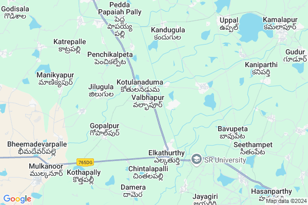
Ramakistapur
Ramakistapur Map
EDIT Map
Add Your House
 ..
..
Current Corona Virus Infected Patients Count in Karimnagar District
| City Name | District Name | Total Covid cases |
|---|---|---|
| Karimnagar District | Karimnagar | 16 |
| Rajanna Sircilla District | Rajanna Sircilla | 3 |
| Karimnagar | Karimnagar | 3 |
| Peddapalli District | Peddapalli | 2 |
| Siddipet District | Siddipet | 1 |
Locality Name :
Ramakistapur
( రామకిస్తాపూర్ )
Mandal Name : Elkathurthi
District : Karimnagar
State : Telangana
Region : Telangana
Language : Telugu and Urdu
Current Time 02:13 PM
Date: Tuesday , Apr 29,2025 (IST)
Time zone: IST (UTC+5:30)
Elevation / Altitude: 262 meters. Above Seal level
Telephone Code / Std Code: 08727
Assembly constituency : Husnabad assembly constituency
Assembly MLA : Ponnam Prabhakar
Lok Sabha constituency : Karimnagar parliamentary constituency
Parliament MP : BANDI SANJAY KUMAR
Serpanch Name :
Pin Code : 505102
Post Office Name : Kamalapur (Karim Nagar)
Main Village Name : Keshavapur
Commodities Prices : Huzzurabad Market / Mandi
Ramakistapur Live Weather
Temperature: 39.9 °C
clear sky
Humidity: 18%
Wind : 1.96 mt/sec towards SW
StationName : "Warangal"
observed on Now
Temperature: 39.9 °C
clear sky
Humidity: 18%
Wind : 1.96 mt/sec towards SW
StationName : "Warangal"
observed on Now
Ramakistapur Weather Forecast for Next 5 days
30-04-2025
28.1°C to 40.3°C
clear sky, few clouds, scattered clouds
28.1°C to 40.3°C
clear sky, few clouds, scattered clouds
01-05-2025
26.7°C to 41.9°C
few clouds, scattered clouds, broken clouds
26.7°C to 41.9°C
few clouds, scattered clouds, broken clouds
02-05-2025
26.7°C to 42.5°C
few clouds, clear sky, broken clouds
26.7°C to 42.5°C
few clouds, clear sky, broken clouds
03-05-2025
27.6°C to 42.8°C
broken clouds, few clouds, scattered clouds, clear sky
27.6°C to 42.8°C
broken clouds, few clouds, scattered clouds, clear sky
04-05-2025
27.5°C to 43.1°C
scattered clouds, clear sky, few clouds, broken clouds
27.5°C to 43.1°C
scattered clouds, clear sky, few clouds, broken clouds
National Highways Reachable To Ramakistapur
Nationa High Way :NH163
Nationa High Way :NH563
Nationa High Way :NH163
Nationa High Way :NH563
Rivers Near Ramakistapur
Sali Vagu
Sali Vagu
About Ramakistapur
Correct below Info and add more info about RamakistapurRamakistapur is a small Village/hamlet in Elkathurthi Mandal in Karimnagar District of Telangana State, India. It comes under Keshavapur Panchayath. It belongs to Telangana region . As part Telangana Districts re-organisation , Ramakistapur Village Elkathurthi Mandal re organised from Karimnagar District to Hanamkonda district. It is located 54 KM towards South from District head quarters Karimnagar.
Ramakistapur Pin code is 505102 and postal head office is Kamalapur (Karim Nagar).
Ramakistapur is surrounded by Kamalapur Mandal towards East , Huzurabad Mandal towards North , Hasanparthy Mandal towards East , Bheemdevarapalli Mandal towards west .
Warangal , Karimnagar , Jangaon , Siddipet are the near by Cities to Ramakistapur.
This Place is in the border of the Karimnagar District and Warangal District. Warangal District Hasanparthy is East towards this place .
Demographics of Ramakistapur
Telugu is the Local Language here. Total population of Ramakistapur is 3982 .Males are 2031 and Females are 1,951 living in 972 Houses. Total area of Ramakistapur is 1289 hectares.Politics in Ramakistapur
TRS , INC are the major political parties in this area.Polling Stations /Booths near Ramakistapur
1)Ummapur2)Valbapur
3)Sundaragiri
4)Suraram
5)Varikol
HOW TO REACH Ramakistapur
By Road
Warangal is the Nearest Town to Ramakistapur. Road connectivity is there from Warangal to Ramakistapur.By Rail
Uppal Rail Way Station , Hasanparthi Road Rail Way Station are the very nearby railway stations to Ramakistapur. Also you can consider railway Stations from Near By town Warangal. Warangal Rail Way Station , Kazipet Town Rail Way Station are the railway Stations near to Warangal. You can reach from Warangal to Ramakistapur by road after .Colleges near Ramakistapur
Sv Junior College
Address :
Sadhana Junior College
Address :
Sai Manasa Junior College
Address :
C V Raman Junior College
Address :
Kakatiya Inistitute Of Management Studies(kims)
Address :
Schools in Ramakistapur
Zilla Parishath Secondary School Keshavapur
Address :
Govt Health Centers near Ramakistapur
1) SubCentre, Dendapalli , 5-303 , yadava nagar , near GP Office2) Primary Health Centre, Elkathurthy , , Warangal road , School
3) Primary Health Centre, Gopalpur , , Mainroad , Bustand
Hospitals in Ramakistapur,Elkathurthi
Srinivasa Medical &General Stores
Narayana Nagar; Elkathurthy; Telangana 505476; India
4.2 KM distance Detail
more ..
Petrol Bunks in Ramakistapur,Elkathurthi
HP PETROL PUMP - PRAISEE FILLING STATION SURARAM
HPC Dealers SH-7; Suraram Village Elakathurthy Mandal; Warangal; 505476; India
0.9 KM distance Detail
K.VIDYASAGAR RAO Chairman; Sujala Bharati Institute of Technology; Warangal
Hyderabad - Warangal - Bhopalpatnam Hwy; Telangana 505476; India
2.0 KM distance Detail
Petrol Pump
3"E; Road Number 2; Reddy Colony; Hanamkonda; Telangana 506011; India
2.9 KM distance Detail
more ..
Colleges in Ramakistapur,Elkathurthi
SRR College of Pharmaceutical sciences
Valbhapur; Karimnagar; Telangana 505476; India
0.7 KM distance Detail
more ..
Super Markets in Ramakistapur,Elkathurthi
Janardhan Kiranam & General Stores
Opp: Police Station; Elkathurthy; Telangana; India
4.1 KM distance Detail
Police Stations near Ramakistapur,Elkathurthi
Elkaturty Police Station
Narayana Nagar; Elkathurthy; Telangana 505476; India
4.1 KM distance Detail
HZB Sub Division 05-05-2015/POINT 2
SDP SI Ravi conducted vehicle checking at Elkaturthy check post; Time: 03.00 to 03.30 hrs; WGL ROAD; Hyderabad - Warangal - Bhopalpatnam Hwy; Telangana 505476; India
5.4 KM distance Detail
Governement Offices near Ramakistapur,Elkathurthi
Mandala Praja Parishad Office; Elkathurthy
Narayana Nagar; Elkathurthy; Telangana 505476; India
4.1 KM distance Detail
About Ramakistapur &
History
How to reach Ramakistapur
Tourist Places Near By Ramakistapur
Schools in Ramakistapur
Colleges in Ramakistapur
Temperature & weather of Ramakistapur
places in Ramakistapur
Ramakistapur photos
More Information
How to reach Ramakistapur
Tourist Places Near By Ramakistapur
Schools in Ramakistapur
Colleges in Ramakistapur
Temperature & weather of Ramakistapur
places in Ramakistapur
Ramakistapur photos
More Information
Village Talk
Post News or Events about this Village
Near Cities
Warangal 23 KM near
Karimnagar 54 KM near
Jangaon 61 KM near
Siddipet 70 KM near
Warangal 23 KM near
Karimnagar 54 KM near
Jangaon 61 KM near
Siddipet 70 KM near
Near By Taluks
Elkathurthi 0 KM near
Kamalapur 10 KM near
Huzurabad 11 KM near
Hasanparthy 13 KM near
Elkathurthi 0 KM near
Kamalapur 10 KM near
Huzurabad 11 KM near
Hasanparthy 13 KM near
Near By Air Ports
Rajiv Gandhi International Airport 163 KM near
Vijayawada Airport 256 KM near
Nanded Airport 282 KM near
Rajahmundry Airport 309 KM near
Rajiv Gandhi International Airport 163 KM near
Vijayawada Airport 256 KM near
Nanded Airport 282 KM near
Rajahmundry Airport 309 KM near
Near By Tourist Places
Warangal 26 KM near
Medaram 97 KM near
Khammam 138 KM near
Medak 139 KM near
Hyderabad 146 KM near
Warangal 26 KM near
Medaram 97 KM near
Khammam 138 KM near
Medak 139 KM near
Hyderabad 146 KM near
Near By Districts
Warangal 24 KM near
Karimnagar 52 KM near
Nalgonda 136 KM near
Khammam 138 KM near
Warangal 24 KM near
Karimnagar 52 KM near
Nalgonda 136 KM near
Khammam 138 KM near
Near By RailWay Station
Uppal Rail Way Station 8.5 KM near
Jammikunta Rail Way Station 20 KM near
Kazipet Junction Rail Way Station 21 KM near
Uppal Rail Way Station 8.5 KM near
Jammikunta Rail Way Station 20 KM near
Kazipet Junction Rail Way Station 21 KM near