| Home | City Bus | Maps | Villages | Cities | Rail | Tourist Places | School | College | Pin Codes | Corona Cases Count |
| Distance Calculator Bus Services IFSC Codes Trace Mobile Number Weather Search Place Trace IP Available Cash ATM/Banks Locate Polling Booth Report an Error contact People |
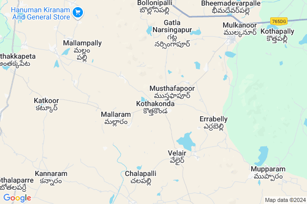
Kothakonda
Kothakonda Map
EDIT Map
Add Your House
 ..
..
Current Corona Virus Infected Patients Count in Karimnagar District
| City Name | District Name | Total Covid cases |
|---|---|---|
| Karimnagar District | Karimnagar | 16 |
| Karimnagar | Karimnagar | 3 |
| Rajanna Sircilla District | Rajanna Sircilla | 3 |
| Peddapalli District | Peddapalli | 2 |
| Siddipet District | Siddipet | 1 |
Locality Name :
Kothakonda
( కొత్తకొండ )
Mandal Name : Bheemdevarapalli
District : Karimnagar
State : Telangana
Region : Telangana
Language : Telugu and Urdu
Current Time 12:22 PM
Date: Sunday , Apr 27,2025 (IST)
Time zone: IST (UTC+5:30)
Elevation / Altitude: 262 meters. Above Seal level
Telephone Code / Std Code: 08727
Assembly constituency : Husnabad assembly constituency
Assembly MLA : Ponnam Prabhakar
Lok Sabha constituency : Karimnagar parliamentary constituency
Parliament MP : BANDI SANJAY KUMAR
Serpanch Name :
Pin Code : 505471
Post Office Name : Mulkanur
Commodities Prices : Husnabad Market / Mandi
Kothakonda Live Weather
Temperature: 35.4 °C
overcast clouds
Humidity: 31%
Wind : 5.56 mt/sec towards SE
StationName : "Warangal"
observed on 1 Hours Back
Temperature: 35.4 °C
overcast clouds
Humidity: 31%
Wind : 5.56 mt/sec towards SE
StationName : "Warangal"
observed on 1 Hours Back
Kothakonda Weather Forecast for Next 5 days
28-04-2025
26.1°C to 38.5°C
overcast clouds, broken clouds, moderate rain, scattered clouds
26.1°C to 38.5°C
overcast clouds, broken clouds, moderate rain, scattered clouds
29-04-2025
25.4°C to 39.2°C
scattered clouds, few clouds, broken clouds
25.4°C to 39.2°C
scattered clouds, few clouds, broken clouds
30-04-2025
26.2°C to 39.0°C
broken clouds, scattered clouds, few clouds, light rain, clear sky
26.2°C to 39.0°C
broken clouds, scattered clouds, few clouds, light rain, clear sky
01-05-2025
26.4°C to 42.2°C
broken clouds, scattered clouds, few clouds
26.4°C to 42.2°C
broken clouds, scattered clouds, few clouds
02-05-2025
26.6°C to 41.4°C
broken clouds, clear sky
26.6°C to 41.4°C
broken clouds, clear sky
National Highways Reachable To Kothakonda
Nationa High Way :NH163
Nationa High Way :NH563
Nationa High Way :NH163
Nationa High Way :NH563
Rivers Near Kothakonda
Sali Vagu
Kurel Vagu
Sali Vagu
Kurel Vagu
About Kothakonda
Correct below Info and add more info about KothakondaKothakonda is a Village in Bheemdevarapalli Mandal in Karimnagar District of Telangana State, India. It belongs to Telangana region . It is located 55 KM towards South from District head quarters Karimnagar. 2 KM from Bheemdevarapalli.
Kothakonda Pin code is 505471 and postal head office is Mulkanur .
Mallaram ( 3 KM ) , Mutharam ( 5 KM ) , Bollonipalli ( 8 KM ) , Katkur ( 8 KM ) , Mulkanoor ( 10 KM ) are the nearby Villages to Kothakonda. Kothakonda is surrounded by Dharmasagar Mandal towards South , Husnabad Mandal towards west , Elkathurthi Mandal towards East , Saidapur Mandal towards North .
Warangal , Jangaon , Karimnagar , Siddipet are the near by Cities to Kothakonda.
This Place is in the border of the Karimnagar District and Warangal District. Warangal District Dharmasagar is South towards this place .
Demographics of Kothakonda
Telugu is the Local Language here. Total population of Kothakonda is 4433 .Males are 2243 and Females are 2,190 living in 1005 Houses. Total area of Kothakonda is 1540 hectares.Politics in Kothakonda
TRS , INC are the major political parties in this area.Polling Stations /Booths near Kothakonda
1)Samudrala2)Seetharampur(kothakonda)
3)Seetharampur(kothakonda)
4)Seetharampur H/o Chigurumamidi
5)Mulknur
HOW TO REACH Kothakonda
By Road
Warangal is the Nearest Town to Kothakonda. Warangal is 32 km from Kothakonda. Road connectivity is there from Warangal to Kothakonda.By Rail
There is no railway station near to Kothakonda in less than 10 km. How ever there are railway Stations from Near By town Warangal. are the railway Stations near to Warangal. You can reach from Warangal to Kothakonda by road after .Colleges near Kothakonda
Swamy R Thirtha Coop Jrcol Mulkanoor
Address : Swamy R Thirtha Coop Jrcol Mulkanoor
Jagruthi Degree College
Address : H.no.9-9-28, Ramnagar, Karimnagar.
Ak Vishvanatha Reddy Degree College
Address : H.no.9-24 & 7-12, Mulkanoor, Bheemadevarapally (p
Sri Vidya Jyothi Degree College
Address : D.no.2-1-40, Near Post Office Road, Sri Ramnagar,
Schools in Kothakonda
Hs Siloam Kothakonda
Address : kothakonda , bheemadevarapalli , karimnagar , Andhra Pradesh . PIN- 505471 , Post - Mulkanur
Zphs Kothakonda
Address : kothakonda , bheemadevarapalli , karimnagar , Andhra Pradesh . PIN- 505471 , Post - Mulkanur
Govt Health Centers near Kothakonda
1) SubCentre Velair , 6-Apr , Subhashi Colony , Subhashi Colony2) Primary Health Centre Velair , 21-Jan , Sc Colony ,
3) SubCentre, Errabelly , 1-120 , shivalayam veedi , near GP Office
Sub Villages in Kothakonda
Colleges in Kothakonda,Bheemdevarapalli
St. Joseph P.G. College
Hyderabad Road; Rampur Village; Dharmasagar Mandal; Hanamkonda; Telangana 506142; India
8.7 KM distance Detail
more ..
Police Stations near Kothakonda,Bheemdevarapalli
HZB sub Division on 22.01.2015
Time: 0300 to 0400 hrs; A. Vijayender SI of VNGR conducted vehicle checking; Siddipet-Husnabad; Telangana 505497; India
8.3 KM distance Detail
HZB Sub Division 21-01-15
SI Kiran HSB conducted vehicle checking from 0210 to 0240 hrs at vangara x road; mulkanoor; Vangara Sammakka Rd; Telangana 505497; India
8.3 KM distance Detail
Mulkanoor Police Station; Bhimadevarapalli
Bhimadevarapalli; Telangana 505497; India
10.1 KM distance Detail
Governement Offices near Kothakonda,Bheemdevarapalli
MeeSeva Center
Kothakonda (L); Bheemadevar Palle (M); Kothakonda; Telangana 505471; India
0.5 KM distance Detail
Musthafapoor
Musthafapoor Village; Bheemadevarpally Mandal; District : Karimnagar; Andhra Pradesh; India; 505471; gollapalli-musthafapur; Musthafapoor; 505471; India
1.5 KM distance Detail
About Kothakonda &
History
How to reach Kothakonda
Tourist Places Near By Kothakonda
Schools in Kothakonda
Colleges in Kothakonda
Temperature & weather of Kothakonda
places in Kothakonda
Kothakonda photos
More Information
How to reach Kothakonda
Tourist Places Near By Kothakonda
Schools in Kothakonda
Colleges in Kothakonda
Temperature & weather of Kothakonda
places in Kothakonda
Kothakonda photos
More Information
Village Talk
Post News or Events about this Village
Near Cities
Warangal 33 KM near
Jangaon 44 KM near
Karimnagar 55 KM near
Siddipet 55 KM near
Warangal 33 KM near
Jangaon 44 KM near
Karimnagar 55 KM near
Siddipet 55 KM near
Near By Taluks
Bheemdevarapalli 1 KM near
Dharmasagar 13 KM near
Husnabad 16 KM near
Elkathurthi 19 KM near
Bheemdevarapalli 1 KM near
Dharmasagar 13 KM near
Husnabad 16 KM near
Elkathurthi 19 KM near
Near By Air Ports
Rajiv Gandhi International Airport 144 KM near
Vijayawada Airport 258 KM near
Nanded Airport 274 KM near
Rajahmundry Airport 319 KM near
Rajiv Gandhi International Airport 144 KM near
Vijayawada Airport 258 KM near
Nanded Airport 274 KM near
Rajahmundry Airport 319 KM near
Near By Tourist Places
Warangal 36 KM near
Medaram 115 KM near
Medak 123 KM near
Hyderabad 127 KM near
Khammam 140 KM near
Warangal 36 KM near
Medaram 115 KM near
Medak 123 KM near
Hyderabad 127 KM near
Khammam 140 KM near
Near By Districts
Warangal 32 KM near
Karimnagar 52 KM near
Nalgonda 123 KM near
Hyderabad 124 KM near
Warangal 32 KM near
Karimnagar 52 KM near
Nalgonda 123 KM near
Hyderabad 124 KM near
Near By RailWay Station
Ghanpur Rail Way Station 24 KM near
Kazipet Junction Rail Way Station 25 KM near
Ghanpur Rail Way Station 24 KM near
Kazipet Junction Rail Way Station 25 KM near