| Home | City Bus | Maps | Villages | Cities | Rail | Tourist Places | School | College | Pin Codes | Corona Cases Count |
| Distance Calculator Bus Services IFSC Codes Trace Mobile Number Weather Search Place Trace IP Available Cash ATM/Banks Locate Polling Booth Report an Error contact People |
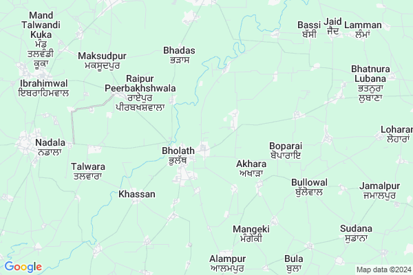
Bagrian
Bagrian Map
EDIT Map
Add Your House
 ..
..
Current Corona Virus Infected Patients Count in Kapurthala District
| City Name | District Name | Total Covid cases |
|---|---|---|
| Kapurthala District | Kapurthala | 2 |
| Kot Kar Khan | Kapurthala | 1 |
Locality Name :
Bagrian
( ਬਾਗੜੀਆਂ )
Tehsil Name : Nadala
District : Kapurthala
State : Punjab
Language : Punjabi and Hindi
Current Time 08:23 PM
Date: Wednesday , Feb 05,2025 (IST)
Time zone: IST (UTC+5:30)
Elevation / Altitude: 202 meters. Above Seal level
Telephone Code / Std Code: 01853
Assembly constituency : Bholath assembly constituency
Assembly MLA : Sukhpal Singh Khaira
Lok Sabha constituency : Hoshiarpur parliamentary constituency
Parliament MP : SOM PARKASH
Serpanch Name :
Pin Code : 144622
Post Office Name : Bholath
Commodities Prices : Bhulath (Ibrahimaaaaval) Market / Mandi
Bagrian Live Weather
Temperature: 19.4 °C
clear sky
Humidity: 21%
Wind : 2.29 mt/sec towards NW
StationName : "Bhulath Gharbi"
observed on 2 Hours Back
Temperature: 19.4 °C
clear sky
Humidity: 21%
Wind : 2.29 mt/sec towards NW
StationName : "Bhulath Gharbi"
observed on 2 Hours Back
Bagrian Weather Forecast for Next 5 days
06-02-2025
9.0°C to 16.9°C
clear sky
9.0°C to 16.9°C
clear sky
07-02-2025
7.8°C to 23.7°C
clear sky, scattered clouds
7.8°C to 23.7°C
clear sky, scattered clouds
08-02-2025
6.4°C to 25.1°C
scattered clouds, broken clouds, overcast clouds
6.4°C to 25.1°C
scattered clouds, broken clouds, overcast clouds
09-02-2025
8.9°C to 26.5°C
overcast clouds, clear sky
8.9°C to 26.5°C
overcast clouds, clear sky
10-02-2025
10.4°C to 29.0°C
clear sky, broken clouds, scattered clouds
10.4°C to 29.0°C
clear sky, broken clouds, scattered clouds
National Highways Reachable To Bagrian
Nationa High Way :NH3
Nationa High Way :NH3;NH54
Nationa High Way :NH3
Nationa High Way :NH3;NH54
Rivers Near Bagrian
Kanjali River
Kanjali River
About Bagrian
Correct below Info and add more info about BagrianBagrian is a Village in Nadala Tehsil in Kapurthala District of Punjab State, India. It is located 27 KM towards North from District head quarters Kapurthala. 6 KM from Nadala. 175 KM from State capital Chandigarh
Bagrian Pin code is 144622 and postal head office is Bholath .
Akala ( 2 KM ) , Chan Chak ( 3 KM ) , Kherabad ( 4 KM ) , Bagwanpur ( 4 KM ) , Khassan ( 4 KM ) are the nearby Villages to Bagrian. Bagrian is surrounded by Bhogpur Tehsil towards East , Tanda Tehsil towards North , Urmar Tanda Tehsil towards North , Dhilwan Tehsil towards west .
Kartarpur , Urmar Tanda , Kapurthala , Jalandhar are the near by Cities to Bagrian.
This Place is in the border of the Kapurthala District and Gurdaspur District. Gurdaspur District Srihargobind Pur is North towards this place . Also it is in the Border of other district Amritsar .
Bagrian 2011 Census Details
Bagrian Local Language is Punjabi. Bagrian Village Total population is 1205 and number of houses are 240. Female Population is 50.2%. Village literacy rate is 70.0% and the Female Literacy rate is 35.6%.
Population
| Census Parameter | Census Data |
| Total Population | 1205 |
| Total No of Houses | 240 |
| Female Population % | 50.2 % ( 605) |
| Total Literacy rate % | 70.0 % ( 844) |
| Female Literacy rate | 35.6 % ( 429) |
| Scheduled Tribes Population % | 0.0 % ( 0) |
| Scheduled Caste Population % | 30.4 % ( 366) |
| Working Population % | 27.6 % |
| Child(0 -6) Population by 2011 | 109 |
| Girl Child(0 -6) Population % by 2011 | 34.9 % ( 38) |
Bagrian Census More Deatils.
Politics in Bagrian
Bharatiya Janata Party , SAD , INC are the major political parties in this area.Polling Stations /Booths near Bagrian
1)Kamrai2)Jati Ke
3)Miyani Bhagupurian
4)Bholath
5)Bajaj
HOW TO REACH Bagrian
By Rail
There is no railway station near to Bagrian in less than 10 km.Colleges near Bagrian
Ramgarhia College Of Law
Address : Ramgarhia Collegephagwara
Ramgarhia Institute Of Engineering And Technology
Address : Ramgarhia Institute Of Engineering And Technology
Schools in Bagrian
Ghs Bagrian
Address : bagrian , nadala , kapurthala , Punjab . PIN- 144622 , Post - Bholath
Doaba Model School
Address : bagrian , nadala , kapurthala , Punjab . PIN- 144622 , Post - Bholath
Govt Health Centers near Bagrian
1) Bholath , Sub Centre Bholath , , Near Punjab Gramin Bank, Bholath2) SDH Bholath , , , Near SDM Office, Bholath, Kapurthala
3) Bagrian , Sub Centre Bagrian , , Adjoining Panchayat Ghar
Hospitals in Bagrian,Nadala
M G Dental & Orthodontic Centre
M G Dental & Orthodontic Centre; Near gurdwara beriyan Wala; Bhogpur road.; Bholath; Punjab 144622; India
0.9 KM distance Detail
Friends Dental Clinic
Bhogpur - Begowal Rara Rd; Adda Cholang; Punjab 144203; India
1.4 KM distance Detail
more ..
Petrol Bunks in Bagrian,Nadala
SANT SINGH FILLING STATION
BHADAS; KAPURTHALA; KAPURTHALA; Punjab 144621; India
3.9 KM distance Detail
HP PETROL PUMP - HP HAMARA PUMP PANDORI
Village Pandori Rajputa Kartarpur Bholath Road; Jalandhar; Punjab 144401; India
5.4 KM distance Detail
HP PETROL PUMP - PAVITAR HP
Tehsil Bholath; Bholath - Bhogpur Rd; Punjab 144621; India
5.8 KM distance Detail
more ..
Colleges in Bagrian,Nadala
Advance Tech. Institute Of Computer
144622; Bholath Nadala Rd; Bholath; Punjab; India
1.8 KM distance Detail
Government College Bholath
Mettla-Bholath Road; Bholath; Punjab 144622; India
2.4 KM distance Detail
more ..
Electronic Shops in Bagrian,Nadala
Baba electronics and music system
Bholath - Bhogpur Rd; Bholath; Punjab 144622; India
1.3 KM distance Detail
Police Stations near Bagrian,Nadala
CPSC SAANJH PUNJAB POLICE
Kartarpur-Bholath Rd; Bholath; Punjab 144622; India
2.0 KM distance Detail
Governement Offices near Bagrian,Nadala
Sub.Harcharan Singh's Office
Tehsil Complex;Bholath;; Bholath; Punjab 144622; India
2.4 KM distance Detail
About Bagrian &
History
How to reach Bagrian
Tourist Places Near By Bagrian
Schools in Bagrian
Colleges in Bagrian
Temperature & weather of Bagrian
places in Bagrian
Bagrian photos
More Information
How to reach Bagrian
Tourist Places Near By Bagrian
Schools in Bagrian
Colleges in Bagrian
Temperature & weather of Bagrian
places in Bagrian
Bagrian photos
More Information
Village Talk
Post News or Events about this Village
Near Cities
Kartarpur 14 KM near
Urmar Tanda 21 KM near
Kapurthala 25 KM near
Jalandhar 27 KM near
Kartarpur 14 KM near
Urmar Tanda 21 KM near
Kapurthala 25 KM near
Jalandhar 27 KM near
Near By Taluks
Nadala 6 KM near
Bhogpur 13 KM near
Tanda 19 KM near
Urmar Tanda 20 KM near
Nadala 6 KM near
Bhogpur 13 KM near
Tanda 19 KM near
Urmar Tanda 20 KM near
Near By Air Ports
Raja Sansi Airport 78 KM near
Pathankot Airport 83 KM near
Ludhiana Airport 88 KM near
Gaggal Airport 122 KM near
Raja Sansi Airport 78 KM near
Pathankot Airport 83 KM near
Ludhiana Airport 88 KM near
Gaggal Airport 122 KM near
Near By Tourist Places
Kapurthala 26 KM near
Jalandhar 27 KM near
Hoshiarpur 42 KM near
Gurdaspur 61 KM near
Amritsar 69 KM near
Kapurthala 26 KM near
Jalandhar 27 KM near
Hoshiarpur 42 KM near
Gurdaspur 61 KM near
Amritsar 69 KM near
Near By Districts
Kapurthala 26 KM near
Jalandhar 27 KM near
Hoshiarpur 41 KM near
Gurdaspur 61 KM near
Kapurthala 26 KM near
Jalandhar 27 KM near
Hoshiarpur 41 KM near
Gurdaspur 61 KM near
Near By RailWay Station
Kartarpur Rail Way Station 14 KM near
Tanda Urmar Rail Way Station 19 KM near
Kartarpur Rail Way Station 14 KM near
Tanda Urmar Rail Way Station 19 KM near