| Home | City Bus | Maps | Villages | Cities | Rail | Tourist Places | School | College | Pin Codes | Corona Cases Count |
| Distance Calculator Bus Services IFSC Codes Trace Mobile Number Weather Search Place Trace IP Available Cash ATM/Banks Locate Polling Booth Report an Error contact People |
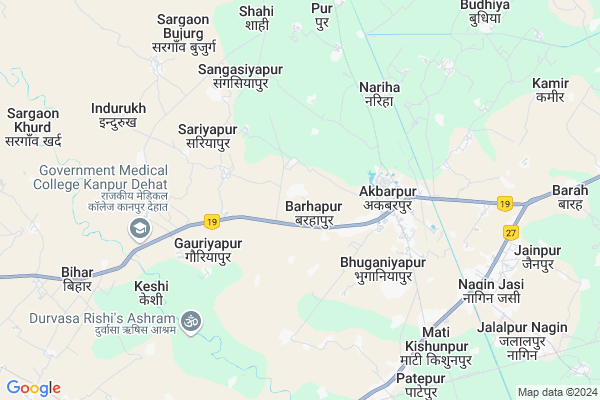
Barhapur
Barhapur Map
EDIT Map
Add Your House
 ..
..
Current Corona Virus Infected Patients Count in Kanpur Dehat District
| City Name | District Name | Total Covid cases |
|---|
Locality Name :
Barhapur
( बरहपुर )
Block Name : Akbarpur
District : Kanpur Dehat
State : Uttar Pradesh
Division : Kanpur
Language : Hindi and Urdu
Current Time 01:14 PM
Date: Monday , Apr 28,2025 (IST)
Time zone: IST (UTC+5:30)
Elevation / Altitude: 137 meters. Above Seal level
Telephone Code / Std Code: 05114
Assembly constituency : Akbarpur Raniya assembly constituency
Assembly MLA : Pratibha Shukla
Lok Sabha constituency : Akbarpur parliamentary constituency
Parliament MP : Devendra Singh 'Bhole'
Serpanch Name :
Pin Code : 209101
Post Office Name : Akbarpur
Commodities Prices : Rura Market / Mandi
National Highways Reachable To Barhapur
Nationa High Way :NH19;NH27
Nationa High Way :NH19
Nationa High Way :NH19;NH27
Nationa High Way :NH19
Rivers Near Barhapur
Betwa
Pandu
Betwa
Pandu
About Barhapur
Correct below Info and add more info about BarhapurBarhapur is a Village in Akbarpur Block in Kanpur Dehat District of Uttar Pradesh State, India. It belongs to Kanpur Division . It is located 3 KM towards west from District head quarters Akbarpur, Ramabai Nagar. 4 KM from Akbarpur. 133 KM from State capital Lucknow
Barhapur Pin code is 209101 and postal head office is Akbarpur .
Patari ( 1 KM ) , Madwai ( 2 KM ) , Kuit Khera ( 2 KM ) , Akbarpur ( 2 KM ) , Bhuganiyapur ( 3 KM ) are the nearby Villages to Barhapur. Barhapur is surrounded by Malasa Block towards South , Derapur Block towards west , Sarbankhera Block towards East , Maitha Block towards North .
Pukhrayan , Chakeri , Ghatampur , Kanpur are the near by Cities to Barhapur.
Barhapur 2011 Census Details
Barhapur Local Language is Hindi. Barhapur Village Total population is 3329 and number of houses are 632. Female Population is 46.1%. Village literacy rate is 68.0% and the Female Literacy rate is 28.4%.
Population
| Census Parameter | Census Data |
| Total Population | 3329 |
| Total No of Houses | 632 |
| Female Population % | 46.1 % ( 1535) |
| Total Literacy rate % | 68.0 % ( 2263) |
| Female Literacy rate | 28.4 % ( 947) |
| Scheduled Tribes Population % | 0.0 % ( 0) |
| Scheduled Caste Population % | 33.5 % ( 1115) |
| Working Population % | 32.9 % |
| Child(0 -6) Population by 2011 | 423 |
| Girl Child(0 -6) Population % by 2011 | 44.7 % ( 189) |
Barhapur Census More Deatils.
Politics in Barhapur
SP , BSP are the major political parties in this area.Polling Stations /Booths near Barhapur
1)Baratshala Bhilahindupur2)Boys Juniyar High School Akbarpur
3)Boys Juniyar High School Akbarpur
4)Boys Juniyar High School Akbarpur
5)Boys Juniyar High School Akbarpur
HOW TO REACH Barhapur
By Rail
Lalpur Rail Way Station , Malasa Rail Way Station are the very nearby railway stations to Barhapur.Colleges near Barhapur
Trilokinath Inter Collage
Address :
Schools near Barhapur
Akberpur Balika Inter College
Address : akbarpur , akbarpur , kanpur dehat , Uttar Pradesh . PIN- 209101 , Post - Akbarpur
Rastiya Sarv.inter College
Address : bhikhanapur , akbarpur , kanpur dehat , Uttar Pradesh . PIN- 209101 , Post - Akbarpur
Janta Inter College Badhapur
Address : nariha , akbarpur , kanpur dehat , Uttar Pradesh . PIN- 209301 , Post - Derapur
Ups Bigahi
Address : wegahi , akbarpur , kanpur dehat , Uttar Pradesh . PIN- 209104
Govt Health Centers near Barhapur
1) Kameer , , ,2) Rurwahar NPHC , , ,
3) AADMPUR , , ,
Sub Villages in Barhapur
Hospitals in Barhapur,Akbarpur
Shree Sai Hospital And Surgical Center
Kripalpur; Uttar Pradesh 209101; India
2.6 KM distance Detail
SANTUSHTI HOSPITAL & TRAUMA CENTER
Neharu nagar; Akbarpur; Uttar Pradesh 209101; India
3.2 KM distance Detail
more ..
Colleges in Barhapur,Akbarpur
Janta Inter College
TIWARIPURWA; Kanpur Dehat; NH-2; AH 1; Akbarpur; Akbarpur; Uttar Pradesh 209101; India
1.3 KM distance Detail
Ram Swaroop Singh Gaur Mahavidyalaya; Akbarpur
Akbarpur; Uttar Pradesh 209101; India
3.4 KM distance Detail
more ..
Schools in Barhapur,Akbarpur
Janta enter collge
janta enter collge barhapur; Akbarpur; Uttar Pradesh; India
1.3 KM distance Detail
New Light Education Centre
Maidu Road Akbarpur; Kanpur; Uttar Pradesh 209101; India
1.7 KM distance Detail
Govt polytecnic mmit kanpur dehat
Govt Polytechnic Mmit dehat; Kanpur; Uttar Pradesh; India
1.7 KM distance Detail
Government Primary School
Kripalpur; Kanpur Dehat; NH-2; AH 1; Akbarpur; Akbarpur; Uttar Pradesh 209101; India
1.8 KM distance Detail
Electronic Shops in Barhapur,Akbarpur
Sudhakar Traders
Ayodhyapuri Near Ramleel Maidan Akbarpur; Kanpur; Uttar Pradesh 209101; India
3.5 KM distance Detail
Madhur Electricals
Roadways Bus Stop Akbarpur; Kanpur; Uttar Pradesh 209101; India
3.6 KM distance Detail
Police Stations near Barhapur,Akbarpur
Police Station Akbarpur Kanpur Dehat
Akbarpur South; Akbarpur; Uttar Pradesh 209101; India
3.2 KM distance Detail
Governement Offices near Barhapur,Akbarpur
RSBS Enterprises
Mati Rd; Akbarpur South; Akbarpur; Uttar Pradesh 209101; India
3.8 KM distance Detail
About Barhapur &
History
How to reach Barhapur
Tourist Places Near By Barhapur
Schools in Barhapur
Colleges in Barhapur
Temperature & weather of Barhapur
places in Barhapur
Barhapur photos
More Information
How to reach Barhapur
Tourist Places Near By Barhapur
Schools in Barhapur
Colleges in Barhapur
Temperature & weather of Barhapur
places in Barhapur
Barhapur photos
More Information
Village Talk
Post News or Events about this Village
Near Cities
Pukhrayan 20 KM near
Chakeri 21 KM near
Ghatampur 40 KM near
Kanpur 45 KM near
Pukhrayan 20 KM near
Chakeri 21 KM near
Ghatampur 40 KM near
Kanpur 45 KM near
Near By Taluks
Akbarpur 4 KM near
Malasa 13 KM near
Derapur 16 KM near
Sarbankhera 18 KM near
Akbarpur 4 KM near
Malasa 13 KM near
Derapur 16 KM near
Sarbankhera 18 KM near
Near By Air Ports
Kanpur Airport 55 KM near
Amausi Airport 117 KM near
Gwalior Airport 188 KM near
Khajuraho Airport 194 KM near
Kanpur Airport 55 KM near
Amausi Airport 117 KM near
Gwalior Airport 188 KM near
Khajuraho Airport 194 KM near
Near By Tourist Places
Kanpur 46 KM near
Bithur 48 KM near
Kannauj 85 KM near
Lucknow 124 KM near
Rae Bareli 149 KM near
Kanpur 46 KM near
Bithur 48 KM near
Kannauj 85 KM near
Lucknow 124 KM near
Rae Bareli 149 KM near
Near By Districts
Kanpur Dehat 3 KM near
Kanpur Nagar 45 KM near
Auraiya 46 KM near
Hamirpur District 58 KM near
Kanpur Dehat 3 KM near
Kanpur Nagar 45 KM near
Auraiya 46 KM near
Hamirpur District 58 KM near
Near By RailWay Station
Lalpur Rail Way Station 8.7 KM near
Rura Rail Way Station 13 KM near
Pokhrayan Rail Way Station 21 KM near
Lalpur Rail Way Station 8.7 KM near
Rura Rail Way Station 13 KM near
Pokhrayan Rail Way Station 21 KM near