| Home | City Bus | Maps | Villages | Cities | Rail | Tourist Places | School | College | Pin Codes | Corona Cases Count |
| Distance Calculator Bus Services IFSC Codes Trace Mobile Number Weather Search Place Trace IP Available Cash ATM/Banks Locate Polling Booth Report an Error contact People |
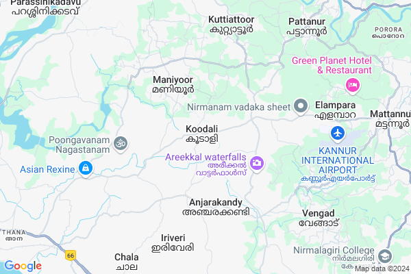
Ninteenth Mile Map
EDIT Map
Add Your House
 ..
..
Current Corona Virus Infected Patients Count in Kannur District
| City Name | District Name | Total Covid cases |
|---|---|---|
| Kannur District | Kannur | 63 |
| Mooriyad | Kannur | 5 |
| Maradu | Kannur | 3 |
| Cheruvanchery | Kannur | 3 |
| Kottayam Malabar | Kannur | 3 |
| Kadirur | Kannur | 3 |
| Temple Gate | Kannur | 2 |
| Kannur | Kannur | 2 |
| Peringathur | Kannur | 2 |
| Madayi | Kannur | 2 |
| Kudiyanmala | Kannur | 2 |
| Chendayad | Kannur | 2 |
| Pathayakunnu | Kannur | 1 |
| New Mahe | Kannur | 1 |
| Kolayad | Kannur | 1 |
| Pathipalam | Kannur | 1 |
| Mooriyadh | Kannur | 1 |
| Peralassery | Kannur | 1 |
| Kottayam-Malabar | Kannur | 1 |
| Chapparapadavu | Kannur | 1 |
| Kunnothuparambu | Kannur | 1 |
| Velapuram | Kannur | 1 |
| Naravoor | Kannur | 1 |
| Muzhappilangad | Kannur | 1 |
| Iriveri | Kannur | 1 |
| Chengalayi | Kannur | 1 |
| Muthiyanga | Kannur | 1 |
| Kanichar | Kannur | 1 |
| Mahe | Kannur | 1 |
| Mokeri | Kannur | 1 |
| Champad | Kannur | 1 |
Locality Name :
Ninteenth Mile
( നിൻറ്റീൻത് മൈൽ )
Block Name : Iritty
District : Kannur
State : Kerala
Division : North Kerala
Language : Malayalam and English
Current Time 03:31 PM
Date: Wednesday , Feb 05,2025 (IST)
Time zone: IST (UTC+5:30)
Elevation / Altitude: 12 meters. Above Seal level
Telephone Code / Std Code: 0490
Assembly constituency : Mattannur assembly constituency
Assembly MLA : K K Shailaja Teacher
Lok Sabha constituency : Kannur parliamentary constituency
Parliament MP : K. SUDHAKARAN
Serpanch Name :
Pin Code : 670592
Post Office Name : Koodali
Main Village Name : Koodali
Commodities Prices : Irikkur Market / Mandi
Ninteenth Mile Live Weather
Temperature: 31.7 °C
clear sky
Humidity: 47%
Wind : 5.3 mt/sec towards SW
StationName : "Mattanur"
observed on 1 Hours Back
Temperature: 31.7 °C
clear sky
Humidity: 47%
Wind : 5.3 mt/sec towards SW
StationName : "Mattanur"
observed on 1 Hours Back
Ninteenth Mile Weather Forecast for Next 5 days
06-02-2025
20.7°C to 31.7°C
clear sky
20.7°C to 31.7°C
clear sky
07-02-2025
20.1°C to 32.1°C
clear sky, few clouds, broken clouds
20.1°C to 32.1°C
clear sky, few clouds, broken clouds
08-02-2025
19.8°C to 32.2°C
broken clouds, overcast clouds, few clouds, scattered clouds
19.8°C to 32.2°C
broken clouds, overcast clouds, few clouds, scattered clouds
09-02-2025
19.0°C to 32.2°C
few clouds, scattered clouds, broken clouds, overcast clouds
19.0°C to 32.2°C
few clouds, scattered clouds, broken clouds, overcast clouds
10-02-2025
19.8°C to 32.0°C
broken clouds, scattered clouds, overcast clouds
19.8°C to 32.0°C
broken clouds, scattered clouds, overcast clouds
Edit below overview about Ninteenth Mile
Edit below overview about Ninteenth Mile
OverView of Ninteenth Mile
Ninteenth mile has a large hotel 'nesma palace' and MRA restaurant and ninteenth mile is the continuation of anjaam mile and aaraam mileEdit below overview about Ninteenth Mile
National Highways Reachable To Ninteenth Mile
Nationa High Way :NH66
Nationa High Way :NH66
Rivers Near Ninteenth Mile
mundayamparambu puzha or vempuzha
mundayamparambu puzha or vempuzha
About Ninteenth Mile
Ninteenth Mile is a small Village/hamlet in Iritty Block in Kannur District of Kerala State, India. It comes under Koodali Panchayath. It belongs to North Kerala Division . It is located 14 KM towards East from District head quarters Kannur. 25 KM from Iritty. 484 KM from State capital Thiruvananthapuram
Ninteenth Mile Pin code is 670592 and postal head office is Koodali .
Ninteenth Mile is surrounded by Kannur Block towards west , Kuthuparamba Block towards South , Irikkur Block towards North , Thalassery Block towards South .
Mattannur , Kannur , Pappinisseri , Koothuparamba are the near by Cities to Ninteenth Mile.
Demographics of Ninteenth Mile
Malayalam is the Local Language here.Politics in Ninteenth Mile
CPM , Indian National Congress , SJD , INC are the major political parties in this area.Polling Stations /Booths near Ninteenth Mile
1)Koodali High School East Building (north Side))2)"koodali U P S (middle Side)
3)Koodali High School
4)"kodoliparam Govt L P S (west Side)
5)Kolari Lps
HOW TO REACH Ninteenth Mile
By Rail
There is no railway station near to Ninteenth Mile in less than 10 km.Colleges near Ninteenth Mile
Iist Mambaram
Address :
College Of Engineering And Technology - Payyanur
Address :
Rabindra Nath Tagore University Admission Centre Kerala
Address : Appus Tower Payyannur New Bustand
Mary Matha Arts & Science College, Alakode
Address :
Govt College Parathode
Address : Po Manantheri
Schools in Ninteenth Mile
Kpc Hs Pattannur
Address : koodali , mattannur , kannur , Kerala . PIN- 670595 , Post - Edayannur
Koodali Hs
Address : koodali , mattannur , kannur , Kerala . PIN- 670592 , Post - Koodali
Fazl E Omar Pub Eng School
Address : koodali , mattannur , kannur , Kerala . PIN- 670592 , Post - Koodali
Koodali Ups
Address : koodali , mattannur , kannur , Kerala . PIN- 670592 , Post - Koodali
Gups Ayipuzha
Address : koodali , mattannur , kannur , Kerala . PIN- 670593 , Post - Irukkur
Govt Health Centers near Ninteenth Mile
1) Malabar Cancer Centre , Kodiyeri,Thalassery, , Muzhikkara - MCC Rd, Illathaazha, , -Hospitals in Ninteenth Mile,Iritty
Munderi Panchayath Primary Health Centre
Panchayath Primary Health Centre;PO); Eachur; Munderi; Kerala 670592; India
3.3 KM distance Detail
more ..
Colleges in Ninteenth Mile,Iritty
NAHER Arts & Science College
P O KANHIRODE; KOODALI; Kannur; Kerala 670592; India
2.4 KM distance Detail
more ..
Super Markets in Ninteenth Mile,Iritty
Anjarakkandi Co-Operative Bank Supermarket
Muzhappala Rd; Muzhappala; Kerala 670613; India
2.1 KM distance Detail
Local Parks in Ninteenth Mile,Iritty
പള്ളി കാട്
Mowenchery - Koyyode Rd; Komathukunnumbram; Chala; Kerala 670621; India
6.1 KM distance Detail
Munderi Kadavu Bird Sanctuary
Valiyannur Nayattupara Rd; Noonheri; Munderi; Kerala 670592; India
6.2 KM distance Detail
Police Stations near Ninteenth Mile,Iritty
Mayyil Police Station
Chirakkal - Mayyil - Kololam Rd; Mayyil; Kerala 670602; India
10.6 KM distance Detail
Governement Offices near Ninteenth Mile,Iritty
Chalode Merchant Welfare Co-operative Society Ltd.
Chalode; Kerala 670595; India
3.1 KM distance Detail
Govindham Marriage Bureau
Thalassery - Irikkur Rd; Chalode; Kerala 670595; India
3.1 KM distance Detail
Grama Panchayath Munderi
Kannur - Mattannur Road; Eachur; Munderi; Kerala 670591; India
3.3 KM distance Detail
About Ninteenth Mile &
History
How to reach Ninteenth Mile
Tourist Places Near By Ninteenth Mile
Schools in Ninteenth Mile
Colleges in Ninteenth Mile
Temperature & weather of Ninteenth Mile
places in Ninteenth Mile
Ninteenth Mile photos
More Information
How to reach Ninteenth Mile
Tourist Places Near By Ninteenth Mile
Schools in Ninteenth Mile
Colleges in Ninteenth Mile
Temperature & weather of Ninteenth Mile
places in Ninteenth Mile
Ninteenth Mile photos
More Information
Village Talk
Post News or Events about this Village
Near Cities
Mattannur 12 KM near
Kannur 14 KM near
Pappinisseri 16 KM near
Koothuparamba 16 KM near
Mattannur 12 KM near
Kannur 14 KM near
Pappinisseri 16 KM near
Koothuparamba 16 KM near
Near By Taluks
Edakkad 7 KM near
Kannur 14 KM near
Kuthuparamba 17 KM near
Thalassery 18 KM near
Edakkad 7 KM near
Kannur 14 KM near
Kuthuparamba 17 KM near
Thalassery 18 KM near
Near By Air Ports
Calicut Airport 112 KM near
Bajpe Airport 148 KM near
Mysore Airport 150 KM near
Peelamedu Airport 220 KM near
Calicut Airport 112 KM near
Bajpe Airport 148 KM near
Mysore Airport 150 KM near
Peelamedu Airport 220 KM near
Near By Tourist Places
Kannur 13 KM near
Muzhappilangad Beach 15 KM near
Thalassery 18 KM near
Ranipuram 36 KM near
Kakkabe 48 KM near
Kannur 13 KM near
Muzhappilangad Beach 15 KM near
Thalassery 18 KM near
Ranipuram 36 KM near
Kakkabe 48 KM near
Near By Districts
Kannur 13 KM near
Kodagu 70 KM near
Wayanad 83 KM near
Kozhikode 89 KM near
Kannur 13 KM near
Kodagu 70 KM near
Wayanad 83 KM near
Kozhikode 89 KM near
Near By RailWay Station
Kannur Main Rail Way Station 14 KM near
Thalassery Rail Way Station 20 KM near
Kannur Main Rail Way Station 14 KM near
Thalassery Rail Way Station 20 KM near