| Home | City Bus | Maps | Villages | Cities | Rail | Tourist Places | School | College | Pin Codes | Corona Cases Count |
| Distance Calculator Bus Services IFSC Codes Trace Mobile Number Weather Search Place Trace IP Available Cash ATM/Banks Locate Polling Booth Report an Error contact People |
Mancode
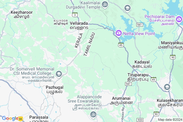
Mancode Map
EDIT Map
Add Your House
 ..
..
Current Corona Virus Infected Patients Count in Kanniyakumari District
| City Name | District Name | Total Covid cases |
|---|
Locality Name :
Mancode
( மாகோ )
Block Name : Melpuram
District : Kanniyakumari
State : Tamil Nadu
Language : Tamil And English
Current Time 11:10 AM
Date: Monday , Apr 28,2025 (IST)
Time zone: IST (UTC+5:30)
Elevation / Altitude: 37 meters. Above Seal level
Telephone Code / Std Code: 04651
Assembly constituency : Vilavancode assembly constituency
Assembly MLA : Vijayadharani S
Lok Sabha constituency : Kanniyakumari parliamentary constituency
Parliament MP : Vasanthakumar. H
Serpanch Name :
Pin Code : 629152
Post Office Name : Idaikkode
Commodities Prices : Parassala Market / Mandi
Mancode Live Weather
Temperature: 28.7 °C
overcast clouds
Humidity: 75%
Wind : 0.58 mt/sec towards E
StationName : "Kuzhithurai"
observed on 2 Hours Back
Temperature: 28.7 °C
overcast clouds
Humidity: 75%
Wind : 0.58 mt/sec towards E
StationName : "Kuzhithurai"
observed on 2 Hours Back
Mancode Weather Forecast for Next 5 days
29-04-2025
24.8°C to 32.8°C
overcast clouds, light rain, moderate rain, broken clouds
24.8°C to 32.8°C
overcast clouds, light rain, moderate rain, broken clouds
30-04-2025
24.5°C to 32.9°C
broken clouds, scattered clouds, light rain
24.5°C to 32.9°C
broken clouds, scattered clouds, light rain
01-05-2025
24.1°C to 32.9°C
overcast clouds, light rain, broken clouds
24.1°C to 32.9°C
overcast clouds, light rain, broken clouds
02-05-2025
24.0°C to 33.0°C
broken clouds, scattered clouds, light rain, overcast clouds
24.0°C to 33.0°C
broken clouds, scattered clouds, light rain, overcast clouds
03-05-2025
24.9°C to 29.5°C
light rain
24.9°C to 29.5°C
light rain
National Highways Reachable To Mancode
Nationa High Way :NH66
Nationa High Way :NH44
Nationa High Way :NH66
Nationa High Way :NH44
About Mancode
Correct below Info and add more info about MancodeMancode is a Village in Melpuram Block in Kanniyakumari District of Tamil Nadu State, India. It is located 42 KM towards North from District head quarters Nagercoil. 8 KM from Melpuram. 719 KM from State capital Chennai
Mancode Pin code is 629152 and postal head office is Idaikkode .
Malayadi ( 7 KM ) , Melpuram ( 8 KM ) , Vanniyoor ( 8 KM ) , Vellamcode ( 9 KM ) , Vilavancode ( 9 KM ) are the nearby Villages to Mancode. Mancode is surrounded by Perumkadavila Block towards west , Parassala Block towards west , Thiruvattar Block towards South , Neyyattinkara Block towards west .
Thiruparappu , Pacode , Neyyattinkara , Unnamalaikadai are the near by Cities to Mancode.
This Place is in the border of the Kanniyakumari District and Thiruvananthapuram District. Thiruvananthapuram District Parassala is west towards this place . It is near to the Kerala State Border.
Demographics of Mancode
Tamil And English is the Local Language here.Politics in Mancode
CPM , DMK , CPI(M) , AIADMK , INC are the major political parties in this area.Polling Stations /Booths near Mancode
1)Holy Family High School Arukani2)Holy Family Higher Sec. School Mukkootukal
3)Govt. High School Mekode At Perungulam
4)Govt. High School Puliyoor Salai
5)Govt. H.s.vellancode At Chitharal
HOW TO REACH Mancode
By Rail
Parassala Rail Way Station , Kuzhithurai West Rail Way Station are the very nearby railway stations to Mancode.Colleges near Mancode
Matha I T I
Address : Matha I T I Railway Station Road Kuzhithurai Tamil Nadu
Global College Of Nursing
Address : Global College Of Nursing, Nattalam Village Vilava
Schools near Mancode
Govt. Middle School Vanniyoor
Address : Vanniyoor
Govt. High School Macode, Vanniyoor
Address : Macode, Vanniyoor
Matha I T I
Address : matha i t i railway station road kuzhithurai tamil nadu
Govt Health Centers near Mancode
1) Government Hospital, Arumanai , , Nediyasalai , Kaliyal Road2) Geetha Hospital , 4//79 , Kozhivilai Junction, , Kaliyakaviali & PO.
3) RV. Hospital , 25/7A , Main Road , Thiruthuvapuram
Hospitals in Mancode,Melpuram
Robert Hospital Panachamoodu
Panachamood - Kulappara Rd; Mancode; Kerala 695505; India
2.8 KM distance Detail
more ..
Petrol Bunks in Mancode,Melpuram
HP PETROL PUMP - SUBASH PETROLEUM
S.no:270/1a; Mancodu Village; Puliyur Salai; Mancodu Post; Vilavancodu Taluk;; Tamil Nadu 629152; India
3.0 KM distance Detail
more ..
Colleges in Mancode,Melpuram
Narayanaguru College of Engineering
Manjalumoodu P.O; ( Via ) Karakonam ;Kanyakumari Dist; Kuzhithurai; Tamil Nadu 629151; India
0.7 KM distance Detail
St.Marys Mainar Seminary;Mukkuttukal
Karode - Manjalumoodu Rd; Karode; Edaicode; Tamil Nadu 629152; India
2.4 KM distance Detail
more ..
Schools in Mancode,Melpuram
Government High School
Puliyoorsala; Parassala Vellarada Rd; Kerala 695505; India
2.1 KM distance Detail
Electronic Shops in Mancode,Melpuram
City Electronics & Sanitaryware Panachamoodu
Parassala Vellarada Rd; Kerala 695505; India
3.1 KM distance Detail
Super Markets in Mancode,Melpuram
Thazhakada Ayurvedic & Stationery
Pancha Kuzhi Road; Vellarada; Kerala 695505; India
3.1 KM distance Detail
Police Stations near Mancode,Melpuram
Parassala Railway Police Station
Parassala Railway Station Road; Parassala; Thiruvananthapuram; Kerala 695502; India
10.8 KM distance Detail
Parassala Police Station
Parassala Vellarada Road; Parassala; Kerala 695502; India
10.9 KM distance Detail
About Mancode &
History
How to reach Mancode
Tourist Places Near By Mancode
Schools in Mancode
Colleges in Mancode
Temperature & weather of Mancode
places in Mancode
Mancode photos
More Information
How to reach Mancode
Tourist Places Near By Mancode
Schools in Mancode
Colleges in Mancode
Temperature & weather of Mancode
places in Mancode
Mancode photos
More Information
Village Talk
Post News or Events about this Village
Near Cities
Thiruparappu 6 KM near
Pacode 9 KM near
Neyyattinkara 15 KM near
Unnamalaikadai 15 KM near
Thiruparappu 6 KM near
Pacode 9 KM near
Neyyattinkara 15 KM near
Unnamalaikadai 15 KM near
Near By Taluks
Melpuram 8 KM near
Perumkadavila 10 KM near
Parassala 14 KM near
Thiruvattar 15 KM near
Melpuram 8 KM near
Perumkadavila 10 KM near
Parassala 14 KM near
Thiruvattar 15 KM near
Near By Air Ports
Trivandrum International Airport 36 KM near
Tuticorin Airport 108 KM near
Madurai Airport 208 KM near
Kochi Airport 239 KM near
Trivandrum International Airport 36 KM near
Tuticorin Airport 108 KM near
Madurai Airport 208 KM near
Kochi Airport 239 KM near
Near By Tourist Places
Poovar 20 KM near
Kovalam 28 KM near
Trivandrum 33 KM near
Ponmudi 44 KM near
Kanyakumari 56 KM near
Poovar 20 KM near
Kovalam 28 KM near
Trivandrum 33 KM near
Ponmudi 44 KM near
Kanyakumari 56 KM near
Near By Districts
Thiruvananthapuram 33 KM near
Kanniyakumari 40 KM near
Tirunelveli 68 KM near
Kollam 99 KM near
Thiruvananthapuram 33 KM near
Kanniyakumari 40 KM near
Tirunelveli 68 KM near
Kollam 99 KM near
Near By RailWay Station
Kulitturai Rail Way Station 13 KM near
Neyyattinkara Rail Way Station 15 KM near
Kulitturai Rail Way Station 13 KM near
Neyyattinkara Rail Way Station 15 KM near