| Home | City Bus | Maps | Villages | Cities | Rail | Tourist Places | School | College | Pin Codes | Corona Cases Count |
| Distance Calculator Bus Services IFSC Codes Trace Mobile Number Weather Search Place Trace IP Available Cash ATM/Banks Locate Polling Booth Report an Error contact People |
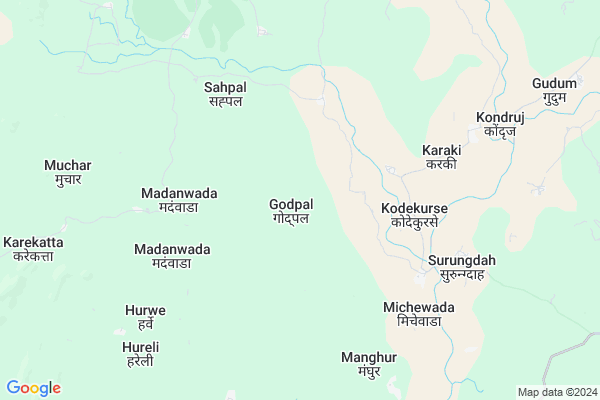
Godpal
Godpal Map
EDIT Map
Add Your House
 ..
..
Current Corona Virus Infected Patients Count in Kanker District
| City Name | District Name | Total Covid cases |
|---|
Locality Name :
Godpal
( गौड़पाल )
Tehsil Name : Durgukondal
District : Kanker
State : Chattisgarh
Language : Chhattisgarhi and Hindi, Gondi And Halbi
Current Time 12:44 PM
Date: Tuesday , Apr 29,2025 (IST)
Time zone: IST (UTC+5:30)
Elevation / Altitude: 412 meters. Above Seal level
Telephone Code / Std Code: 07850
Assembly constituency : Bhanupratappur assembly constituency
Assembly MLA : Savitri Manoj Mandavi
Lok Sabha constituency : Kanker parliamentary constituency
Parliament MP : MOHAN MANDAVI
Serpanch Name :
Pin Code : 494669
Post Office Name : Bhanupratappur
Alternate Village Name : Gondpal
Commodities Prices : Pakhanjur Market / Mandi
Godpal Live Weather
Temperature: 39.2 °C
clear sky
Humidity: 22%
Wind : 4.31 mt/sec towards SW
StationName : "AmbÄ\u0081garh Chauki"
observed on Now
Temperature: 39.2 °C
clear sky
Humidity: 22%
Wind : 4.31 mt/sec towards SW
StationName : "AmbÄ\u0081garh Chauki"
observed on Now
Godpal Weather Forecast for Next 5 days
30-04-2025
26.1°C to 38.5°C
few clouds, scattered clouds
26.1°C to 38.5°C
few clouds, scattered clouds
01-05-2025
25.4°C to 41.1°C
few clouds, scattered clouds, clear sky
25.4°C to 41.1°C
few clouds, scattered clouds, clear sky
02-05-2025
26.8°C to 41.6°C
clear sky, scattered clouds
26.8°C to 41.6°C
clear sky, scattered clouds
03-05-2025
26.4°C to 41.6°C
few clouds, scattered clouds, clear sky
26.4°C to 41.6°C
few clouds, scattered clouds, clear sky
04-05-2025
27.1°C to 42.7°C
few clouds, clear sky, scattered clouds, light rain, broken clouds
27.1°C to 42.7°C
few clouds, clear sky, scattered clouds, light rain, broken clouds
Rivers Near Godpal
Mahanadi :تهر مهاندي :Mahanadi River :महानदी :ಮಹಾನದೀ :دریائے مہاندی :مهاندي
Hatkul
Mahanadi :تهر مهاندي :Mahanadi River :महानदी :ಮಹಾನದೀ :دریائے مہاندی :مهاندي
Hatkul
About Godpal
Correct below Info and add more info about GodpalGodpal is a Village in Durgukondal Tehsil in Kanker District of Chattisgarh State, India. It is located 90 KM towards west from District head quarters Kanker. 19 KM from Durgukondal. 169 KM from State capital Raipur
Godpal Pin code is 494669 and postal head office is Bhanupratappur .
Karaki ( 4 KM ) , Gudum ( 10 KM ) , Hamatwahi ( 11 KM ) , Badgaon ( 14 KM ) , Pachangi ( 17 KM ) are the nearby Villages to Godpal. Godpal is surrounded by Manpur (Td) Tehsil towards North , Koilebeda Tehsil towards South , Bhanupratappur Tehsil towards East , Mohala (Td) Tehsil towards North .
Dalli-Rajhara , Balod , Kanker , Gadchiroli are the near by Cities to Godpal.
Godpal 2011 Census Details
Godpal Local Language is Chhattisgarhi. Godpal Village Total population is 752 and number of houses are 152. Female Population is 48.7%. Village literacy rate is 65.8% and the Female Literacy rate is 29.0%.
Population
| Census Parameter | Census Data |
| Total Population | 752 |
| Total No of Houses | 152 |
| Female Population % | 48.7 % ( 366) |
| Total Literacy rate % | 65.8 % ( 495) |
| Female Literacy rate | 29.0 % ( 218) |
| Scheduled Tribes Population % | 87.4 % ( 657) |
| Scheduled Caste Population % | 9.6 % ( 72) |
| Working Population % | 56.9 % |
| Child(0 -6) Population by 2011 | 126 |
| Girl Child(0 -6) Population % by 2011 | 46.8 % ( 59) |
Godpal Census More Deatils.
Politics in Godpal
Bharatiya Janata Party , BJP , INC are the major political parties in this area.Polling Stations /Booths near Godpal
1)Charbhata2)Gitpahar ~2
3)Kanlagpuri
4)Karmoti
5)Nawagaon (saradhu)
HOW TO REACH Godpal
By Rail
There is no railway station near to Godpal in less than 10 km.Colleges near Godpal
Govt.college Sarona
Address :
Govt Degree College
Address :
Govt.mahrishi Valmiki Mahavidyalay Bhanupratappur
Address : New Railway Line Junction,bhanupratappur,kanker Cg
Shahid Gendlal Government Pg College Charama,kanker
Address : Vill- Jaiskarra,charama Dist - Kanker,cg
Government Veer Gend Singh Collage,pakhanjore
Address : P.v.116,sangam Road,pakhanjore
Schools in Godpal
Ms Godpal
Address : godpal , durgukondal , kanker , Chattisgarh . PIN- 494669 , Post - Bhanupratappur
Govt Health Centers near Godpal
1) SHC Kodekurse , , ,2) PHC Kodekurse , , ,
3) SHC Dorde , Sub Health Center Dorde , ,
Electronic Shops in Godpal,Durgukondal
Super Markets in Godpal,Durgukondal
Local Parks in Godpal,Durgukondal
Police Stations near Godpal,Durgukondal
Governement Offices near Godpal,Durgukondal
About Godpal &
History
How to reach Godpal
Tourist Places Near By Godpal
Schools in Godpal
Colleges in Godpal
Temperature & weather of Godpal
places in Godpal
Godpal photos
More Information
How to reach Godpal
Tourist Places Near By Godpal
Schools in Godpal
Colleges in Godpal
Temperature & weather of Godpal
places in Godpal
Godpal photos
More Information
Village Talk
Post News or Events about this Village
Near Cities
Dalli-Rajhara 56 KM near
Balod 80 KM near
Kanker 85 KM near
Gadchiroli 87 KM near
Dalli-Rajhara 56 KM near
Balod 80 KM near
Kanker 85 KM near
Gadchiroli 87 KM near
Near By Taluks
Durgukondal 18 KM near
Manpur (Td) 19 KM near
Koilebeda 35 KM near
Bhanupratappur 44 KM near
Durgukondal 18 KM near
Manpur (Td) 19 KM near
Koilebeda 35 KM near
Bhanupratappur 44 KM near
Near By Air Ports
Raipur Airport 163 KM near
Sonegaon Airport 223 KM near
Jabalpur Airport 315 KM near
Rajahmundry Airport 410 KM near
Raipur Airport 163 KM near
Sonegaon Airport 223 KM near
Jabalpur Airport 315 KM near
Rajahmundry Airport 410 KM near
Near By Tourist Places
Kanker 87 KM near
Bhamragarh Wildlife Sanctuary 105 KM near
Dhamtari 109 KM near
Rajnandgaon 110 KM near
Durg 132 KM near
Kanker 87 KM near
Bhamragarh Wildlife Sanctuary 105 KM near
Dhamtari 109 KM near
Rajnandgaon 110 KM near
Durg 132 KM near
Near By Districts
Kanker 85 KM near
Gadchiroli 88 KM near
Narayanpur 89 KM near
Dhamtari 108 KM near
Kanker 85 KM near
Gadchiroli 88 KM near
Narayanpur 89 KM near
Dhamtari 108 KM near
Near By RailWay Station
Raj Nandgaon Rail Way Station 111 KM near
Dongargarh Rail Way Station 116 KM near
Raj Nandgaon Rail Way Station 111 KM near
Dongargarh Rail Way Station 116 KM near