| Home | City Bus | Maps | Villages | Cities | Rail | Tourist Places | School | College | Pin Codes | Corona Cases Count |
| Distance Calculator Bus Services IFSC Codes Trace Mobile Number Weather Search Place Trace IP Available Cash ATM/Banks Locate Polling Booth Report an Error contact People |
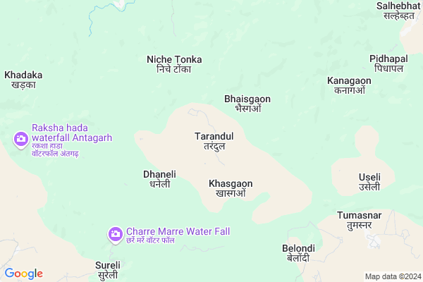
Tarandul
Tarandul Map
EDIT Map
Add Your House
 ..
..
Current Corona Virus Infected Patients Count in Kanker District
| City Name | District Name | Total Covid cases |
|---|
Locality Name :
Tarandul
( तरान्दुल )
Tehsil Name : Bhanupratappur
District : Kanker
State : Chattisgarh
Language : Chhattisgarhi and Hindi, Gondi And Halbi
Current Time 10:58 PM
Date: Sunday , Apr 27,2025 (IST)
Time zone: IST (UTC+5:30)
Elevation / Altitude: 412 meters. Above Seal level
Telephone Code / Std Code: 07850
Assembly constituency : Bhanupratappur assembly constituency
Assembly MLA : Savitri Manoj Mandavi
Lok Sabha constituency : Kanker parliamentary constituency
Parliament MP : MOHAN MANDAVI
Serpanch Name :
Pin Code : 494670
Post Office Name : Korar
Commodities Prices : Korar Market / Mandi
Tarandul Live Weather
Temperature: 24.0 °C
broken clouds
Humidity: 57%
Wind : 2.15 mt/sec towards SE
StationName : "KÄ\u0081nker"
observed on Now
Temperature: 24.0 °C
broken clouds
Humidity: 57%
Wind : 2.15 mt/sec towards SE
StationName : "KÄ\u0081nker"
observed on Now
Tarandul Weather Forecast for Next 5 days
28-04-2025
24.2°C to 24.2°C
broken clouds
24.2°C to 24.2°C
broken clouds
29-04-2025
22.3°C to 36.7°C
scattered clouds, clear sky, broken clouds
22.3°C to 36.7°C
scattered clouds, clear sky, broken clouds
30-04-2025
22.9°C to 38.8°C
scattered clouds, clear sky
22.9°C to 38.8°C
scattered clouds, clear sky
01-05-2025
24.9°C to 40.0°C
broken clouds, scattered clouds, few clouds, clear sky
24.9°C to 40.0°C
broken clouds, scattered clouds, few clouds, clear sky
02-05-2025
24.9°C to 40.6°C
clear sky, scattered clouds, few clouds
24.9°C to 40.6°C
clear sky, scattered clouds, few clouds
Rivers Near Tarandul
Mahanadi :تهر مهاندي :Mahanadi River :महानदी :ಮಹಾನದೀ :دریائے مہاندی :مهاندي
Hatkul
Mahanadi :تهر مهاندي :Mahanadi River :महानदी :ಮಹಾನದೀ :دریائے مہاندی :مهاندي
Hatkul
About Tarandul
Correct below Info and add more info about TarandulTarandul is a Village in Bhanupratappur Tehsil in Kanker District of Chattisgarh State, India. It is located 29 KM towards west from District head quarters Kanker. 23 KM from Bhanupratappur. 148 KM from State capital Raipur
Tarandul Pin code is 494670 and postal head office is Korar .
Useli ( 9 KM ) , Domaharra ( 9 KM ) , Tumasnar ( 9 KM ) , Amabeda ( 13 KM ) , Tultuli ( 13 KM ) are the nearby Villages to Tarandul. Tarandul is surrounded by Bhanupratappur Tehsil towards west , Kanker Tehsil towards East , Charama Tehsil towards North , Keshkal Tehsil towards East .
Kanker , Dalli-Rajhara , Balod , Dhamtari are the near by Cities to Tarandul.
Tarandul 2011 Census Details
Tarandul Local Language is Chhattisgarhi. Tarandul Village Total population is 728 and number of houses are 117. Female Population is 56.9%. Village literacy rate is 52.3% and the Female Literacy rate is 27.2%.
Population
| Census Parameter | Census Data |
| Total Population | 728 |
| Total No of Houses | 117 |
| Female Population % | 56.9 % ( 414) |
| Total Literacy rate % | 52.3 % ( 381) |
| Female Literacy rate | 27.2 % ( 198) |
| Scheduled Tribes Population % | 78.2 % ( 569) |
| Scheduled Caste Population % | 16.1 % ( 117) |
| Working Population % | 49.6 % |
| Child(0 -6) Population by 2011 | 154 |
| Girl Child(0 -6) Population % by 2011 | 55.8 % ( 86) |
Tarandul Census More Deatils.
Politics in Tarandul
Bharatiya Janata Party , BJP , INC are the major political parties in this area.Polling Stations /Booths near Tarandul
1)Taraighotiya2)Daragahan
3)Katagaon
4)Bandatola
5)Hatakondl
HOW TO REACH Tarandul
By Rail
There is no railway station near to Tarandul in less than 10 km.Colleges near Tarandul
Govt Degree College
Address :
Govt.mahrishi Valmiki Mahavidyalay Bhanupratappur
Address : New Railway Line Junction,bhanupratappur,kanker Cg
Schools in Tarandul
Ups Tarandul
Address : tarandul , bhanupratappur , kanker , Chattisgarh . PIN- 494670 , Post - Korar
Govt Health Centers near Tarandul
1) SHC Tarandul , , ,2) SHC Bhaisgaon , , ,
3) SHC Barepinjori , , ,
Hospitals in Tarandul,Bhanupratappur
pashu aushadhalaya Dhanelikanhar kanker
Markatlola; Chhattisgarh 494670; India
20.6 KM distance Detail
Primary Health Center
Korar; Kanker; SH-6; Bhanupratapur Kanker Road; Kanker; Kanker; Chhattisgarh 494336; India
20.8 KM distance Detail
more ..
Schools in Tarandul,Bhanupratappur
Gurukul Public School
Antagarh Narayanpur Rd; Antagarh; Chhattisgarh 494665; India
15.3 KM distance Detail
Super Markets in Tarandul,Bhanupratappur
Local Parks in Tarandul,Bhanupratappur
About Tarandul &
History
How to reach Tarandul
Tourist Places Near By Tarandul
Schools in Tarandul
Colleges in Tarandul
Temperature & weather of Tarandul
places in Tarandul
Tarandul photos
More Information
How to reach Tarandul
Tourist Places Near By Tarandul
Schools in Tarandul
Colleges in Tarandul
Temperature & weather of Tarandul
places in Tarandul
Tarandul photos
More Information
Village Talk
Post News or Events about this Village
Near Cities
Kanker 28 KM near
Dalli-Rajhara 56 KM near
Balod 71 KM near
Dhamtari 76 KM near
Kanker 28 KM near
Dalli-Rajhara 56 KM near
Balod 71 KM near
Dhamtari 76 KM near
Near By Taluks
Antagarh 14 KM near
Bhanupratappur 22 KM near
Kanker 26 KM near
Charama 40 KM near
Antagarh 14 KM near
Bhanupratappur 22 KM near
Kanker 26 KM near
Charama 40 KM near
Near By Air Ports
Raipur Airport 138 KM near
Sonegaon Airport 282 KM near
Jabalpur Airport 348 KM near
Vishakhapatnam Airport 380 KM near
Raipur Airport 138 KM near
Sonegaon Airport 282 KM near
Jabalpur Airport 348 KM near
Vishakhapatnam Airport 380 KM near
Near By Tourist Places
Kanker 29 KM near
Dhamtari 75 KM near
Rajnandgaon 119 KM near
Bhamragarh Wildlife Sanctuary 122 KM near
Durg 128 KM near
Kanker 29 KM near
Dhamtari 75 KM near
Rajnandgaon 119 KM near
Bhamragarh Wildlife Sanctuary 122 KM near
Durg 128 KM near
Near By Districts
Kanker 28 KM near
Narayanpur 54 KM near
Dhamtari 74 KM near
Rajnandgaon 119 KM near
Kanker 28 KM near
Narayanpur 54 KM near
Dhamtari 74 KM near
Rajnandgaon 119 KM near
Near By RailWay Station
Raj Nandgaon Rail Way Station 120 KM near
Durg Junction Rail Way Station 129 KM near
Raj Nandgaon Rail Way Station 120 KM near
Durg Junction Rail Way Station 129 KM near