| Home | City Bus | Maps | Villages | Cities | Rail | Tourist Places | School | College | Pin Codes | Corona Cases Count |
| Distance Calculator Bus Services IFSC Codes Trace Mobile Number Weather Search Place Trace IP Available Cash ATM/Banks Locate Polling Booth Report an Error contact People |
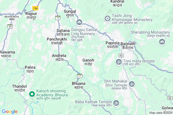
Ganoh
Ganoh Map
EDIT Map
Add Your House
 ..
..
Current Corona Virus Infected Patients Count in Kangra District
| City Name | District Name | Total Covid cases |
|---|---|---|
| Kangra | Kangra | 3 |
| Kangra District | Kangra | 2 |
Locality Name :
Ganoh
( गनोह )
Tehsil Name : Panchrukhi
District : Kangra
State : Himachal Pradesh
Language : Hindi and Kangri
Current Time 09:29 AM
Date: Friday , Apr 25,2025 (IST)
Time zone: IST (UTC+5:30)
Elevation / Altitude: 1301 meters. Above Seal level
Telephone Code / Std Code: 01894
Assembly constituency : Baijnath assembly constituency
Assembly MLA : Kishori Lal
Lok Sabha constituency : Kangra parliamentary constituency
Parliament MP : Kishan Kapoor
Serpanch Name :
Pin Code : 176063
Post Office Name : Majherna
Main Village Name : Gangoh
Commodities Prices : Kangra(Baijnath) Market / Mandi
Ganoh Live Weather
Temperature: 29.7 °C
scattered clouds
Humidity: 12%
Wind : 2.08 mt/sec towards S
StationName : "PÄ\u0081lampur"
observed on 5 Mins Back
Temperature: 29.7 °C
scattered clouds
Humidity: 12%
Wind : 2.08 mt/sec towards S
StationName : "PÄ\u0081lampur"
observed on 5 Mins Back
Ganoh Weather Forecast for Next 5 days
26-04-2025
20.7°C to 30.6°C
scattered clouds, broken clouds, clear sky
20.7°C to 30.6°C
scattered clouds, broken clouds, clear sky
27-04-2025
20.3°C to 32.7°C
clear sky, scattered clouds, broken clouds
20.3°C to 32.7°C
clear sky, scattered clouds, broken clouds
28-04-2025
20.9°C to 33.5°C
clear sky, scattered clouds
20.9°C to 33.5°C
clear sky, scattered clouds
29-04-2025
21.7°C to 33.7°C
clear sky
21.7°C to 33.7°C
clear sky
30-04-2025
22.5°C to 33.9°C
few clouds, scattered clouds, clear sky
22.5°C to 33.9°C
few clouds, scattered clouds, clear sky
National Highways Reachable To Ganoh
Nationa High Way :NH503
Nationa High Way :NH503
Rivers Near Ganoh
Buhal Khad
Ghoralatinu Nala
Buhal Khad
Ghoralatinu Nala
About Ganoh
Correct below Info and add more info about GanohGanoh is a small Village/hamlet in Panchrukhi Tehsil in Kangra District of Himachal Pradesh State, India. It comes under Gangoh Panchayath. It is located 37 KM towards East from District head quarters Dharamsala. 2 KM from Panchrukhi. 137 KM from State capital Shimla
Ganoh Pin code is 176063 and postal head office is Majherna .
Biara ( 2 KM ) , Nauri Jhikli ( 3 KM ) , Bhuana ( 3 KM ) , Kasba Paprola ( 4 KM ) , Bharwana ( 4 KM ) are the nearby Villages to Ganoh. Ganoh is surrounded by Baijnath Tehsil towards East , Bhawarna Tehsil towards west , Lambagaon Tehsil towards South , Chauntra Tehsil towards East .
Dharamsala , Hamirpur , Mandi , Sundarnagar are the near by Cities to Ganoh.
Ganoh 2011 Census Details
Ganoh Local Language is Hindi. Ganoh Village Total population is 75 and number of houses are 16. Female Population is 56.0%. Village literacy rate is 66.7% and the Female Literacy rate is 34.7%.
Population
| Census Parameter | Census Data |
| Total Population | 75 |
| Total No of Houses | 16 |
| Female Population % | 56.0 % ( 42) |
| Total Literacy rate % | 66.7 % ( 50) |
| Female Literacy rate | 34.7 % ( 26) |
| Scheduled Tribes Population % | 0.0 % ( 0) |
| Scheduled Caste Population % | 89.3 % ( 67) |
| Working Population % | 42.7 % |
| Child(0 -6) Population by 2011 | 14 |
| Girl Child(0 -6) Population % by 2011 | 64.3 % ( 9) |
Ganoh Census More Deatils.
Politics in Ganoh
BJP , INC are the major political parties in this area.Polling Stations /Booths near Ganoh
1)G.p.s. Rupehed2)G.h.s. Rajot (west Wing)
3)G.s.s.s. Lohardi (west Wing)
4)G.h.s. Hared
5)G.h.s. Rajot (east Wing)
HOW TO REACH Ganoh
By Rail
Majhairan Himachal Rail Way Station , Panchrukhi Rail Way Station are the very nearby railway stations to Ganoh.Colleges near Ganoh
Maharan Sansar Chand Memorial Degree College Naun Thural
Address :
Satyam College Of Nursing
Address :
Govt College Lanj
Address :
Tahl Mata Mandir
Address :
Govt Arya Degree College Nurpur
Address :
Schools near Ganoh
Green View S.s.s Bundla
Address : bundla , panchrukhi , kangra , Himachal Pradesh . PIN- 176061 , Post - Palampur
Gsss Averi
Address : averi , panchrukhi , kangra , Himachal Pradesh . PIN- 176081 , Post - Taragarh (Kangra)
N.m.p.s.saparu
Address : sapairu , panchrukhi , kangra , Himachal Pradesh . PIN- 176061 , Post - Palampur
Gms Tikari
Address : tikari , panchrukhi , kangra , Himachal Pradesh . PIN- 176063 , Post - Majherna
Govt Health Centers near Ganoh
1) Utpur PHC , VPO Utpur Tehsil Tauni Devi Distt. Hamirpur H.P. , Utpur ,2) Chauri PHC , VPO Chauri Tehsil Sujanpur Distt. Hamirpur H.P. , Chauri ,
3) Phahal SC , V.P.O. Phahal Tehsil Nadaun Distt. Hamirpur H.P. , Phahal ,
Hospitals in Ganoh,Panchrukhi
Dispensary Rakkar; Baijnath Bus Stop
32°02'24. 76°35'48.; 78; Cra. 3; Ulloa; Valle del Cauca 762030; India
0.4 KM distance Detail
Heera Adhrang Chikitsa Kendra
Panchrukhi - Paprola Rd; Panchrukhi; Himachal Pradesh 176103; India
3.1 KM distance Detail
more ..
Petrol Bunks in Ganoh,Panchrukhi
HP PETROL PUMP - PANCHRUKHI HP CENTRE
VPO Andretta Jaisinghpur Road Panchrukhi; Shimla; Himachal Pradesh 176103; India
3.0 KM distance Detail
PANCHRUKHI H.P. CENTRE
Panchrukhi Rd; Palampur; Himachal Pradesh 176103; India
3.8 KM distance Detail
Prakash Filling Station
Mandi - Pathankot Rd; Paprola; Himachal Pradesh 176063; India
4.2 KM distance Detail
more ..
Colleges in Ganoh,Panchrukhi
Rajiv Gandhi Government Post Graduate Ayurvedic College
Paprola - Panchrukhi Road;; Paprola; Himachal Pradesh 176115; India
3.3 KM distance Detail
Ambition Institute Of I.T Panchrukhi
Panchrukhi; Himachal Pradesh 176103; India
4.3 KM distance Detail
more ..
Schools in Ganoh,Panchrukhi
Rakkar Bheri
176103; Panchrukhi - Paprola Rd; Rakar Bheri; Himachal Pradesh; India
0.4 KM distance Detail
Government Senior Secondary School
Panchrukhi Rd; Bagri; Himachal Pradesh 176063; India
0.4 KM distance Detail
Govt. Primary School; Behdu
Labol - Behdu Rd; Majheran Uparla; Himachal Pradesh 176063; India
1.4 KM distance Detail
Electronic Shops in Ganoh,Panchrukhi
Amit Communication
176081 GHS Tharu; NH154; Jalbimbi; Himachal Pradesh 176047; India
4.0 KM distance Detail
Police Stations near Ganoh,Panchrukhi
Police Help Cell
National Highway 20; Paprola; Himachal Pradesh 176063; India
4.1 KM distance Detail
Police Station Baijnath
Police Station Road; Kasba; Kangra; Himachal Pradesh 176125; India
4.5 KM distance Detail
About Ganoh &
History
How to reach Ganoh
Tourist Places Near By Ganoh
Schools in Ganoh
Colleges in Ganoh
Temperature & weather of Ganoh
places in Ganoh
Ganoh photos
More Information
How to reach Ganoh
Tourist Places Near By Ganoh
Schools in Ganoh
Colleges in Ganoh
Temperature & weather of Ganoh
places in Ganoh
Ganoh photos
More Information
Village Talk
Post News or Events about this Village
Near Cities
Dharamsala 37 KM near
Hamirpur 45 KM near
Mandi 54 KM near
Sundarnagar 70 KM near
Dharamsala 37 KM near
Hamirpur 45 KM near
Mandi 54 KM near
Sundarnagar 70 KM near
Near By Taluks
Panchrukhi 2 KM near
Baijnath 7 KM near
Bhawarna 12 KM near
Lambagaon 16 KM near
Panchrukhi 2 KM near
Baijnath 7 KM near
Bhawarna 12 KM near
Lambagaon 16 KM near
Near By Air Ports
Gaggal Airport 47 KM near
Bhuntar Airport 53 KM near
Pathankot Airport 104 KM near
Simla Airport 128 KM near
Gaggal Airport 47 KM near
Bhuntar Airport 53 KM near
Pathankot Airport 104 KM near
Simla Airport 128 KM near
Near By Tourist Places
Palampur 10 KM near
Bir 12 KM near
Jawalaji 35 KM near
Mcleodganj 38 KM near
Dharamsala 38 KM near
Palampur 10 KM near
Bir 12 KM near
Jawalaji 35 KM near
Mcleodganj 38 KM near
Dharamsala 38 KM near
Near By Districts
Kangra 35 KM near
Hamirpur 44 KM near
Mandi 54 KM near
Kullu 54 KM near
Kangra 35 KM near
Hamirpur 44 KM near
Mandi 54 KM near
Kullu 54 KM near
Near By RailWay Station
Majhairan Himachal Rail Way Station 1.5 KM near
Panchrukhi Rail Way Station 4.4 KM near
Baijnath Mandir Rail Way Station 5.9 KM near
Nangal Dam Rail Way Station 86 KM near
Anandpur Sahib Rail Way Station 101 KM near
Majhairan Himachal Rail Way Station 1.5 KM near
Panchrukhi Rail Way Station 4.4 KM near
Baijnath Mandir Rail Way Station 5.9 KM near
Nangal Dam Rail Way Station 86 KM near
Anandpur Sahib Rail Way Station 101 KM near