| Home | City Bus | Maps | Villages | Cities | Rail | Tourist Places | School | College | Pin Codes | Corona Cases Count |
| Distance Calculator Bus Services IFSC Codes Trace Mobile Number Weather Search Place Trace IP Available Cash ATM/Banks Locate Polling Booth Report an Error contact People |
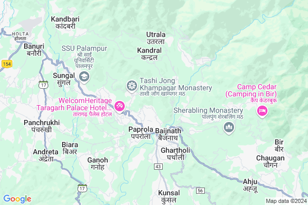
Paprola Khas
Paprola Khas Map
EDIT Map
Add Your House
 ..
..
Current Corona Virus Infected Patients Count in Kangra District
| City Name | District Name | Total Covid cases |
|---|---|---|
| Kangra | Kangra | 3 |
| Kangra District | Kangra | 2 |
Locality Name :
Paprola Khas
( पपरोला खास )
Tehsil Name : Baijnath
District : Kangra
State : Himachal Pradesh
Language : Hindi and Kangri
Current Time 08:49 AM
Date: Friday , Apr 25,2025 (IST)
Time zone: IST (UTC+5:30)
Elevation / Altitude: 1042 meters. Above Seal level
Telephone Code / Std Code: 01894
Assembly constituency : Baijnath assembly constituency
Assembly MLA : Kishori Lal
Lok Sabha constituency : Kangra parliamentary constituency
Parliament MP : Kishan Kapoor
Serpanch Name :
Pin Code : 176081
Post Office Name : Taragarh (Kangra)
Commodities Prices : Kangra(Baijnath) Market / Mandi
Edit below overview about Paprola Khas
Edit below overview about Paprola Khas
OverView of Paprola Khas
People of Paprola believe to celebrate each function with everyone. They believe a divine entity (known as Baba Gyan Das) is protecting them. A temple is made for him where the power is believed to reside in a stone sculpture. The natives of Paprola are very helpful and friendly.There is a good market in Paprola. People from nearby towns and villages come here for shopping.Edit below overview about Paprola Khas
National Highways Reachable To Paprola Khas
Nationa High Way :NH3
Nationa High Way :NH503
Nationa High Way :NH3
Nationa High Way :NH503
Rivers Near Paprola Khas
Manjhi Khad
Binwa Khadd
Manjhi Khad
Binwa Khadd
About Paprola Khas
Paprola Khas is a Village in Baijnath Tehsil in Kangra District of Himachal Pradesh State, India. It is located 39 KM towards East from District head quarters Dharamsala. 3 KM from Baijnath. 138 KM from State capital Shimla
Paprola Khas Pin code is 176081 and postal head office is Taragarh (Kangra) .
Baijnath ( 2 KM ) , Nauri Jhikli ( 2 KM ) , Averi ( 3 KM ) , Majherna Khas ( 3 KM ) , Sehal ( 4 KM ) are the nearby Villages to Paprola Khas. Paprola Khas is surrounded by Panchrukhi Tehsil towards west , Bhawarna Tehsil towards west , Chauntra Tehsil towards South , Lambagaon Tehsil towards South .
Dharamsala , Hamirpur , Mandi , Sundarnagar are the near by Cities to Paprola Khas.
This Place is in the border of the Kangra District and Mandi District. Mandi District Chauntra is South towards this place .
Paprola Khas 2011 Census Details
Paprola Khas Local Language is Hindi. Paprola Khas Village Total population is 860 and number of houses are 122. Female Population is 44.8%. Village literacy rate is 87.3% and the Female Literacy rate is 37.9%.
Population
| Census Parameter | Census Data |
| Total Population | 860 |
| Total No of Houses | 122 |
| Female Population % | 44.8 % ( 385) |
| Total Literacy rate % | 87.3 % ( 751) |
| Female Literacy rate | 37.9 % ( 326) |
| Scheduled Tribes Population % | 3.4 % ( 29) |
| Scheduled Caste Population % | 25.0 % ( 215) |
| Working Population % | 21.9 % |
| Child(0 -6) Population by 2011 | 47 |
| Girl Child(0 -6) Population % by 2011 | 38.3 % ( 18) |
Paprola Khas Census More Deatils.
Politics in Paprola Khas
BJP , INC are the major political parties in this area.Polling Stations /Booths near Paprola Khas
1)G.p.s. Keori2)G.s.s.s. Utrala (south Wing )
3)G.s.s.s. (girls) Paprola (south Wing)
4)G.s.s..s. Sansal
5)G.m.s. Mahankal
HOW TO REACH Paprola Khas
By Rail
Baijnath Mandir Rail Way Station , Baijnath Paprola Rail Way Station are the very nearby railway stations to Paprola Khas.Colleges near Paprola Khas
Pandit Sant Ram Govt Degree College
Address :
Schools near Paprola Khas
Vishudha Pub. Sr.sec. Sch. Baijnath
Address : baijnath , baijnath , kangra , Himachal Pradesh . PIN- 176125 , Post - Baijnath (Kangra)
Learn Well S.s.s. Bir
Address : bir , baijnath , kangra , Himachal Pradesh . PIN- 176077 , Post - Bir (Kangra)
M.p.s. Mahakal
Address : mahakal , baijnath , kangra , Himachal Pradesh . PIN- 176125 , Post - Baijnath (Kangra)
Bharti V.p.pub.s Baijnath
Address : baijnath , baijnath , kangra , Himachal Pradesh . PIN- 176125 , Post - Baijnath (Kangra)
Govt Health Centers near Paprola Khas
1) Utpur PHC , VPO Utpur Tehsil Tauni Devi Distt. Hamirpur H.P. , Utpur ,2) Chauri PHC , VPO Chauri Tehsil Sujanpur Distt. Hamirpur H.P. , Chauri ,
3) Phahal SC , V.P.O. Phahal Tehsil Nadaun Distt. Hamirpur H.P. , Phahal ,
Hospitals in Paprola Khas,Baijnath
Thyrocare lab Collection Centre
National Highway; 20; Panchrukhi-Paprola Rd; Kasba; Himachal Pradesh 176063; India
2.1 KM distance Detail
more ..
Petrol Bunks in Paprola Khas,Baijnath
Prakash Filling Station
Mandi - Pathankot Rd; Paprola; Himachal Pradesh 176063; India
1.9 KM distance Detail
HP Petrol Pump Krishna HP Centre
Baijnath; Shimla; Himachal Pradesh 176125; India
2.3 KM distance Detail
Indian oil corporation
Bridge; Mandi-Pathankot Rd; Sarsawa; Himachal Pradesh 176081; India
6.1 KM distance Detail
more ..
Colleges in Paprola Khas,Baijnath
Industrial Training Institutes
National Highway 20; Baijnath; Himachal Pradesh 176125; India
2.5 KM distance Detail
Shaheed Diwan Chand Katoch Industrial Training Institute
Mandi - Pathankot Rd; Baijnath; Himachal Pradesh 176125; India
2.5 KM distance Detail
PAMMIT HEALTHCARE(EDUCATION) ;PAPROLA MBA;BA;B.SC;BCA;MCA;B TECH;PHD;M.
Baijnath; Himachal Pradesh 176125; India
2.5 KM distance Detail
Rajiv Gandhi Government Post Graduate Ayurvedic College
Paprola - Panchrukhi Road;; Paprola; Himachal Pradesh 176115; India
3.0 KM distance Detail
more ..
Schools in Paprola Khas,Baijnath
Government Middle School
Paprola-Utrala Rd; Malghota; Himachal Pradesh 176115; India
1.7 KM distance Detail
Khampagar Monastery
Khampagar Monastery; Tashigong; Himachal Pradesh; India; India
1.8 KM distance Detail
Moon Light Public School
National Highway 20; Kasba Paprola; Himachal Pradesh 176115; India
2.1 KM distance Detail
Electronic Shops in Paprola Khas,Baijnath
Ambalika Incorporation
near state bank of India; Paprola; Himachal Pradesh; India
1.8 KM distance Detail
Super Markets in Paprola Khas,Baijnath
Frontier Stores
Mandi - Pathankot Rd; Paprola; Himachal Pradesh 176063; India
2.2 KM distance Detail
KK General Store
Mandi-Pathankot Road; Paprola; Himachal Pradesh 176115; India
2.3 KM distance Detail
Police Stations near Paprola Khas,Baijnath
Police Help Cell
National Highway 20; Paprola; Himachal Pradesh 176063; India
2.4 KM distance Detail
Police Assistance Room
Chowin Chowk; Neri - Bajnath Rd; Baijnath; Himachal Pradesh 176125; India
2.6 KM distance Detail
Governement Offices near Paprola Khas,Baijnath
Gram Panchayat Office
Paprola-Utrala Rd; Paprola; Himachal Pradesh 176125; India
2.2 KM distance Detail
About Paprola Khas &
History
How to reach Paprola Khas
Tourist Places Near By Paprola Khas
Schools in Paprola Khas
Colleges in Paprola Khas
Temperature & weather of Paprola Khas
places in Paprola Khas
Paprola Khas photos
More Information
How to reach Paprola Khas
Tourist Places Near By Paprola Khas
Schools in Paprola Khas
Colleges in Paprola Khas
Temperature & weather of Paprola Khas
places in Paprola Khas
Paprola Khas photos
More Information
Village Talk
Post News or Events about this Village
Near Cities
Dharamsala 38 KM near
Hamirpur 50 KM near
Mandi 54 KM near
Sundarnagar 72 KM near
Dharamsala 38 KM near
Hamirpur 50 KM near
Mandi 54 KM near
Sundarnagar 72 KM near
Near By Taluks
Baijnath 2 KM near
Panchrukhi 6 KM near
Bhawarna 15 KM near
Chauntra 20 KM near
Baijnath 2 KM near
Panchrukhi 6 KM near
Bhawarna 15 KM near
Chauntra 20 KM near
Near By Air Ports
Gaggal Airport 48 KM near
Bhuntar Airport 49 KM near
Pathankot Airport 107 KM near
Simla Airport 130 KM near
Gaggal Airport 48 KM near
Bhuntar Airport 49 KM near
Pathankot Airport 107 KM near
Simla Airport 130 KM near
Near By Tourist Places
Bir 7 KM near
Palampur 11 KM near
Mcleodganj 39 KM near
Dharamsala 39 KM near
Jawalaji 41 KM near
Bir 7 KM near
Palampur 11 KM near
Mcleodganj 39 KM near
Dharamsala 39 KM near
Jawalaji 41 KM near
Near By Districts
Kangra 37 KM near
Hamirpur 49 KM near
Kullu 51 KM near
Mandi 54 KM near
Kangra 37 KM near
Hamirpur 49 KM near
Kullu 51 KM near
Mandi 54 KM near
Near By RailWay Station
Baijnath Paprola Rail Way Station 2.8 KM near
Baijnath Mandir Rail Way Station 2.8 KM near
Majhairan Himachal Rail Way Station 4.4 KM near
Nangal Dam Rail Way Station 91 KM near
Anandpur Sahib Rail Way Station 105 KM near
Baijnath Paprola Rail Way Station 2.8 KM near
Baijnath Mandir Rail Way Station 2.8 KM near
Majhairan Himachal Rail Way Station 4.4 KM near
Nangal Dam Rail Way Station 91 KM near
Anandpur Sahib Rail Way Station 105 KM near