| Home | City Bus | Maps | Villages | Cities | Rail | Tourist Places | School | College | Pin Codes | Corona Cases Count |
| Distance Calculator Bus Services IFSC Codes Trace Mobile Number Weather Search Place Trace IP Available Cash ATM/Banks Locate Polling Booth Report an Error contact People |
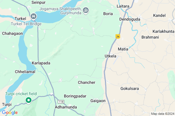
Kokomunda Map
EDIT Map
Add Your House
 ..
..
Current Corona Virus Infected Patients Count in Kalahandi District
| City Name | District Name | Total Covid cases |
|---|---|---|
| Golamunda | Kalahandi | 1 |
| Kalahandi District | Kalahandi | 1 |
Locality Name :
Kokomunda
( କମୁଣ୍ଡା )
Tehsil Name : Kesinga
District : Kalahandi
State : Odisha
Language : Oriya and Hindi,
Current Time 12:49 PM
Date: Monday , Apr 28,2025 (IST)
Time zone: IST (UTC+5:30)
Elevation / Altitude: 183 meters. Above Seal level
Telephone Code / Std Code: 06655
Assembly constituency : Bhawanipatna assembly constituency
Assembly MLA : anam naik
Lok Sabha constituency : Kalahandi parliamentary constituency
Parliament MP : BASANTA KUMAR PANDA
Serpanch Name :
Pin Code : 766011
Post Office Name : Utkela
Commodities Prices : Kesinga Market / Mandi
National Highways Reachable To Kokomunda
Nationa High Way :NH26
Nationa High Way :NH26
Rivers Near Kokomunda
Dongadarha Nadi :Dongadarha Nadi
Kodobhāta Nadi :Kodobhata Nadi
Dongadarha Nadi :Dongadarha Nadi
Kodobhāta Nadi :Kodobhata Nadi
About Kokomunda
Correct below Info and add more info about KokomundaKokomunda is a small Village/hamlet in Kesinga Tehsil in Kalahandi District of Odisha State, India. It is located 24 KM towards North from District head quarters Bhawanipatna. 10 KM from Kesinga. 329 KM from State capital Bhubaneswar
Kokomunda Pin code is 766011 and postal head office is Utkela .
Kundabandh ( 5 KM ) , Gaiagaon ( 6 KM ) , Adhamunda ( 7 KM ) , Boria ( 7 KM ) , Phatkamal ( 7 KM ) are the nearby Villages to Kokomunda. Kokomunda is surrounded by Titlagarh Tehsil towards North , Bhawanipatna Tehsil towards South , Narala Tehsil towards East , Muribahal Tehsil towards North .
Titlagarh , Bhawanipatna , Kantabanji , Balangir are the near by Cities to Kokomunda.
This Place is in the border of the Kalahandi District and Balangir District. Balangir District Titlagarh is North towards this place .
Kokomunda 2011 Census Details
Kokomunda Local Language is Oriya. Kokomunda Village Total population is 712 and number of houses are 162. Female Population is 51.0%. Village literacy rate is 53.9% and the Female Literacy rate is 23.5%.
Population
| Census Parameter | Census Data |
| Total Population | 712 |
| Total No of Houses | 162 |
| Female Population % | 51.0 % ( 363) |
| Total Literacy rate % | 53.9 % ( 384) |
| Female Literacy rate | 23.5 % ( 167) |
| Scheduled Tribes Population % | 31.3 % ( 223) |
| Scheduled Caste Population % | 20.6 % ( 147) |
| Working Population % | 42.4 % |
| Child(0 -6) Population by 2011 | 99 |
| Girl Child(0 -6) Population % by 2011 | 48.5 % ( 48) |
Kokomunda Census More Deatils.
Politics in Kokomunda
BJP , BJD , INC are the major political parties in this area.Polling Stations /Booths near Kokomunda
1)Kokodmal Ps2)Ajrai Ps
3)Chahagon Nups
4)Dumermunda Ps
5)Utkela Cps
HOW TO REACH Kokomunda
By Rail
There is no railway station near to Kokomunda in less than 10 km.Colleges near Kokomunda
Utkela Junior Mahavidyalaya
Address :
Kesinga Mahavidyalaya Kesinga Kalahandi Odisha
Address : At-kesinga Ps-kesinga Dist-kalahandi State-odiaha India
Schools near Kokomunda
Kapileswar High School Kanteshir
Address : At-kanteshir po-kanteshir dist-kalahandi state-odiaha block-kesinga
Tundla High School,tundla
Address : At/PO:Tundla
VIA:Kesinga
Dist.:Kalahandi
State: Odisha
PIN:766012
Up-graded Govt High School Nunmath
Address :
Govt Health Centers near Kokomunda
1) Udit Narayan Pur T.B Hospital , Kalahandi , Kalahandi , Kalahandi2) Lanjigarh Road SC , LANJIGARH ROAD , LANJIGARH ROAD , Near PHC (N) Lanjigarh road
3) SINAPALI , SINAPALI , SINAPALI ,
Hospitals in Kokomunda,Kesinga
Homeopathic Hospital ; Utkela
National Highway 201; Utkela; Odisha 766011; India
3.3 KM distance Detail
PRIMARY HEALTH CENTER UTKELA
National Highway 201; Themara; Odisha 766011; India
3.3 KM distance Detail
more ..
Petrol Bunks in Kokomunda,Kesinga
HP PETROL PUMP - ANJANEE SPEED SERVICE GAIGAON
AT Gaigaon PO: Utkela PS: Kesinga Sambalpur; Odisha 766011; India
5.7 KM distance Detail
more ..
Colleges in Kokomunda,Kesinga
Govt. Women's College; Bhawanipatna.
National Highway 26; Jeypore - Bhawanipatna - Balangir - Bargarh Hwy; Junagarh; Odisha; India
3.1 KM distance Detail
more ..
Schools in Kokomunda,Kesinga
Lal Bahadur School
Utkela; Kalahandi; NH-201; Borigumma Bargarh Highway; Kesinga; Kesinga; Odisha 766012; India
3.2 KM distance Detail
Governement Offices near Kokomunda,Kesinga
Ri Office Pastikudi
Jeypore - Bhawanipatna - Balangir - Bargarh Hwy; Pasti Kudi; Odisha 766011; India
11.3 KM distance Detail
About Kokomunda &
History
How to reach Kokomunda
Tourist Places Near By Kokomunda
Schools in Kokomunda
Colleges in Kokomunda
Temperature & weather of Kokomunda
places in Kokomunda
Kokomunda photos
More Information
How to reach Kokomunda
Tourist Places Near By Kokomunda
Schools in Kokomunda
Colleges in Kokomunda
Temperature & weather of Kokomunda
places in Kokomunda
Kokomunda photos
More Information
Village Talk
Post News or Events about this Village
Near Cities
Titlagarh 23 KM near
Bhawanipatna 23 KM near
Kantabanji 54 KM near
Balangir 85 KM near
Titlagarh 23 KM near
Bhawanipatna 23 KM near
Kantabanji 54 KM near
Balangir 85 KM near
Near By Taluks
Kesinga 9 KM near
Titlagarh 19 KM near
Bhawanipatna 21 KM near
Narala 22 KM near
Kesinga 9 KM near
Titlagarh 19 KM near
Bhawanipatna 21 KM near
Narala 22 KM near
Near By Air Ports
Raipur Airport 212 KM near
Vishakhapatnam Airport 295 KM near
Bhubaneswar Airport 312 KM near
Rajahmundry Airport 404 KM near
Raipur Airport 212 KM near
Vishakhapatnam Airport 295 KM near
Bhubaneswar Airport 312 KM near
Rajahmundry Airport 404 KM near
Near By Tourist Places
Kalahandi 30 KM near
Phulbani 134 KM near
Jeypore 168 KM near
Mahasamund 175 KM near
Jagdalpur 182 KM near
Kalahandi 30 KM near
Phulbani 134 KM near
Jeypore 168 KM near
Mahasamund 175 KM near
Jagdalpur 182 KM near
Near By Districts
Kalahandi 23 KM near
Balangir 85 KM near
Nuapada 114 KM near
Rayagada 119 KM near
Kalahandi 23 KM near
Balangir 85 KM near
Nuapada 114 KM near
Rayagada 119 KM near
Near By RailWay Station
Kesinga Rail Way Station 14 KM near
Rupra Road Rail Way Station 21 KM near
Kesinga Rail Way Station 14 KM near
Rupra Road Rail Way Station 21 KM near