| Home | City Bus | Maps | Villages | Cities | Rail | Tourist Places | School | College | Pin Codes | Corona Cases Count |
| Distance Calculator Bus Services IFSC Codes Trace Mobile Number Weather Search Place Trace IP Available Cash ATM/Banks Locate Polling Booth Report an Error contact People |
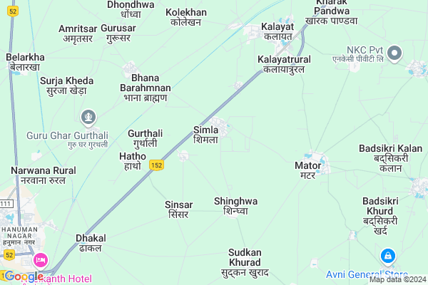
Simla Map
EDIT Map
Add Your House
 ..
..
Current Corona Virus Infected Patients Count in Kaithal District
| City Name | District Name | Total Covid cases |
|---|---|---|
| Kaithal District | Kaithal | 2 |
Locality Name :
Simla
( शिमला )
Tehsil Name : Kalayat
District : Kaithal
State : Haryana
Division : Ambala
Language : Hindi and Punjabi
Current Time 06:45 AM
Date: Saturday , Apr 26,2025 (IST)
Time zone: IST (UTC+5:30)
Elevation / Altitude: 235 meters. Above Seal level
Telephone Code / Std Code: 01749
Assembly constituency : Kalayat assembly constituency
Assembly MLA : Kamlesh Dhanda
Lok Sabha constituency : Kurukshetra parliamentary constituency
Parliament MP : NAYAB SINGH
Serpanch Name :
Pin Code : 136117
Post Office Name : Kalayat
Commodities Prices : Narwana Market / Mandi
Simla Live Weather
Temperature: 27.1 °C
few clouds
Humidity: 10%
Wind : 1.04 mt/sec towards S
StationName : "NarwÄ\u0081na"
observed on 13 Mins Back
Temperature: 27.1 °C
few clouds
Humidity: 10%
Wind : 1.04 mt/sec towards S
StationName : "NarwÄ\u0081na"
observed on 13 Mins Back
Simla Weather Forecast for Next 5 days
27-04-2025
29.0°C to 41.1°C
scattered clouds, broken clouds
29.0°C to 41.1°C
scattered clouds, broken clouds
28-04-2025
28.4°C to 42.8°C
broken clouds, scattered clouds, clear sky, few clouds
28.4°C to 42.8°C
broken clouds, scattered clouds, clear sky, few clouds
29-04-2025
27.5°C to 43.0°C
clear sky
27.5°C to 43.0°C
clear sky
30-04-2025
28.9°C to 44.4°C
clear sky, few clouds
28.9°C to 44.4°C
clear sky, few clouds
01-05-2025
27.7°C to 43.6°C
clear sky
27.7°C to 43.6°C
clear sky
Edit below overview about Simla
Edit below overview about Simla
OverView of Simla
Village simla is tha last village of district kaithal towards Jind district haryana, that's why it has named as simla(i.e last village of district kaithal)Edit below overview about Simla
National Highways Reachable To Simla
Nationa High Way :NH152
Nationa High Way :NH52
Nationa High Way :NH152
Nationa High Way :NH52
Rivers Near Simla
Ghaggar
Ghaggar
About Simla
Simla is a Village in Kalayat Tehsil in Kaithal District of Haryana State, India. It belongs to Ambala Division . It is located 30 KM towards west from District head quarters Kaithal. 8 KM from Kalayat. 156 KM from State capital Chandigarh
Simla Pin code is 136117 and postal head office is Kalayat .
Kolekhan ( 6 KM ) , Panjupura ( 6 KM ) , Kalayat ( 6 KM ) , Ramgarh Pandwa ( 7 KM ) , Badsikri Khurd ( 10 KM ) are the nearby Villages to Simla. Simla is surrounded by Narwana Tehsil towards west , Uchana Tehsil towards South , Rajound Tehsil towards East , Cheeka Tehsil towards North .
Narwana , Kaithal , Tohana , Jind are the near by Cities to Simla.
This Place is in the border of the Kaithal District and Jind District. Jind District Narwana is west towards this place .
Simla 2011 Census Details
Simla Local Language is Hindi. Simla Village Total population is 4371 and number of houses are 866. Female Population is 45.8%. Village literacy rate is 57.1% and the Female Literacy rate is 19.9%.
Population
| Census Parameter | Census Data |
| Total Population | 4371 |
| Total No of Houses | 866 |
| Female Population % | 45.8 % ( 2003) |
| Total Literacy rate % | 57.1 % ( 2498) |
| Female Literacy rate | 19.9 % ( 870) |
| Scheduled Tribes Population % | 0.0 % ( 0) |
| Scheduled Caste Population % | 25.0 % ( 1094) |
| Working Population % | 44.7 % |
| Child(0 -6) Population by 2011 | 527 |
| Girl Child(0 -6) Population % by 2011 | 46.7 % ( 246) |
Simla Census More Deatils.
Politics in Simla
Bharatiya Janata Party , BJP , INLD , INC are the major political parties in this area.Polling Stations /Booths near Simla
1)Simla2)Simla
3)Serdha
4)Peoda
5)Birkhadalwa Be Cheerag Abadi Matour
HOW TO REACH Simla
By Rail
Kalayat Rail Way Station , Gurthuri Rail Way Station are the very nearby railway stations to Simla.Colleges near Simla
Shri Kapil Muni Mahila College, Kalayat
Address : Railway Road,indira Colony, Kalayat, Distt. Kaithal, Haryana
Shri Kapil Muni Mahila College
Address :
Schools near Simla
Geeta Vidya Mandir Kolekhan
Address : kole khan , kalayat , kaithal , Haryana . PIN- 136117 , Post - Kalayat
Tagore Sr.sec.sc.mator
Address : matour , kalayat , kaithal , Haryana . PIN- 136117 , Post - Kalayat
D.r.s.c.r.sr.sec. Sinnad
Address : sinnad , kalayat , kaithal , Haryana . PIN- 136117 , Post - Kalayat
Bal Vikas Pub.scl. Kyt.
Address : kalayat city , kalayat , kaithal , Haryana . PIN- 136117 , Post - Kalayat
Govt Health Centers near Simla
1) Kurar , , ,2) MUNAK , , ,
3) PHC BARODA , , ,
Petrol Bunks in Simla,Kalayat
Petrol Pump
Kaithal - Hisar Road; Auto Market; Tayal Bagh Colony; Hisar; Haryana 125011; India
2.5 KM distance Detail
HP PETROL PUMP - SORABH FILLING STATION
Hpcl Dealers Kalayat Road ON Kalayat Kithana Link RD. Tehsil Kalayat; Panipat; Haryana 136117; India
5.2 KM distance Detail
more ..
Colleges in Simla,Kalayat
S.S.M. College of Education
NH-65; NARWANA ROAD; KALAYAT; Kaithal; Haryana 136117; India
5.3 KM distance Detail
SSM College of Physical Education
Kalayat; Kaithal; NH-65; Kaithal Road; Kaithal; Kaithal; Haryana 136117; India
5.3 KM distance Detail
M.D.N. College of Education
Hisar Chandigarh Road; National Highway No.6; Kaithal District; Kalayat; Haryana 136117; India
6.4 KM distance Detail
more ..
Schools in Simla,Kalayat
Government Primary School
Bidhrana; Jind; NH-65; Kaithal Road; Narwana; Narwana; Haryana 126116; India
2.1 KM distance Detail
About Simla &
History
How to reach Simla
Tourist Places Near By Simla
Schools in Simla
Colleges in Simla
Temperature & weather of Simla
places in Simla
Simla photos
More Information
How to reach Simla
Tourist Places Near By Simla
Schools in Simla
Colleges in Simla
Temperature & weather of Simla
places in Simla
Simla photos
More Information
Village Talk
Post News or Events about this Village
Near Cities
Narwana 11 KM near
Kaithal 29 KM near
Tohana 36 KM near
Jind 40 KM near
Narwana 11 KM near
Kaithal 29 KM near
Tohana 36 KM near
Jind 40 KM near
Near By Taluks
Kalayat 8 KM near
Narwana 16 KM near
Uchana 19 KM near
Rajound 27 KM near
Kalayat 8 KM near
Narwana 16 KM near
Uchana 19 KM near
Rajound 27 KM near
Near By Air Ports
Chandigarh Airport 144 KM near
Muzaffarnagar Airport 158 KM near
Ludhiana Airport 163 KM near
Indira Gandhi International Airport 164 KM near
Chandigarh Airport 144 KM near
Muzaffarnagar Airport 158 KM near
Ludhiana Airport 163 KM near
Indira Gandhi International Airport 164 KM near
Near By Tourist Places
Hansi 71 KM near
Kurukshetra 75 KM near
Karna lake 83 KM near
panipat 86 KM near
Sangrur 87 KM near
Hansi 71 KM near
Kurukshetra 75 KM near
Karna lake 83 KM near
panipat 86 KM near
Sangrur 87 KM near
Near By Districts
Kaithal 29 KM near
Jind 40 KM near
Hisar 78 KM near
Kurukshetra 80 KM near
Kaithal 29 KM near
Jind 40 KM near
Hisar 78 KM near
Kurukshetra 80 KM near
Near By RailWay Station
Kalayat Rail Way Station 6.5 KM near
Gurthuri Rail Way Station 6.9 KM near
Narwana Junction Rail Way Station 13 KM near
Tohana Rail Way Station 35 KM near
Kalayat Rail Way Station 6.5 KM near
Gurthuri Rail Way Station 6.9 KM near
Narwana Junction Rail Way Station 13 KM near
Tohana Rail Way Station 35 KM near