| Home | City Bus | Maps | Villages | Cities | Rail | Tourist Places | School | College | Pin Codes | Corona Cases Count |
| Distance Calculator Bus Services IFSC Codes Trace Mobile Number Weather Search Place Trace IP Available Cash ATM/Banks Locate Polling Booth Report an Error contact People |
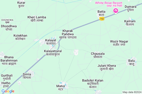
Kalasar Map
EDIT Map
Add Your House
 ..
..
Current Corona Virus Infected Patients Count in Kaithal District
| City Name | District Name | Total Covid cases |
|---|---|---|
| Kaithal District | Kaithal | 2 |
Locality Name :
Kalasar
( कालसर )
Tehsil Name : Kalayat
District : Kaithal
State : Haryana
Division : Ambala
Language : Hindi and Punjabi
Current Time 12:33 PM
Date: Tuesday , Apr 29,2025 (IST)
Time zone: IST (UTC+5:30)
Elevation / Altitude: 235 meters. Above Seal level
Telephone Code / Std Code: 01749
Assembly constituency : Kalayat assembly constituency
Assembly MLA : Kamlesh Dhanda
Lok Sabha constituency : Kurukshetra parliamentary constituency
Parliament MP : NAYAB SINGH
Serpanch Name :
Pin Code : 136117
Post Office Name : Kalayat
Commodities Prices : Narwana Market / Mandi
Kalasar Live Weather
Temperature: 34.5 °C
clear sky
Humidity: 21%
Wind : 5.96 mt/sec towards SE
StationName : "Kaithal"
observed on 1 Hours Back
Temperature: 34.5 °C
clear sky
Humidity: 21%
Wind : 5.96 mt/sec towards SE
StationName : "Kaithal"
observed on 1 Hours Back
Kalasar Weather Forecast for Next 5 days
30-04-2025
29.1°C to 40.5°C
clear sky
29.1°C to 40.5°C
clear sky
01-05-2025
27.6°C to 43.3°C
clear sky, few clouds
27.6°C to 43.3°C
clear sky, few clouds
02-05-2025
27.9°C to 43.4°C
few clouds, clear sky, scattered clouds, broken clouds, overcast clouds
27.9°C to 43.4°C
few clouds, clear sky, scattered clouds, broken clouds, overcast clouds
03-05-2025
27.1°C to 42.1°C
overcast clouds, broken clouds, light rain, scattered clouds
27.1°C to 42.1°C
overcast clouds, broken clouds, light rain, scattered clouds
04-05-2025
27.0°C to 42.5°C
scattered clouds, overcast clouds, broken clouds, light rain
27.0°C to 42.5°C
scattered clouds, overcast clouds, broken clouds, light rain
National Highways Reachable To Kalasar
Nationa High Way :NH152
Nationa High Way :NH52
Nationa High Way :NH152
Nationa High Way :NH52
Rivers Near Kalasar
Ghaggar
Ghaggar
About Kalasar
Correct below Info and add more info about KalasarKalasar is a Village in Kalayat Tehsil in Kaithal District of Haryana State, India. It belongs to Ambala Division . It is located 21 KM towards west from District head quarters Kaithal. 148 KM from State capital Chandigarh
Kalasar Pin code is 136117 and postal head office is Kalayat .
Kalasar is surrounded by Cheeka Tehsil towards North , Kaithal Tehsil towards North , Rajound Tehsil towards East , Narwana Tehsil towards west .
Narwana , Kaithal , Assandh , Tohana are the near by Cities to Kalasar.
This Place is in the border of the Kaithal District and Jind District. Jind District Narwana is west towards this place .
Demographics of Kalasar
Hindi is the Local Language here.Politics in Kalasar
Bharatiya Janata Party , BJP , INLD , INC are the major political parties in this area.Polling Stations /Booths near Kalasar
1)Rajound2)Ramgarh Pandwa
3)Kasan
4)Kharak Pandwa
5)Kharak Pandwa
HOW TO REACH Kalasar
By Rail
Kalayat Rail Way Station is the very nearby railway stations to Kalasar.Colleges near Kalasar
Shri Kapil Muni Mahila College, Kalayat
Address : Railway Road,indira Colony, Kalayat, Distt. Kaithal, Haryana
Shri Kapil Muni Mahila College
Address :
Schools in Kalasar
Gps Kalasar
Address : kalasar , kalayat , kaithal , Haryana . PIN- 136117 , Post - Kalayat
Govt Health Centers near Kalasar
1) MUNAK , , ,2) Kurar , , ,
3) PHC BARODA , , ,
Petrol Bunks in Kalasar,Kalayat
Prithi Chand Munna Lal Filling Station Hindustan Petroleum
Kalayat; Kaithal; NH-65; Kaithal Road; Kaithal; Kaithal; Haryana 136117; India
3.2 KM distance Detail
more ..
Colleges in Kalasar,Kalayat
SSM College of Physical Education
Kalayat; Kaithal; NH-65; Kaithal Road; Kaithal; Kaithal; Haryana 136117; India
3.7 KM distance Detail
S.S.M. College of Education
NH-65; NARWANA ROAD; KALAYAT; Kaithal; Haryana 136117; India
3.7 KM distance Detail
more ..
Schools in Kalasar,Kalayat
Vivekanand Educational Institute
Narawana Road; Kalayat; Haryana 136117; India
2.6 KM distance Detail
AP CAMPUS & LIBRARY
NH152; OPPOSITE BUS STAND; Kalayat; Haryana 136117; India
2.7 KM distance Detail
Electronic Shops in Kalasar,Kalayat
Janta submursible
Kaithal - Hisar Road; Panjupura; Kalayat; Haryana 136117; India
2.8 KM distance Detail
Super Markets in Kalasar,Kalayat
Ultratech Cement Store Kalayat 136117
Railway Rd; Panjupura; Kalayat; Haryana 136117; India
3.2 KM distance Detail
Shiv Steel Shutteting Store and building material Kalayat
Panjupura; Kalayat; Haryana 136117; India
3.2 KM distance Detail
About Kalasar &
History
How to reach Kalasar
Tourist Places Near By Kalasar
Schools in Kalasar
Colleges in Kalasar
Temperature & weather of Kalasar
places in Kalasar
Kalasar photos
More Information
How to reach Kalasar
Tourist Places Near By Kalasar
Schools in Kalasar
Colleges in Kalasar
Temperature & weather of Kalasar
places in Kalasar
Kalasar photos
More Information
Village Talk
Post News or Events about this Village
Near Cities
Narwana 19 KM near
Kaithal 20 KM near
Assandh 39 KM near
Tohana 41 KM near
Narwana 19 KM near
Kaithal 20 KM near
Assandh 39 KM near
Tohana 41 KM near
Near By Taluks
Kalayat 0 KM near
Cheeka 20 KM near
Rajound 22 KM near
Kaithal 22 KM near
Kalayat 0 KM near
Cheeka 20 KM near
Rajound 22 KM near
Kaithal 22 KM near
Near By Air Ports
Chandigarh Airport 136 KM near
Muzaffarnagar Airport 153 KM near
Ludhiana Airport 160 KM near
Indira Gandhi International Airport 164 KM near
Chandigarh Airport 136 KM near
Muzaffarnagar Airport 153 KM near
Ludhiana Airport 160 KM near
Indira Gandhi International Airport 164 KM near
Near By Tourist Places
Kurukshetra 67 KM near
Karna lake 75 KM near
Hansi 78 KM near
panipat 82 KM near
Patiala 83 KM near
Kurukshetra 67 KM near
Karna lake 75 KM near
Hansi 78 KM near
panipat 82 KM near
Patiala 83 KM near
Near By Districts
Kaithal 20 KM near
Jind 43 KM near
Kurukshetra 72 KM near
Karnal 76 KM near
Kaithal 20 KM near
Jind 43 KM near
Kurukshetra 72 KM near
Karnal 76 KM near
Near By RailWay Station
Kalayat Rail Way Station 6.0 KM near
Narwana Junction Rail Way Station 21 KM near
Tohana Rail Way Station 40 KM near
Kalayat Rail Way Station 6.0 KM near
Narwana Junction Rail Way Station 21 KM near
Tohana Rail Way Station 40 KM near