| Home | City Bus | Maps | Villages | Cities | Rail | Tourist Places | School | College | Pin Codes | Corona Cases Count |
| Distance Calculator Bus Services IFSC Codes Trace Mobile Number Weather Search Place Trace IP Available Cash ATM/Banks Locate Polling Booth Report an Error contact People |
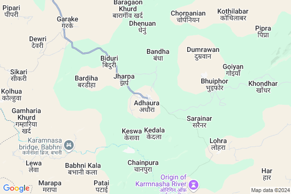
Chaya
Chaya Map
EDIT Map
Add Your House
 ..
..
Current Corona Virus Infected Patients Count in Kaimur (bhabua) District
| City Name | District Name | Total Covid cases |
|---|
Locality Name :
Chaya
( चाय )
Block Name : Adhaura
District : Kaimur (bhabua)
State : Bihar
Division : Patna
Language : Maithili and Hindi, Urdu
Current Time 10:23 AM
Date: Wednesday , Feb 05,2025 (IST)
Time zone: IST (UTC+5:30)
Elevation / Altitude: 92 meters. Above Seal level
Telephone Code / Std Code: 06180
Assembly constituency : Chainpur assembly constituency
Assembly MLA : Mohd. Zama Khan
Lok Sabha constituency : Sasaram parliamentary constituency
Parliament MP : CHHEDI PASWAN
Serpanch Name :
Main Village Name : CHAYA
Commodities Prices : Robertsganj Market / Mandi
Chaya Live Weather
Temperature: 18.2 °C
overcast clouds
Humidity: 44%
Wind : 1.71 mt/sec towards SW
StationName : "Bhabhua"
observed on 2 Hours Back
Temperature: 18.2 °C
overcast clouds
Humidity: 44%
Wind : 1.71 mt/sec towards SW
StationName : "Bhabhua"
observed on 2 Hours Back
Chaya Weather Forecast for Next 5 days
06-02-2025
15.5°C to 31.0°C
overcast clouds, scattered clouds, clear sky
15.5°C to 31.0°C
overcast clouds, scattered clouds, clear sky
07-02-2025
11.7°C to 26.6°C
clear sky
11.7°C to 26.6°C
clear sky
08-02-2025
9.8°C to 26.0°C
clear sky
9.8°C to 26.0°C
clear sky
09-02-2025
10.3°C to 26.3°C
few clouds, scattered clouds, broken clouds, clear sky
10.3°C to 26.3°C
few clouds, scattered clouds, broken clouds, clear sky
10-02-2025
12.4°C to 28.6°C
few clouds, clear sky, broken clouds, scattered clouds
12.4°C to 28.6°C
few clouds, clear sky, broken clouds, scattered clouds
National Highways Reachable To Chaya
Nationa High Way :NH119
Nationa High Way :NH119
Rivers Near Chaya
Son
Batra Nadi
Son
Batra Nadi
About Chaya
Correct below Info and add more info about ChayaChaya is a small Village/hamlet in Adhaura Block in Kaimur (bhabua) District of Bihar State, India. It comes under CHAYA Panchayath. It belongs to Patna Division . It is located 36 KM towards South from District head quarters Bhabua. 214 KM from State capital Patna
Chaya is surrounded by Bhawnathpur Block towards South , Nagwa Block towards west , Nawhatta Block towards East , Kaimur (Bhabua) Block towards North .
Bhabua , Hussainabad , Sasaram , Mohania are the near by Cities to Chaya.
Chaya 2011 Census Details
Chaya Local Language is Maithili. Chaya Village Total population is 371 and number of houses are 65. Female Population is 49.1%. Village literacy rate is 38.0% and the Female Literacy rate is 13.5%.
Population
| Census Parameter | Census Data |
| Total Population | 371 |
| Total No of Houses | 65 |
| Female Population % | 49.1 % ( 182) |
| Total Literacy rate % | 38.0 % ( 141) |
| Female Literacy rate | 13.5 % ( 50) |
| Scheduled Tribes Population % | 92.7 % ( 344) |
| Scheduled Caste Population % | 0.0 % ( 0) |
| Working Population % | 33.2 % |
| Child(0 -6) Population by 2011 | 93 |
| Girl Child(0 -6) Population % by 2011 | 45.2 % ( 42) |
Chaya Census More Deatils.
Politics in Chaya
Bharatiya Janata Party , BJP , RJD , BSP , INC are the major political parties in this area.Polling Stations /Booths near Chaya
1)Utkramit Madhya Vidyalay Saraiyo (purvi Bhag)2)Utkramit Madhya Vidyalay Songar
3)Anusuchit Jati Anusuchit Jan Jati Avasiy Madhya Vidyalay Semara
4)Prathmik Vidyalay Baradhi
5)Prthamik Vidyalay Pipariya
HOW TO REACH Chaya
By Rail
There is no railway station near to Chaya in less than 10 km. are the Rail way stations reachable from near by towns.By Road
Bhabua are the nearby by towns to Chaya having road connectivity to ChayaPincodes near Chaya
821102 ( Bhagwanpur (Kaimur (Bhabua)) ) , 821104 ( Chenari ) , 821304 ( Baulia )Colleges near Chaya
Jagdev Memorial College
Address :
Sardar Valav Bhai Patel College,
Address :
Gram Bharti Colleges
Address :
M.p. College, Mohania
Address : M.p. College, Mohania
J.m.college Sakri Kudra
Address : J.m.college Sakri Kudra, Kaimur
Schools in Chaya
P.s. Chaya
Address : chaya , adhaura , kaimur (bhabua) , Bihar . PIN- 821116
Govt Health Centers near Chaya
1) Bargaonkhurd , Health Sub Centre Bargaonkhurd , Health Sub Centre Bargaonkhurd , Bargaonkhurd2) Deori , Health Sub Centre Dewari , Health Sub Centre Dewari , Dewari
3) Bhuiphore , Health Sub Centre Bhuephor , Health Sub Centre Bhuephor , Bhephor
Hospitals in Chaya,Adhaura
VSK Leprosy Hospital
Kaimur Dist.; Near Adhaura Block Office; Adhaura; Bihar 821102; India
1.5 KM distance Detail
more ..
Schools in Chaya,Adhaura
Dighar Upgraded Middle School
Dighar - Jamuninar - Karar Rd; Dighar; Bihar 821102; India
17.0 KM distance Detail
Electronic Shops in Chaya,Adhaura
Super Markets in Chaya,Adhaura
Local Parks in Chaya,Adhaura
Police Stations near Chaya,Adhaura
Governement Offices near Chaya,Adhaura
About Chaya &
History
How to reach Chaya
Tourist Places Near By Chaya
Schools in Chaya
Colleges in Chaya
Temperature & weather of Chaya
places in Chaya
Chaya photos
More Information
How to reach Chaya
Tourist Places Near By Chaya
Schools in Chaya
Colleges in Chaya
Temperature & weather of Chaya
places in Chaya
Chaya photos
More Information
Village Talk
Post News or Events about this Village
Near Cities
Bhabua 41 KM near
Hussainabad 55 KM near
Sasaram 55 KM near
Mohania 56 KM near
Bhabua 41 KM near
Hussainabad 55 KM near
Sasaram 55 KM near
Mohania 56 KM near
Near By Taluks
Adhaura 0 KM near
Bhawnathpur 28 KM near
Nagwa 28 KM near
Nawhatta 30 KM near
Adhaura 0 KM near
Bhawnathpur 28 KM near
Nagwa 28 KM near
Nawhatta 30 KM near
Near By Air Ports
Varanasi Airport 126 KM near
Gaya Airport 151 KM near
Patna Airport 200 KM near
Bamrauli Airport 230 KM near
Varanasi Airport 126 KM near
Gaya Airport 151 KM near
Patna Airport 200 KM near
Bamrauli Airport 230 KM near
Near By Tourist Places
Rohtasgarh Fort 36 KM near
Sasaram 55 KM near
Varanasi 105 KM near
Sarnath 107 KM near
Betla National Park 123 KM near
Rohtasgarh Fort 36 KM near
Sasaram 55 KM near
Varanasi 105 KM near
Sarnath 107 KM near
Betla National Park 123 KM near
Near By Districts
Kaimur (Bhabua) 34 KM near
Rohtas 55 KM near
Sonbhadra 61 KM near
Garhwa 70 KM near
Kaimur (Bhabua) 34 KM near
Rohtas 55 KM near
Sonbhadra 61 KM near
Garhwa 70 KM near
Near By RailWay Station
Mohammad Ganj Rail Way Station 45 KM near
Haidar Nagar Rail Way Station 46 KM near
Mohammad Ganj Rail Way Station 45 KM near
Haidar Nagar Rail Way Station 46 KM near