| Home | City Bus | Maps | Villages | Cities | Rail | Tourist Places | School | College | Pin Codes | Corona Cases Count |
| Distance Calculator Bus Services IFSC Codes Trace Mobile Number Weather Search Place Trace IP Available Cash ATM/Banks Locate Polling Booth Report an Error contact People |
 ..
..
Current Corona Virus Infected Patients Count in Kaimur (bhabua) District
| City Name | District Name | Total Covid cases |
|---|
Block Name : Bhabua
District : Kaimur (bhabua)
State : Bihar
Division : Patna
Language : Maithili and Hindi, Urdu
Current Time 07:35 AM
Date: Saturday , Apr 26,2025 (IST)
Time zone: IST (UTC+5:30)
Elevation / Altitude: 83 meters. Above Seal level
Telephone Code / Std Code: 06189
Assembly constituency : Bhabua assembly constituency
Assembly MLA : Bharat Bind
Lok Sabha constituency : Sasaram parliamentary constituency
Parliament MP : CHHEDI PASWAN
Serpanch Name :
Main Village Name : KHURMABAD
Commodities Prices : Jamanian Market / Mandi
Temperature: 34.1 °C
clear sky
Humidity: 7%
Wind : 1.18 mt/sec towards S
StationName : "Bhabhua"
observed on Now
35.0°C to 44.6°C
clear sky, scattered clouds, broken clouds, overcast clouds
28.2°C to 43.0°C
overcast clouds, broken clouds, light rain
26.5°C to 42.2°C
scattered clouds, few clouds, broken clouds
26.3°C to 40.8°C
overcast clouds, broken clouds, clear sky, scattered clouds
23.9°C to 40.6°C
broken clouds, scattered clouds, clear sky, overcast clouds
OverView of Khurmabad
Prince khurram s/o shahjehan of the mughal dynasty is said
to have granted them to stay there which place was commemorated as khurram abad
now crude form name known as khurmabad.
The muslim population originally started by syed shia sect of islam, is now dominated by qureshi sunni sect, with each sect having their own masjids (shia 1 masjid, n sunni 2 masjid) or religious house for prayers, but live amicably together. Population practised farming, but now migrating to other cities for better prospects. Every moharram taziya is taken put in a procession to karbala nearby on the other side of g.t. Road. Shia sect has one masjid, 1 imambara, 4 chowks.
Nearest city is benaras, about 15 km away which is a city with also an airport, and an university.
Edit below overview about Khurmabad
Nationa High Way :NH19
Nationa High Way :NH31
Varuna
Varuna
About Khurmabad
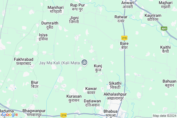
Khurmabad is a small Village/hamlet in Bhabua Block in Kaimur (bhabua) District of Bihar State, India. It comes under KHURMABAD Panchayath. It belongs to Patna Division . It is located 17 KM towards North from District head quarters Bhabua. 193 KM from State capital Patna
Khurmabad is surrounded by Chainpur Block towards west , Mohania Block towards North , Bhagwanpur Block towards South , Durgawati Block towards North .
Mohania , Bhabua , Zamania , Sasaram are the near by Cities to Khurmabad.
Khurmabad 2011 Census Details
Khurmabad Local Language is Maithili. Khurmabad Village Total population is 223 and number of houses are 48. Female Population is 50.2%. Village literacy rate is 17.0% and the Female Literacy rate is 4.9%.
Population
| Census Parameter | Census Data |
| Total Population | 223 |
| Total No of Houses | 48 |
| Female Population % | 50.2 % ( 112) |
| Total Literacy rate % | 17.0 % ( 38) |
| Female Literacy rate | 4.9 % ( 11) |
| Scheduled Tribes Population % | 4.0 % ( 9) |
| Scheduled Caste Population % | 93.7 % ( 209) |
| Working Population % | 26.9 % |
| Child(0 -6) Population by 2011 | 48 |
| Girl Child(0 -6) Population % by 2011 | 52.1 % ( 25) |
Khurmabad Census More Deatils.
Politics in Khurmabad
JD(U) , LJP , Bharatiya Janata Party , BJP , INC are the major political parties in this area.Polling Stations /Booths near Khurmabad
1)Uchcha Vidyalay Sonhan2)Utkramit Madhya Vidyalay Bichhiyo
3)Utkramit Madhya Vidyalay Darauli
4)Madhya Vidyalay Bhariganva
5)Pra0 Vidyalay Ekauni
HOW TO REACH Khurmabad
By Rail
Bhabua Road Rail Way Station , Muthani Rail Way Station are the very nearby railway stations to Khurmabad. are the Rail way stations reachable from near by towns.By Road
Bhabua are the nearby by towns to Khurmabad having road connectivity to KhurmabadPincodes near Khurmabad
821109 ( Mohania ) , 821105 ( Durgawati ) , 821101 ( Bhabua )Colleges near Khurmabad
Sardar Valav Bhai Patel College,Schools near Khurmabad
P.s. Nauva JhotiGovt Health Centers near Khurmabad
1) Kabar , SUB CENTRE KABAR , KABAR , KABAR2) Bhabua - Urban (1-25 ward) , PRIMARY HEALTH CENTRE, BHABUA , BHABUA , NEAR JAGJIVAN STADIUM & B.D.O. OFFICE, BHABUA
3) Odar , SUB CENTRE ODAR , ODAR , ODAR
Petrol Bunks in Khurmabad,Bhabua
Indian Oil Petroleum
Bare; kaimur; SH-14; kaimur; kaimur; Bihar 821109; India
7.0 KM distance Detail
HP PETROL PUMP - SHYAMAGOPAL JI AUTOMOBILES
Plot NO. 74; Khata NO. 25; Thana NO. 478 Mauza- Sikra; Bhabhua; Patna; Bihar 821101; India
7.7 KM distance Detail
more ..
Colleges in Khurmabad,Bhabua
MRSD Inter Mahila College
2; Bhabhua - Chainpur - Chand - Dharuali Rd; Azad Nagar; Bhabua; Bihar 821101; India
7.4 KM distance Detail
more ..
Schools in Khurmabad,Bhabua
मिडील स्कूल रूईयाँ
ग्राम-रूईयाँ;पोस्ट-दरौली; जिला; थाना; Bhabua; Bihar 821109; India
1.1 KM distance Detail
Electronic Shops in Khurmabad,Bhabua
P.N TECHNOLOGY BHABUA
AMAN NAGAR NEAR NEW POWER HOUSE BUS STAND AKHALASPUR BHABHUA; BHABHUA; Bihar 821101; India
6.2 KM distance Detail
Super Markets in Khurmabad,Bhabua
PRAKASH GENERAL STORE
Bhabhua - ward no.1 Hanuman nagar; Bhabua; Bihar 821101; India
7.9 KM distance Detail
Local Parks in Khurmabad,Bhabua
M/R Satya Narayan Singh Garden
NH 2; Near Shiv Temple; Bare; Bihar 821109; India
5.9 KM distance Detail
Police Stations near Khurmabad,Bhabua
Bhabhua police station
Bhabhua - Chainpur - Chand - Dharuali Rd; Bhabua; Bihar 821101; India
8.4 KM distance Detail
How to reach Khurmabad
Tourist Places Near By Khurmabad
Schools in Khurmabad
Colleges in Khurmabad
Temperature & weather of Khurmabad
places in Khurmabad
Khurmabad photos
More Information
Village Talk
Post News or Events about this Village
Mohania 7 KM near
Bhabua 8 KM near
Zamania 41 KM near
Sasaram 52 KM near
Bhabua 0 KM near
Chainpur 13 KM near
Mohania 14 KM near
Bhagwanpur 14 KM near
Varanasi Airport 92 KM near
Gaya Airport 160 KM near
Patna Airport 180 KM near
Gorakhpur Airport 205 KM near
Sasaram 52 KM near
Rohtasgarh Fort 71 KM near
Sarnath 72 KM near
Varanasi 73 KM near
Vindhyachal 121 KM near
Kaimur (Bhabua) 15 KM near
Chandauli 40 KM near
Rohtas 52 KM near
Ghazipur 61 KM near
Bhabua Road Rail Way Station 10 KM near
Durgauti Rail Way Station 14 KM near