| Home | City Bus | Maps | Villages | Cities | Rail | Tourist Places | School | College | Pin Codes | Corona Cases Count |
| Distance Calculator Bus Services IFSC Codes Trace Mobile Number Weather Search Place Trace IP Available Cash ATM/Banks Locate Polling Booth Report an Error contact People |
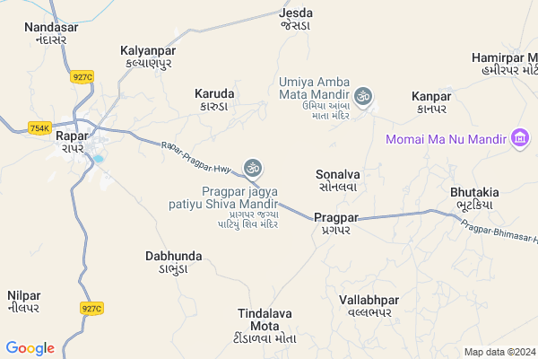
Rampar Map
EDIT Map
Add Your House
 ..
..
Current Corona Virus Infected Patients Count in Kachchh District
| City Name | District Name | Total Covid cases |
|---|
Locality Name :
Rampar
( રામપર )
Taluka Name : Rapar
District : Kachchh
State : Gujarat
Language : Gujarati and Sindhi, And Hindi, Kutchi
Current Time 10:05 AM
Date: Tuesday , Apr 29,2025 (IST)
Time zone: IST (UTC+5:30)
Elevation / Altitude: 115 meters. Above Seal level
Telephone Code / Std Code: 02830
Assembly constituency : assembly constituency
Assembly MLA :
Lok Sabha constituency : parliamentary constituency
Parliament MP :
Serpanch Name :
Pin Code : 370165
Post Office Name : Rahpar
Commodities Prices : Rapar Market / Mandi
Rampar Live Weather
Temperature: 38.1 °C
clear sky
Humidity: 17%
Wind : 9.74 mt/sec towards W
StationName : "RÄ\u0081par"
observed on Now
Temperature: 38.1 °C
clear sky
Humidity: 17%
Wind : 9.74 mt/sec towards W
StationName : "RÄ\u0081par"
observed on Now
Rampar Weather Forecast for Next 5 days
30-04-2025
28.4°C to 42.1°C
few clouds, scattered clouds
28.4°C to 42.1°C
few clouds, scattered clouds
01-05-2025
26.9°C to 42.6°C
clear sky, few clouds, broken clouds, scattered clouds
26.9°C to 42.6°C
clear sky, few clouds, broken clouds, scattered clouds
02-05-2025
26.6°C to 42.8°C
scattered clouds, few clouds, clear sky
26.6°C to 42.8°C
scattered clouds, few clouds, clear sky
03-05-2025
25.0°C to 41.3°C
clear sky
25.0°C to 41.3°C
clear sky
04-05-2025
25.3°C to 39.6°C
clear sky, scattered clouds
25.3°C to 39.6°C
clear sky, scattered clouds
National Highways Reachable To Rampar
Nationa High Way :NH151A
Nationa High Way :NH41
Nationa High Way :NH151A
Nationa High Way :NH41
Rivers Near Rampar
Puspavati River
Luni :लूनी
Puspavati River
Luni :लूनी
About Rampar
Correct below Info and add more info about RamparRampar is a Village in Rapar Taluka in Kachchh District of Gujarat State, India. It is located 132 KM towards East from District head quarters Bhuj. 234 KM from State capital Gandhinagar
Rampar Pin code is 370165 and postal head office is Rahpar .
Rampar is surrounded by Bhachau Taluka towards west , Maliya Taluka towards South , Santalpur Taluka towards East , Halvad Taluka towards South .
Rapar , Gandhidham , Morvi , Adipur are the near by Cities to Rampar.
Rampar 2011 Census Details
Rampar Local Language is Gujarati. Rampar Village Total population is 330 and number of houses are 65. Female Population is 51.2%. Village literacy rate is 26.1% and the Female Literacy rate is 8.2%.
Population
| Census Parameter | Census Data |
| Total Population | 330 |
| Total No of Houses | 65 |
| Female Population % | 51.2 % ( 169) |
| Total Literacy rate % | 26.1 % ( 86) |
| Female Literacy rate | 8.2 % ( 27) |
| Scheduled Tribes Population % | 0.0 % ( 0) |
| Scheduled Caste Population % | 0.0 % ( 0) |
| Working Population % | 40.3 % |
| Child(0 -6) Population by 2011 | 80 |
| Girl Child(0 -6) Population % by 2011 | 61.3 % ( 49) |
Rampar Census More Deatils.
HOW TO REACH Rampar
By Rail
There is no railway station near to Rampar in less than 10 km.Colleges near Rampar
Keniya And Anchorwala Or Shah Arts And Commerce College
Address :
Srk Institute Of Management
Address :
Veerayatan Institute Of Pharmacy
Address :
Scientific International Training Institute.
Address : Naliya Bhuj Kutch Gujarat.
Montessori Teacher Training
Address : Naliya Bhuj Kutch Gujarat.
Schools in Rampar
Ramparvandh Primary Shala
Address : rampar , rapar , kachchh , Gujarat . PIN- 370165 , Post - Rahpar
Govt Health Centers near Rampar
1) Rapar , Community Health Centre Rapar , selari naka ,2) Chitrod , Phc Chitrod , juna chitrod bus stand ni bajuma , Ambaji Temple
3) Adesar , NEAR HIGHWAY BRIDGE ROAD NO 15 , MAIN HIGHWAY , ON VENU ROAD
Hospitals in Rampar,Rapar
Shreeram Clinic Dr. Kamlesh Patel
Rapar - Chitrod Rd; Rapar; Gujarat 370165; India
19.4 KM distance Detail
more ..
Petrol Bunks in Rampar,Rapar
Ekalvy Petrol Pump
Bhimasar - Fatehgadh Rd; Fatehgadh; Gujarat 370155; India
22.5 KM distance Detail
more ..
Police Stations near Rampar,Rapar
Governement Offices near Rampar,Rapar
vashundhra minerals
Bhimasar-Adesar Hwy; Dodiya; Bhimasar; Gujarat 370160; India
18.8 KM distance Detail
About Rampar &
History
How to reach Rampar
Tourist Places Near By Rampar
Schools in Rampar
Colleges in Rampar
Temperature & weather of Rampar
places in Rampar
Rampar photos
More Information
How to reach Rampar
Tourist Places Near By Rampar
Schools in Rampar
Colleges in Rampar
Temperature & weather of Rampar
places in Rampar
Rampar photos
More Information
Village Talk
Post News or Events about this Village
Near Cities
Rapar 9 KM near
Gandhidham 88 KM near
Morvi 93 KM near
Adipur 95 KM near
Rapar 9 KM near
Gandhidham 88 KM near
Morvi 93 KM near
Adipur 95 KM near
Near By Taluks
Rapar 0 KM near
Bhachau 44 KM near
Maliya 65 KM near
Santalpur 77 KM near
Rapar 0 KM near
Bhachau 44 KM near
Maliya 65 KM near
Santalpur 77 KM near
Near By Air Ports
Kandla Airport 89 KM near
Rudra Mata Airport 124 KM near
Civil Airport 155 KM near
Govardhanpur Airport 158 KM near
Kandla Airport 89 KM near
Rudra Mata Airport 124 KM near
Civil Airport 155 KM near
Govardhanpur Airport 158 KM near
Near By Tourist Places
Kutch 59 KM near
Dholavira 70 KM near
Gandhidham 90 KM near
Morvi 93 KM near
Wankaner 120 KM near
Kutch 59 KM near
Dholavira 70 KM near
Gandhidham 90 KM near
Morvi 93 KM near
Wankaner 120 KM near
Near By Districts
Kachchh 126 KM near
Surendranagar 147 KM near
Jamnagar 154 KM near
Rajkot 158 KM near
Kachchh 126 KM near
Surendranagar 147 KM near
Jamnagar 154 KM near
Rajkot 158 KM near
Near By RailWay Station
Samakhiali Junction Rail Way Station 39 KM near
Bhachau Rail Way Station 52 KM near
Samakhiali Junction Rail Way Station 39 KM near
Bhachau Rail Way Station 52 KM near