| Home | City Bus | Maps | Villages | Cities | Rail | Tourist Places | School | College | Pin Codes | Corona Cases Count |
| Distance Calculator Bus Services IFSC Codes Trace Mobile Number Weather Search Place Trace IP Available Cash ATM/Banks Locate Polling Booth Report an Error contact People |
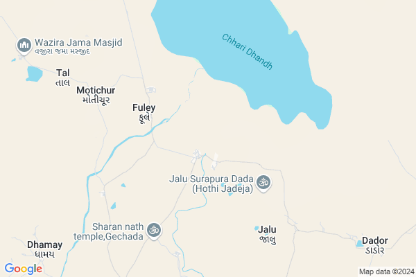
Fulay
Fulay Map
EDIT Map
Add Your House
 ..
..
Current Corona Virus Infected Patients Count in Kachchh District
| City Name | District Name | Total Covid cases |
|---|
Locality Name :
Fulay
( ફુલાય )
Taluka Name : Nakhatrana
District : Kachchh
State : Gujarat
Language : Gujarati and Sindhi, And Hindi, Kutchi
Current Time 09:32 PM
Date: Wednesday , Feb 05,2025 (IST)
Time zone: IST (UTC+5:30)
Elevation / Altitude: 89 meters. Above Seal level
Telephone Code / Std Code: 02835
Assembly constituency : Abdasa assembly constituency
Assembly MLA : Jadeja Pradhyumansinh Mahipatsinh
Lok Sabha constituency : Kutch parliamentary constituency
Parliament MP : CHAVDA VINOD LAKHAMSHI
Serpanch Name :
Pin Code : 380004
Post Office Name : Sub Foreign
Fulay Live Weather
Temperature: 19.8 °C
clear sky
Humidity: 26%
Wind : 3.06 mt/sec towards N
StationName : "Roha"
observed on 1 Hours Back
Temperature: 19.8 °C
clear sky
Humidity: 26%
Wind : 3.06 mt/sec towards N
StationName : "Roha"
observed on 1 Hours Back
Fulay Weather Forecast for Next 5 days
06-02-2025
17.5°C to 19.5°C
clear sky
17.5°C to 19.5°C
clear sky
07-02-2025
16.2°C to 25.9°C
clear sky, few clouds
16.2°C to 25.9°C
clear sky, few clouds
08-02-2025
17.2°C to 26.2°C
few clouds, broken clouds, scattered clouds, overcast clouds
17.2°C to 26.2°C
few clouds, broken clouds, scattered clouds, overcast clouds
09-02-2025
18.4°C to 27.7°C
overcast clouds, broken clouds, few clouds, scattered clouds
18.4°C to 27.7°C
overcast clouds, broken clouds, few clouds, scattered clouds
10-02-2025
18.5°C to 28.9°C
broken clouds, scattered clouds, few clouds
18.5°C to 28.9°C
broken clouds, scattered clouds, few clouds
National Highways Reachable To Fulay
Nationa High Way :NH341
Nationa High Way :NH341
About Fulay
Correct below Info and add more info about FulayFulay is a Village in Nakhatrana Taluka in Kachchh District of Gujarat State, India. It is located 58 KM towards west from District head quarters Bhuj. 21 KM from Nakhatrana Nana. 401 KM from State capital Gandhinagar
Fulay Pin code is 380004 and postal head office is Sub Foreign .
Aral Moti ( 9 KM ) , Tal ( 9 KM ) , Dador ( 11 KM ) , Dhamay ( 11 KM ) , Charakhada ( 11 KM ) are the nearby Villages to Fulay. Fulay is surrounded by Bhuj Taluka towards East , Abdasa Taluka towards west , Lakhpat Taluka towards west , Mandvi Taluka towards South .
Bhuj , Mandvi , Adipur , Gandhidham are the near by Cities to Fulay.
Fulay 2011 Census Details
Fulay Local Language is Gujarati. Fulay Village Total population is 1839 and number of houses are 415. Female Population is 49.3%. Village literacy rate is 42.4% and the Female Literacy rate is 16.3%.
Population
| Census Parameter | Census Data |
| Total Population | 1839 |
| Total No of Houses | 415 |
| Female Population % | 49.3 % ( 907) |
| Total Literacy rate % | 42.4 % ( 779) |
| Female Literacy rate | 16.3 % ( 300) |
| Scheduled Tribes Population % | 0.0 % ( 0) |
| Scheduled Caste Population % | 0.0 % ( 0) |
| Working Population % | 40.5 % |
| Child(0 -6) Population by 2011 | 312 |
| Girl Child(0 -6) Population % by 2011 | 47.4 % ( 148) |
Fulay Census More Deatils.
Politics in Fulay
Bharatiya Janata Party , BJP , INC are the major political parties in this area.Polling Stations /Booths near Fulay
1)Laxmipar Netra2)Laiyari
3)Jakhau (solt)
4)Dumra - 3
5)Ludbay Athmani
HOW TO REACH Fulay
By Rail
There is no railway station near to Fulay in less than 10 km.Colleges near Fulay
Srk Institute Of Social Science
Address : Srk Institute Of Social Science,sapeda, Tal. Anjar
Schools in Fulay
Fulay Primary Shala
Address : fulay , nakhatrana , kachchh , Gujarat . PIN- 370665 , Post - Virani
Govt Health Centers near Fulay
1) Ref. Hospital Mandvi , 2-Dec , Layja Road Mandvi , Near nana bus standSub Villages in Fulay
Hospitals in Fulay,Nakhatrana
Desalpar Guntli Primary Health Centre
Desalpar Guntli; Gujarat 370605; India
18.7 KM distance Detail
more ..
Petrol Bunks in Fulay,Nakhatrana
Reliance Petroleum
SURVEY NO. 69/P; VILL: KOTHARA; TAL: ABDASA; DIS: KUTCH. 370645; Kothara; Gujarat 370645; India
9.3 KM distance Detail
more ..
Electronic Shops in Fulay,Nakhatrana
Sagar Battery
Virani Nakhatrana College Road; Virani Moti; Gujarat 370615; India
22.9 KM distance Detail
Police Stations near Fulay,Nakhatrana
Governement Offices near Fulay,Nakhatrana
Virani Moti Gram Panchayat
opp. of BOB bank ; village: virani moti ;ta. nakhatrana; dist; Gujarat; India
20.9 KM distance Detail
About Fulay &
History
How to reach Fulay
Tourist Places Near By Fulay
Schools in Fulay
Colleges in Fulay
Temperature & weather of Fulay
places in Fulay
Fulay photos
More Information
How to reach Fulay
Tourist Places Near By Fulay
Schools in Fulay
Colleges in Fulay
Temperature & weather of Fulay
places in Fulay
Fulay photos
More Information
Village Talk
Post News or Events about this Village
Near Cities
Bhuj 54 KM near
Mandvi 85 KM near
Adipur 106 KM near
Gandhidham 114 KM near
Bhuj 54 KM near
Mandvi 85 KM near
Adipur 106 KM near
Gandhidham 114 KM near
Near By Taluks
Nakhatrana 20 KM near
Bhuj 56 KM near
Abdasa 58 KM near
Lakhpat 61 KM near
Nakhatrana 20 KM near
Bhuj 56 KM near
Abdasa 58 KM near
Lakhpat 61 KM near
Near By Air Ports
Rudra Mata Airport 52 KM near
Kandla Airport 106 KM near
Govardhanpur Airport 156 KM near
Civil Airport 228 KM near
Rudra Mata Airport 52 KM near
Kandla Airport 106 KM near
Govardhanpur Airport 156 KM near
Civil Airport 228 KM near
Near By Tourist Places
Bhuj 56 KM near
Mandvi 85 KM near
Gandhidham 111 KM near
Dholavira 112 KM near
Kutch 130 KM near
Bhuj 56 KM near
Mandvi 85 KM near
Gandhidham 111 KM near
Dholavira 112 KM near
Kutch 130 KM near
Near By Districts
Kachchh 55 KM near
Jamnagar 161 KM near
Rajkot 231 KM near
Porbandar 237 KM near
Kachchh 55 KM near
Jamnagar 161 KM near
Rajkot 231 KM near
Porbandar 237 KM near
Near By RailWay Station
Bhuj Rail Way Station 55 KM near
Anjar Rail Way Station 99 KM near
Bhuj Rail Way Station 55 KM near
Anjar Rail Way Station 99 KM near