| Home | City Bus | Maps | Villages | Cities | Rail | Tourist Places | School | College | Pin Codes | Corona Cases Count |
| Distance Calculator Bus Services IFSC Codes Trace Mobile Number Weather Search Place Trace IP Available Cash ATM/Banks Locate Polling Booth Report an Error contact People |
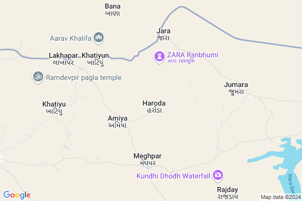
Haroda Map
EDIT Map
Add Your House
 ..
..
Current Corona Virus Infected Patients Count in Kachchh District
| City Name | District Name | Total Covid cases |
|---|
Locality Name :
Haroda
( હરોળ )
Taluka Name : Lakhpat
District : Kachchh
State : Gujarat
Language : Gujarati and Sindhi, And Hindi, Kutchi
Current Time 12:55 PM
Date: Monday , Apr 28,2025 (IST)
Time zone: IST (UTC+5:30)
Elevation / Altitude: 89 meters. Above Seal level
Telephone Code / Std Code: 02839
Assembly constituency : Abdasa assembly constituency
Assembly MLA : Jadeja Pradhyumansinh Mahipatsinh
Lok Sabha constituency : Kutch parliamentary constituency
Parliament MP : CHAVDA VINOD LAKHAMSHI
Serpanch Name :
Pin Code : 370625
Post Office Name : Ravapar
Haroda Live Weather
Temperature: 37.1 °C
clear sky
Humidity: 28%
Wind : 9.72 mt/sec towards W
StationName : "Naliya"
observed on Now
Temperature: 37.1 °C
clear sky
Humidity: 28%
Wind : 9.72 mt/sec towards W
StationName : "Naliya"
observed on Now
Haroda Weather Forecast for Next 5 days
29-04-2025
26.9°C to 38.1°C
clear sky
26.9°C to 38.1°C
clear sky
30-04-2025
26.1°C to 38.2°C
clear sky, scattered clouds, broken clouds
26.1°C to 38.2°C
clear sky, scattered clouds, broken clouds
01-05-2025
25.7°C to 36.7°C
broken clouds, few clouds, scattered clouds, clear sky
25.7°C to 36.7°C
broken clouds, few clouds, scattered clouds, clear sky
02-05-2025
25.2°C to 35.7°C
clear sky, scattered clouds
25.2°C to 35.7°C
clear sky, scattered clouds
03-05-2025
25.4°C to 34.8°C
scattered clouds, few clouds, clear sky
25.4°C to 34.8°C
scattered clouds, few clouds, clear sky
Rivers Near Haroda
Nara River
Nara River
About Haroda
Correct below Info and add more info about HarodaHaroda is a Village in Lakhpat Taluka in Kachchh District of Gujarat State, India. It is located 95 KM towards west from District head quarters Bhuj. 27 KM from Lakhpat. 438 KM from State capital Gandhinagar
Haroda Pin code is 370625 and postal head office is Ravapar .
Jara ( 5 KM ) , Nara ( 9 KM ) , Dayapar ( 13 KM ) , Mudhan ( 14 KM ) , Virani ( 15 KM ) are the nearby Villages to Haroda. Haroda is surrounded by Nakhatrana Taluka towards South , Abdasa Taluka towards South , Bhuj Taluka towards East , Mandvi Taluka towards South .
Bhuj , Mandvi , Adipur , Gandhidham are the near by Cities to Haroda.
It is near to arabian sea. There is a chance of humidity in the weather.
Haroda 2011 Census Details
Haroda Local Language is Gujarati. Haroda Village Total population is 718 and number of houses are 120. Female Population is 47.2%. Village literacy rate is 30.2% and the Female Literacy rate is 9.7%.
Population
| Census Parameter | Census Data |
| Total Population | 718 |
| Total No of Houses | 120 |
| Female Population % | 47.2 % ( 339) |
| Total Literacy rate % | 30.2 % ( 217) |
| Female Literacy rate | 9.7 % ( 70) |
| Scheduled Tribes Population % | 0.0 % ( 0) |
| Scheduled Caste Population % | 0.0 % ( 0) |
| Working Population % | 27.2 % |
| Child(0 -6) Population by 2011 | 176 |
| Girl Child(0 -6) Population % by 2011 | 46.0 % ( 81) |
Haroda Census More Deatils.
Politics in Haroda
Bharatiya Janata Party , BJP , INC are the major political parties in this area.Polling Stations /Booths near Haroda
1)Manjal - 22)Mathal - 2
3)Julrai
4)Valka Mota
5)Lakhaniya
HOW TO REACH Haroda
By Rail
There is no railway station near to Haroda in less than 10 km.Colleges near Haroda
Keniya And Anchorwala Or Shah Arts And Commerce College
Address :
Srk Institute Of Management
Address :
Veerayatan Institute Of Pharmacy
Address :
Scientific International Training Institute.
Address : Naliya Bhuj Kutch Gujarat.
Montessori Teacher Training
Address : Naliya Bhuj Kutch Gujarat.
Schools in Haroda
Haroda Primary Shala
Address : haroda , lakhapat , kachchh , Gujarat . PIN- 370625 , Post - Ravapar
Govt Health Centers near Haroda
1) Ref. Hospital Mandvi , 2-Dec , Layja Road Mandvi , Near nana bus standHospitals in Haroda,Lakhpat
Samuhik Arogya Kendra
Dayapar; Kutch; SH-42; Kutch Road; Kutch; Kutch; Gujarat 370630; India
13.6 KM distance Detail
Ishavasyam Hospital
Kutch; SH-42; Kutch Road; Kutch; Kutch; Gujarat 370630; India
13.7 KM distance Detail
more ..
Petrol Bunks in Haroda,Lakhpat
Patel Petroleum Bharat Petroleum
Kutch; SH-42; Kutch Road; Kutch; Kutch; Gujarat 370630; India
13.6 KM distance Detail
more ..
Local Parks in Haroda,Lakhpat
About Haroda &
History
How to reach Haroda
Tourist Places Near By Haroda
Schools in Haroda
Colleges in Haroda
Temperature & weather of Haroda
places in Haroda
Haroda photos
More Information
How to reach Haroda
Tourist Places Near By Haroda
Schools in Haroda
Colleges in Haroda
Temperature & weather of Haroda
places in Haroda
Haroda photos
More Information
Village Talk
Post News or Events about this Village
Near Cities
Bhuj 91 KM near
Mandvi 109 KM near
Adipur 143 KM near
Gandhidham 151 KM near
Bhuj 91 KM near
Mandvi 109 KM near
Adipur 143 KM near
Gandhidham 151 KM near
Near By Taluks
Lakhpat 25 KM near
Nakhatrana 48 KM near
Abdasa 55 KM near
Bhuj 92 KM near
Lakhpat 25 KM near
Nakhatrana 48 KM near
Abdasa 55 KM near
Bhuj 92 KM near
Near By Air Ports
Rudra Mata Airport 89 KM near
Kandla Airport 143 KM near
Govardhanpur Airport 189 KM near
Porbandar Airport 262 KM near
Rudra Mata Airport 89 KM near
Kandla Airport 143 KM near
Govardhanpur Airport 189 KM near
Porbandar Airport 262 KM near
Near By Tourist Places
Bhuj 92 KM near
Mandvi 109 KM near
Dholavira 139 KM near
Gandhidham 148 KM near
Kutch 157 KM near
Bhuj 92 KM near
Mandvi 109 KM near
Dholavira 139 KM near
Gandhidham 148 KM near
Kutch 157 KM near
Near By Districts
Kachchh 91 KM near
Jamnagar 194 KM near
Porbandar 260 KM near
Rajkot 266 KM near
Kachchh 91 KM near
Jamnagar 194 KM near
Porbandar 260 KM near
Rajkot 266 KM near
Near By RailWay Station
Bhuj Rail Way Station 91 KM near
Anjar Rail Way Station 135 KM near
Bhuj Rail Way Station 91 KM near
Anjar Rail Way Station 135 KM near