| Home | City Bus | Maps | Villages | Cities | Rail | Tourist Places | School | College | Pin Codes | Corona Cases Count |
| Distance Calculator Bus Services IFSC Codes Trace Mobile Number Weather Search Place Trace IP Available Cash ATM/Banks Locate Polling Booth Report an Error contact People |
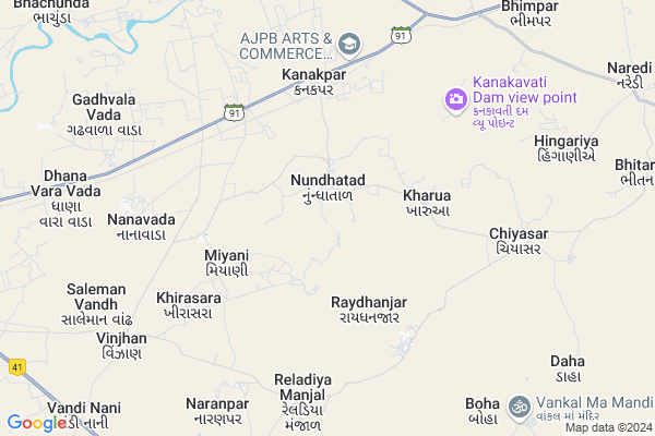
Nundhatad Map
EDIT Map
Add Your House
 ..
..
Current Corona Virus Infected Patients Count in Kachchh District
| City Name | District Name | Total Covid cases |
|---|
Locality Name :
Nundhatad
( નુંધાતડ )
Taluka Name : Abdasa
District : Kachchh
State : Gujarat
Language : Gujarati and Sindhi, And Hindi, Kutchi
Current Time 06:55 AM
Date: Saturday , Apr 26,2025 (IST)
Time zone: IST (UTC+5:30)
Elevation / Altitude: 89 meters. Above Seal level
Telephone Code / Std Code: 02835
Assembly constituency : Abdasa assembly constituency
Assembly MLA : Jadeja Pradhyumansinh Mahipatsinh
Lok Sabha constituency : Kutch parliamentary constituency
Parliament MP : CHAVDA VINOD LAKHAMSHI
Serpanch Name :
Pin Code : 370650
Post Office Name : Mothara
Nundhatad Live Weather
Temperature: 25.1 °C
clear sky
Humidity: 85%
Wind : 4.32 mt/sec towards SW
StationName : "Roha"
observed on Now
Temperature: 25.1 °C
clear sky
Humidity: 85%
Wind : 4.32 mt/sec towards SW
StationName : "Roha"
observed on Now
Nundhatad Weather Forecast for Next 5 days
27-04-2025
26.3°C to 37.3°C
clear sky, scattered clouds, broken clouds
26.3°C to 37.3°C
clear sky, scattered clouds, broken clouds
28-04-2025
25.7°C to 37.0°C
broken clouds, overcast clouds, scattered clouds, clear sky, few clouds
25.7°C to 37.0°C
broken clouds, overcast clouds, scattered clouds, clear sky, few clouds
29-04-2025
25.6°C to 35.9°C
few clouds, clear sky, scattered clouds
25.6°C to 35.9°C
few clouds, clear sky, scattered clouds
30-04-2025
25.4°C to 36.0°C
few clouds, clear sky
25.4°C to 36.0°C
few clouds, clear sky
01-05-2025
25.6°C to 35.4°C
clear sky, few clouds, scattered clouds
25.6°C to 35.4°C
clear sky, few clouds, scattered clouds
Rivers Near Nundhatad
Naiera
Kankawati
Naiera
Kankawati
About Nundhatad
Correct below Info and add more info about NundhatadNundhatad is a Village in Abdasa Taluka in Kachchh District of Gujarat State, India. It is located 70 KM towards west from District head quarters Bhuj. 24 KM from . 426 KM from State capital Gandhinagar
Nundhatad Pin code is 370650 and postal head office is Mothara .
Kharua ( 3 KM ) , Miyani ( 3 KM ) , Raydhanjar ( 3 KM ) , Kanakpar ( 5 KM ) , Nanavada ( 6 KM ) are the nearby Villages to Nundhatad. Nundhatad is surrounded by Nakhatrana Taluka towards North , Mandvi Taluka towards East , Bhuj Taluka towards East , Lakhpat Taluka towards North .
Mandvi , Bhuj , Mithapur , Dwarka are the near by Cities to Nundhatad.
It is near to arabian sea. There is a chance of humidity in the weather.
Nundhatad 2011 Census Details
Nundhatad Local Language is Gujarati. Nundhatad Village Total population is 1381 and number of houses are 291. Female Population is 51.8%. Village literacy rate is 56.8% and the Female Literacy rate is 25.6%.
Population
| Census Parameter | Census Data |
| Total Population | 1381 |
| Total No of Houses | 291 |
| Female Population % | 51.8 % ( 715) |
| Total Literacy rate % | 56.8 % ( 784) |
| Female Literacy rate | 25.6 % ( 354) |
| Scheduled Tribes Population % | 0.7 % ( 10) |
| Scheduled Caste Population % | 9.7 % ( 134) |
| Working Population % | 39.1 % |
| Child(0 -6) Population by 2011 | 213 |
| Girl Child(0 -6) Population % by 2011 | 54.0 % ( 115) |
Nundhatad Census More Deatils.
Politics in Nundhatad
Bharatiya Janata Party , BJP , INC are the major political parties in this area.Polling Stations /Booths near Nundhatad
1)Nirona - 42)Guneri
3)Kharai
4)Kanakavati
5)Khirasra (netra)
HOW TO REACH Nundhatad
By Rail
There is no railway station near to Nundhatad in less than 10 km.Colleges near Nundhatad
Scientific International Training Institute.
Address : Naliya Bhuj Kutch Gujarat.
Montessori Teacher Training
Address : Naliya Bhuj Kutch Gujarat.
Shri Z.n. Patel Cheritable Trust Sanchalit Master Of Social Work
Address : Shri Z.n. Patel Cheritable Trust Sanchalit Master
Schools in Nundhatad
Nundhatad Primary Shala
Address : nundhatad , abdasa , kachchh , Gujarat . PIN- 370650 , Post - Mothara
Govt Health Centers near Nundhatad
1) Ref. Hospital Mandvi , 2-Dec , Layja Road Mandvi , Near nana bus standElectronic Shops in Nundhatad,Abdasa
Momay Electronics & Video
Mothada Road; Near Sidhhi Farsan Mart; Mothara; Gujarat 370650; India
10.1 KM distance Detail
Super Markets in Nundhatad,Abdasa
Local Parks in Nundhatad,Abdasa
Police Stations near Nundhatad,Abdasa
POLICE STATION (KOTHARA)
1; Gujarat State Highway 91; Kothara; Gujarat 370645; India
17.8 KM distance Detail
Governement Offices near Nundhatad,Abdasa
About Nundhatad &
History
How to reach Nundhatad
Tourist Places Near By Nundhatad
Schools in Nundhatad
Colleges in Nundhatad
Temperature & weather of Nundhatad
places in Nundhatad
Nundhatad photos
More Information
How to reach Nundhatad
Tourist Places Near By Nundhatad
Schools in Nundhatad
Colleges in Nundhatad
Temperature & weather of Nundhatad
places in Nundhatad
Nundhatad photos
More Information
Village Talk
Post News or Events about this Village
Near Cities
Mandvi 48 KM near
Bhuj 67 KM near
Mithapur 91 KM near
Dwarka 112 KM near
Mandvi 48 KM near
Bhuj 67 KM near
Mithapur 91 KM near
Dwarka 112 KM near
Near By Taluks
Abdasa 23 KM near
Nakhatrana 36 KM near
Mandvi 39 KM near
Bhuj 68 KM near
Abdasa 23 KM near
Nakhatrana 36 KM near
Mandvi 39 KM near
Bhuj 68 KM near
Near By Air Ports
Rudra Mata Airport 68 KM near
Kandla Airport 116 KM near
Govardhanpur Airport 135 KM near
Porbandar Airport 197 KM near
Rudra Mata Airport 68 KM near
Kandla Airport 116 KM near
Govardhanpur Airport 135 KM near
Porbandar Airport 197 KM near
Near By Tourist Places
Mandvi 48 KM near
Bhuj 67 KM near
Dwarka 114 KM near
Gandhidham 120 KM near
Jamnagar 141 KM near
Mandvi 48 KM near
Bhuj 67 KM near
Dwarka 114 KM near
Gandhidham 120 KM near
Jamnagar 141 KM near
Near By Districts
Kachchh 67 KM near
Jamnagar 141 KM near
Porbandar 195 KM near
Rajkot 222 KM near
Kachchh 67 KM near
Jamnagar 141 KM near
Porbandar 195 KM near
Rajkot 222 KM near
Near By RailWay Station
Bhuj Rail Way Station 69 KM near
Okha Rail Way Station 83 KM near
Bhuj Rail Way Station 69 KM near
Okha Rail Way Station 83 KM near