| Home | City Bus | Maps | Villages | Cities | Rail | Tourist Places | School | College | Pin Codes | Corona Cases Count |
| Distance Calculator Bus Services IFSC Codes Trace Mobile Number Weather Search Place Trace IP Available Cash ATM/Banks Locate Polling Booth Report an Error contact People |
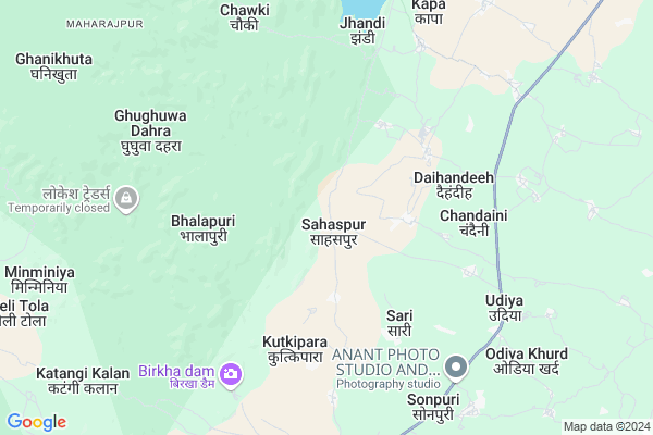
Sahaspur
Sahaspur Map
EDIT Map
Add Your House
 ..
..
Current Corona Virus Infected Patients Count in Kabirdham District
| City Name | District Name | Total Covid cases |
|---|
Locality Name :
Sahaspur
( सहसपुर )
Tehsil Name : S.lohara
District : Kabirdham
State : Chattisgarh
Language : Chhattisgarhi and Hindi, Agariya
Current Time 11:04 AM
Date: Monday , Apr 28,2025 (IST)
Time zone: IST (UTC+5:30)
Elevation / Altitude: 292 meters. Above Seal level
Telephone Code / Std Code: 07741
Assembly constituency : Kawardha assembly constituency
Assembly MLA : Vijay Sharma
Lok Sabha constituency : Rajnandgaon parliamentary constituency
Parliament MP : SANTOSH PANDEY
Serpanch Name :
Pin Code : 491995
Post Office Name : Kawardha
Main Village Name : Sahaspur
Commodities Prices : Kawardha Market / Mandi
Rivers Near Sahaspur
Son
Shivnath :Seonath
Son
Shivnath :Seonath
About Sahaspur
Correct below Info and add more info about SahaspurSahaspur is a small Village/hamlet in S.lohara Tehsil in Kabirdham District of Chattisgarh State, India. It comes under Sahaspur Panchayath. It is located 18 KM towards South from District head quarters Kawardha. 13 KM from S.Lohara. 104 KM from State capital Raipur
Sahaspur Pin code is 491995 and postal head office is Kawardha .
Chandaini ( 5 KM ) , Biranpur ( 7 KM ) , Chhotupara ( 8 KM ) , Bano ( 10 KM ) , Kumhar Daniya ( 10 KM ) are the nearby Villages to Sahaspur. Sahaspur is surrounded by Kabirdham Tehsil towards East , Kawardha Tehsil towards East , Bodla Tehsil towards North , Chhuikhadan Tehsil towards South .
Kawardha , Malajkhand , Bemetra , Mungeli are the near by Cities to Sahaspur.
Sahaspur 2011 Census Details
Sahaspur Local Language is Chhattisgarhi. Sahaspur Village Total population is 491 and number of houses are 128. Female Population is 49.1%. Village literacy rate is 53.8% and the Female Literacy rate is 22.8%.
Population
| Census Parameter | Census Data |
| Total Population | 491 |
| Total No of Houses | 128 |
| Female Population % | 49.1 % ( 241) |
| Total Literacy rate % | 53.8 % ( 264) |
| Female Literacy rate | 22.8 % ( 112) |
| Scheduled Tribes Population % | 44.8 % ( 220) |
| Scheduled Caste Population % | 5.5 % ( 27) |
| Working Population % | 50.5 % |
| Child(0 -6) Population by 2011 | 78 |
| Girl Child(0 -6) Population % by 2011 | 33.3 % ( 26) |
Sahaspur Census More Deatils.
Politics in Sahaspur
Bharatiya Janata Party , BJP , INC are the major political parties in this area.Polling Stations /Booths near Sahaspur
1)Rol2)Baroda Kala
3)Chhata Jha
4)Dabrabhath
5)Sarekha
HOW TO REACH Sahaspur
By Rail
There is no railway station near to Sahaspur in less than 10 km.Colleges near Sahaspur
Government Swami Vivekanand Collage Bodla
Address :
Naw Govt. Science College Pipariya
Address : Main Road Pipariya
Shekh Sameer College Mungeli Road,pandariya
Address : Shekh Sameer College Mungeli Road,pandariya
Shekh Sameer Pg College Pandariya
Address : Shekh Sameer Auto Care Mungeli Road,pandariya Distt.-kabirdham(c.g.)491559 Pass Pandariya
Ma Bamleshwary Medical Institute
Address : Kawardha, Raipur
Schools in Sahaspur
N.m.s. Sahaspur
Address : sahaspur , sahaspur lohara , kawardha , Chattisgarh . PIN- 491995 , Post - Kawardha
Govt Health Centers near Sahaspur
1) SHC Sahaspur , Hospital building , Udiyakala Sector ,2) SHC Barondakala , , ,
3) SHC Maharatola , SHC Bulding , Udiyakala Sector ,
Sub Villages in Sahaspur
Petrol Bunks in Sahaspur,S.lohara
Hindustan Petroleum
Biroria; Lakhanpur; Rajnandgaon; SH-5; Dalli Rajhara Bhanupratappur Road; Khairagarh; Khairagarh; Chhattisgarh 491441; India
11.6 KM distance Detail
Hindustan Petroleum
Kailash Nagar; Kawardha; SH-5; Rajnadgaon Dalli Rajhra Road; Kawardha; Kawardha; Chhattisgarh 491995; India
17.5 KM distance Detail
more ..
Colleges in Sahaspur,S.lohara
Sant Kabir College of Agriculture and Research Station
Ghotiya; Kawardha; Chhattisgarh 491995; India
17.1 KM distance Detail
Bhoramdev College of Agriculture
Ghughari Kawardha; Kawardha; Kabeerdham; Chhattisgarh 492006; India
17.2 KM distance Detail
Acharya Panth Shri Grindh Muni Naam Saheb Government PG college
Kabirdham; Kawardha; Chhattisgarh 491995; India
17.6 KM distance Detail
more ..
Schools in Sahaspur,S.lohara
Abhyuday School
Sarodha Canal Road; S.H. 9; Ghothiya Village; Kawardha; Ghothiya; Chhattisgarh 491995; India
16.1 KM distance Detail
Super Markets in Sahaspur,S.lohara
Ashu New Look Hair Cut
near ssm school; Ramnagar; Kawardha; Chhattisgarh; India
16.7 KM distance Detail
Police Stations near Sahaspur,S.lohara
Office Of Superintendent Of Police; Kawardha
Link Road Number 3; Bhopal; India
17.1 KM distance Detail
Governement Offices near Sahaspur,S.lohara
Amin Office
Vindhyavasini Ward; Dani Tola; Dhamtari; Chhattisgarh 491995; India
18.1 KM distance Detail
About Sahaspur &
History
How to reach Sahaspur
Tourist Places Near By Sahaspur
Schools in Sahaspur
Colleges in Sahaspur
Temperature & weather of Sahaspur
places in Sahaspur
Sahaspur photos
More Information
How to reach Sahaspur
Tourist Places Near By Sahaspur
Schools in Sahaspur
Colleges in Sahaspur
Temperature & weather of Sahaspur
places in Sahaspur
Sahaspur photos
More Information
Village Talk
Post News or Events about this Village
Near Cities
Kawardha 20 KM near
Malajkhand 48 KM near
Bemetra 54 KM near
Mungeli 68 KM near
Kawardha 20 KM near
Malajkhand 48 KM near
Bemetra 54 KM near
Mungeli 68 KM near
Near By Taluks
S.Lohara 13 KM near
Kabirdham 20 KM near
Kawardha 25 KM near
Bodla 32 KM near
S.Lohara 13 KM near
Kabirdham 20 KM near
Kawardha 25 KM near
Bodla 32 KM near
Near By Air Ports
Raipur Airport 115 KM near
Jabalpur Airport 166 KM near
Sonegaon Airport 259 KM near
Khajuraho Airport 387 KM near
Raipur Airport 115 KM near
Jabalpur Airport 166 KM near
Sonegaon Airport 259 KM near
Khajuraho Airport 387 KM near
Near By Tourist Places
Kawardha 18 KM near
Kanha National park 74 KM near
Durg 91 KM near
Bhilai 92 KM near
Raipur 101 KM near
Kawardha 18 KM near
Kanha National park 74 KM near
Durg 91 KM near
Bhilai 92 KM near
Raipur 101 KM near
Near By Districts
Kabirdham 17 KM near
Durg 91 KM near
Rajnandgaon 102 KM near
Raipur 102 KM near
Kabirdham 17 KM near
Durg 91 KM near
Rajnandgaon 102 KM near
Raipur 102 KM near
Near By RailWay Station
Tilda Rail Way Station 89 KM near
Durg Junction Rail Way Station 90 KM near
Tilda Rail Way Station 89 KM near
Durg Junction Rail Way Station 90 KM near