| Home | City Bus | Maps | Villages | Cities | Rail | Tourist Places | School | College | Pin Codes | Corona Cases Count |
| Distance Calculator Bus Services IFSC Codes Trace Mobile Number Weather Search Place Trace IP Available Cash ATM/Banks Locate Polling Booth Report an Error contact People |
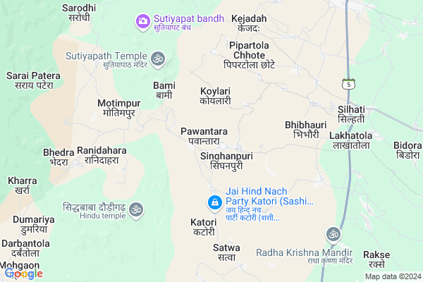
Pawantara
Pawantara Map
EDIT Map
Add Your House
 ..
..
Current Corona Virus Infected Patients Count in Kabirdham District
| City Name | District Name | Total Covid cases |
|---|
Locality Name :
Pawantara
( पवनतरा )
Tehsil Name : S.lohara
District : Kabirdham
State : Chattisgarh
Language : Chhattisgarhi and Hindi, Agariya
Current Time 05:28 PM
Date: Monday , Apr 28,2025 (IST)
Time zone: IST (UTC+5:30)
Elevation / Altitude: 292 meters. Above Seal level
Telephone Code / Std Code: 07741
Assembly constituency : Kawardha assembly constituency
Assembly MLA : Vijay Sharma
Lok Sabha constituency : Rajnandgaon parliamentary constituency
Parliament MP : SANTOSH PANDEY
Serpanch Name :
Pin Code : 491995
Post Office Name : Kawardha
Commodities Prices : Gandai Market / Mandi
Pawantara Live Weather
Temperature: 39.3 °C
broken clouds
Humidity: 13%
Wind : 5.39 mt/sec towards W
StationName : "Gandai"
observed on 2 Hours Back
Temperature: 39.3 °C
broken clouds
Humidity: 13%
Wind : 5.39 mt/sec towards W
StationName : "Gandai"
observed on 2 Hours Back
Pawantara Weather Forecast for Next 5 days
29-04-2025
24.7°C to 38.6°C
broken clouds, scattered clouds, clear sky
24.7°C to 38.6°C
broken clouds, scattered clouds, clear sky
30-04-2025
24.7°C to 42.0°C
scattered clouds, clear sky, broken clouds
24.7°C to 42.0°C
scattered clouds, clear sky, broken clouds
01-05-2025
25.0°C to 42.8°C
broken clouds, clear sky, few clouds, scattered clouds
25.0°C to 42.8°C
broken clouds, clear sky, few clouds, scattered clouds
02-05-2025
23.3°C to 42.6°C
few clouds, clear sky
23.3°C to 42.6°C
few clouds, clear sky
03-05-2025
22.6°C to 42.9°C
clear sky, few clouds, scattered clouds, light rain, broken clouds
22.6°C to 42.9°C
clear sky, few clouds, scattered clouds, light rain, broken clouds
Rivers Near Pawantara
Son
Shivnath :Seonath
Son
Shivnath :Seonath
About Pawantara
Correct below Info and add more info about PawantaraPawantara is a Village in S.lohara Tehsil in Kabirdham District of Chattisgarh State, India. It is located 36 KM towards South from District head quarters Kawardha. 13 KM from S.Lohara. 97 KM from State capital Raipur
Pawantara Pin code is 491995 and postal head office is Kawardha .
Kuruwa ( 4 KM ) , Kalyanpur ( 7 KM ) , Basinjhori ( 7 KM ) , Silhati ( 7 KM ) , Lakhatola ( 8 KM ) are the nearby Villages to Pawantara. Pawantara is surrounded by Chhuikhadan Tehsil towards South , Saja Tehsil towards East , Kabirdham Tehsil towards North , Kawardha Tehsil towards East .
Kawardha , Malajkhand , Bemetra , Bhilai are the near by Cities to Pawantara.
Pawantara 2011 Census Details
Pawantara Local Language is Chhattisgarhi. Pawantara Village Total population is 1147 and number of houses are 269. Female Population is 52.0%. Village literacy rate is 49.3% and the Female Literacy rate is 18.6%.
Population
| Census Parameter | Census Data |
| Total Population | 1147 |
| Total No of Houses | 269 |
| Female Population % | 52.0 % ( 597) |
| Total Literacy rate % | 49.3 % ( 565) |
| Female Literacy rate | 18.6 % ( 213) |
| Scheduled Tribes Population % | 33.0 % ( 378) |
| Scheduled Caste Population % | 0.4 % ( 5) |
| Working Population % | 58.4 % |
| Child(0 -6) Population by 2011 | 183 |
| Girl Child(0 -6) Population % by 2011 | 54.6 % ( 100) |
Pawantara Census More Deatils.
Politics in Pawantara
Bharatiya Janata Party , BJP , INC are the major political parties in this area.Polling Stations /Booths near Pawantara
1)Khirsali2)Singarpur
3)Koylari
4)Koylari
5)Sukhatal
HOW TO REACH Pawantara
By Rail
There is no railway station near to Pawantara in less than 10 km.Colleges near Pawantara
Government Swami Vivekanand Collage Bodla
Address :
Naw Govt. Science College Pipariya
Address : Main Road Pipariya
Shekh Sameer College Mungeli Road,pandariya
Address : Shekh Sameer College Mungeli Road,pandariya
Shekh Sameer Pg College Pandariya
Address : Shekh Sameer Auto Care Mungeli Road,pandariya Distt.-kabirdham(c.g.)491559 Pass Pandariya
Ma Bamleshwary Medical Institute
Address : Kawardha, Raipur
Schools in Pawantara
N.m.s.pawantara
Address : pawantara , sahaspur lohara , kawardha , Chattisgarh . PIN- 491995 , Post - Kawardha
Govt Health Centers near Pawantara
1) SHC Koylari , , Bhimbhori sector ,2) SHC Bamhantola , , Bhimbhori sector ,
3) SHC Motimpur , , Bhimbhori sector ,
Petrol Bunks in Pawantara,S.lohara
Hindustan Petroleum
Biroria; Lakhanpur; Rajnandgaon; SH-5; Dalli Rajhara Bhanupratappur Road; Khairagarh; Khairagarh; Chhattisgarh 491441; India
10.3 KM distance Detail
more ..
Local Parks in Pawantara,S.lohara
Police Stations near Pawantara,S.lohara
About Pawantara &
History
How to reach Pawantara
Tourist Places Near By Pawantara
Schools in Pawantara
Colleges in Pawantara
Temperature & weather of Pawantara
places in Pawantara
Pawantara photos
More Information
How to reach Pawantara
Tourist Places Near By Pawantara
Schools in Pawantara
Colleges in Pawantara
Temperature & weather of Pawantara
places in Pawantara
Pawantara photos
More Information
Village Talk
Post News or Events about this Village
Near Cities
Kawardha 37 KM near
Malajkhand 49 KM near
Bemetra 55 KM near
Bhilai 77 KM near
Kawardha 37 KM near
Malajkhand 49 KM near
Bemetra 55 KM near
Bhilai 77 KM near
Near By Taluks
S.Lohara 12 KM near
Chhuikhadan 20 KM near
Saja 35 KM near
Kabirdham 37 KM near
S.Lohara 12 KM near
Chhuikhadan 20 KM near
Saja 35 KM near
Kabirdham 37 KM near
Near By Air Ports
Raipur Airport 107 KM near
Jabalpur Airport 172 KM near
Sonegaon Airport 247 KM near
Khajuraho Airport 401 KM near
Raipur Airport 107 KM near
Jabalpur Airport 172 KM near
Sonegaon Airport 247 KM near
Khajuraho Airport 401 KM near
Near By Tourist Places
Kawardha 36 KM near
Durg 76 KM near
Bhilai 79 KM near
Kanha National park 81 KM near
Rajnandgaon 83 KM near
Kawardha 36 KM near
Durg 76 KM near
Bhilai 79 KM near
Kanha National park 81 KM near
Rajnandgaon 83 KM near
Near By Districts
Kabirdham 35 KM near
Durg 76 KM near
Rajnandgaon 84 KM near
Raipur 93 KM near
Kabirdham 35 KM near
Durg 76 KM near
Rajnandgaon 84 KM near
Raipur 93 KM near
Near By RailWay Station
Durg Junction Rail Way Station 75 KM near
Bhilai Power House Rail Way Station 78 KM near
Durg Junction Rail Way Station 75 KM near
Bhilai Power House Rail Way Station 78 KM near