| Home | City Bus | Maps | Villages | Cities | Rail | Tourist Places | School | College | Pin Codes | Corona Cases Count |
| Distance Calculator Bus Services IFSC Codes Trace Mobile Number Weather Search Place Trace IP Available Cash ATM/Banks Locate Polling Booth Report an Error contact People |
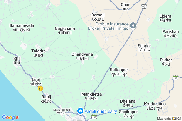
Gorej Map
EDIT Map
Add Your House
 ..
..
Current Corona Virus Infected Patients Count in Junagadh District
| City Name | District Name | Total Covid cases |
|---|
Locality Name :
Gorej
( ગોરેજ )
Taluka Name : Mangrol
District : Junagadh
State : Gujarat
Language : Gujarati and Hindi, English
Current Time 12:31 PM
Date: Monday , Apr 28,2025 (IST)
Time zone: IST (UTC+5:30)
Elevation / Altitude: 54 meters. Above Seal level
Telephone Code / Std Code: 02629
Assembly constituency : Keshod assembly constituency
Assembly MLA : Devabhai Punjabhai Malam
Lok Sabha constituency : Porbandar parliamentary constituency
Parliament MP : RAMESHBHAI LAVJIBHAI DHADUK
Serpanch Name :
Pin Code : 362225
Post Office Name : Mangrol (Junagadh)
Commodities Prices : Mangrol Market / Mandi
Rivers Near Gorej
Hiran
Hiran
About Gorej
Correct below Info and add more info about GorejGorej is a Village in Mangrol Taluka in Junagadh District of Gujarat State, India. It is located 59 KM towards South from District head quarters Junagadh. 4 KM from . 402 KM from State capital Gandhinagar
Gorej Pin code is 362225 and postal head office is Mangrol (Junagadh).
Menanj ( 1 KM ) , Roodalpur ( 2 KM ) , Chingariya ( 3 KM ) , Sultanpur ( 3 KM ) , Karamdi ( 3 KM ) are the nearby Villages to Gorej. Gorej is surrounded by Keshod Taluka towards North , Malia Taluka towards East , Mendarda Taluka towards East , Vanthali Taluka towards North .
Mangrol , Keshod , Manavadar , Veraval are the near by Cities to Gorej.
It is near to arabian sea. There is a chance of humidity in the weather.
Gorej 2011 Census Details
Gorej Local Language is Gujarati. Gorej Village Total population is 2424 and number of houses are 439. Female Population is 48.8%. Village literacy rate is 71.7% and the Female Literacy rate is 30.7%.
Population
| Census Parameter | Census Data |
| Total Population | 2424 |
| Total No of Houses | 439 |
| Female Population % | 48.8 % ( 1183) |
| Total Literacy rate % | 71.7 % ( 1739) |
| Female Literacy rate | 30.7 % ( 743) |
| Scheduled Tribes Population % | 0.0 % ( 0) |
| Scheduled Caste Population % | 18.9 % ( 458) |
| Working Population % | 36.7 % |
| Child(0 -6) Population by 2011 | 250 |
| Girl Child(0 -6) Population % by 2011 | 51.2 % ( 128) |
Gorej Census More Deatils.
Politics in Gorej
BJP , INC are the major political parties in this area.Polling Stations /Booths near Gorej
1)Ghodadar-22)Gorej-1
3)Miti-2
4)Movana-1
5)Keshod-47
HOW TO REACH Gorej
By Rail
There is no railway station near to Gorej in less than 10 km.Colleges near Gorej
Shri Arjun Arts And Bsw.brs.bca College.supasi
Address :
Shri Arjun B.sc College Supasi
Address : At.supasi Ta Veraval Dist.girsomnath
Bahauddin Science College (junagadh)
Address :
Shri Karmyogi Arts And Comm.college Gadu
Address :
S. R. Vasani School Of Management
Address :
Schools in Gorej
Gorej Pra Shala
Address : gorej , mangrol , junagadh , Gujarat . PIN- 362225 , Post - Mangrol (Junagadh)
Govt Health Centers near Gorej
1) C.M.Z. H. Junagardh , CIVIL HOSPITAL , NEAR AZAD CHOWK , NEAR AZAD CHOWK2) Sargavada , SUBCENTER SARAGWADA , , NEAR BUS STATION SARAGWADA
3) Jamjodhpur , , Balwa Fatak ,
Petrol Bunks in Gorej,Mangrol
HP PETROL PUMP - SHIVAM PETROLEUM
HP Petrol Pump Survey NO. 184/paiki 2 Vill. Mankhetra; TAL. Mangrol; Rajkot; Gujarat 362225; India
6.0 KM distance Detail
Mangrol Petroleum (Raju Chandera)
Mangrol;; Fishrish Colony; Mangrol; Gujarat 362225; India
7.7 KM distance Detail
more ..
Colleges in Gorej,Mangrol
Shri M.B. Gardi College Of Education
Shapur Road; Shardagram; Mangrol; Junagadh; Gujarat 362225; India
11.4 KM distance Detail
V.M. Chandera Arts College
Loej Ta Mangrol Dist; Junagadh; Gujarat 362001; India
11.5 KM distance Detail
more ..
Schools in Gorej,Mangrol
Chandavana High School (Gnaneshvar Vidya Mandir)
chandavana nagichana road; near bus stand; chandavana; Gujarat 362225; India
1.1 KM distance Detail
About Gorej &
History
How to reach Gorej
Tourist Places Near By Gorej
Schools in Gorej
Colleges in Gorej
Temperature & weather of Gorej
places in Gorej
Gorej photos
More Information
How to reach Gorej
Tourist Places Near By Gorej
Schools in Gorej
Colleges in Gorej
Temperature & weather of Gorej
places in Gorej
Gorej photos
More Information
Village Talk
Post News or Events about this Village
Near Cities
Mangrol 8 KM near
Keshod 21 KM near
Manavadar 38 KM near
Veraval 44 KM near
Mangrol 8 KM near
Keshod 21 KM near
Manavadar 38 KM near
Veraval 44 KM near
Near By Taluks
Mangrol 4 KM near
Keshod 19 KM near
Malia 25 KM near
Mendarda 39 KM near
Mangrol 4 KM near
Keshod 19 KM near
Malia 25 KM near
Mendarda 39 KM near
Near By Air Ports
Porbandar Airport 79 KM near
Diu Airport 108 KM near
Civil Airport 158 KM near
Govardhanpur Airport 159 KM near
Porbandar Airport 79 KM near
Diu Airport 108 KM near
Civil Airport 158 KM near
Govardhanpur Airport 159 KM near
Near By Tourist Places
Chorwad 23 KM near
Veraval 44 KM near
Somnath 46 KM near
Sasan Gir 54 KM near
Junagadh 56 KM near
Chorwad 23 KM near
Veraval 44 KM near
Somnath 46 KM near
Sasan Gir 54 KM near
Junagadh 56 KM near
Near By Districts
Junagadh 57 KM near
Porbandar 82 KM near
Amreli 136 KM near
Rajkot 157 KM near
Junagadh 57 KM near
Porbandar 82 KM near
Amreli 136 KM near
Rajkot 157 KM near
Near By RailWay Station
Keshod Rail Way Station 19 KM near
Maliya Hatina Rail Way Station 20 KM near
Keshod Rail Way Station 19 KM near
Maliya Hatina Rail Way Station 20 KM near