| Home | City Bus | Maps | Villages | Cities | Rail | Tourist Places | School | College | Pin Codes | Corona Cases Count |
| Distance Calculator Bus Services IFSC Codes Trace Mobile Number Weather Search Place Trace IP Available Cash ATM/Banks Locate Polling Booth Report an Error contact People |
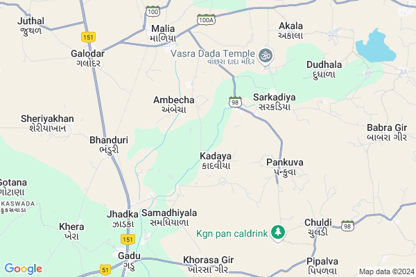
Kerala Map
EDIT Map
Add Your House
 ..
..
Current Corona Virus Infected Patients Count in Junagadh District
| City Name | District Name | Total Covid cases |
|---|
Locality Name :
Kerala
( કેરળ )
Taluka Name : Malia
District : Junagadh
State : Gujarat
Language : Gujarati and Hindi, English
Current Time 10:39 AM
Date: Wednesday , Apr 30,2025 (IST)
Time zone: IST (UTC+5:30)
Elevation / Altitude: 54 meters. Above Seal level
Telephone Code / Std Code: 02870
Assembly constituency : Mangrol assembly constituency
Assembly MLA : Kargatiya Bhagvanjibhai Lakhabhai
Lok Sabha constituency : Junagadh parliamentary constituency
Parliament MP : CHUDASAMA RAJESHBHAI NARANBHAI
Serpanch Name :
Pin Code : 362245
Post Office Name : Malia Hatina
Commodities Prices : Talalagir Market / Mandi
Kerala Live Weather
Temperature: 32.6 °C
clear sky
Humidity: 44%
Wind : 5.67 mt/sec towards NW
StationName : "MÄ\u0081ngrol"
observed on 1 Hours Back
Temperature: 32.6 °C
clear sky
Humidity: 44%
Wind : 5.67 mt/sec towards NW
StationName : "MÄ\u0081ngrol"
observed on 1 Hours Back
Kerala Weather Forecast for Next 5 days
01-05-2025
26.0°C to 36.1°C
clear sky
26.0°C to 36.1°C
clear sky
02-05-2025
25.4°C to 35.5°C
clear sky
25.4°C to 35.5°C
clear sky
03-05-2025
25.4°C to 34.0°C
clear sky
25.4°C to 34.0°C
clear sky
04-05-2025
25.8°C to 32.5°C
clear sky
25.8°C to 32.5°C
clear sky
05-05-2025
26.6°C to 31.4°C
clear sky, few clouds
26.6°C to 31.4°C
clear sky, few clouds
Edit below overview about Kerala
Edit below overview about Kerala
OverView of Kerala
This place is famous because of Bhagat Shree Dasaram Bapas Temple and This Temple is made by Sagar community.every night miricle happens in this Temple.Edit below overview about Kerala
Rivers Near Kerala
Hiran
Devka River
Hiran
Devka River
About Kerala
Kerala is a Village in Malia Taluka in Junagadh District of Gujarat State, India. It is located 58 KM towards South from District head quarters Junagadh. 392 KM from State capital Gandhinagar
Kerala Pin code is 362245 and postal head office is Malia Hatina .
Kerala is surrounded by Patan Veraval Taluka towards South , Mendarda Taluka towards North , Mangrol Taluka towards west , Talala Taluka towards East .
Mangrol , Veraval , Keshod , Junagadh are the near by Cities to Kerala.
It is near to arabian sea. There is a chance of humidity in the weather.
Kerala 2011 Census Details
Kerala Local Language is Gujarati. Kerala Village Total population is 1487 and number of houses are 293. Female Population is 48.8%. Village literacy rate is 63.9% and the Female Literacy rate is 25.8%.
Population
| Census Parameter | Census Data |
| Total Population | 1487 |
| Total No of Houses | 293 |
| Female Population % | 48.8 % ( 726) |
| Total Literacy rate % | 63.9 % ( 950) |
| Female Literacy rate | 25.8 % ( 384) |
| Scheduled Tribes Population % | 0.0 % ( 0) |
| Scheduled Caste Population % | 3.2 % ( 48) |
| Working Population % | 54.9 % |
| Child(0 -6) Population by 2011 | 195 |
| Girl Child(0 -6) Population % by 2011 | 51.3 % ( 100) |
Kerala Census More Deatils.
Politics in Kerala
Bharatiya Janata Party , BJP , INC are the major political parties in this area.Polling Stations /Booths near Kerala
1)Virdi-12)Vadala-2
3)Akala Virdi
4)Vadiya-1
5)Gadu-4
HOW TO REACH Kerala
By Rail
Maliya Hatina Rail Way Station , Chorvad Road Rail Way Station are the very nearby railway stations to Kerala.Colleges near Kerala
Shri Karmyogi Arts And Comm.college Gadu
Address :
Schools in Kerala
Kerala Pra Shala
Address : kerala , malia hatina , junagadh , Gujarat . PIN- 362245 , Post - Malia Hatina
Govt Health Centers near Kerala
1) C.M.Z. H. Junagardh , CIVIL HOSPITAL , NEAR AZAD CHOWK , NEAR AZAD CHOWK2) Sargavada , SUBCENTER SARAGWADA , , NEAR BUS STATION SARAGWADA
3) Balapur , Sub Center Balapur , ,
Hospitals in Kerala,Malia
Dr. J. D. Sutariya Hospital
Maliya Hatina Internal Rd; Malia; Gujarat 362245; India
7.1 KM distance Detail
more ..
Petrol Bunks in Kerala,Malia
Matruashish Petroleum Gadu
Junagadh-Somanath Hwy; Jhadka; Gujarat 362250; India
7.6 KM distance Detail
more ..
Colleges in Kerala,Malia
Karmyogi College Gadu Sherbaug B.A.B.Com.And.B.R.S.
OM SANTI NAGAR LHERA ROAD MALIYA; Gadu; Gujarat; India
8.6 KM distance Detail
more ..
Schools in Kerala,Malia
Smt. S. B. Gradi Vidyalaya; Moti Dhanej
Moti Dhanej; Taluka - Maliya Hatina; Gujarat 362250; India
3.7 KM distance Detail
Shree Pankava Primary School
Pankuva - Patla - Chuldi Rd; Patla; Gujarat 362245; India
5.0 KM distance Detail
Super Markets in Kerala,Malia
Bajarang Traders
Maliya Hatina Internal Rd; Madhav Nagar; Malia; Gujarat 362245; India
6.7 KM distance Detail
Local Parks in Kerala,Malia
Malia Local Park
Nr. Block Development Office; Maliya Hatina Internal Rd; Malia; Gujarat 362245; India
7.2 KM distance Detail
About Kerala &
History
How to reach Kerala
Tourist Places Near By Kerala
Schools in Kerala
Colleges in Kerala
Temperature & weather of Kerala
places in Kerala
Kerala photos
More Information
How to reach Kerala
Tourist Places Near By Kerala
Schools in Kerala
Colleges in Kerala
Temperature & weather of Kerala
places in Kerala
Kerala photos
More Information
Village Talk
Post News or Events about this Village
Near Cities
Mangrol 24 KM near
Veraval 24 KM near
Keshod 28 KM near
Junagadh 53 KM near
Mangrol 24 KM near
Veraval 24 KM near
Keshod 28 KM near
Junagadh 53 KM near
Near By Taluks
Malia 0 KM near
Patan Veraval 20 KM near
Mendarda 27 KM near
Mangrol 29 KM near
Malia 0 KM near
Patan Veraval 20 KM near
Mendarda 27 KM near
Mangrol 29 KM near
Near By Air Ports
Diu Airport 84 KM near
Porbandar Airport 102 KM near
Civil Airport 158 KM near
Govardhanpur Airport 172 KM near
Diu Airport 84 KM near
Porbandar Airport 102 KM near
Civil Airport 158 KM near
Govardhanpur Airport 172 KM near
Near By Tourist Places
Chorwad 14 KM near
Veraval 24 KM near
Somnath 26 KM near
Sasan Gir 31 KM near
Junagadh 53 KM near
Chorwad 14 KM near
Veraval 24 KM near
Somnath 26 KM near
Sasan Gir 31 KM near
Junagadh 53 KM near
Near By Districts
Junagadh 55 KM near
Porbandar 106 KM near
Amreli 120 KM near
Rajkot 156 KM near
Junagadh 55 KM near
Porbandar 106 KM near
Amreli 120 KM near
Rajkot 156 KM near
Near By RailWay Station
Maliya Hatina Rail Way Station 7.5 KM near
Chorvad Road Rail Way Station 8.9 KM near
Keshod Rail Way Station 25 KM near
Maliya Hatina Rail Way Station 7.5 KM near
Chorvad Road Rail Way Station 8.9 KM near
Keshod Rail Way Station 25 KM near