| Home | City Bus | Maps | Villages | Cities | Rail | Tourist Places | School | College | Pin Codes | Corona Cases Count |
| Distance Calculator Bus Services IFSC Codes Trace Mobile Number Weather Search Place Trace IP Available Cash ATM/Banks Locate Polling Booth Report an Error contact People |
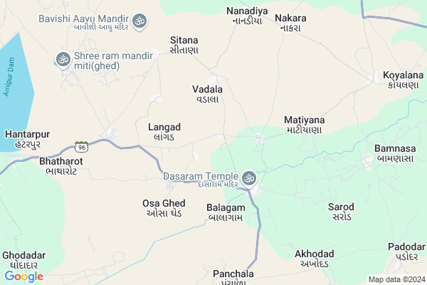
Indrana Map
EDIT Map
Add Your House
 ..
..
Current Corona Virus Infected Patients Count in Junagadh District
| City Name | District Name | Total Covid cases |
|---|
Locality Name :
Indrana
( ઇન્દ્રના )
Taluka Name : Keshod
District : Junagadh
State : Gujarat
Language : Gujarati and Hindi, English
Current Time 07:15 AM
Date: Saturday , Apr 26,2025 (IST)
Time zone: IST (UTC+5:30)
Elevation / Altitude: 39 meters. Above Seal level
Telephone Code / Std Code: 02871
Assembly constituency : Keshod assembly constituency
Assembly MLA : Devabhai Punjabhai Malam
Lok Sabha constituency : Porbandar parliamentary constituency
Parliament MP : RAMESHBHAI LAVJIBHAI DHADUK
Serpanch Name :
Pin Code : 362625
Post Office Name : Nanadia
Commodities Prices : Manavdar Market / Mandi
Indrana Live Weather
Temperature: 26.0 °C
clear sky
Humidity: 83%
Wind : 3.64 mt/sec towards NW
StationName : "BÄ\u0081ntva"
observed on Now
Temperature: 26.0 °C
clear sky
Humidity: 83%
Wind : 3.64 mt/sec towards NW
StationName : "BÄ\u0081ntva"
observed on Now
Indrana Weather Forecast for Next 5 days
27-04-2025
25.9°C to 36.2°C
clear sky
25.9°C to 36.2°C
clear sky
28-04-2025
25.3°C to 37.9°C
few clouds, clear sky
25.3°C to 37.9°C
few clouds, clear sky
29-04-2025
25.3°C to 37.5°C
clear sky
25.3°C to 37.5°C
clear sky
30-04-2025
25.1°C to 36.1°C
clear sky, few clouds
25.1°C to 36.1°C
clear sky, few clouds
01-05-2025
25.3°C to 36.4°C
clear sky
25.3°C to 36.4°C
clear sky
Rivers Near Indrana
Hiran
Hiran
About Indrana
Correct below Info and add more info about IndranaIndrana is a Village in Keshod Taluka in Junagadh District of Gujarat State, India. It is located 49 KM towards west from District head quarters Junagadh. 18 KM from . 390 KM from State capital Gandhinagar
Indrana Pin code is 362625 and postal head office is Nanadia .
Langad ( 4 KM ) , Balagam ( 4 KM ) , Ambaliya ( 4 KM ) , Osa Ghed ( 5 KM ) , Sitana ( 5 KM ) are the nearby Villages to Indrana. Indrana is surrounded by Keshod Taluka towards East , Mangrol Taluka towards South , Kutiyana Taluka towards North , Vanthali Taluka towards East .
Manavadar , Keshod , Mangrol , Junagadh are the near by Cities to Indrana.
Indrana 2011 Census Details
Indrana Local Language is Gujarati. Indrana Village Total population is 879 and number of houses are 176. Female Population is 49.8%. Village literacy rate is 67.2% and the Female Literacy rate is 26.6%.
Population
| Census Parameter | Census Data |
| Total Population | 879 |
| Total No of Houses | 176 |
| Female Population % | 49.8 % ( 438) |
| Total Literacy rate % | 67.2 % ( 591) |
| Female Literacy rate | 26.6 % ( 234) |
| Scheduled Tribes Population % | 15.8 % ( 139) |
| Scheduled Caste Population % | 18.1 % ( 159) |
| Working Population % | 53.7 % |
| Child(0 -6) Population by 2011 | 101 |
| Girl Child(0 -6) Population % by 2011 | 59.4 % ( 60) |
Indrana Census More Deatils.
Politics in Indrana
BJP , INC are the major political parties in this area.Polling Stations /Booths near Indrana
1)Nunarada2)Osa Ghed-1
3)Koylana Lathiya
4)Farangta
5)Bhathrot-1
HOW TO REACH Indrana
By Rail
There is no railway station near to Indrana in less than 10 km.Colleges near Indrana
Shri Arjun Arts And Bsw.brs.bca College.supasi
Address :
Shri Arjun B.sc College Supasi
Address : At.supasi Ta Veraval Dist.girsomnath
Bahauddin Science College (junagadh)
Address :
Shri Karmyogi Arts And Comm.college Gadu
Address :
S. R. Vasani School Of Management
Address :
Schools in Indrana
Indrana Pra Shala
Address : indrana , keshod , junagadh , Gujarat . PIN- 362625 , Post - Nanadia
Govt Health Centers near Indrana
1) C.M.Z. H. Junagardh , CIVIL HOSPITAL , NEAR AZAD CHOWK , NEAR AZAD CHOWK2) Sargavada , SUBCENTER SARAGWADA , , NEAR BUS STATION SARAGWADA
3) Jamjodhpur , , Balwa Fatak ,
Colleges in Indrana,Keshod
JM Panera Arts Commerce & Computer Science College
Bantva Road; GJ SH 32; Manavadar; Gujarat 362630; India
15.0 KM distance Detail
V.M. Chandera Arts College
Loej Ta Mangrol Dist; Junagadh; Gujarat 362001; India
15.8 KM distance Detail
more ..
Local Parks in Indrana,Keshod
Kailash Garden; Manavader
Mitadi - Manavadar Road; Kailash Nagar; Ratanpara; Manavadar; Gujarat 362630; India
14.8 KM distance Detail
Police Stations near Indrana,Keshod
Keshod Police Line
police line; Keshod;; Charchock; Keshod; Gujarat 362220; India
22.9 KM distance Detail
Governement Offices near Indrana,Keshod
Gram Panchayat Office Koyalana(GHED)
Unnamed Rd;; Koyalana; Gujarat 362625; India
11.6 KM distance Detail
About Indrana &
History
How to reach Indrana
Tourist Places Near By Indrana
Schools in Indrana
Colleges in Indrana
Temperature & weather of Indrana
places in Indrana
Indrana photos
More Information
How to reach Indrana
Tourist Places Near By Indrana
Schools in Indrana
Colleges in Indrana
Temperature & weather of Indrana
places in Indrana
Indrana photos
More Information
Village Talk
Post News or Events about this Village
Near Cities
Manavadar 15 KM near
Keshod 20 KM near
Mangrol 33 KM near
Junagadh 46 KM near
Manavadar 15 KM near
Keshod 20 KM near
Mangrol 33 KM near
Junagadh 46 KM near
Near By Taluks
Manavadar 17 KM near
Keshod 18 KM near
Mangrol 23 KM near
Kutiyana 30 KM near
Manavadar 17 KM near
Keshod 18 KM near
Mangrol 23 KM near
Kutiyana 30 KM near
Near By Air Ports
Porbandar Airport 58 KM near
Diu Airport 128 KM near
Govardhanpur Airport 133 KM near
Civil Airport 140 KM near
Porbandar Airport 58 KM near
Diu Airport 128 KM near
Govardhanpur Airport 133 KM near
Civil Airport 140 KM near
Near By Tourist Places
Junagadh 46 KM near
Girnar 47 KM near
Chorwad 48 KM near
Porbandar 60 KM near
Sasan Gir 65 KM near
Junagadh 46 KM near
Girnar 47 KM near
Chorwad 48 KM near
Porbandar 60 KM near
Sasan Gir 65 KM near
Near By Districts
Junagadh 47 KM near
Porbandar 62 KM near
Jamnagar 133 KM near
Amreli 134 KM near
Junagadh 47 KM near
Porbandar 62 KM near
Jamnagar 133 KM near
Amreli 134 KM near
Near By RailWay Station
Keshod Rail Way Station 23 KM near
Maliya Hatina Rail Way Station 38 KM near
Keshod Rail Way Station 23 KM near
Maliya Hatina Rail Way Station 38 KM near