| Home | City Bus | Maps | Villages | Cities | Rail | Tourist Places | School | College | Pin Codes | Corona Cases Count |
| Distance Calculator Bus Services IFSC Codes Trace Mobile Number Weather Search Place Trace IP Available Cash ATM/Banks Locate Polling Booth Report an Error contact People |
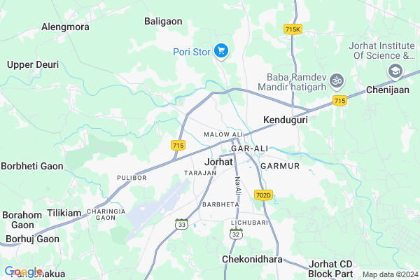
Choladhara Map
EDIT Map
Add Your House
 ..
..
Current Corona Virus Infected Patients Count in Jorhat District
| City Name | District Name | Total Covid cases |
|---|---|---|
| Jorhat District | Jorhat | 8 |
Village Name :
Choladhara
( चोलधारा )
Tehsil Name : Jorhat
District : Jorhat
State : Assam
Language : Assamese and Aiton, Shan, Burmese
Current Time 01:22 AM
Date: Tuesday , Mar 04,2025 (IST)
Time zone: IST (UTC+5:30)
Elevation / Altitude: 100 meters. Above Seal level
Telephone Code / Std Code: 0376
Ward : Ward
Assembly constituency : Jorhat assembly constituency
Assembly MLA : Hitendra Nath Goswami
Lok Sabha constituency : Jorhat parliamentary constituency
Parliament MP : TOPON KUMAR GOGOI
Commodities Prices : Mangkolemba Market / Mandi
Choladhara Live Weather
Temperature: 20.7 °C
scattered clouds
Humidity: 55%
Wind : 2.69 mt/sec towards NE
StationName : "JorhÄ\u0081t"
observed on 2 Hours Back
Temperature: 20.7 °C
scattered clouds
Humidity: 55%
Wind : 2.69 mt/sec towards NE
StationName : "JorhÄ\u0081t"
observed on 2 Hours Back
Choladhara Weather Forecast for Next 5 days
04-03-2025
17.7°C to 19.4°C
scattered clouds
17.7°C to 19.4°C
scattered clouds
05-03-2025
16.5°C to 31.3°C
few clouds, clear sky
16.5°C to 31.3°C
few clouds, clear sky
06-03-2025
16.3°C to 31.6°C
clear sky, scattered clouds, broken clouds
16.3°C to 31.6°C
clear sky, scattered clouds, broken clouds
07-03-2025
16.9°C to 32.9°C
clear sky
16.9°C to 32.9°C
clear sky
08-03-2025
16.7°C to 33.7°C
clear sky
16.7°C to 33.7°C
clear sky
Edit below overview about Choladhara
Edit below overview about Choladhara
OverView of Choladhara
The history behind the name:In 1794, the then Ahom king instructed Choladhora Phukan to construct a road connecting Seuni Ali (the present National Highway 37) with Malow Ali, located in the western part of Jorhat town. The new road constructed under the supervision of Chladhara Phukan later came to be known as Choladhara Road, and it improved road communication in the area to a great extent. It continues to be an important thoroughfare of the township.Edit below overview about Choladhara
National Highways Reachable To Choladhara
Nationa High Way :NH
Nationa High Way :NH715K
Nationa High Way :NH
Nationa High Way :NH715K
Rivers Near Choladhara
Dhansiri River
Gelabil River
Dhansiri River
Gelabil River
About Choladhara
Choladhara is a Locality in Jorhat City in Assam State, India.
Malow Ali , Rajahowli , Macharhaat , Jorhat , Gohain Phesual are the nearby Localities to Choladhara.
Jorhat , Mariani , Golaghat , Sibsagar are the nearby Cities to Jorhat.
Demographics of Choladhara
Assamese is the Local Language here.Politics in Choladhara
65331 , Bharatiya Janata Party , BJP , 79.71% , CPI , INC are the major political parties in this area.Polling Stations /Booths near Choladhara
1)No.83 Garamur Kumar Gaon L.p. School (right)2)Dahikhor L.p. School
3)Darangichuk L.p. School (left)
4)Paragati M.e. School
5)Polytechnic High School (part-a)
HOW TO REACH Choladhara
By Rail
Jorhat Town Rail Way Station , Bhalukmara Rail Way Station are the very nearby railway station to Choladhara.Pincodes near Choladhara
785001 ( Jorhat ) , 785010 ( Chengeli Gaon ) , 785006 ( Jorhat Reserch Lab )Govt Health Centers near Choladhara
1) Bamunkohar SC , , ,2) Pub-Kakodunga SC , , , Near Namkhatuwal Post Office
3) Mazikuchi MPHC , , ,
Sub Localities in Choladhara
Hospitals in Choladhara,Jorhat
Priyanki Medicare A.T Road Tarajan Opp.Sanjivani Hospital
Choladhara; Jorhat; Assam 785001; India
0.4 KM distance Detail
VINAYAK MEDICAL A.T. ROAD JORHAT ASSAM
Jorhat; Kakoti Gaon; Tarajan; Jorhat; Assam 785001; India
0.4 KM distance Detail
more ..
Petrol Bunks in Choladhara,Jorhat
ESSAR Oil Filling Station
AT Rd; Seuj Nagar; Sonari Gaon; Tarajan; Jorhat; Assam 785001; India
1.1 KM distance Detail
more ..
Colleges in Choladhara,Jorhat
COMIT group of institutions
T R Phukan Rd; Choladhara; Jorhat; Assam 785001; India
0.3 KM distance Detail
Sankardev College of Allied Sciences
Choladhara Rd; Choladhara; Jorhat; Assam 785001; India
0.4 KM distance Detail
more ..
Schools in Choladhara,Jorhat
Shemford Futuristic School - Jorhat
Annalisha Complex; Opp. Progoti Samaj; Choladhara; Jorhat; Assam 785001; India
0.2 KM distance Detail
vivekananda centre jorhat
Jorhat; Madhubon; Choladhara; Jorhat; Assam 785001; India
0.4 KM distance Detail
Kidzee
Atilagaon(Jail road); Nr.Dhalar Satra Press; Nakul Bhuyan Path; Jorhat; Assam 785001; India
1.0 KM distance Detail
Electronic Shops in Choladhara,Jorhat
LG Electronics
NOVA Apparel; Phukan Ali Road; Near; AT Rd; Tarajan; Jorhat; Assam 785001; India
0.4 KM distance Detail
Super Markets in Choladhara,Jorhat
Dapoon Ladies Beauty Parlour And Training Centre
Jorhat MG Rd; Gar-Ali; Jorhat; Assam 785001; India
1.3 KM distance Detail
Local Parks in Choladhara,Jorhat
Millenium Park
Tulasi Narayan Sharma Path; Malow Ali; Jorhat; Assam 785001; India
0.6 KM distance Detail
Police Stations near Choladhara,Jorhat
Jorhat Sadar Police Station
Mahatma Gandhi Rd; Opp Nokia Care; Jorhat; Assam 785001; India
1.5 KM distance Detail
Governement Offices near Choladhara,Jorhat
Food Corporation Of India; District Office Jorhat
Chandra Bhawan; Jorhat; Assam 785001; India
0.4 KM distance Detail
Rubber Board Regional Office
Tulasi Narayan Sharma Path; Malow Ali; Jorhat; Assam 785001; India
0.5 KM distance Detail
Jorhat development authority
Phukan Ali Rd; Kakoti Gaon; Choladhara; Jorhat; Assam 785001; India
0.6 KM distance Detail
About Choladhara &
History
How to reach Choladhara
Tourist Places Near By Choladhara
Schools in Choladhara
Colleges in Choladhara
Temperature & weather of Choladhara
places in Choladhara
Choladhara photos
More Information
How to reach Choladhara
Tourist Places Near By Choladhara
Schools in Choladhara
Colleges in Choladhara
Temperature & weather of Choladhara
places in Choladhara
Choladhara photos
More Information
Locality Talk
Post News or Events about this Locality
Near Cities
Jorhat 1 KM near
Mariani 18 KM near
Golaghat 40 KM near
Sibsagar 55 KM near
Jorhat 1 KM near
Mariani 18 KM near
Golaghat 40 KM near
Sibsagar 55 KM near
Near By Taluks
Jorhat Central 1 KM near
Jorhat 1 KM near
Jorhat East 2 KM near
North West Jorhat 3 KM near
Jorhat Central 1 KM near
Jorhat 1 KM near
Jorhat East 2 KM near
North West Jorhat 3 KM near
Near By Air Ports
Rowriah Airport 3 KM near
Lilabari Airport 67 KM near
Dimapur Airport 119 KM near
Chabua Airport 128 KM near
Rowriah Airport 3 KM near
Lilabari Airport 67 KM near
Dimapur Airport 119 KM near
Chabua Airport 128 KM near
Near By Tourist Places
Jorhat 1 KM near
Majuli 23 KM near
Sibsagar 55 KM near
Mokokchung 64 KM near
Yupia 71 KM near
Jorhat 1 KM near
Majuli 23 KM near
Sibsagar 55 KM near
Mokokchung 64 KM near
Yupia 71 KM near
Near By Districts
Jorhat 1 KM near
Golaghat 40 KM near
Sivasagar 55 KM near
Lakhimpur 59 KM near
Jorhat 1 KM near
Golaghat 40 KM near
Sivasagar 55 KM near
Lakhimpur 59 KM near
Near By RailWay Station
Jorhat Town Rail Way Station 2.4 KM near
Bhalukmara Rail Way Station 6.3 KM near
Barua Bamungaon Rail Way Station 6.3 KM near
Mariani Junction Rail Way Station 18 KM near
Amguri Junction Rail Way Station 36 KM near
Jorhat Town Rail Way Station 2.4 KM near
Bhalukmara Rail Way Station 6.3 KM near
Barua Bamungaon Rail Way Station 6.3 KM near
Mariani Junction Rail Way Station 18 KM near
Amguri Junction Rail Way Station 36 KM near