| Home | City Bus | Maps | Villages | Cities | Rail | Tourist Places | School | College | Pin Codes | Corona Cases Count |
| Distance Calculator Bus Services IFSC Codes Trace Mobile Number Weather Search Place Trace IP Available Cash ATM/Banks Locate Polling Booth Report an Error contact People |
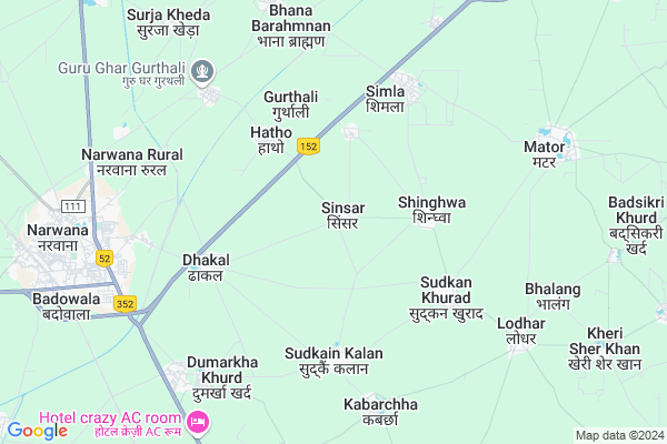
Sinsar Map
EDIT Map
Add Your House
 ..
..
Current Corona Virus Infected Patients Count in Jind District
| City Name | District Name | Total Covid cases |
|---|---|---|
| Jind District | Jind | 2 |
Locality Name :
Sinsar
( सिंसार )
Tehsil Name : Narwana
District : Jind
State : Haryana
Division : Hisar
Language : Hindi and Punjabi, English, Haryanvi
Current Time 08:55 PM
Date: Sunday , Apr 27,2025 (IST)
Time zone: IST (UTC+5:30)
Elevation / Altitude: 235 meters. Above Seal level
Telephone Code / Std Code: 01749
Assembly constituency : Narwana assembly constituency
Assembly MLA : Ram Niwas
Lok Sabha constituency : Sirsa parliamentary constituency
Parliament MP : Sunita Duggal
Serpanch Name :
Pin Code : 126116
Post Office Name : Narwana
Commodities Prices : Narwana Market / Mandi
Edit below overview about Sinsar
Edit below overview about Sinsar
OverView of Sinsar
Founder of sinsar - Asha Singh Ghanghas(Commander in Maharaja Ranjeet Singh Army) year of foundation in 1804, he belong to Dhakal village.Edit below overview about Sinsar
National Highways Reachable To Sinsar
Nationa High Way :NH152
Nationa High Way :NH152D
Nationa High Way :NH152
Nationa High Way :NH152D
Rivers Near Sinsar
Ghaggar
Ghaggar
About Sinsar
Sinsar is a Village in Narwana Tehsil in Jind District of Haryana State, India. It belongs to Hisar Division . It is located 38 KM towards North from District head quarters Jind. 16 KM from Narwana. 160 KM from State capital Chandigarh
Sinsar Pin code is 126116 and postal head office is Narwana .
Singwal ( 3 KM ) , Hatho ( 3 KM ) , Gurthali ( 4 KM ) , Sudhken Kalan ( 4 KM ) , Dakal ( 4 KM ) are the nearby Villages to Sinsar. Sinsar is surrounded by Uchana Tehsil towards South , Narwana Tehsil towards west , Alewa Tehsil towards East , Rajound Tehsil towards East .
Narwana , Kaithal , Tohana , Jind are the near by Cities to Sinsar.
This Place is in the border of the Jind District and Kaithal District. Kaithal District Kalayat is North towards this place .
Sinsar 2011 Census Details
Sinsar Local Language is Hindi. Sinsar Village Total population is 3466 and number of houses are 640. Female Population is 46.6%. Village literacy rate is 57.6% and the Female Literacy rate is 21.0%.
Population
| Census Parameter | Census Data |
| Total Population | 3466 |
| Total No of Houses | 640 |
| Female Population % | 46.6 % ( 1616) |
| Total Literacy rate % | 57.6 % ( 1995) |
| Female Literacy rate | 21.0 % ( 727) |
| Scheduled Tribes Population % | 0.0 % ( 0) |
| Scheduled Caste Population % | 19.4 % ( 674) |
| Working Population % | 55.0 % |
| Child(0 -6) Population by 2011 | 469 |
| Girl Child(0 -6) Population % by 2011 | 46.7 % ( 219) |
Sinsar Census More Deatils.
Politics in Sinsar
JJP , BJP , INLD , INC are the major political parties in this area.Polling Stations /Booths near Sinsar
1)Sinsar2)Singhwal
3)Bhikhewala
4)Singhwal
5)Singhwal
HOW TO REACH Sinsar
By Rail
Gurthuri Rail Way Station , Kalayat Rail Way Station are the very nearby railway stations to Sinsar.Colleges near Sinsar
K.m.govt. College
Address :
Adarsh University
Address :
Kgk
Address :
Schools in Sinsar
Sarvodya High School
Address : sinsar , narwana , jind , Haryana . PIN- 126116 , Post - Narwana
G.h.s. Sinsar
Address : sinsar , narwana , jind , Haryana . PIN- 126116 , Post - Narwana
Govt Health Centers near Sinsar
1) Kurar , , ,2) MUNAK , , ,
3) PHC BARODA , , ,
Petrol Bunks in Sinsar,Narwana
Kavita Filling Station Indian Oil Petrol Pump
Hatho; Jind; NH-65; Kaithal Road; Narwana; Narwana; Haryana 126116; India
2.6 KM distance Detail
Savita Filling Station Hatho
Kaithal - Hisar Road; Hatho; Haryana 136117; India
2.7 KM distance Detail
Petrol Pump
Kaithal - Hisar Road; Auto Market; Tayal Bagh Colony; Hisar; Haryana 125011; India
7.0 KM distance Detail
Hariyal Filling Station Indian Oil Petrol Pump
Hari Nagar; Jind; NH-71; Patran Narwana Road; Narwana; Narwana; Haryana 126116; India
7.9 KM distance Detail
more ..
Colleges in Sinsar,Narwana
Rajiv Gandhi Govt. Polytechnic
Patiala Road; Behind I.T.I. Campus; Narwana; Haryana 126116; India
8.1 KM distance Detail
more ..
Schools in Sinsar,Narwana
Swami Vivekanand Sen Sec School Singowal
Near Bus Stand; Sighwal; Haryana 126116; India
2.6 KM distance Detail
Local Parks in Sinsar,Narwana
Kapil Baag
Hariyal Chowk; National Highway 65; Hari Nagar; Badowala; Haryana 126116; India
8.2 KM distance Detail
Police Stations near Sinsar,Narwana
City Police Station
Railway Station Rd; Model Town; Narwana; Haryana 126116; India
9.9 KM distance Detail
Police Station
Old Ct Rd; FCI Area; Gandhi Nagar; Narwana; Haryana 126116; India
10.6 KM distance Detail
Governement Offices near Sinsar,Narwana
Haryana Roadways Bus Depot Narwana
Hanuman Nagar; Narwana; Haryana 126116; India
8.3 KM distance Detail
Gurudwara Teg Bahadur Duttal DeRa
Patran - Narwana Rd; Mohala Kheda; Narwana Rural; Haryana 126116; India
8.6 KM distance Detail
About Sinsar &
History
How to reach Sinsar
Tourist Places Near By Sinsar
Schools in Sinsar
Colleges in Sinsar
Temperature & weather of Sinsar
places in Sinsar
Sinsar photos
More Information
How to reach Sinsar
Tourist Places Near By Sinsar
Schools in Sinsar
Colleges in Sinsar
Temperature & weather of Sinsar
places in Sinsar
Sinsar photos
More Information
Village Talk
Post News or Events about this Village
Near Cities
Narwana 8 KM near
Kaithal 33 KM near
Tohana 35 KM near
Jind 37 KM near
Narwana 8 KM near
Kaithal 33 KM near
Tohana 35 KM near
Jind 37 KM near
Near By Taluks
Kalayat 12 KM near
Uchana 14 KM near
Narwana 15 KM near
Alewa 28 KM near
Kalayat 12 KM near
Uchana 14 KM near
Narwana 15 KM near
Alewa 28 KM near
Near By Air Ports
Chandigarh Airport 148 KM near
Muzaffarnagar Airport 160 KM near
Indira Gandhi International Airport 162 KM near
Ludhiana Airport 166 KM near
Chandigarh Airport 148 KM near
Muzaffarnagar Airport 160 KM near
Indira Gandhi International Airport 162 KM near
Ludhiana Airport 166 KM near
Near By Tourist Places
Hansi 67 KM near
Kurukshetra 79 KM near
Karna lake 85 KM near
panipat 87 KM near
Sangrur 89 KM near
Hansi 67 KM near
Kurukshetra 79 KM near
Karna lake 85 KM near
panipat 87 KM near
Sangrur 89 KM near
Near By Districts
Kaithal 33 KM near
Jind 37 KM near
Hisar 74 KM near
Fatehabad 78 KM near
Kaithal 33 KM near
Jind 37 KM near
Hisar 74 KM near
Fatehabad 78 KM near
Near By RailWay Station
Gurthuri Rail Way Station 6.7 KM near
Narwana Junction Rail Way Station 9 KM near
Jind Junction Rail Way Station 35 KM near
Gurthuri Rail Way Station 6.7 KM near
Narwana Junction Rail Way Station 9 KM near
Jind Junction Rail Way Station 35 KM near