| Home | City Bus | Maps | Villages | Cities | Rail | Tourist Places | School | College | Pin Codes | Corona Cases Count |
| Distance Calculator Bus Services IFSC Codes Trace Mobile Number Weather Search Place Trace IP Available Cash ATM/Banks Locate Polling Booth Report an Error contact People |
Ghusuramunda
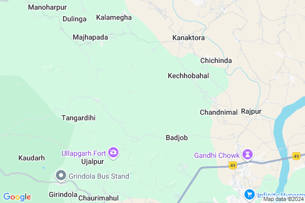
Ghusuramunda Map
EDIT Map
Add Your House
 ..
..
Current Corona Virus Infected Patients Count in Jharsuguda District
| City Name | District Name | Total Covid cases |
|---|
Locality Name :
Ghusuramunda
( ଘୁଷୁରାମୁଣ୍ଡା )
Tehsil Name : Jharsuguda
District : Jharsuguda
State : Odisha
Language : Oriya and Hindi,
Current Time 02:02 PM
Date: Tuesday , Apr 29,2025 (IST)
Time zone: IST (UTC+5:30)
Elevation / Altitude: 236 meters. Above Seal level
Telephone Code / Std Code: 06645
Assembly constituency : Brajarajnagar assembly constituency
Assembly MLA : radharani panda
Lok Sabha constituency : Bargarh parliamentary constituency
Parliament MP :
Serpanch Name :
Pin Code : 768216
Post Office Name : Sr Brajarajnagar
Commodities Prices : Jharsuguda Market / Mandi
National Highways Reachable To Ghusuramunda
Nationa High Way :NH49
Nationa High Way :NH49
Rivers Near Ghusuramunda
Ib River :इब नदी
Badaljgana
Ib River :इब नदी
Badaljgana
About Ghusuramunda
Correct below Info and add more info about GhusuramundaGhusuramunda is a small Village/hamlet in Jharsuguda Tehsil in Jharsuguda District of Odisha State, India. It is located 19 KM towards west from District head quarters Jharsuguda. 15 KM from Jharsuguda. 320 KM from State capital Bhubaneswar
Ghusuramunda Pin code is 768216 and postal head office is Sr Brajarajnagar .
Banjari ( 10 KM ) , Loisingh ( 12 KM ) , Kudaloi ( 13 KM ) , Jamera ( 14 KM ) , Kudopali ( 15 KM ) are the nearby Villages to Ghusuramunda. Ghusuramunda is surrounded by Lakhanpur Tehsil towards South , Hemgir Tehsil towards west , Lephripara Tehsil towards North , Tangarpali Tehsil towards North .
Belpahar , Brajrajnagar , Jharsuguda , Sundargarh are the near by Cities to Ghusuramunda.
Ghusuramunda 2011 Census Details
Ghusuramunda Local Language is Oriya. Ghusuramunda Village Total population is 292 and number of houses are 71. Female Population is 53.4%. Village literacy rate is 59.9% and the Female Literacy rate is 25.7%.
Population
| Census Parameter | Census Data |
| Total Population | 292 |
| Total No of Houses | 71 |
| Female Population % | 53.4 % ( 156) |
| Total Literacy rate % | 59.9 % ( 175) |
| Female Literacy rate | 25.7 % ( 75) |
| Scheduled Tribes Population % | 50.3 % ( 147) |
| Scheduled Caste Population % | 28.4 % ( 83) |
| Working Population % | 50.0 % |
| Child(0 -6) Population by 2011 | 28 |
| Girl Child(0 -6) Population % by 2011 | 42.9 % ( 12) |
Ghusuramunda Census More Deatils.
Politics in Ghusuramunda
BJP , BJD , INC are the major political parties in this area.Polling Stations /Booths near Ghusuramunda
1)B.r High School Belpahar (east)2)Katarbaga Primary School
3)Bundia Primary School
4)Chhualiberna Ashram School
5)Gobindpur Project Upper Primary School
HOW TO REACH Ghusuramunda
By Rail
Belpahar Rail Way Station is the very nearby railway stations to Ghusuramunda.Colleges near Ghusuramunda
Laxminarayan College
Address : Jharsuguda-768201orissa
Schools near Ghusuramunda
Jawahar Navodaya Vidyalaya
Address : ward-14 , jharsuguda mpl , jharsuguda , Sikkim . PIN- 768202 , Post - K.M. Road Jharsuguda
Assembly Of God School
Address : ward-05 , jharsuguda mpl , jharsuguda , Sikkim . PIN- 768201 , Post - Jharsuguda
Central School, Jharsuguda
Address : ward-23 , jharsuguda mpl , jharsuguda , Sikkim . PIN- 768201 , Post - Jharsuguda
St. Marrys Higher Secondary
Address : ward-10 , jharsuguda mpl , jharsuguda , Sikkim . PIN- 768203 , Post - Industrial Estate Jharsuguda S
Govt Health Centers near Ghusuramunda
1) UFWC, AITHAPALI , URBAN FAMILY WELFARE CENTER AINTHAPALI , Aithapali , Near Trafic2) DR.JANARDAN PUJARI MATERNITY HOME SAMBALPUR , JPM SAMBALPUR , GOLEBAZAR , Golebazar
3) Hatibari , , ,
Petrol Bunks in Ghusuramunda,Jharsuguda
Sri Balaji Fuels (Bpcl) Gandhichowk
Rajiv Gandhi Chowk; Bilaspur; Chhattisgarh 495001; India
8.9 KM distance Detail
HP Petrol Pump - Anshita Fuel Station
Near Sukhabandh; NH 49; Belpahar; Odisha 768217; India
9.1 KM distance Detail
more ..
Schools in Ghusuramunda,Jharsuguda
Up School.Chandanimal
AT/PO -chandanimal; Dist-jharsuguda;pin -768216; Odisha 768216; India
4.9 KM distance Detail
Governement Offices near Ghusuramunda,Jharsuguda
Brjn Live Office
768216; OPM Colony; Nuapada; Brajrajnagar; Odisha 768216; India
12.3 KM distance Detail
About Ghusuramunda &
History
How to reach Ghusuramunda
Tourist Places Near By Ghusuramunda
Schools in Ghusuramunda
Colleges in Ghusuramunda
Temperature & weather of Ghusuramunda
places in Ghusuramunda
Ghusuramunda photos
More Information
How to reach Ghusuramunda
Tourist Places Near By Ghusuramunda
Schools in Ghusuramunda
Colleges in Ghusuramunda
Temperature & weather of Ghusuramunda
places in Ghusuramunda
Ghusuramunda photos
More Information
Village Talk
Post News or Events about this Village
Near Cities
Belpahar 12 KM near
Brajrajnagar 12 KM near
Jharsuguda 18 KM near
Sundargarh 33 KM near
Belpahar 12 KM near
Brajrajnagar 12 KM near
Jharsuguda 18 KM near
Sundargarh 33 KM near
Near By Taluks
Jharsuguda 15 KM near
Lakhanpur 22 KM near
Hemgir 23 KM near
Lephripara 25 KM near
Jharsuguda 15 KM near
Lakhanpur 22 KM near
Hemgir 23 KM near
Lephripara 25 KM near
Near By Air Ports
Ranchi Airport 243 KM near
Raipur Airport 261 KM near
Bhubaneswar Airport 306 KM near
Gaya Airport 375 KM near
Ranchi Airport 243 KM near
Raipur Airport 261 KM near
Bhubaneswar Airport 306 KM near
Gaya Airport 375 KM near
Near By Tourist Places
Hirakud 45 KM near
Raigarh 53 KM near
Sambalpur 55 KM near
Simdega 115 KM near
Rourkela 125 KM near
Hirakud 45 KM near
Raigarh 53 KM near
Sambalpur 55 KM near
Simdega 115 KM near
Rourkela 125 KM near
Near By Districts
Jharsuguda 19 KM near
Sundargarh 33 KM near
Raigarh 53 KM near
Sambalpur 53 KM near
Jharsuguda 19 KM near
Sundargarh 33 KM near
Raigarh 53 KM near
Sambalpur 53 KM near
Near By RailWay Station
Brajrajnagar Rail Way Station 12 KM near
Jharsuguda Junction Rail Way Station 18 KM near
Brajrajnagar Rail Way Station 12 KM near
Jharsuguda Junction Rail Way Station 18 KM near