| Home | City Bus | Maps | Villages | Cities | Rail | Tourist Places | School | College | Pin Codes | Corona Cases Count |
| Distance Calculator Bus Services IFSC Codes Trace Mobile Number Weather Search Place Trace IP Available Cash ATM/Banks Locate Polling Booth Report an Error contact People |
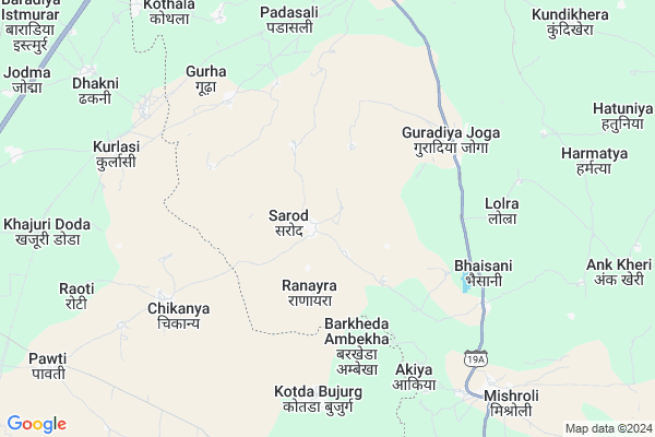
Sarod
Sarod Map
EDIT Map
Add Your House
 ..
..
Current Corona Virus Infected Patients Count in Jhalawar District
| City Name | District Name | Total Covid cases |
|---|---|---|
| Jhalawar District | Jhalawar | 30 |
Locality Name :
Sarod
( सरोद )
Tehsil Name : Jhalrapatan
District : Jhalawar
State : Rajasthan
Division : Kota
Language : Hindi and Rajasthani
Current Time 01:32 PM
Date: Monday , Apr 28,2025 (IST)
Time zone: IST (UTC+5:30)
Elevation / Altitude: 361 meters. Above Seal level
Telephone Code / Std Code: 07432
Assembly constituency : Dag assembly constituency
Assembly MLA : Kaluram
Lok Sabha constituency : Jhalawar-Baran parliamentary constituency
Parliament MP : DUSHYANT SINGH
Serpanch Name :
Pin Code : 326512
Post Office Name : Pach Pahar
Commodities Prices : Bhawani Mandi Market / Mandi
Rivers Near Sarod
Lhasi
Andheri
Lhasi
Andheri
About Sarod
Correct below Info and add more info about SarodSarod is a Village in Jhalrapatan Tehsil in Jhalawar District of Rajasthan State, India. It belongs to Kota Division . It is located 55 KM towards west from District head quarters Jhalawar. 49 KM from Jhalrapatan. 336 KM from State capital Jaipur
Sarod Pin code is 326512 and postal head office is Pach Pahar .
Guradiya Mana ( 11 KM ) , Kundi Khera ( 11 KM ) , Mogra ( 13 KM ) , Sileh Garh ( 14 KM ) , Narayan Khera ( 15 KM ) are the nearby Villages to Sarod. Sarod is surrounded by Bhanpura Tehsil towards North , Pirawa (Sunel) Tehsil towards East , Dag Tehsil towards South , Jhalrapatan Tehsil towards East .
Shamgarh , Ramganj Mandi , Jhalawar , Manasa are the near by Cities to Sarod.
Sarod 2011 Census Details
Sarod Local Language is Hindi. Sarod Village Total population is 3314 and number of houses are 615. Female Population is 48.8%. Village literacy rate is 48.0% and the Female Literacy rate is 16.9%.
Population
| Census Parameter | Census Data |
| Total Population | 3314 |
| Total No of Houses | 615 |
| Female Population % | 48.8 % ( 1618) |
| Total Literacy rate % | 48.0 % ( 1591) |
| Female Literacy rate | 16.9 % ( 561) |
| Scheduled Tribes Population % | 0.7 % ( 22) |
| Scheduled Caste Population % | 5.6 % ( 185) |
| Working Population % | 34.0 % |
| Child(0 -6) Population by 2011 | 457 |
| Girl Child(0 -6) Population % by 2011 | 46.8 % ( 214) |
Sarod Census More Deatils.
Politics in Sarod
BJP , INC are the major political parties in this area.Polling Stations /Booths near Sarod
1)Govt. Sec.sch. Ratanpura2)Govt. Sec.sch. Sarod (front Room)
3)Govt. U.p.s. Kali Talai (new Room)
4)Govt. U.p.sch.sindhala
5)Govt. Sec. Sch. Aankkhedi
HOW TO REACH Sarod
By Rail
Kurlasi Rail Way Station , Garoth Rail Way Station are the very nearby railway stations to Sarod.Colleges near Sarod
Government Birla College
Address :
Dharmraj Bairwa
Address : Khanpur
Jhalawar Medical College Hospital
Address : Jhalawar Medical College Hospital, Jhalawar
Government P. G. College Of Jhalawar
Address : Government P. G. College Of Jhalawar - 326001
Government Engg. College,jhalawar
Address : Teh.-jhalrapatan,dist.-jhalawar.
Schools in Sarod
G.sec.s.,sarod
Address : sarod , jhalarapatan , jhalawar , Rajasthan . PIN- 326512 , Post - Pach Pahar
Govt Health Centers near Sarod
1) Blakhen , Blakhen Sub Center Building , near govindgarh , near govindgarh2) Wani , , ,
3) Diyan , , ,
Petrol Bunks in Sarod,Jhalrapatan
Kanheya Filling Station Essar Oil Petrol Pump
Pagriya; Jhalawar; SH-19A; Jhalawar Road; Jhalawar; Jhalawar; Rajasthan 326033; India
13.3 KM distance Detail
Rana Partap Filling Station Bharat Petroleum
Pagriya; Jhalawar; SH-19A; Jhalawar Road; Jhalawar; Jhalawar; Rajasthan 326033; India
13.4 KM distance Detail
Essar petrol pump- Sisodia filling station
RJ SH 19A; Silehgarh; Rajasthan 326512; India
13.5 KM distance Detail
more ..
Schools in Sarod,Jhalrapatan
Tirupati Bal Vidhya Mandir School Silehgarh
Silehgarh; Rajasthan 326512; India
13.6 KM distance Detail
Government School
Pagriya; Jhalawar; SH-19A; Jhalawar Road; Jhalawar; Jhalawar; Rajasthan 326033; India
13.7 KM distance Detail
Electronic Shops in Sarod,Jhalrapatan
Mahakal Dj Light Decoretion And Tend House
Boliya Bujurg; Rajasthan 326034; India
18.6 KM distance Detail
Super Markets in Sarod,Jhalrapatan
श्री नाथ हौंडा शोरूम / Shri Nath Honda showroom
Sunel; Rajasthan 326513; India
20.1 KM distance Detail
Police Stations near Sarod,Jhalrapatan
Police Station Sunel;Rajasthan
Sunel - Pirawa Rd; Sunel; Rajasthan 326513; India
20.3 KM distance Detail
Rajasthan Police Station
Near Government Hospital; Sunel; Rajasthan 326513; India
20.3 KM distance Detail
Governement Offices near Sarod,Jhalrapatan
Atal Seva Kendra
Aavalikala; Jhalawar; SH-19A; Jhalawar Road; Jhalawar; Jhalawar; Rajasthan 326001; India
17.9 KM distance Detail
About Sarod &
History
How to reach Sarod
Tourist Places Near By Sarod
Schools in Sarod
Colleges in Sarod
Temperature & weather of Sarod
places in Sarod
Sarod photos
More Information
How to reach Sarod
Tourist Places Near By Sarod
Schools in Sarod
Colleges in Sarod
Temperature & weather of Sarod
places in Sarod
Sarod photos
More Information
Village Talk
Post News or Events about this Village
Near Cities
Shamgarh 25 KM near
Ramganj Mandi 43 KM near
Jhalawar 52 KM near
Manasa 75 KM near
Shamgarh 25 KM near
Ramganj Mandi 43 KM near
Jhalawar 52 KM near
Manasa 75 KM near
Near By Taluks
Garoth 22 KM near
Bhanpura 23 KM near
Pirawa (Sunel) 27 KM near
Dag 46 KM near
Garoth 22 KM near
Bhanpura 23 KM near
Pirawa (Sunel) 27 KM near
Dag 46 KM near
Near By Air Ports
Indore Airport 199 KM near
Dabok Airport 218 KM near
Bhopal Airport 219 KM near
Sanganeer Airport 310 KM near
Indore Airport 199 KM near
Dabok Airport 218 KM near
Bhopal Airport 219 KM near
Sanganeer Airport 310 KM near
Near By Tourist Places
Jhalawar 33 KM near
Kota 105 KM near
Neemuch 105 KM near
Bijolia 115 KM near
Bundi 139 KM near
Jhalawar 33 KM near
Kota 105 KM near
Neemuch 105 KM near
Bijolia 115 KM near
Bundi 139 KM near
Near By Districts
Jhalawar 53 KM near
Mandsaur 89 KM near
Neemuch 104 KM near
Kota 108 KM near
Jhalawar 53 KM near
Mandsaur 89 KM near
Neemuch 104 KM near
Kota 108 KM near
Near By RailWay Station
Kurlasi Rail Way Station 7.4 KM near
Garoth Rail Way Station 8.1 KM near
Bhawani Mandi Rail Way Station 12 KM near
Shamgarh Rail Way Station 24 KM near
Kurlasi Rail Way Station 7.4 KM near
Garoth Rail Way Station 8.1 KM near
Bhawani Mandi Rail Way Station 12 KM near
Shamgarh Rail Way Station 24 KM near