| Home | City Bus | Maps | Villages | Cities | Rail | Tourist Places | School | College | Pin Codes | Corona Cases Count |
| Distance Calculator Bus Services IFSC Codes Trace Mobile Number Weather Search Place Trace IP Available Cash ATM/Banks Locate Polling Booth Report an Error contact People |
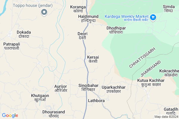
Kersai
Kersai Map
EDIT Map
Add Your House
 ..
..
Current Corona Virus Infected Patients Count in Jashpur District
| City Name | District Name | Total Covid cases |
|---|
Locality Name :
Kersai
( केरसई )
Tehsil Name : Pharsabahar
District : Jashpur
State : Chattisgarh
Language : Chhattisgarhi and Hindi
Current Time 08:34 PM
Date: Tuesday , Apr 29,2025 (IST)
Time zone: IST (UTC+5:30)
Elevation / Altitude: 229 meters. Above Seal level
Telephone Code / Std Code: 07761
Assembly constituency : Kunkuri assembly constituency
Assembly MLA : Vishnu Deo Sai
Lok Sabha constituency : Raigarh parliamentary constituency
Parliament MP : GOMATI SAI
Serpanch Name :
Pin Code : 496227
Post Office Name : Tapkara
Commodities Prices : Kunkuri Market / Mandi
Rivers Near Kersai
Gahira
Drongjor
Gahira
Drongjor
About Kersai
Correct below Info and add more info about KersaiKersai is a Village in Pharsabahar Tehsil in Jashpur District of Chattisgarh State, India. It is located 43 KM towards South from District head quarters Jashpur Nagar. 20 KM from Pharsabahar. 331 KM from State capital Raipur
Kersai Pin code is 496227 and postal head office is Tapkara .
Singi Bahar ( 3 KM ) , Kohpani ( 4 KM ) , Uparkachhar ( 5 KM ) , Deori ( 5 KM ) , Lathbora ( 5 KM ) are the nearby Villages to Kersai. Kersai is surrounded by Pharsabahar Tehsil towards South , Kurdeg Tehsil towards East , Duldula Tehsil towards East , Kunkuri Tehsil towards North .
Jashpurnagar , Sundargarh , Simdega , Bamra are the near by Cities to Kersai.
Kersai 2011 Census Details
Kersai Local Language is Chhattisgarhi. Kersai Village Total population is 4618 and number of houses are 1076. Female Population is 50.5%. Village literacy rate is 57.7% and the Female Literacy rate is 24.5%.
Population
| Census Parameter | Census Data |
| Total Population | 4618 |
| Total No of Houses | 1076 |
| Female Population % | 50.5 % ( 2334) |
| Total Literacy rate % | 57.7 % ( 2664) |
| Female Literacy rate | 24.5 % ( 1133) |
| Scheduled Tribes Population % | 61.6 % ( 2845) |
| Scheduled Caste Population % | 1.3 % ( 61) |
| Working Population % | 57.9 % |
| Child(0 -6) Population by 2011 | 640 |
| Girl Child(0 -6) Population % by 2011 | 53.9 % ( 345) |
Kersai Census More Deatils.
Politics in Kersai
Bharatiya Janata Party , BJP , INC are the major political parties in this area.Polling Stations /Booths near Kersai
1)Keradih 22)Kersai - 2
3)Kersai ~1
4)Sindrimunda
5)Singibahar - 2
HOW TO REACH Kersai
By Rail
There is no railway station near to Kersai in less than 10 km.Colleges near Kersai
Government Girls College, Kansabel
Address : Church Road, Near High School
New Government College Kansabel
Address :
Govt. Vbsd Girls College Jashpur Nagar
Address : Major-priti Road, Basant Vihar, Jashpur
Schools in Kersai
Twd P.m.s. Ghansimunda
Address : kersai , farsabahar , jashpur , Chattisgarh . PIN- 496227 , Post - Tapkara
Twd P.m.s. Kersai
Address : kersai , farsabahar , jashpur , Chattisgarh . PIN- 496227 , Post - Tapkara
Govt Health Centers near Kersai
1) SHC Rapadand , Rapadand , Rapadand , Rapadand2) PHC Kersai , Kersai , Kersai , Kersai
3) SHC Singibahar , Singibahar , Singibahar , Singibahar
Hospitals in Kersai,Pharsabahar
Kersai Hospital प्राथमिक स्वास्थ्य केंद्र
Jashpur Nagar; Chhattisgarh 496227; India
2.5 KM distance Detail
Shival Medical
shivam medical farsabahar Road; Dokada; Chhattisgarh 496223; India
9.7 KM distance Detail
more ..
Colleges in Kersai,Pharsabahar
Loyola College Kunkuri
Infront Of Loyola School; P.O. - Kunkuri; NH - 78; Kunkuri; Chhattisgarh 496225; India
20.3 KM distance Detail
more ..
Police Stations near Kersai,Pharsabahar
Police Station Pathalgaon
Pharsabahal; Jashpur; SH-22; Pathalgaon Road; Pathalgaon; Pathalgaon; Chhattisgarh 496223; India
16.2 KM distance Detail
About Kersai &
History
How to reach Kersai
Tourist Places Near By Kersai
Schools in Kersai
Colleges in Kersai
Temperature & weather of Kersai
places in Kersai
Kersai photos
More Information
How to reach Kersai
Tourist Places Near By Kersai
Schools in Kersai
Colleges in Kersai
Temperature & weather of Kersai
places in Kersai
Kersai photos
More Information
Village Talk
Post News or Events about this Village
Near Cities
Jashpurnagar 44 KM near
Sundargarh 59 KM near
Simdega 61 KM near
Bamra 77 KM near
Jashpurnagar 44 KM near
Sundargarh 59 KM near
Simdega 61 KM near
Bamra 77 KM near
Near By Taluks
Kansabel 17 KM near
Pharsabahar 19 KM near
Kurdeg 21 KM near
Duldula 22 KM near
Kansabel 17 KM near
Pharsabahar 19 KM near
Kurdeg 21 KM near
Duldula 22 KM near
Near By Air Ports
Ranchi Airport 180 KM near
Gaya Airport 291 KM near
Raipur Airport 310 KM near
Bhubaneswar Airport 362 KM near
Ranchi Airport 180 KM near
Gaya Airport 291 KM near
Raipur Airport 310 KM near
Bhubaneswar Airport 362 KM near
Near By Tourist Places
Jashpur 42 KM near
Simdega 62 KM near
Gumla 87 KM near
Raigarh 107 KM near
Ambikapur 109 KM near
Jashpur 42 KM near
Simdega 62 KM near
Gumla 87 KM near
Raigarh 107 KM near
Ambikapur 109 KM near
Near By Districts
Jashpur 41 KM near
Sundargarh 59 KM near
Simdega 60 KM near
Gumla 87 KM near
Jashpur 41 KM near
Sundargarh 59 KM near
Simdega 60 KM near
Gumla 87 KM near
Near By RailWay Station
Bamra Rail Way Station 77 KM near
Rajgangpur Rail Way Station 87 KM near
Bamra Rail Way Station 77 KM near
Rajgangpur Rail Way Station 87 KM near