| Home | City Bus | Maps | Villages | Cities | Rail | Tourist Places | School | College | Pin Codes | Corona Cases Count |
| Distance Calculator Bus Services IFSC Codes Trace Mobile Number Weather Search Place Trace IP Available Cash ATM/Banks Locate Polling Booth Report an Error contact People |
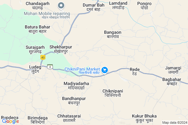
Saraitola
Saraitola Map
EDIT Map
Add Your House
 ..
..
Current Corona Virus Infected Patients Count in Jashpur District
| City Name | District Name | Total Covid cases |
|---|
Locality Name :
Saraitola
( सरईटोला )
Tehsil Name : Patthalgaon
District : Jashpur
State : Chattisgarh
Language : Chhattisgarhi and Hindi
Current Time 11:36 AM
Date: Sunday , Apr 27,2025 (IST)
Time zone: IST (UTC+5:30)
Elevation / Altitude: 243 meters. Above Seal level
Telephone Code / Std Code: 07765
Assembly constituency : Pathalgaon assembly constituency
Assembly MLA : Gomati Sai
Lok Sabha constituency : Raigarh parliamentary constituency
Parliament MP : GOMATI SAI
Serpanch Name :
Pin Code : 496220
Post Office Name : Ludeg
Commodities Prices : Kotba Market / Mandi
Rivers Near Saraitola
Samarsuta
Ib River :इब नदी
Samarsuta
Ib River :इब नदी
About Saraitola
Correct below Info and add more info about SaraitolaSaraitola is a Village in Patthalgaon Tehsil in Jashpur District of Chattisgarh State, India. It is located 69 KM towards west from District head quarters Jashpur Nagar. 10 KM from Patthalgaon. 299 KM from State capital Raipur
Saraitola Pin code is 496220 and postal head office is Ludeg .
Rede ( 5 KM ) , Dumarbahar ( 6 KM ) , Loker ( 6 KM ) , Billdegi ( 6 KM ) , Chhatasarie ( 6 KM ) are the nearby Villages to Saraitola. Saraitola is surrounded by Kansabel Tehsil towards East , Lailunga Tehsil towards South , Sitapur Tehsil towards North , Pharsabahar Tehsil towards East .
Sundargarh , Jashpurnagar , Raigarh , Ambikapur are the near by Cities to Saraitola.
This Place is in the border of the Jashpur District and Raigarh District. Raigarh District Lailunga is South towards this place .
Saraitola 2011 Census Details
Saraitola Local Language is Chhattisgarhi. Saraitola Village Total population is 2296 and number of houses are 472. Female Population is 48.5%. Village literacy rate is 53.8% and the Female Literacy rate is 21.1%.
Population
| Census Parameter | Census Data |
| Total Population | 2296 |
| Total No of Houses | 472 |
| Female Population % | 48.5 % ( 1114) |
| Total Literacy rate % | 53.8 % ( 1236) |
| Female Literacy rate | 21.1 % ( 485) |
| Scheduled Tribes Population % | 66.3 % ( 1522) |
| Scheduled Caste Population % | 3.3 % ( 75) |
| Working Population % | 60.7 % |
| Child(0 -6) Population by 2011 | 295 |
| Girl Child(0 -6) Population % by 2011 | 45.4 % ( 134) |
Saraitola Census More Deatils.
Politics in Saraitola
Bharatiya Janata Party , BJP , INC are the major political parties in this area.Polling Stations /Booths near Saraitola
1)Chidora2)Chiknipani ~k
3)Saraipani
4)Saraitola ~k
5)Kukurbhuka ~g
HOW TO REACH Saraitola
By Rail
There is no railway station near to Saraitola in less than 10 km.Colleges near Saraitola
Government Girls College, Kansabel
Address : Church Road, Near High School
New Government College Kansabel
Address :
Govt. Vbsd Girls College Jashpur Nagar
Address : Major-priti Road, Basant Vihar, Jashpur
Schools in Saraitola
Govt. P.m.s. Saraitola
Address : saraitola , pathalgaon , jashpur , Chattisgarh . PIN- 496220 , Post - Ludeg
Govt Health Centers near Saraitola
1) SHC KHUTAPANI , , Khutapani , Khutapani2) SHC CHIKNIPANI , , SHC CHIKNIPANI , CHIKNIPANI
3) SHC KUKURBHUKA , , kUKURBHUKA , KUKURBHUKA
Petrol Bunks in Saraitola,Patthalgaon
HP PETROL PUMP - MAHENDRA PREET FUELS
Hpcl Petrol Pump Ludeg Tehsil Pathalgaon; Raipur; Chhattisgarh 496118; India
7.0 KM distance Detail
more ..
Colleges in Saraitola,Patthalgaon
Aisect computer
Jashpur Nagar Highway Marg; Shanti Nagar; Kusumtal; Chhattisgarh 496223; India
14.7 KM distance Detail
more ..
Schools in Saraitola,Patthalgaon
Government Middle School
Dimarbahar; Dumar Bahaar; Jashpur; NH-78; Ranchi Road; Kansabil; Kansabil; Chhattisgarh 496223; India
6.2 KM distance Detail
Super Markets in Saraitola,Patthalgaon
DJ Kamlesh Mixing गाना और विडियो मिक्सिंग सेंटर
Sadkpara; Bildegi; Chhattisgarh 496220; India
5.7 KM distance Detail
Police Stations near Saraitola,Patthalgaon
Police Station Pathalgaon
Pharsabahal; Jashpur; SH-22; Pathalgaon Road; Pathalgaon; Pathalgaon; Chhattisgarh 496223; India
22.3 KM distance Detail
Governement Offices near Saraitola,Patthalgaon
Tehsil Office
Jashpur Nagar Highway Marg; Kansabel; Chhattisgarh 496223; India
15.2 KM distance Detail
About Saraitola &
History
How to reach Saraitola
Tourist Places Near By Saraitola
Schools in Saraitola
Colleges in Saraitola
Temperature & weather of Saraitola
places in Saraitola
Saraitola photos
More Information
How to reach Saraitola
Tourist Places Near By Saraitola
Schools in Saraitola
Colleges in Saraitola
Temperature & weather of Saraitola
places in Saraitola
Saraitola photos
More Information
Village Talk
Post News or Events about this Village
Near Cities
Sundargarh 68 KM near
Jashpurnagar 69 KM near
Raigarh 88 KM near
Ambikapur 88 KM near
Sundargarh 68 KM near
Jashpurnagar 69 KM near
Raigarh 88 KM near
Ambikapur 88 KM near
Near By Taluks
Patthalgaon 9 KM near
Kansabel 20 KM near
Lailunga 30 KM near
Sitapur 31 KM near
Patthalgaon 9 KM near
Kansabel 20 KM near
Lailunga 30 KM near
Sitapur 31 KM near
Near By Air Ports
Ranchi Airport 211 KM near
Raipur Airport 281 KM near
Gaya Airport 308 KM near
Varanasi Airport 371 KM near
Ranchi Airport 211 KM near
Raipur Airport 281 KM near
Gaya Airport 308 KM near
Varanasi Airport 371 KM near
Near By Tourist Places
Jashpur 67 KM near
Raigarh 87 KM near
Ambikapur 88 KM near
Simdega 96 KM near
Sarguja 111 KM near
Jashpur 67 KM near
Raigarh 87 KM near
Ambikapur 88 KM near
Simdega 96 KM near
Sarguja 111 KM near
Near By Districts
Jashpur 66 KM near
Sundargarh 69 KM near
Raigarh 88 KM near
Surguja 89 KM near
Jashpur 66 KM near
Sundargarh 69 KM near
Raigarh 88 KM near
Surguja 89 KM near
Near By RailWay Station
Raigarh Rail Way Station 89 KM near
Bamra Rail Way Station 95 KM near
Raigarh Rail Way Station 89 KM near
Bamra Rail Way Station 95 KM near