| Home | City Bus | Maps | Villages | Cities | Rail | Tourist Places | School | College | Pin Codes | Corona Cases Count |
| Distance Calculator Bus Services IFSC Codes Trace Mobile Number Weather Search Place Trace IP Available Cash ATM/Banks Locate Polling Booth Report an Error contact People |
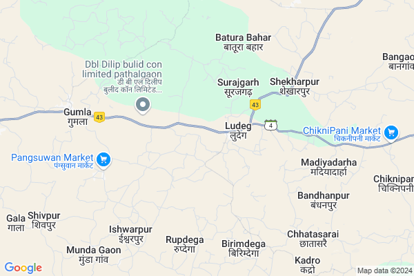
Indranagar
Indranagar Map
EDIT Map
Add Your House
 ..
..
Current Corona Virus Infected Patients Count in Jashpur District
| City Name | District Name | Total Covid cases |
|---|
Locality Name :
Indranagar
( इंद्रानगर )
Tehsil Name : Patthalgaon
District : Jashpur
State : Chattisgarh
Language : Chhattisgarhi and Hindi
Current Time 07:37 PM
Date: Wednesday , Feb 05,2025 (IST)
Time zone: IST (UTC+5:30)
Elevation / Altitude: 243 meters. Above Seal level
Telephone Code / Std Code: 07765
Assembly constituency : Pathalgaon assembly constituency
Assembly MLA : Gomati Sai
Lok Sabha constituency : Raigarh parliamentary constituency
Parliament MP : GOMATI SAI
Serpanch Name :
Main Village Name : Gala
Commodities Prices : Pathalgaon Market / Mandi
Indranagar Live Weather
Temperature: 25.3 °C
few clouds
Humidity: 27%
Wind : 1.03 mt/sec towards W
StationName : "Pathalgaon"
observed on 35 Mins Back
Temperature: 25.3 °C
few clouds
Humidity: 27%
Wind : 1.03 mt/sec towards W
StationName : "Pathalgaon"
observed on 35 Mins Back
Indranagar Weather Forecast for Next 5 days
06-02-2025
18.6°C to 25.8°C
scattered clouds, few clouds
18.6°C to 25.8°C
scattered clouds, few clouds
07-02-2025
16.8°C to 30.8°C
clear sky
16.8°C to 30.8°C
clear sky
08-02-2025
15.1°C to 30.7°C
clear sky
15.1°C to 30.7°C
clear sky
09-02-2025
12.9°C to 30.5°C
clear sky
12.9°C to 30.5°C
clear sky
10-02-2025
14.4°C to 32.1°C
clear sky
14.4°C to 32.1°C
clear sky
Rivers Near Indranagar
Samarsuta
Ib River :इब नदी
Samarsuta
Ib River :इब नदी
About Indranagar
Correct below Info and add more info about IndranagarIndranagar is a small Village/hamlet in Patthalgaon Tehsil in Jashpur District of Chattisgarh State, India. It comes under Gala Panchayath. It is located 79 KM towards west from District head quarters Jashpur Nagar. 290 KM from State capital Raipur
Indranagar is surrounded by Lailunga Tehsil towards South , Sitapur Tehsil towards North , Kansabel Tehsil towards East , Dharamjaigarh Tehsil towards west .
Sundargarh , Jashpurnagar , Raigarh , Ambikapur are the near by Cities to Indranagar.
This Place is in the border of the Jashpur District and Raigarh District. Raigarh District Lailunga is South towards this place .
Demographics of Indranagar
Chhattisgarhi is the Local Language here.Politics in Indranagar
Bharatiya Janata Party , BJP , INC are the major political parties in this area.Polling Stations /Booths near Indranagar
1)Ludeg2)Loker
3)Jumikela ~2
4)Kachhar
5)Kachhar ~k
HOW TO REACH Indranagar
By Rail
There is no railway station near to Indranagar in less than 10 km.Pincodes near Indranagar
496118 ( Pathalgoan ) , 496220 ( Ludeg ) , 496115 ( Rajpur (RIH) )Colleges near Indranagar
Government Girls College, Kansabel
Address : Church Road, Near High School
New Government College Kansabel
Address :
Govt. Vbsd Girls College Jashpur Nagar
Address : Major-priti Road, Basant Vihar, Jashpur
Schools near Indranagar
Pvt. Public Ps. Pathalgaon
Address : pathhalgaon , pathalgaon , jashpur , Chattisgarh . PIN- 496118 , Post - Pathalgoan
Govt. Model Ms. Pandripani
Address : pandripani , pathalgaon , jashpur , Chattisgarh . PIN- 496118 , Post - Pathalgoan
Pvt. J.p. Ps.ms. Pathalgaon
Address : pathhalgaon , pathalgaon , jashpur , Chattisgarh . PIN- 496118 , Post - Pathalgoan
Govt Hss Pathalgaon
Address : pathhalgaon , pathalgaon , jashpur , Chattisgarh . PIN- 496118 , Post - Pathalgoan
Govt Health Centers near Indranagar
1) SHC LUDEG , , SHC LUDEG JASHPUR ROAD , LUDEG2) SHC KADRO , , SHC KADRO , KADRO
3) PHC LUDEG , , Jashpur Road Bansapara , Basapara Ludeg
Petrol Bunks in Indranagar,Patthalgaon
HP PETROL PUMP - MAHENDRA PREET FUELS
Hpcl Petrol Pump Ludeg Tehsil Pathalgaon; Raipur; Chhattisgarh 496118; India
2.8 KM distance Detail
Indian Oil Petrol Pump
Lagjhar; Patarapali; Jashpur; NH-78; Ranchi Road; Pathalgaon; Pathalgaon; Chhattisgarh 496220; India
10.6 KM distance Detail
more ..
Colleges in Indranagar,Patthalgaon
Aisect computer
Jashpur Nagar Highway Marg; Shanti Nagar; Kusumtal; Chhattisgarh 496223; India
22.5 KM distance Detail
more ..
Super Markets in Indranagar,Patthalgaon
DJ Kamlesh Mixing गाना और विडियो मिक्सिंग सेंटर
Sadkpara; Bildegi; Chhattisgarh 496220; India
7.4 KM distance Detail
Governement Offices near Indranagar,Patthalgaon
Tehsil Office
Jashpur Nagar Highway Marg; Kansabel; Chhattisgarh 496223; India
22.8 KM distance Detail
About Indranagar &
History
How to reach Indranagar
Tourist Places Near By Indranagar
Schools in Indranagar
Colleges in Indranagar
Temperature & weather of Indranagar
places in Indranagar
Indranagar photos
More Information
How to reach Indranagar
Tourist Places Near By Indranagar
Schools in Indranagar
Colleges in Indranagar
Temperature & weather of Indranagar
places in Indranagar
Indranagar photos
More Information
Village Talk
Post News or Events about this Village
Near Cities
Sundargarh 73 KM near
Jashpurnagar 77 KM near
Raigarh 83 KM near
Ambikapur 84 KM near
Sundargarh 73 KM near
Jashpurnagar 77 KM near
Raigarh 83 KM near
Ambikapur 84 KM near
Near By Taluks
Patthalgaon 0 KM near
Lailunga 27 KM near
Kansabel 28 KM near
Sitapur 29 KM near
Patthalgaon 0 KM near
Lailunga 27 KM near
Kansabel 28 KM near
Sitapur 29 KM near
Near By Air Ports
Ranchi Airport 220 KM near
Raipur Airport 273 KM near
Gaya Airport 314 KM near
Varanasi Airport 370 KM near
Ranchi Airport 220 KM near
Raipur Airport 273 KM near
Gaya Airport 314 KM near
Varanasi Airport 370 KM near
Near By Tourist Places
Jashpur 75 KM near
Ambikapur 83 KM near
Raigarh 83 KM near
Simdega 105 KM near
Korba 107 KM near
Jashpur 75 KM near
Ambikapur 83 KM near
Raigarh 83 KM near
Simdega 105 KM near
Korba 107 KM near
Near By Districts
Sundargarh 74 KM near
Jashpur 75 KM near
Raigarh 84 KM near
Surguja 84 KM near
Sundargarh 74 KM near
Jashpur 75 KM near
Raigarh 84 KM near
Surguja 84 KM near
Near By RailWay Station
Raigarh Rail Way Station 85 KM near
Kharsia Rail Way Station 90 KM near
Raigarh Rail Way Station 85 KM near
Kharsia Rail Way Station 90 KM near