| Home | City Bus | Maps | Villages | Cities | Rail | Tourist Places | School | College | Pin Codes | Corona Cases Count |
| Distance Calculator Bus Services IFSC Codes Trace Mobile Number Weather Search Place Trace IP Available Cash ATM/Banks Locate Polling Booth Report an Error contact People |
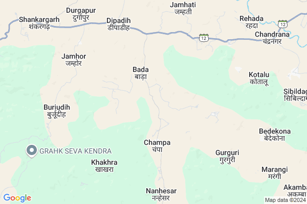
Champa
Champa Map
EDIT Map
Add Your House
 ..
..
Current Corona Virus Infected Patients Count in Jashpur District
| City Name | District Name | Total Covid cases |
|---|
Locality Name :
Champa
( चंपा )
Tehsil Name : Bagicha
District : Jashpur
State : Chattisgarh
Language : Chhattisgarhi and Hindi
Current Time 11:25 AM
Date: Tuesday , Apr 29,2025 (IST)
Time zone: IST (UTC+5:30)
Elevation / Altitude: 619 meters. Above Seal level
Telephone Code / Std Code: 07769
Assembly constituency : Jashpur assembly constituency
Assembly MLA : Raymuni Bhagat
Lok Sabha constituency : Raigarh parliamentary constituency
Parliament MP : GOMATI SAI
Serpanch Name :
Pin Code : 496336
Post Office Name : Sanna
Commodities Prices : Kusmee Market / Mandi
National Highways Reachable To Champa
Nationa High Way :NH343
Nationa High Way :NH343
Rivers Near Champa
Ib
Lawa
Ib
Lawa
About Champa
Correct below Info and add more info about ChampaChampa is a Village in Bagicha Tehsil in Jashpur District of Chattisgarh State, India. It is located 66 KM towards west from District head quarters Jashpur Nagar. 35 KM from Bagicha. 362 KM from State capital Raipur
Champa Pin code is 496336 and postal head office is Sanna .
Nanhesar ( 7 KM ) , Kawai ( 8 KM ) , Kodopara ( 8 KM ) , Mahnai ( 13 KM ) , Chhichhali-a ( 16 KM ) are the nearby Villages to Champa. Champa is surrounded by Kusmi Tehsil towards North , Bagicha Tehsil towards South , Lundra Tehsil towards west , Manora Tehsil towards East .
Jashpurnagar , Ambikapur , Gumla , Lohardaga are the near by Cities to Champa.
Champa 2011 Census Details
Champa Local Language is Chhattisgarhi. Champa Village Total population is 2274 and number of houses are 512. Female Population is 50.1%. Village literacy rate is 44.9% and the Female Literacy rate is 19.4%.
Population
| Census Parameter | Census Data |
| Total Population | 2274 |
| Total No of Houses | 512 |
| Female Population % | 50.1 % ( 1140) |
| Total Literacy rate % | 44.9 % ( 1020) |
| Female Literacy rate | 19.4 % ( 442) |
| Scheduled Tribes Population % | 80.4 % ( 1828) |
| Scheduled Caste Population % | 0.3 % ( 6) |
| Working Population % | 71.5 % |
| Child(0 -6) Population by 2011 | 371 |
| Girl Child(0 -6) Population % by 2011 | 50.7 % ( 188) |
Champa Census More Deatils.
Politics in Champa
Bharatiya Janata Party , BJP , INC are the major political parties in this area.Polling Stations /Booths near Champa
1)Chalni2)Champa -1
3)Fatepur
4)Durgapara
5)Kurkuriya
HOW TO REACH Champa
By Rail
There is no railway station near to Champa in less than 10 km.Colleges near Champa
Government Girls College, Kansabel
Address : Church Road, Near High School
New Government College Kansabel
Address :
Govt. Vbsd Girls College Jashpur Nagar
Address : Major-priti Road, Basant Vihar, Jashpur
Schools in Champa
S.s.m. G. Vidyalaya Champa
Address : champa , bagicha , jashpur , Chattisgarh . PIN- 496336 , Post - Sanna
P.m.s. Champa
Address : champa , bagicha , jashpur , Chattisgarh . PIN- 496336 , Post - Sanna
Govt Health Centers near Champa
1) PHC Champa , primary health center , village- Champa , Tahsil- Bagicha2) SHC Gurguri , SHC Gurguri , Gurguri , Gurguri
3) PHC Dipadihkala , , ,
Super Markets in Champa,Bagicha
Local Parks in Champa,Bagicha
Governement Offices near Champa,Bagicha
About Champa &
History
How to reach Champa
Tourist Places Near By Champa
Schools in Champa
Colleges in Champa
Temperature & weather of Champa
places in Champa
Champa photos
More Information
How to reach Champa
Tourist Places Near By Champa
Schools in Champa
Colleges in Champa
Temperature & weather of Champa
places in Champa
Champa photos
More Information
Village Talk
Post News or Events about this Village
Near Cities
Jashpurnagar 62 KM near
Ambikapur 64 KM near
Gumla 93 KM near
Lohardaga 108 KM near
Jashpurnagar 62 KM near
Ambikapur 64 KM near
Gumla 93 KM near
Lohardaga 108 KM near
Near By Taluks
Shankargarh 17 KM near
Kusmi 23 KM near
Bagicha 34 KM near
Lundra 40 KM near
Shankargarh 17 KM near
Kusmi 23 KM near
Bagicha 34 KM near
Lundra 40 KM near
Near By Air Ports
Ranchi Airport 180 KM near
Gaya Airport 231 KM near
Varanasi Airport 293 KM near
Patna Airport 330 KM near
Ranchi Airport 180 KM near
Gaya Airport 231 KM near
Varanasi Airport 293 KM near
Patna Airport 330 KM near
Near By Tourist Places
Jashpur 63 KM near
Sarguja 64 KM near
Ambikapur 65 KM near
Netarhat 66 KM near
Gumla 93 KM near
Jashpur 63 KM near
Sarguja 64 KM near
Ambikapur 65 KM near
Netarhat 66 KM near
Gumla 93 KM near
Near By Districts
Jashpur 63 KM near
Surguja 64 KM near
Gumla 93 KM near
Latehar 105 KM near
Jashpur 63 KM near
Surguja 64 KM near
Gumla 93 KM near
Latehar 105 KM near
Near By RailWay Station
Barwadih Junction Rail Way Station 86 KM near
Latehar Rail Way Station 101 KM near
Barwadih Junction Rail Way Station 86 KM near
Latehar Rail Way Station 101 KM near