| Home | City Bus | Maps | Villages | Cities | Rail | Tourist Places | School | College | Pin Codes | Corona Cases Count |
| Distance Calculator Bus Services IFSC Codes Trace Mobile Number Weather Search Place Trace IP Available Cash ATM/Banks Locate Polling Booth Report an Error contact People |
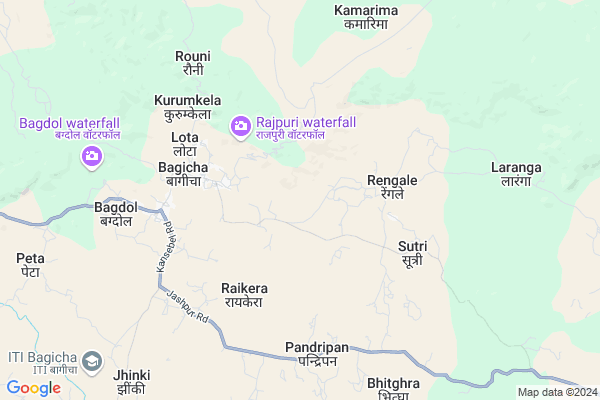
Bijatoli
Bijatoli Map
EDIT Map
Add Your House
 ..
..
Current Corona Virus Infected Patients Count in Jashpur District
| City Name | District Name | Total Covid cases |
|---|
Locality Name :
Bijatoli
( बीजाटोली बीजाटोली )
Tehsil Name : Bagicha
District : Jashpur
State : Chattisgarh
Language : Chhattisgarhi and Hindi
Current Time 02:13 PM
Date: Tuesday , Apr 29,2025 (IST)
Time zone: IST (UTC+5:30)
Elevation / Altitude: 619 meters. Above Seal level
Telephone Code / Std Code: 07769
Assembly constituency : Jashpur assembly constituency
Assembly MLA : Raymuni Bhagat
Lok Sabha constituency : Raigarh parliamentary constituency
Parliament MP : GOMATI SAI
Serpanch Name :
Main Village Name : Dumarkona
Commodities Prices : Sitapur Market / Mandi
Bijatoli Live Weather
Temperature: 25.1 °C
overcast clouds
Humidity: 40%
Wind : 7.66 mt/sec towards E
StationName : "Jashpurnagar"
observed on 0 Mins Back
Temperature: 25.1 °C
overcast clouds
Humidity: 40%
Wind : 7.66 mt/sec towards E
StationName : "Jashpurnagar"
observed on 0 Mins Back
Bijatoli Weather Forecast for Next 5 days
30-04-2025
20.6°C to 27.8°C
light rain, overcast clouds, scattered clouds
20.6°C to 27.8°C
light rain, overcast clouds, scattered clouds
01-05-2025
19.0°C to 37.1°C
few clouds, clear sky, scattered clouds, light rain
19.0°C to 37.1°C
few clouds, clear sky, scattered clouds, light rain
02-05-2025
19.6°C to 35.1°C
clear sky, light rain, few clouds
19.6°C to 35.1°C
clear sky, light rain, few clouds
03-05-2025
18.7°C to 34.8°C
clear sky, light rain, overcast clouds, scattered clouds
18.7°C to 34.8°C
clear sky, light rain, overcast clouds, scattered clouds
04-05-2025
20.8°C to 36.0°C
few clouds, clear sky, scattered clouds, broken clouds
20.8°C to 36.0°C
few clouds, clear sky, scattered clouds, broken clouds
National Highways Reachable To Bijatoli
Nationa High Way :NH343
Nationa High Way :NH343
Rivers Near Bijatoli
Ib
Lawa
Ib
Lawa
About Bijatoli
Correct below Info and add more info about BijatoliBijatoli is a small Village/hamlet in Bagicha Tehsil in Jashpur District of Chattisgarh State, India. It comes under Dumarkona Panchayath. It is located 54 KM towards west from District head quarters Jashpur Nagar. 333 KM from State capital Raipur
Bijatoli is surrounded by Batauli Tehsil towards west , Sitapur Tehsil towards South , Kunkuri Tehsil towards East , Lundra Tehsil towards west .
Jashpurnagar , Ambikapur , Gumla , Simdega are the near by Cities to Bijatoli.
Demographics of Bijatoli
Chhattisgarhi is the Local Language here.Politics in Bijatoli
Bharatiya Janata Party , BJP , INC are the major political parties in this area.Polling Stations /Booths near Bijatoli
1)Kurumdhodha2)Nimgaon
3)Tambakchhar
4)Ratamati
5)Remne
HOW TO REACH Bijatoli
By Rail
There is no railway station near to Bijatoli in less than 10 km.Pincodes near Bijatoli
496224 ( Bagicha ) , 496336 ( Sanna ) , 496225 ( Kunkuri )Colleges near Bijatoli
Government Girls College, Kansabel
Address : Church Road, Near High School
New Government College Kansabel
Address :
Govt. Vbsd Girls College Jashpur Nagar
Address : Major-priti Road, Basant Vihar, Jashpur
Schools near Bijatoli
Govt.p.ms.pandripani (ssa)
Address : pandripani(sarab) , bagicha , jashpur , Chattisgarh . PIN- 496225 , Post - Kunkuri
Gurukul Adarsha Sendwar
Address : kamarima , bagicha , jashpur , Chattisgarh . PIN- 496336 , Post - Sanna
Govt. Model.school Bagicha(rems)
Address : bagicha , bagicha , jashpur , Chattisgarh . PIN- 496224 , Post - Bagicha
Govt M.s. Bagdol
Address : bagdol , bagicha , jashpur , Chattisgarh . PIN- 496224 , Post - Bagicha
Govt Health Centers near Bijatoli
1) SHC Raoni , Sub Health Center , village- Raoni , Tahsil- Bagicha2) SHC Dumarpani , Sub Health Center , village- Dumarpani , Tahsil- Bagicha
3) SHC Guramhakona , Sub Health Center , village- Gurmhakona , Tahsil- Bagicha
Hospitals in Bijatoli,Bagicha
C.H.C. CAMPUS
SS High School Rd; Murli Bagicha; Gumla; Chhattisgarh 835207; India
4.2 KM distance Detail
more ..
Petrol Bunks in Bijatoli,Bagicha
HP PETROL PUMP - ANAMIKA FUELS
HP Petrol Pump Raikera Chowk Post & Tehsil Bagicha; Raipur; Chhattisgarh 496224; India
5.9 KM distance Detail
Om Darshana Petroleum
National Highway 78; Bagicha; Chhattisgarh 496224; India
6.2 KM distance Detail
more ..
Schools in Bijatoli,Bagicha
D. A. V. MUKHYAMANTRI PUBLIC SCHOOL BAGICHA
Jashpur Nagar; Chhattisgarh 496224; India
3.3 KM distance Detail
About Bijatoli &
History
How to reach Bijatoli
Tourist Places Near By Bijatoli
Schools in Bijatoli
Colleges in Bijatoli
Temperature & weather of Bijatoli
places in Bijatoli
Bijatoli photos
More Information
How to reach Bijatoli
Tourist Places Near By Bijatoli
Schools in Bijatoli
Colleges in Bijatoli
Temperature & weather of Bijatoli
places in Bijatoli
Bijatoli photos
More Information
Village Talk
Post News or Events about this Village
Near Cities
Jashpurnagar 53 KM near
Ambikapur 59 KM near
Gumla 98 KM near
Simdega 102 KM near
Jashpurnagar 53 KM near
Ambikapur 59 KM near
Gumla 98 KM near
Simdega 102 KM near
Near By Taluks
Bagicha 0 KM near
Batauli 27 KM near
Sitapur 29 KM near
Kunkuri 37 KM near
Bagicha 0 KM near
Batauli 27 KM near
Sitapur 29 KM near
Kunkuri 37 KM near
Near By Air Ports
Ranchi Airport 191 KM near
Gaya Airport 263 KM near
Raipur Airport 316 KM near
Varanasi Airport 323 KM near
Ranchi Airport 191 KM near
Gaya Airport 263 KM near
Raipur Airport 316 KM near
Varanasi Airport 323 KM near
Near By Tourist Places
Jashpur 53 KM near
Ambikapur 59 KM near
Sarguja 73 KM near
Netarhat 91 KM near
Gumla 97 KM near
Jashpur 53 KM near
Ambikapur 59 KM near
Sarguja 73 KM near
Netarhat 91 KM near
Gumla 97 KM near
Near By Districts
Jashpur 52 KM near
Surguja 59 KM near
Gumla 98 KM near
Simdega 101 KM near
Jashpur 52 KM near
Surguja 59 KM near
Gumla 98 KM near
Simdega 101 KM near
Near By RailWay Station
Barwadih Junction Rail Way Station 119 KM near
Latehar Rail Way Station 129 KM near
Barwadih Junction Rail Way Station 119 KM near
Latehar Rail Way Station 129 KM near