| Home | City Bus | Maps | Villages | Cities | Rail | Tourist Places | School | College | Pin Codes | Corona Cases Count |
| Distance Calculator Bus Services IFSC Codes Trace Mobile Number Weather Search Place Trace IP Available Cash ATM/Banks Locate Polling Booth Report an Error contact People |
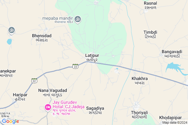
Latipur Map
EDIT Map
Add Your House
 ..
..
Current Corona Virus Infected Patients Count in Jamnagar District
| City Name | District Name | Total Covid cases |
|---|---|---|
| Jamnagar District | Jamnagar | 1 |
Locality Name :
Latipur
( લતીપુર )
Taluka Name : Dhrol
District : Jamnagar
State : Gujarat
Language : Gujarati and Hindi, Kachchi
Current Time 01:11 PM
Date: Monday , Apr 28,2025 (IST)
Time zone: IST (UTC+5:30)
Elevation / Altitude: 84 meters. Above Seal level
Telephone Code / Std Code: 02897
Assembly constituency : Kalavad assembly constituency
Assembly MLA : Chavda Meghjibhai Amarabhai
Lok Sabha constituency : Jamnagar parliamentary constituency
Parliament MP : POONAMBEN HEMATBHAI MAADAM
Serpanch Name :
Pin Code : 361220
Post Office Name : Latipur
Alternate Village Name : Latipar
Commodities Prices : Dhrol Market / Mandi
Latipur Live Weather
Temperature: 39.1 °C
clear sky
Humidity: 17%
Wind : 8.57 mt/sec towards W
StationName : "Dhrol"
observed on 8 Mins Back
Temperature: 39.1 °C
clear sky
Humidity: 17%
Wind : 8.57 mt/sec towards W
StationName : "Dhrol"
observed on 8 Mins Back
Latipur Weather Forecast for Next 5 days
29-04-2025
26.9°C to 40.1°C
clear sky
26.9°C to 40.1°C
clear sky
30-04-2025
26.1°C to 41.8°C
clear sky, scattered clouds, broken clouds, few clouds
26.1°C to 41.8°C
clear sky, scattered clouds, broken clouds, few clouds
01-05-2025
26.2°C to 39.5°C
few clouds, clear sky
26.2°C to 39.5°C
few clouds, clear sky
02-05-2025
25.8°C to 38.3°C
clear sky
25.8°C to 38.3°C
clear sky
03-05-2025
25.4°C to 37.2°C
clear sky
25.4°C to 37.2°C
clear sky
Edit below overview about Latipur
Edit below overview about Latipur
OverView of Latipur
BHARSHAT MENDAPARA VADI ,Is my best native place ,there soil having nutrients suac as Nitrogen, phosphorus enable plant growth and soils have sustained agriculter for thousands of years.Edit below overview about Latipur
National Highways Reachable To Latipur
Nationa High Way :NH151A
Nationa High Way :NH27
Nationa High Way :NH151A
Nationa High Way :NH27
Rivers Near Latipur
Unad
Aji :આજી
Unad
Aji :આજી
About Latipur
Latipur is a Village in Dhrol Taluka in Jamnagar District of Gujarat State, India. It is located 57 KM towards East from District head quarters Jamnagar. 16 KM from . 266 KM from State capital Gandhinagar
Latipur Pin code is 361220 and postal head office is Latipur .
Nana Vagudad ( 6 KM ) , Bhensdad ( 7 KM ) , Jasapar ( 7 KM ) , Pithad ( 8 KM ) , Mota Vagudad ( 9 KM ) are the nearby Villages to Latipur. Latipur is surrounded by Dhrol Taluka towards South , Tankara Taluka towards East , Paddhari Taluka towards South , Morvi Taluka towards East .
Morvi , Wankaner , Rajkot , Jamnagar are the near by Cities to Latipur.
It is near to arabian sea. There is a chance of humidity in the weather.
Latipur 2011 Census Details
Latipur Local Language is Gujarati. Latipur Village Total population is 9677 and number of houses are 1987. Female Population is 49.5%. Village literacy rate is 62.7% and the Female Literacy rate is 28.2%.
Population
| Census Parameter | Census Data |
| Total Population | 9677 |
| Total No of Houses | 1987 |
| Female Population % | 49.5 % ( 4793) |
| Total Literacy rate % | 62.7 % ( 6064) |
| Female Literacy rate | 28.2 % ( 2732) |
| Scheduled Tribes Population % | 0.2 % ( 17) |
| Scheduled Caste Population % | 3.4 % ( 333) |
| Working Population % | 37.3 % |
| Child(0 -6) Population by 2011 | 982 |
| Girl Child(0 -6) Population % by 2011 | 46.5 % ( 457) |
Latipur Census More Deatils.
Politics in Latipur
Bharatiya Janata Party , BJP , INC are the major political parties in this area.Polling Stations /Booths near Latipur
1)Latipur-32)Latipur-6
3)Latipur-12
4)Latipur-4
5)Latipur-2
HOW TO REACH Latipur
By Rail
There is no railway station near to Latipur in less than 10 km.Colleges near Latipur
Government Arts College
Address :
Shri Gulab Kunverba Ayurveda Mahavidyalaya
Address : Shri Gulab Kunverba Ayurveda Mahavidyalaya- Jamnag
Shri Shah Medical College
Address : Shri Shah Medical College -jamnagar, Gujarat.
Akshar-preet Institute Of Pharmacy
Address : Akshar-preet Institute Of Pharmacy, Jamnagar, Ahma
J V Institute Of Management Studies
Address : J V Institute Of Management Studies, B.k.shah Educ
Schools in Latipur
Akshar Gyan Vidhamandir
Address : latipur , dhrol , jamnagar , Gujarat . PIN- 361220 , Post - Latipur
Latipur Ashram Shala
Address : latipur , dhrol , jamnagar , Gujarat . PIN- 361220 , Post - Latipur
Swaminarayan Vidhyalay
Address : latipur , dhrol , jamnagar , Gujarat . PIN- 361220 , Post - Latipur
Latipur Vadi Shala-6
Address : latipur , dhrol , jamnagar , Gujarat . PIN- 361220 , Post - Latipur
Latipur Vadi Shala-5
Address : latipur , dhrol , jamnagar , Gujarat . PIN- 361220 , Post - Latipur
Govt Health Centers near Latipur
1) Jivapar(Bamanbor) , Subcenter -Jivapar(Bamanbor) , ,2) Bamanbor , SubCentre -Bamanbor , ,
3) Navagam(Bamanbor) , Subcenter-Navagam , ,
Sub Villages in Latipur
Petrol Bunks in Latipur,Dhrol
Vijay Petroleum Indian Oil Petrol Pump
Jamnagar; SH-22; Porbandar Road; Visawada; Visawada; Gujarat 361315; India
0.2 KM distance Detail
Swami narayan Petroleum Indian Oil Petrol Pump
Jamnagar; NH-947; Jodiya Road; Latipur; Latipur; Gujarat 361220; India
0.9 KM distance Detail
more ..
Colleges in Latipur,Dhrol
S.H.Gardi Arts & C.R.Gardi Commerce College
Near Ram Roti Ashram; Kharva Road; Dhrol; Jamnagar; Gujarat 361210; India
15.7 KM distance Detail
Smt. R. O. Patel Female PTC College
Kanya Chhatralya Campus; Near Mamlatdar Kacheri; I.T.I. Campus; Morbi-Rajkot Highway; Tankara; Rajkot; Gujarat 363650; India
16.8 KM distance Detail
Umiyaji Mahila B.ED. College; Dhrol
State Highway; Near Bavni River; C/O G.M Patel Girls High School; Dhrol; Jamnagar; Gujarat 361210; India
16.9 KM distance Detail
more ..
Schools in Latipur,Dhrol
Gram panchayat high school (Milan J. Gohel )
GJ SH 22; Latipur; Gujarat 361220; India
0.3 KM distance Detail
Super Markets in Latipur,Dhrol
Ramdev Provision Store
Nagpur road ;ramnagar plot; Latipur; Gujarat 361220; India
1.0 KM distance Detail
Police Stations near Latipur,Dhrol
Latipur Highway Patrol Station - ATM
petrol station near; Latipur; Gujarat; India
0.9 KM distance Detail
DHROL POLICE STATION; JAMNAGAR
Jamnagar Rajkot Highway; Dhrol; Gujarat 361210; India
15.9 KM distance Detail
About Latipur &
History
How to reach Latipur
Tourist Places Near By Latipur
Schools in Latipur
Colleges in Latipur
Temperature & weather of Latipur
places in Latipur
Latipur photos
More Information
How to reach Latipur
Tourist Places Near By Latipur
Schools in Latipur
Colleges in Latipur
Temperature & weather of Latipur
places in Latipur
Latipur photos
More Information
Village Talk
Post News or Events about this Village
Near Cities
Morvi 42 KM near
Wankaner 47 KM near
Rajkot 50 KM near
Jamnagar 52 KM near
Morvi 42 KM near
Wankaner 47 KM near
Rajkot 50 KM near
Jamnagar 52 KM near
Near By Taluks
Jodiya 13 KM near
Dhrol 15 KM near
Tankara 21 KM near
Paddhari 29 KM near
Jodiya 13 KM near
Dhrol 15 KM near
Tankara 21 KM near
Paddhari 29 KM near
Near By Air Ports
Civil Airport 48 KM near
Govardhanpur Airport 62 KM near
Kandla Airport 78 KM near
Rudra Mata Airport 128 KM near
Civil Airport 48 KM near
Govardhanpur Airport 62 KM near
Kandla Airport 78 KM near
Rudra Mata Airport 128 KM near
Near By Tourist Places
Morvi 42 KM near
Wankaner 47 KM near
Rajkot 49 KM near
Jamnagar 54 KM near
Gandhidham 72 KM near
Morvi 42 KM near
Wankaner 47 KM near
Rajkot 49 KM near
Jamnagar 54 KM near
Gandhidham 72 KM near
Near By Districts
Rajkot 50 KM near
Jamnagar 54 KM near
Kachchh 125 KM near
Surendranagar 126 KM near
Rajkot 50 KM near
Jamnagar 54 KM near
Kachchh 125 KM near
Surendranagar 126 KM near
Near By RailWay Station
Rajkot Junction Rail Way Station 49 KM near
Wankaner Junction Rail Way Station 49 KM near
Rajkot Junction Rail Way Station 49 KM near
Wankaner Junction Rail Way Station 49 KM near