| Home | City Bus | Maps | Villages | Cities | Rail | Tourist Places | School | College | Pin Codes | Corona Cases Count |
| Distance Calculator Bus Services IFSC Codes Trace Mobile Number Weather Search Place Trace IP Available Cash ATM/Banks Locate Polling Booth Report an Error contact People |
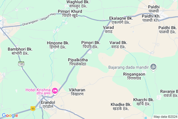
Pimpalkothe Kd.
Pimpalkothe Kd. Map
EDIT Map
Add Your House
 ..
..
Current Corona Virus Infected Patients Count in Jalgaon District
| City Name | District Name | Total Covid cases |
|---|---|---|
| Jalgaon District | Jalgaon | 8 |
| Jalgaon Rural | Jalgaon | 1 |
Locality Name :
Pimpalkothe Kd.
( पिंपळकोठे Kd. )
Taluka Name : Erandol
District : Jalgaon
State : Maharashtra
Region : Khandesh and Northern Maharashtra
Division : Nashik
Language : Hindi and Ahirani, Kandeshi, Marathi And Bhili
Current Time 06:21 PM
Date: Wednesday , Feb 05,2025 (IST)
Time zone: IST (UTC+5:30)
Elevation / Altitude: 211 meters. Above Seal level
Telephone Code / Std Code: 02588
Assembly constituency : Erandol assembly constituency
Assembly MLA : Chimanrao Rupchand Patil
Lok Sabha constituency : Jalgaon parliamentary constituency
Parliament MP : Unmesh Bhaiyyasaheb Patil
Serpanch Name :
Alternate Village Name : Pimpalkothe Kh
Commodities Prices : Dharangaon Market / Mandi
Pimpalkothe Kd. Live Weather
Temperature: 27.6 °C
clear sky
Humidity: 23%
Wind : 2.87 mt/sec towards NW
StationName : "Erandol"
observed on Now
Temperature: 27.6 °C
clear sky
Humidity: 23%
Wind : 2.87 mt/sec towards NW
StationName : "Erandol"
observed on Now
Pimpalkothe Kd. Weather Forecast for Next 5 days
06-02-2025
21.3°C to 28.5°C
clear sky
21.3°C to 28.5°C
clear sky
07-02-2025
19.6°C to 31.1°C
clear sky
19.6°C to 31.1°C
clear sky
08-02-2025
20.0°C to 32.1°C
clear sky
20.0°C to 32.1°C
clear sky
09-02-2025
21.1°C to 34.1°C
clear sky, broken clouds, scattered clouds
21.1°C to 34.1°C
clear sky, broken clouds, scattered clouds
10-02-2025
23.3°C to 35.8°C
clear sky, few clouds
23.3°C to 35.8°C
clear sky, few clouds
National Highways Reachable To Pimpalkothe Kd.
Nationa High Way :NH53
Nationa High Way :NH53
Rivers Near Pimpalkothe Kd.
Vaghur River
Anjani
Vaghur River
Anjani
About Pimpalkothe Kd.
Correct below Info and add more info about Pimpalkothe Kd.Pimpalkothe Kd. is a Village in Erandol Taluka in Jalgaon District of Maharashtra State, India. It belongs to Khandesh and Northern Maharashtra region . It belongs to Nashik Division . It is located 20 KM towards west from District head quarters Jalgaon. 9 KM from Erandol. 400 KM from State capital Mumbai
Varad Kh. ( 2 KM ) , Kalyane Kh. ( 4 KM ) , Varad Bk. ( 4 KM ) , Bhod Bk. ( 4 KM ) , Hingone Bk. ( 4 KM ) are the nearby Villages to Pimpalkothe Kd.. Pimpalkothe Kd. is surrounded by Dharangaon Taluka towards North , Jalgaon Taluka towards East , Chopda Taluka towards North , Parola Taluka towards west .
Jalgaon , Parola , Pachora , Yawal are the near by Cities to Pimpalkothe Kd..
Demographics of Pimpalkothe Kd.
Hindi is the Local Language here.Politics in Pimpalkothe Kd.
Bharatiya Janata Party , BJP , NCP , SHS are the major political parties in this area.Polling Stations /Booths near Pimpalkothe Kd.
1)Pimplkothe Pr2)Pimpri Bk
3)Pimparkhed
4)Pimpalgaon Bk
5)Pimpalkothe Bk
HOW TO REACH Pimpalkothe Kd.
By Rail
Chavalkhede Rail Way Station , Paldhi Rail Way Station are the very nearby railway stations to Pimpalkothe Kd.. Dharangaon Rail Way Station (near to Dharangaon) , Jalgaon Junction Rail Way Station (near to Jalgaon) , Pachora Junction Rail Way Station (near to Pachora) , Galan Rail Way Station (near to Pachora) , Chavalkhede Rail Way Station (near to Dharangaon) are the Rail way stations reachable from near by towns.By Road
Erandol , Dharangaon , Jalgaon , Pachora are the nearby by towns to Pimpalkothe Kd. having road connectivity to Pimpalkothe Kd.Pincodes near Pimpalkothe Kd.
425103 ( Paldhi ) , 425104 ( Pimpri Khurd ) , 425109 ( Erandol )Colleges near Pimpalkothe Kd.
Rehan Khan Urdu Jr Collage Kasoda
Address :
Dadasaheb Digambar Shankar Patil College Erandol
Address :
Abc Iti Kasoda, Anturli
Address : Kasoda, Erandol
Schools near Pimpalkothe Kd.
Shahejari Urdu Sec. Sch.
Address : kasoda , erandol , jalgaon , Maharashtra . PIN- 425110 , Post - Kasoda
Gourishankar Sec. Sch.
Address : ravnje bk. , erandol , jalgaon , Maharashtra . PIN- 425109 , Post - Erandol
Sec. Sch.
Address : pimpalkhote bk. , erandol , jalgaon , Maharashtra . PIN- 425103 , Post - Paldhi
Jijamata High Sch.
Address : erandol , erandol , jalgaon , Maharashtra . PIN- 425109 , Post - Erandol
Govt Health Centers near Pimpalkothe Kd.
1) Girad , - , - , -2) Anjanvihire , A/p. Anjanvihire , A/p. Anjanvihire , A/p. Anjanvihire
3) Nandra Bk , At.Nandra Bk , At.Nandra Bk , At.Nandra Bk
Hospitals in Pimpalkothe Kd.,Erandol
Lokmanya Hospital
Pimpri Khurd; Jalgaon; SH-6; Dharangaon Jalgaon Highway; Jalgaon; Jalgaon; Maharashtra 425104; India
6.9 KM distance Detail
Shshrasha Hospital
Pimpri Khurd; Jalgaon; SH-6; Dharangaon Jalgaon Highway; Dharangaon; Dharangaon; Maharashtra 425104; India
6.9 KM distance Detail
more ..
Petrol Bunks in Pimpalkothe Kd.,Erandol
Shree Padmalaya Gas Agency Erandol
Mahajan Nagar;; Erandol; Maharashtra 425109; India
6.8 KM distance Detail
more ..
Colleges in Pimpalkothe Kd.,Erandol
Abasaheb Shivajirao Sitaram Patil College
Pimpri Khurd; Jalgaon; SH-6; Dharangaon Jalgaon Highway; Jalgaon; Jalgaon; Maharashtra 425105; India
5.6 KM distance Detail
Samarth Medical And General Stoars
Jay Hind Chouk; Kagzi Pura; Erandol; Maharashtra 425109; India
8.7 KM distance Detail
more ..
Schools in Pimpalkothe Kd.,Erandol
SIDDHESHVAR MADHYAMIL VIDYALAY;PIMPALKOTHA
Pimpri Bk.; Maharashtra 425103; India
1.5 KM distance Detail
Electronic Shops in Pimpalkothe Kd.,Erandol
Navdurga welding
Dharangaon - Jalgaon Hwy; Pimpri Khurd; Maharashtra 425104; India
6.7 KM distance Detail
Pedkaimata Electronics
Dharangaon - Jalgaon Hwy; Pimpri Khurd; Maharashtra 425104; India
6.8 KM distance Detail
Om Computer
Dharangaon - Jalgaon Hwy; Pimpri Khurd; Maharashtra 425104; India
6.8 KM distance Detail
Super Markets in Pimpalkothe Kd.,Erandol
Vijay Marbales And Plumbing
Dharangaon - Jalgaon Hwy; Pimpri Khurd; Maharashtra 425104; India
6.7 KM distance Detail
Rudra Auto Deals
Bhim Nagar; Sambhaji Nagar; Erandol; Maharashtra 425109; India
8.0 KM distance Detail
Local Parks in Pimpalkothe Kd.,Erandol
Ahmad Raza Chowk
Mohalla Masjid Ali; Lahan Maliwada; Dharangaon; Maharashtra 425105; India
14.1 KM distance Detail
Pashtane Wildlife Sanctuary
Pashtane - Salva Rd; Bhamardi; Maharashtra 425105; India
16.0 KM distance Detail
About Pimpalkothe Kd. &
History
How to reach Pimpalkothe Kd.
Tourist Places Near By Pimpalkothe Kd.
Schools in Pimpalkothe Kd.
Colleges in Pimpalkothe Kd.
Temperature & weather of Pimpalkothe Kd.
places in Pimpalkothe Kd.
Pimpalkothe Kd. photos
More Information
How to reach Pimpalkothe Kd.
Tourist Places Near By Pimpalkothe Kd.
Schools in Pimpalkothe Kd.
Colleges in Pimpalkothe Kd.
Temperature & weather of Pimpalkothe Kd.
places in Pimpalkothe Kd.
Pimpalkothe Kd. photos
More Information
Village Talk
Post News or Events about this Village
Near Cities
Jalgaon 22 KM near
Parola 31 KM near
Pachora 39 KM near
Yawal 45 KM near
Jalgaon 22 KM near
Parola 31 KM near
Pachora 39 KM near
Yawal 45 KM near
Near By Taluks
Erandol 8 KM near
Dharangaon 9 KM near
Jalgaon 20 KM near
Chopda 33 KM near
Erandol 8 KM near
Dharangaon 9 KM near
Jalgaon 20 KM near
Chopda 33 KM near
Near By Air Ports
Chikkalthana Airport 137 KM near
Gandhinagar Airport 221 KM near
Indore Airport 224 KM near
Vadodara Airport 302 KM near
Chikkalthana Airport 137 KM near
Gandhinagar Airport 221 KM near
Indore Airport 224 KM near
Vadodara Airport 302 KM near
Near By Tourist Places
Dhule 71 KM near
Burhanpur 85 KM near
Grishneshwar 120 KM near
Aurangabad 135 KM near
Maheshwar 152 KM near
Dhule 71 KM near
Burhanpur 85 KM near
Grishneshwar 120 KM near
Aurangabad 135 KM near
Maheshwar 152 KM near
Near By Districts
Jalgaon 20 KM near
Dhule 70 KM near
Burhanpur 106 KM near
Buldhana 108 KM near
Jalgaon 20 KM near
Dhule 70 KM near
Burhanpur 106 KM near
Buldhana 108 KM near
Near By RailWay Station
Chavalkhede Rail Way Station 9.2 KM near
Jalgaon Junction Rail Way Station 22 KM near
Pachora Junction Rail Way Station 37 KM near
Chavalkhede Rail Way Station 9.2 KM near
Jalgaon Junction Rail Way Station 22 KM near
Pachora Junction Rail Way Station 37 KM near