| Home | City Bus | Maps | Villages | Cities | Rail | Tourist Places | School | College | Pin Codes | Corona Cases Count |
| Distance Calculator Bus Services IFSC Codes Trace Mobile Number Weather Search Place Trace IP Available Cash ATM/Banks Locate Polling Booth Report an Error contact People |
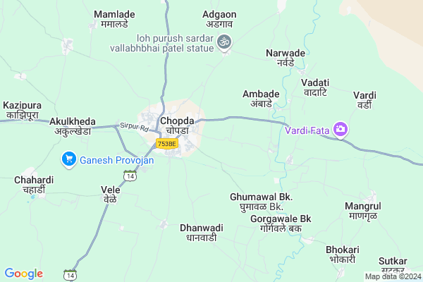
Tandalwadi
Tandalwadi Map
EDIT Map
Add Your House
 ..
..
Current Corona Virus Infected Patients Count in Jalgaon District
| City Name | District Name | Total Covid cases |
|---|---|---|
| Jalgaon District | Jalgaon | 8 |
| Jalgaon Rural | Jalgaon | 1 |
Locality Name :
Tandalwadi
( तांदळवाडी )
Taluka Name : Chopda
District : Jalgaon
State : Maharashtra
Region : Khandesh and Northern Maharashtra
Division : Nashik
Language : Hindi and Ahirani, Kandeshi, Marathi And Bhili
Current Time 09:26 PM
Date: Wednesday , Feb 05,2025 (IST)
Time zone: IST (UTC+5:30)
Elevation / Altitude: 211 meters. Above Seal level
Telephone Code / Std Code: 02586
Assembly constituency : Chopda assembly constituency
Assembly MLA : Latabai Chandrakant Sonawane
Lok Sabha constituency : Raver parliamentary constituency
Parliament MP : Khadse Raksha Nikhil
Serpanch Name :
Pin Code : 425107
Post Office Name : Chopda
Commodities Prices : Chopada Market / Mandi
Tandalwadi Live Weather
Temperature: 27.3 °C
clear sky
Humidity: 23%
Wind : 3.89 mt/sec towards NW
StationName : "Chopda"
observed on 2 Hours Back
Temperature: 27.3 °C
clear sky
Humidity: 23%
Wind : 3.89 mt/sec towards NW
StationName : "Chopda"
observed on 2 Hours Back
Tandalwadi Weather Forecast for Next 5 days
06-02-2025
21.5°C to 28.0°C
clear sky
21.5°C to 28.0°C
clear sky
07-02-2025
19.9°C to 31.0°C
clear sky
19.9°C to 31.0°C
clear sky
08-02-2025
21.2°C to 32.5°C
clear sky
21.2°C to 32.5°C
clear sky
09-02-2025
21.1°C to 33.9°C
clear sky, few clouds, broken clouds, scattered clouds
21.1°C to 33.9°C
clear sky, few clouds, broken clouds, scattered clouds
10-02-2025
22.7°C to 35.2°C
clear sky, few clouds
22.7°C to 35.2°C
clear sky, few clouds
Rivers Near Tandalwadi
Gavi
Gavi
Gavi
Gavi
About Tandalwadi
Correct below Info and add more info about TandalwadiTandalwadi is a Village in Chopda Taluka in Jalgaon District of Maharashtra State, India. It belongs to Khandesh and Northern Maharashtra region . It belongs to Nashik Division . It is located 41 KM towards North from District head quarters Jalgaon. 416 KM from State capital Mumbai
Tandalwadi Pin code is 425107 and postal head office is Chopda .
Tandalwadi is surrounded by Dharangaon Taluka towards South , Amalner Taluka towards west , Jalgaon Taluka towards South , Erandol Taluka towards South .
Jalgaon , Yawal , Parola , Shirpur-Warwade are the near by Cities to Tandalwadi.
Tandalwadi 2011 Census Details
Tandalwadi Local Language is Hindi. Tandalwadi Village Total population is 1155 and number of houses are 252. Female Population is 48.1%. Village literacy rate is 62.4% and the Female Literacy rate is 26.4%.
Population
| Census Parameter | Census Data |
| Total Population | 1155 |
| Total No of Houses | 252 |
| Female Population % | 48.1 % ( 556) |
| Total Literacy rate % | 62.4 % ( 721) |
| Female Literacy rate | 26.4 % ( 305) |
| Scheduled Tribes Population % | 32.5 % ( 375) |
| Scheduled Caste Population % | 3.0 % ( 35) |
| Working Population % | 60.1 % |
| Child(0 -6) Population by 2011 | 130 |
| Girl Child(0 -6) Population % by 2011 | 43.8 % ( 57) |
Tandalwadi Census More Deatils.
Politics in Tandalwadi
Bharatiya Janata Party , BJP , NCP , SHS are the major political parties in this area.Polling Stations /Booths near Tandalwadi
1)Chopda2)Chopda
3)Chopda
4)Chopda
5)Chopda
HOW TO REACH Tandalwadi
By Rail
There is no railway station near to Tandalwadi in less than 10 km. Jalgaon Junction Rail Way Station (near to Jalgaon) are the Rail way stations reachable from near by towns.By Road
Jalgaon are the nearby by towns to Tandalwadi having road connectivity to TandalwadiColleges near Tandalwadi
Bapu Mahajan English Medium School And Junior College
Address :
Kai. Shamrao Shivram Patil Higher Secondary School
Address :
Schools in Tandalwadi
Jai Shri Dadaji Sec. Sch.
Address : tandalwadi , chopada , jalgaon , Maharashtra . PIN- 425107 , Post - Chopda
Govt Health Centers near Tandalwadi
1) Bhokar , At.Bhokar , At.Bhokar , At.Bhokar2) Kinod , At.Kinod , At.Kinod , At.Kinod
3) Anjanvihire , A/p. Anjanvihire , A/p. Anjanvihire , A/p. Anjanvihire
Hospitals in Tandalwadi,Chopda
Mahalaxmi clinic
Mahalaxmi nagar;yawal road; Chopda; Maharashtra 425107; India
2.0 KM distance Detail
more ..
Petrol Bunks in Tandalwadi,Chopda
Reliance Petroleum
Gajanan Co Operative Housing Society; Jalgaon; SH-4; Shirpur Chopda Highway; Jalgaon; Jalgaon; Maharashtra 425107; India
1.5 KM distance Detail
Vihaan Auto Garege And Tyres Servic
Gajanan Co Operative Housing Society; Chopda; Maharashtra 425107; India
1.5 KM distance Detail
Reliance Petroleum
SY.NO -876;PLOT NO.50/51; Chopda; Maharashtra 425107; India
2.2 KM distance Detail
more ..
Colleges in Tandalwadi,Chopda
Bhagini Mandal Chopda’s College of Social Work
At post chopda; Tal - Chopda; Gajanan Co Operative Housing Society; Jalgaon; Maharashtra 425107; India
2.2 KM distance Detail
MGSM’s Arts; Science and Commerce College
Chopda; Jalgaon; Maharashtra 425107; India
2.9 KM distance Detail
Smt. Sharchchandrika Suresh Patil Institute of Technology
Barhanpur – Ankleshwar state highway no. 4; Dist: Jalgaon; Chopda; Maharashtra 425107; India
3.3 KM distance Detail
more ..
Schools in Tandalwadi,Chopda
Vivekanand Vidyalay
425107; K.G.N Colony; Gajanan Co Operative Housing Society; Chopda; Maharashtra 425107; India
1.9 KM distance Detail
Pankaj High-School
Maharashtra State Highway 4; Pankaj Nagar; Chopda; Maharashtra 425107; India
2.1 KM distance Detail
Pankaj Bal Sanskar Kendra
Vidya Vihar Colony; Jalgaon; SH-4; Chopda Dharangaon Erandol Road; Chopda; Chopda; Maharashtra 425107; India
2.1 KM distance Detail
Electronic Shops in Tandalwadi,Chopda
OM ELECTRIC & REPAIRING
Pankaj Nagar; Khedibhokari; Chopda; Maharashtra 425107; India
2.2 KM distance Detail
Super Markets in Tandalwadi,Chopda
kgn colony chopda dis. jalgon.
K.G.N Colony; Gajanan Co Operative Housing Society; Chopda; Maharashtra 425107; India
1.9 KM distance Detail
Agrawal Provision
Opp.Pankaj Highschool;Pankaj Nagar; Chopda; Maharashtra 425107; India
2.1 KM distance Detail
Super Mutton Shop
room no 1; chopda court ambedkar chowk bk no 773; Chopda; Maharashtra 425107; India
2.2 KM distance Detail
Police Stations near Tandalwadi,Chopda
Chopda City Police Station
Rani Laxmibai Chowk; Chopda; Maharashtra 425107; India
3.1 KM distance Detail
Governement Offices near Tandalwadi,Chopda
Up Adhikshak Bhumi Abhilekh Office
Vidya Vihar Colon; Jalgaon; SH-14; Chopda Dharangaon Erandol Road; Jalgaon; Jalgaon; Maharashtra 425107; India
3.1 KM distance Detail
About Tandalwadi &
History
How to reach Tandalwadi
Tourist Places Near By Tandalwadi
Schools in Tandalwadi
Colleges in Tandalwadi
Temperature & weather of Tandalwadi
places in Tandalwadi
Tandalwadi photos
More Information
How to reach Tandalwadi
Tourist Places Near By Tandalwadi
Schools in Tandalwadi
Colleges in Tandalwadi
Temperature & weather of Tandalwadi
places in Tandalwadi
Tandalwadi photos
More Information
Village Talk
Post News or Events about this Village
Near Cities
Jalgaon 38 KM near
Yawal 45 KM near
Parola 50 KM near
Shirpur-Warwade 52 KM near
Jalgaon 38 KM near
Yawal 45 KM near
Parola 50 KM near
Shirpur-Warwade 52 KM near
Near By Taluks
Chopda 0 KM near
Dharangaon 24 KM near
Amalner 34 KM near
Jalgaon 39 KM near
Chopda 0 KM near
Dharangaon 24 KM near
Amalner 34 KM near
Jalgaon 39 KM near
Near By Air Ports
Chikkalthana Airport 171 KM near
Indore Airport 193 KM near
Gandhinagar Airport 236 KM near
Vadodara Airport 278 KM near
Chikkalthana Airport 171 KM near
Indore Airport 193 KM near
Gandhinagar Airport 236 KM near
Vadodara Airport 278 KM near
Near By Tourist Places
Dhule 76 KM near
Burhanpur 92 KM near
Maheshwar 120 KM near
Toranmal 127 KM near
Grishneshwar 152 KM near
Dhule 76 KM near
Burhanpur 92 KM near
Maheshwar 120 KM near
Toranmal 127 KM near
Grishneshwar 152 KM near
Near By Districts
Jalgaon 40 KM near
Dhule 75 KM near
Khargone 79 KM near
Burhanpur 104 KM near
Jalgaon 40 KM near
Dhule 75 KM near
Khargone 79 KM near
Burhanpur 104 KM near
Near By RailWay Station
Amalner Rail Way Station 38 KM near
Jalgaon Junction Rail Way Station 39 KM near
Amalner Rail Way Station 38 KM near
Jalgaon Junction Rail Way Station 39 KM near