| Home | City Bus | Maps | Villages | Cities | Rail | Tourist Places | School | College | Pin Codes | Corona Cases Count |
| Distance Calculator Bus Services IFSC Codes Trace Mobile Number Weather Search Place Trace IP Available Cash ATM/Banks Locate Polling Booth Report an Error contact People |
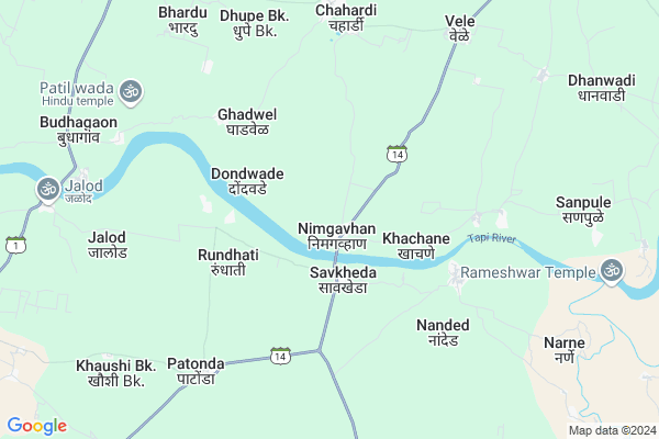
Nimgavhan
Nimgavhan Map
EDIT Map
Add Your House
 ..
..
Current Corona Virus Infected Patients Count in Jalgaon District
| City Name | District Name | Total Covid cases |
|---|---|---|
| Jalgaon District | Jalgaon | 8 |
| Jalgaon Rural | Jalgaon | 1 |
Locality Name :
Nimgavhan
( निमगव्हाण )
Taluka Name : Chopda
District : Jalgaon
State : Maharashtra
Region : Khandesh and Northern Maharashtra
Division : Nashik
Language : Hindi and Ahirani, Kandeshi, Marathi And Bhili
Current Time 09:57 AM
Date: Thursday , Apr 24,2025 (IST)
Time zone: IST (UTC+5:30)
Elevation / Altitude: 211 meters. Above Seal level
Telephone Code / Std Code: 02586
Assembly constituency : Chopda assembly constituency
Assembly MLA : Latabai Chandrakant Sonawane
Lok Sabha constituency : Raver parliamentary constituency
Parliament MP : Khadse Raksha Nikhil
Serpanch Name :
Pin Code : 425107
Post Office Name : Chopda
Alternate Village Name : Nimgavan
Commodities Prices : Chopada Market / Mandi
Nimgavhan Live Weather
Temperature: 36.3 °C
clear sky
Humidity: 15%
Wind : 4.23 mt/sec towards NW
StationName : "Chopda"
observed on Now
Temperature: 36.3 °C
clear sky
Humidity: 15%
Wind : 4.23 mt/sec towards NW
StationName : "Chopda"
observed on Now
Nimgavhan Weather Forecast for Next 5 days
25-04-2025
31.7°C to 42.5°C
clear sky
31.7°C to 42.5°C
clear sky
26-04-2025
28.8°C to 42.2°C
clear sky
28.8°C to 42.2°C
clear sky
27-04-2025
28.0°C to 40.6°C
clear sky, scattered clouds, overcast clouds, broken clouds
28.0°C to 40.6°C
clear sky, scattered clouds, overcast clouds, broken clouds
28-04-2025
27.4°C to 42.4°C
scattered clouds, clear sky
27.4°C to 42.4°C
scattered clouds, clear sky
29-04-2025
27.5°C to 43.3°C
clear sky, scattered clouds, few clouds
27.5°C to 43.3°C
clear sky, scattered clouds, few clouds
Edit below overview about Nimgavhan
Edit below overview about Nimgavhan
OverView of Nimgavhan
Languages spoken in nimgavhan are Ahirani ,gujrav.and bhilli.There are various religion are living in nimgavhan.Nimgavhan is located on state highway number 14.Edit below overview about Nimgavhan
Rivers Near Nimgavhan
Gavi
Gavi
Gavi
Gavi
About Nimgavhan
Nimgavhan is a Village in Chopda Taluka in Jalgaon District of Maharashtra State, India. It belongs to Khandesh and Northern Maharashtra region . It belongs to Nashik Division . It is located 43 KM towards west from District head quarters Jalgaon. 14 KM from Chopda. 401 KM from State capital Mumbai
Nimgavhan Pin code is 425107 and postal head office is Chopda .
Mungase ( 3 KM ) , Dhavade ( 3 KM ) , Dondwade ( 3 KM ) , Rundhati ( 4 KM ) , Mathagavhan ( 4 KM ) are the nearby Villages to Nimgavhan. Nimgavhan is surrounded by Dharangaon Taluka towards East , Amalner Taluka towards west , Erandol Taluka towards South , Parola Taluka towards South .
Parola , Jalgaon , Shirpur-Warwade , Yawal are the near by Cities to Nimgavhan.
Nimgavhan 2011 Census Details
Nimgavhan Local Language is Hindi. Nimgavhan Village Total population is 1777 and number of houses are 398. Female Population is 49.5%. Village literacy rate is 67.3% and the Female Literacy rate is 29.2%.
Population
| Census Parameter | Census Data |
| Total Population | 1777 |
| Total No of Houses | 398 |
| Female Population % | 49.5 % ( 880) |
| Total Literacy rate % | 67.3 % ( 1196) |
| Female Literacy rate | 29.2 % ( 519) |
| Scheduled Tribes Population % | 47.0 % ( 835) |
| Scheduled Caste Population % | 7.9 % ( 141) |
| Working Population % | 55.0 % |
| Child(0 -6) Population by 2011 | 212 |
| Girl Child(0 -6) Population % by 2011 | 44.3 % ( 94) |
Nimgavhan Census More Deatils.
Politics in Nimgavhan
Bharatiya Janata Party , BJP , NCP , SHS are the major political parties in this area.Polling Stations /Booths near Nimgavhan
1)Nhavi Pr Adavad2)Nimagavhan
3)Sutakar
4)Khachane
5)Kathora
HOW TO REACH Nimgavhan
By Rail
There is no railway station near to Nimgavhan in less than 10 km. Jalgaon Junction Rail Way Station (near to Jalgaon) are the Rail way stations reachable from near by towns.By Road
Jalgaon are the nearby by towns to Nimgavhan having road connectivity to NimgavhanColleges near Nimgavhan
Bapu Mahajan English Medium School And Junior College
Address :
Kai. Shamrao Shivram Patil Higher Secondary School
Address :
Schools in Nimgavhan
Z.p. Sch.
Address : nimgavhan , chopada , jalgaon , Maharashtra . PIN- 425107 , Post - Chopda
Govt Health Centers near Nimgavhan
1) Amalgaon , STAFF QUATERS , KHEDI ROAD , NEAR RH AMALGAON2) Bhokar , At.Bhokar , At.Bhokar , At.Bhokar
3) Anjanvihire , A/p. Anjanvihire , A/p. Anjanvihire , A/p. Anjanvihire
Colleges in Nimgavhan,Chopda
ITI College
Patonda; Jalgaon; SH-14; Dhule Amalner Savkheda Chopda Road; Amalner; Amalner; Maharashtra 425401; India
7.0 KM distance Detail
Smt. S. S. Patil college of pharmacy;Chopda
Chopda; Maharashtra 425107; India
12.4 KM distance Detail
Smt. S.S. Patil Institute Of Technology D.Pharmacy
Chopda; Maharashtra 425107; India
12.4 KM distance Detail
more ..
Schools in Nimgavhan,Chopda
Zila Parishad Centre School
Dharangaon; Jalgaon; SH-14; Chopda Dharangaon Erandol Road; Chopda; Chopda; Maharashtra 425105; India
2.3 KM distance Detail
Local Parks in Nimgavhan,Chopda
Pashtane Wildlife Sanctuary
Pashtane - Salva Rd; Bhamardi; Maharashtra 425105; India
14.7 KM distance Detail
Police Stations near Nimgavhan,Chopda
Chopda City Police Station
Rani Laxmibai Chowk; Chopda; Maharashtra 425107; India
14.0 KM distance Detail
Dharangaon Police Station
SH185; Bhave Galli; Dharangaon; Maharashtra 425105; India
20.5 KM distance Detail
Governement Offices near Nimgavhan,Chopda
Swatantra Khandesh Raja Service Centre
Sanbhaji Nagar; Chahardi; Maharashtra 425107; India
8.2 KM distance Detail
Grampanchayat Chahardi
Hated Road; Khalcha Pura; Chahardi; Maharashtra 425107; India
8.2 KM distance Detail
About Nimgavhan &
History
How to reach Nimgavhan
Tourist Places Near By Nimgavhan
Schools in Nimgavhan
Colleges in Nimgavhan
Temperature & weather of Nimgavhan
places in Nimgavhan
Nimgavhan photos
More Information
How to reach Nimgavhan
Tourist Places Near By Nimgavhan
Schools in Nimgavhan
Colleges in Nimgavhan
Temperature & weather of Nimgavhan
places in Nimgavhan
Nimgavhan photos
More Information
Village Talk
Post News or Events about this Village
Near Cities
Parola 36 KM near
Jalgaon 42 KM near
Shirpur-Warwade 46 KM near
Yawal 55 KM near
Parola 36 KM near
Jalgaon 42 KM near
Shirpur-Warwade 46 KM near
Yawal 55 KM near
Near By Taluks
Chopda 13 KM near
Dharangaon 20 KM near
Amalner 20 KM near
Erandol 34 KM near
Chopda 13 KM near
Dharangaon 20 KM near
Amalner 20 KM near
Erandol 34 KM near
Near By Air Ports
Chikkalthana Airport 162 KM near
Indore Airport 206 KM near
Gandhinagar Airport 222 KM near
Vadodara Airport 274 KM near
Chikkalthana Airport 162 KM near
Indore Airport 206 KM near
Gandhinagar Airport 222 KM near
Vadodara Airport 274 KM near
Near By Tourist Places
Dhule 62 KM near
Burhanpur 101 KM near
Toranmal 126 KM near
Maheshwar 133 KM near
Grishneshwar 141 KM near
Dhule 62 KM near
Burhanpur 101 KM near
Toranmal 126 KM near
Maheshwar 133 KM near
Grishneshwar 141 KM near
Near By Districts
Jalgaon 42 KM near
Dhule 61 KM near
Khargone 92 KM near
Burhanpur 116 KM near
Jalgaon 42 KM near
Dhule 61 KM near
Khargone 92 KM near
Burhanpur 116 KM near
Near By RailWay Station
Amalner Rail Way Station 24 KM near
Jalgaon Junction Rail Way Station 42 KM near
Amalner Rail Way Station 24 KM near
Jalgaon Junction Rail Way Station 42 KM near