| Home | City Bus | Maps | Villages | Cities | Rail | Tourist Places | School | College | Pin Codes | Corona Cases Count |
| Distance Calculator Bus Services IFSC Codes Trace Mobile Number Weather Search Place Trace IP Available Cash ATM/Banks Locate Polling Booth Report an Error contact People |
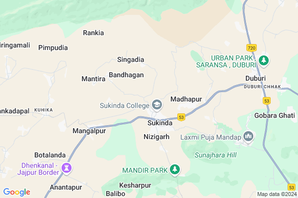
Ambadul Map
EDIT Map
Add Your House
 ..
..
Current Corona Virus Infected Patients Count in Jajapur District
| City Name | District Name | Total Covid cases |
|---|
Locality Name :
Ambadul
( ଅମ୍ବାଦୁଲା )
Tehsil Name : Sukinda
District : Jajapur
State : Odisha
Language : Oriya and Hindi,
Current Time 06:13 PM
Date: Wednesday , Feb 05,2025 (IST)
Time zone: IST (UTC+5:30)
Elevation / Altitude: 72 meters. Above Seal level
Telephone Code / Std Code: 06726
Assembly constituency : Sukinda assembly constituency
Assembly MLA : pritiranjan gharai
Lok Sabha constituency : Jajpur parliamentary constituency
Parliament MP : SARMISTHA SETHI
Serpanch Name :
Commodities Prices : Anandapur Market / Mandi
Ambadul Live Weather
Temperature: 31.0 °C
scattered clouds
Humidity: 32%
Wind : 1.81 mt/sec towards SW
StationName : "Bhuban"
observed on 28 Mins Back
Temperature: 31.0 °C
scattered clouds
Humidity: 32%
Wind : 1.81 mt/sec towards SW
StationName : "Bhuban"
observed on 28 Mins Back
Ambadul Weather Forecast for Next 5 days
06-02-2025
22.3°C to 29.3°C
scattered clouds, overcast clouds
22.3°C to 29.3°C
scattered clouds, overcast clouds
07-02-2025
21.2°C to 34.1°C
broken clouds, scattered clouds, few clouds, clear sky
21.2°C to 34.1°C
broken clouds, scattered clouds, few clouds, clear sky
08-02-2025
20.4°C to 33.0°C
clear sky
20.4°C to 33.0°C
clear sky
09-02-2025
18.9°C to 32.7°C
clear sky, scattered clouds, few clouds
18.9°C to 32.7°C
clear sky, scattered clouds, few clouds
10-02-2025
18.1°C to 33.5°C
clear sky
18.1°C to 33.5°C
clear sky
National Highways Reachable To Ambadul
Nationa High Way :NH16
Nationa High Way :NH16
Rivers Near Ambadul
Nigra
Brahmani :Брагмані
Nigra
Brahmani :Брагмані
About Ambadul
Correct below Info and add more info about AmbadulAmbadul is a small Village/hamlet in Sukinda Tehsil in Jajapur District of Odisha State, India. It is located 54 KM towards west from District head quarters Jajpur. 92 KM from State capital Bhubaneswar
Ambadul is surrounded by Danagadi Tehsil towards East , Bhuban Tehsil towards west , Byasanagar Tehsil towards East , Gondia Tehsil towards South .
Bhuban , Byasanagar , Anandapur , Jajapur are the near by Cities to Ambadul.
This Place is in the border of the Jajapur District and Kendujhar District. Kendujhar District Ghasipura is East towards this place .
Demographics of Ambadul
Oriya is the Local Language here.Politics in Ambadul
BJD is the major political party in this area.Polling Stations /Booths near Ambadul
1)Maa Khandarai Nodal Up School2)Madhapur Ugme School
3)Jagadiha Pry. School
4)Jagannath High School
5)Jagannath High School(ew)
HOW TO REACH Ambadul
By Rail
Sukinda Road Rail Way Station is the very nearby railway stations to Ambadul.Pincodes near Ambadul
755018 ( Sukinda ) , 755026 ( Dangadi ) , 759017 ( Bhuban )Colleges near Ambadul
Bharati Bihar Mahavidyalaya, Haripur
Address :
Schools near Ambadul
N.g.b Memorial High School
Address : saruabil , sukinda , jajpur , Sikkim . PIN- 755028 , Post - Kalaringatta
Panchayat H.s
Address : chingudipal , sukinda , jajpur , Sikkim . PIN- 755028 , Post - Kalaringatta
Saraswati Sishu Mandir
Address : kaliapani , sukinda , jajpur , Sikkim . PIN- 755028 , Post - Kalaringatta
Langulababa High School
Address : bandhagaon , sukinda , jajpur , Sikkim . PIN- 755018 , Post - Sukinda
Govt Health Centers near Ambadul
1) Daitari B , , , Daitari Panchet Office2) Kabatabandha SC , Upaswasthya kendra Kabatbandha , 44 , PHC N Campous
3) Sarasada SC , , , AFTER SARSADA HIGH SCHOOL,NATIONAL HIGHWAY 5 SIDE
Hospitals in Ambadul,Sukinda
Jagannath Medicine Store
infront of mahagiri high school; Kuhika; Odisha 755018; India
8.9 KM distance Detail
more ..
Petrol Bunks in Ambadul,Sukinda
Indian Oil Petrol Pump
Jajapur; NH-200; Raipur Chandikhol Highway; Duburi; Duburi; Odisha 755026; India
9.1 KM distance Detail
more ..
Schools in Ambadul,Sukinda
Satyanarayana Memorial High School; Sansailo
NH53; Sansailo; Odisha 755026; India
7.1 KM distance Detail
Governement Offices near Ambadul,Sukinda
SUKINDA PROGRAM; DUBURI
Naranpur - Duburi Road; Duburi Chhak; Duburi; Odisha 755026; India
9.6 KM distance Detail
About Ambadul &
History
How to reach Ambadul
Tourist Places Near By Ambadul
Schools in Ambadul
Colleges in Ambadul
Temperature & weather of Ambadul
places in Ambadul
Ambadul photos
More Information
How to reach Ambadul
Tourist Places Near By Ambadul
Schools in Ambadul
Colleges in Ambadul
Temperature & weather of Ambadul
places in Ambadul
Ambadul photos
More Information
Village Talk
Post News or Events about this Village
Near Cities
Bhuban 14 KM near
Byasanagar 25 KM near
Anandapur 40 KM near
Jajapur 51 KM near
Bhuban 14 KM near
Byasanagar 25 KM near
Anandapur 40 KM near
Jajapur 51 KM near
Near By Taluks
Sukinda 0 KM near
Danagadi 15 KM near
Bhuban 20 KM near
Byasanagar 26 KM near
Sukinda 0 KM near
Danagadi 15 KM near
Bhuban 20 KM near
Byasanagar 26 KM near
Near By Air Ports
Bhubaneswar Airport 91 KM near
Ranchi Airport 298 KM near
Netaji Subhas Chandra Bose Airport 358 KM near
Gaya Airport 481 KM near
Bhubaneswar Airport 91 KM near
Ranchi Airport 298 KM near
Netaji Subhas Chandra Bose Airport 358 KM near
Gaya Airport 481 KM near
Near By Tourist Places
Cuttack 64 KM near
Nandan Kanan National Park 73 KM near
Bhubaneswar 85 KM near
Barehipani & Joranda Barehipani & Joranda Falls 107 KM near
Paradeep Beach 116 KM near
Cuttack 64 KM near
Nandan Kanan National Park 73 KM near
Bhubaneswar 85 KM near
Barehipani & Joranda Barehipani & Joranda Falls 107 KM near
Paradeep Beach 116 KM near
Near By Districts
Jajapur 52 KM near
Dhenkanal 55 KM near
Cuttack 63 KM near
Bhadrak 69 KM near
Jajapur 52 KM near
Dhenkanal 55 KM near
Cuttack 63 KM near
Bhadrak 69 KM near
Near By RailWay Station
Sukinda Road Rail Way Station 8.9 KM near
Jajpur Keonjhar Road Rail Way Station 26 KM near
Dhenkanal Rail Way Station 53 KM near
Sukinda Road Rail Way Station 8.9 KM near
Jajpur Keonjhar Road Rail Way Station 26 KM near
Dhenkanal Rail Way Station 53 KM near