| Home | City Bus | Maps | Villages | Cities | Rail | Tourist Places | School | College | Pin Codes | Corona Cases Count |
| Distance Calculator Bus Services IFSC Codes Trace Mobile Number Weather Search Place Trace IP Available Cash ATM/Banks Locate Polling Booth Report an Error contact People |
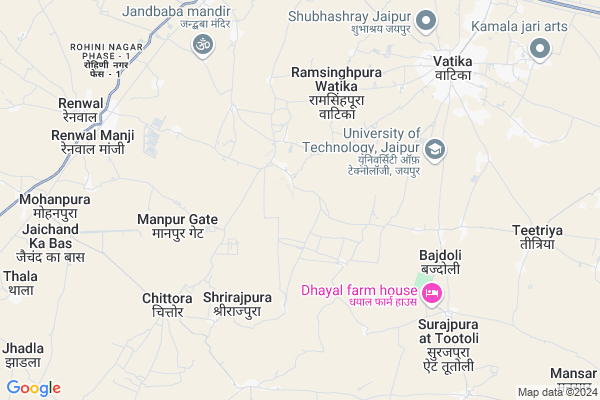
Pahariya Map
EDIT Map
Add Your House
 ..
..
Current Corona Virus Infected Patients Count in Jaipur District
| City Name | District Name | Total Covid cases |
|---|---|---|
| Jaipur District | Jaipur | 783 |
| Ramganj | Jaipur | 15 |
| Jaipur | Jaipur | 7 |
| Shastrinagar | Jaipur | 2 |
| Ghat Gate | Jaipur | 1 |
Locality Name :
Pahariya
( पहरिया )
Tehsil Name : Phagi
District : Jaipur
State : Rajasthan
Division : Jaipur
Language : English and Hindi, Rajasthani
Current Time 11:27 AM
Date: Tuesday , Apr 29,2025 (IST)
Time zone: IST (UTC+5:30)
Elevation / Altitude: 383 meters. Above Seal level
Telephone Code / Std Code: 01430
Assembly constituency : Chaksu assembly constituency
Assembly MLA : Ramavtar Bairwa
Lok Sabha constituency : Dausa parliamentary constituency
Parliament MP : Jaskaur Meena
Serpanch Name :
Pin Code : 303904
Post Office Name : Chittora Renwal
Commodities Prices : Chaksu Market / Mandi
Pahariya Live Weather
Temperature: 30.3 °C
haze
Humidity: 37%
Wind : 5.14 mt/sec towards E
StationName : "Jagatpura"
observed on 1 Hours Back
Temperature: 30.3 °C
haze
Humidity: 37%
Wind : 5.14 mt/sec towards E
StationName : "Jagatpura"
observed on 1 Hours Back
Pahariya Weather Forecast for Next 5 days
30-04-2025
29.4°C to 41.3°C
clear sky, few clouds
29.4°C to 41.3°C
clear sky, few clouds
01-05-2025
28.1°C to 42.1°C
clear sky
28.1°C to 42.1°C
clear sky
02-05-2025
28.0°C to 44.0°C
clear sky, scattered clouds, broken clouds, overcast clouds
28.0°C to 44.0°C
clear sky, scattered clouds, broken clouds, overcast clouds
03-05-2025
29.5°C to 43.6°C
broken clouds, scattered clouds, few clouds, overcast clouds
29.5°C to 43.6°C
broken clouds, scattered clouds, few clouds, overcast clouds
04-05-2025
27.6°C to 41.2°C
light rain, overcast clouds, broken clouds, clear sky, few clouds
27.6°C to 41.2°C
light rain, overcast clouds, broken clouds, clear sky, few clouds
National Highways Reachable To Pahariya
Nationa High Way :NH48
Nationa High Way :NH148
Nationa High Way :NH48
Nationa High Way :NH148
Rivers Near Pahariya
Dhund
Morel
Dhund
Morel
About Pahariya
Correct below Info and add more info about PahariyaPahariya is a Village in Phagi Tehsil in Jaipur District of Rajasthan State, India. It belongs to Jaipur Division . It is located 30 KM towards South from District head quarters Jaipur. 19 KM from Phagi. 32 KM from State capital Jaipur
Pahariya Pin code is 303904 and postal head office is Chittora Renwal .
Panwaliya ( 5 KM ) , Kumhariyawas ( 6 KM ) , Chittora ( 7 KM ) , Watika ( 8 KM ) , Mohanpura ( 10 KM ) are the nearby Villages to Pahariya. Pahariya is surrounded by Phagi Tehsil towards west , Chaksu Tehsil towards East , Jaipur Tehsil towards North , Jhotwara Tehsil towards North .
Jaipur , Niwai , Malpura , Tonk are the near by Cities to Pahariya.
Pahariya 2011 Census Details
Pahariya Local Language is English. Pahariya Village Total population is 2070 and number of houses are 335. Female Population is 47.4%. Village literacy rate is 54.2% and the Female Literacy rate is 19.7%.
Population
| Census Parameter | Census Data |
| Total Population | 2070 |
| Total No of Houses | 335 |
| Female Population % | 47.4 % ( 981) |
| Total Literacy rate % | 54.2 % ( 1121) |
| Female Literacy rate | 19.7 % ( 407) |
| Scheduled Tribes Population % | 7.9 % ( 163) |
| Scheduled Caste Population % | 29.1 % ( 602) |
| Working Population % | 42.7 % |
| Child(0 -6) Population by 2011 | 318 |
| Girl Child(0 -6) Population % by 2011 | 43.7 % ( 139) |
Pahariya Census More Deatils.
Politics in Pahariya
Bharatiya Janata Party , BJP , NPP , INC are the major political parties in this area.Polling Stations /Booths near Pahariya
1)U.p.s Raingal Manji2)U.p.s Pahadiya Naya Bhawan
3)Govt.sec.s Bhankrota
4)Govt.sec.s. Chitoda R. No. 2
5)Govt.sec.s. Khejdi Bujurag
HOW TO REACH Pahariya
By Rail
There is no railway station near to Pahariya in less than 10 km.Colleges near Pahariya
Shri Kalyan College
Address : Renwal Manji
Vedic Kanya P. G College
Address : Near Parnami Mandir, Raja Park
Schools near Pahariya
Anil Yadav Public Sec School
Address : 6,Kapdio ki dani ,chittora phagi
Government Secondary School ,pachala
Address :
The Scholar New Arena Public School
Address : Madhrajpura Datuli Road
Adarsh Public Sec.school Peepla
Address : PEEPLA PHAGI JAIPUR
Govt Health Centers near Pahariya
1) Watika , PRIMARY HEALTH CENTER WATIKA , MAIN ROAD WATIKA , BUS STAND WATIKA2) Lakhna , SUB CENTRE LAKHNA , , OPPOSINT SENIOR SECONDARY SCHOOL
3) Bhapura , SUB CENTRE BHAPURA , , NEAR GOVT. SCHOOL BHAPURA
Hospitals in Pahariya,Phagi
Primary health Centre chittora
proposed knowledge city south jaipur; Rajasthan 303904; India
6.9 KM distance Detail
Shri Karni Ayurved Hospital
Bhated Road; near watika CHC; Watika; Sanganer; Jaipur; Rajasthan; India
7.8 KM distance Detail
more ..
Petrol Bunks in Pahariya,Phagi
HP PETROL PUMP - MOOND FILLING STATION
HPC Petrol Pump Phagi Road Renwal; Jaipur; Rajasthan 302018; India
9.5 KM distance Detail
Lakshman Fiiling Station-Hindustan Petroleum
Renwal; Jaipur; SH-12; Diggi Road; Jaipur; Jaipur; Rajasthan 303328; India
9.5 KM distance Detail
more ..
Colleges in Pahariya,Phagi
Bansal School of Engineering and Technology; Jaipur
Jaipur; Rajasthan 303904; India
4.1 KM distance Detail
Universal Technical College
Opp. Stud Farm; Heera Pura Road; Manzi Renwal; Sanganer-Phagi Road; Jaipur; Rajasthan 302011; India
8.6 KM distance Detail
more ..
Schools in Pahariya,Phagi
Navjyoti Shiksha Niketan
Near Paharia Bus Stand; Paharia; Rajasthan 303904; India
1.4 KM distance Detail
Govt Upper Primary School; Sitarampura Lakholai
Jaipur; Rajasthan 303904; India
3.2 KM distance Detail
Government Upper Primary School; ShriRajapura
Mali Khera at Rajpura; Rajasthan 303904; India
3.3 KM distance Detail
Electronic Shops in Pahariya,Phagi
Shri Ram Watch & Electronics-Mobile Point
Simliya Rd; Vatika; Jaipur; Rajasthan 303905; India
8.1 KM distance Detail
Police Stations near Pahariya,Phagi
Sanganer Sadar Police Station
2; Tonk Rd; Sukhpuria; Shatabdi Nagar; Govardhan Nagar; Jaipur; Rajasthan 302033; India
17.0 KM distance Detail
Governement Offices near Pahariya,Phagi
Sri Laxmi Marrige Garden
भाटावाला वाटिका रोड; Beelwa; Sanganer; Jaipur; Rajasthan 303905; India
10.5 KM distance Detail
About Pahariya &
History
How to reach Pahariya
Tourist Places Near By Pahariya
Schools in Pahariya
Colleges in Pahariya
Temperature & weather of Pahariya
places in Pahariya
Pahariya photos
More Information
How to reach Pahariya
Tourist Places Near By Pahariya
Schools in Pahariya
Colleges in Pahariya
Temperature & weather of Pahariya
places in Pahariya
Pahariya photos
More Information
Village Talk
Post News or Events about this Village
Near Cities
Jaipur 31 KM near
Niwai 40 KM near
Malpura 61 KM near
Tonk 61 KM near
Jaipur 31 KM near
Niwai 40 KM near
Malpura 61 KM near
Tonk 61 KM near
Near By Taluks
Sanganer 12 KM near
Phagi 18 KM near
Chaksu 23 KM near
Jaipur 28 KM near
Sanganer 12 KM near
Phagi 18 KM near
Chaksu 23 KM near
Jaipur 28 KM near
Near By Air Ports
Sanganeer Airport 19 KM near
Kheria Airport 253 KM near
Indira Gandhi International Airport 278 KM near
Gwalior Airport 280 KM near
Sanganeer Airport 19 KM near
Kheria Airport 253 KM near
Indira Gandhi International Airport 278 KM near
Gwalior Airport 280 KM near
Near By Tourist Places
Jaipur 29 KM near
Jantar Mantar 32 KM near
Galta 33 KM near
Jamwa Ramgarh 52 KM near
Samode 66 KM near
Jaipur 29 KM near
Jantar Mantar 32 KM near
Galta 33 KM near
Jamwa Ramgarh 52 KM near
Samode 66 KM near
Near By Districts
Jaipur 28 KM near
Tonk 62 KM near
Dausa 69 KM near
Sawai Madhopur 107 KM near
Jaipur 28 KM near
Tonk 62 KM near
Dausa 69 KM near
Sawai Madhopur 107 KM near
Near By RailWay Station
Getor Jagatpura Rail Way Station 22 KM near
Durgapura Rail Way Station 23 KM near
Getor Jagatpura Rail Way Station 22 KM near
Durgapura Rail Way Station 23 KM near