| Home | City Bus | Maps | Villages | Cities | Rail | Tourist Places | School | College | Pin Codes | Corona Cases Count |
| Distance Calculator Bus Services IFSC Codes Trace Mobile Number Weather Search Place Trace IP Available Cash ATM/Banks Locate Polling Booth Report an Error contact People |
Lymba
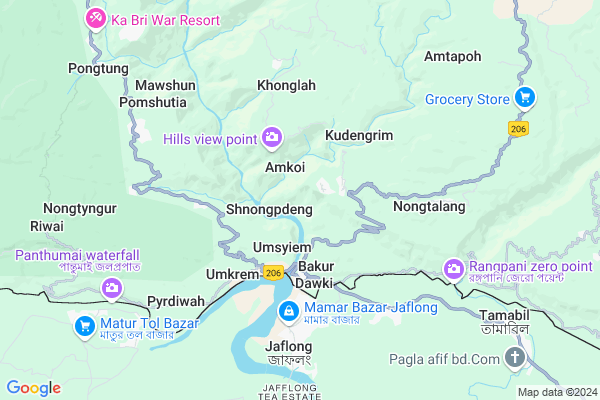
Lymba Map
EDIT Map
Add Your House
 ..
..
Current Corona Virus Infected Patients Count in Jaintia Hills District
| City Name | District Name | Total Covid cases |
|---|
Locality Name :
Lymba
( लिम्बा )
Block Name : Amlarem
District : Jaintia Hills
State : Meghalaya
Language : English and Khasi, Garo
Current Time 03:21 PM
Date: Tuesday , Apr 29,2025 (IST)
Time zone: IST (UTC+5:30)
Telephone Code / Std Code: 03653
Assembly constituency : Amlarem assembly constituency
Assembly MLA : stephanson mukhim
Lok Sabha constituency : Shillong parliamentary constituency
Parliament MP : VINCENT H. PALA
Serpanch Name :
Pin Code : 793109
Post Office Name : Dawki
Commodities Prices : Sohra Market / Mandi
Lymba Live Weather
Temperature: 26.5 °C
few clouds
Humidity: 67%
Wind : 1.29 mt/sec towards W
StationName : "DopÄ\u0081kul"
observed on 29 Mins Back
Temperature: 26.5 °C
few clouds
Humidity: 67%
Wind : 1.29 mt/sec towards W
StationName : "DopÄ\u0081kul"
observed on 29 Mins Back
Lymba Weather Forecast for Next 5 days
30-04-2025
20.4°C to 25.5°C
light rain, broken clouds
20.4°C to 25.5°C
light rain, broken clouds
01-05-2025
19.2°C to 28.8°C
overcast clouds, light rain, clear sky
19.2°C to 28.8°C
overcast clouds, light rain, clear sky
02-05-2025
19.7°C to 31.2°C
light rain, clear sky
19.7°C to 31.2°C
light rain, clear sky
03-05-2025
19.9°C to 30.7°C
light rain, broken clouds
19.9°C to 30.7°C
light rain, broken clouds
04-05-2025
20.2°C to 30.2°C
light rain
20.2°C to 30.2°C
light rain
National Highways Reachable To Lymba
Nationa High Way :NH6
Nationa High Way :NH6
Rivers Near Lymba
Simleng
Umngot
Simleng
Umngot
About Lymba
Correct below Info and add more info about LymbaLymba is a Village in Amlarem Block in Jaintia Hills District of Meghalaya State, India. It is located 38 KM towards South from District head quarters Jowai. 12 KM from Amlarem. 49 KM from State capital Shillong
Lymba Pin code is 793109 and postal head office is Dawki .
Shnongpdeng ( 1 KM ) , Kongwang ( 1 KM ) , Lamin ( 1 KM ) , Amkoi ( 1 KM ) , Bakur ( 2 KM ) are the nearby Villages to Lymba. Lymba is surrounded by Pynursla Block towards west , Mawkynrew Block towards North , Khadarshnong-Laitkroh Block towards west , Shella Bholaganj Block towards west .
Jowai , Shillong , Karimganj , Hailakandi are the near by Cities to Lymba.
This Place is in the border of the Jaintia Hills District and East Khasi Hills District. East Khasi Hills District Pynursla is west towards this place .
Lymba 2011 Census Details
Lymba Local Language is English. Lymba Village Total population is 145 and number of houses are 24. Female Population is 47.6%. Village literacy rate is 72.4% and the Female Literacy rate is 33.8%.
Population
| Census Parameter | Census Data |
| Total Population | 145 |
| Total No of Houses | 24 |
| Female Population % | 47.6 % ( 69) |
| Total Literacy rate % | 72.4 % ( 105) |
| Female Literacy rate | 33.8 % ( 49) |
| Scheduled Tribes Population % | 99.3 % ( 144) |
| Scheduled Caste Population % | 0.0 % ( 0) |
| Working Population % | 9.0 % |
| Child(0 -6) Population by 2011 | 25 |
| Girl Child(0 -6) Population % by 2011 | 48.0 % ( 12) |
Lymba Census More Deatils.
Politics in Lymba
UDP , Indian National Congress , INC are the major political parties in this area.Polling Stations /Booths near Lymba
1)Darrang A2)Kamsing
3)Amlympiang
4)Lamin Shnong A (male)
5)Padubah A (male)
HOW TO REACH Lymba
By Rail
There is no railway station near to Lymba in less than 10 km.Colleges near Lymba
Shangpung College
Address :
Schools in Lymba
Lymba Govt. Lps
Address : lymba , amlarem , jaintia hills , Meghalaya . PIN- 793109 , Post - Dawki
Govt Health Centers near Lymba
1) Darrang SC , Darrang Village , Darrang Shnongpdeng Road , Near Football Field2) Lamin SC , Lamin Subcentre , Lamin North ,
3) Dawki PHC , Dawki PHC , Amlarem Dawki Road , Near BSF Camp
Hospitals in Lymba,Amlarem
Nongtalang Community Health Centre (CHC)
West Jaintia Hills; Meghalaya 793109; India
4.7 KM distance Detail
more ..
Petrol Bunks in Lymba,Amlarem
PUBLIC REFILL CENTRE
DAWKI NH 40 DIST. JAINTIA; WEST JAINTIA HILLS; Meghalaya 793109; India
3.8 KM distance Detail
more ..
Colleges in Lymba,Amlarem
Martin Luther Christian University
Nongtalang Mission; Nongtalang Road; Nongtalang; Meghalaya 793109; India
5.3 KM distance Detail
more ..
Schools in Lymba,Amlarem
Sohkha Govt. Higher; Secondary School
Jowai-Dawki Rd; Meghalaya 793109; India
1.7 KM distance Detail
About Lymba &
History
How to reach Lymba
Tourist Places Near By Lymba
Schools in Lymba
Colleges in Lymba
Temperature & weather of Lymba
places in Lymba
Lymba photos
More Information
How to reach Lymba
Tourist Places Near By Lymba
Schools in Lymba
Colleges in Lymba
Temperature & weather of Lymba
places in Lymba
Lymba photos
More Information
Village Talk
Post News or Events about this Village
Near Cities
Jowai 18 KM near
Shillong 46 KM near
Karimganj 56 KM near
Hailakandi 89 KM near
Jowai 18 KM near
Shillong 46 KM near
Karimganj 56 KM near
Hailakandi 89 KM near
Near By Taluks
Amlarem 11 KM near
Pynursla 13 KM near
Mawkynrew 21 KM near
Khadarshnong-Laitkroh 32 KM near
Amlarem 11 KM near
Pynursla 13 KM near
Mawkynrew 21 KM near
Khadarshnong-Laitkroh 32 KM near
Near By Air Ports
Shillong Airport 47 KM near
Kumbhirgram Airport 114 KM near
Borjhar Airport 121 KM near
Aizawl Airport 183 KM near
Shillong Airport 47 KM near
Kumbhirgram Airport 114 KM near
Borjhar Airport 121 KM near
Aizawl Airport 183 KM near
Near By Tourist Places
Jowai 35 KM near
Cherrapunjee 37 KM near
Shillong 48 KM near
Karimganj 58 KM near
Nongpoh 87 KM near
Jowai 35 KM near
Cherrapunjee 37 KM near
Shillong 48 KM near
Karimganj 58 KM near
Nongpoh 87 KM near
Near By Districts
Jaintia Hills 36 KM near
East Khasi Hills 47 KM near
Karimganj 56 KM near
Ri Bhoi 87 KM near
Jaintia Hills 36 KM near
East Khasi Hills 47 KM near
Karimganj 56 KM near
Ri Bhoi 87 KM near
Near By RailWay Station
Badarpur Junction Rail Way Station 74 KM near
Silchar Rail Way Station 98 KM near
Badarpur Junction Rail Way Station 74 KM near
Silchar Rail Way Station 98 KM near