| Home | City Bus | Maps | Villages | Cities | Rail | Tourist Places | School | College | Pin Codes | Corona Cases Count |
| Distance Calculator Bus Services IFSC Codes Trace Mobile Number Weather Search Place Trace IP Available Cash ATM/Banks Locate Polling Booth Report an Error contact People |
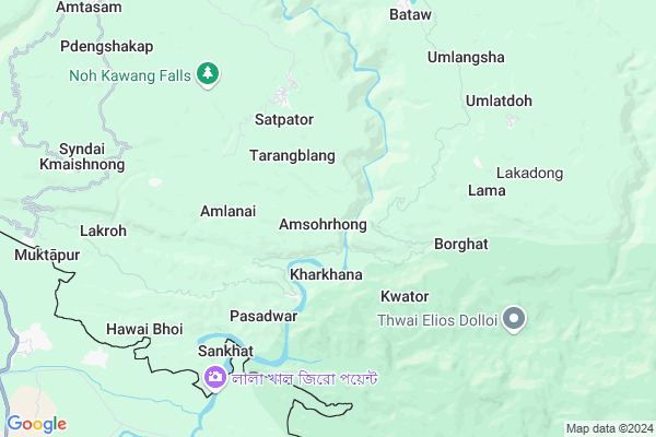
Amsohrhong
Amsohrhong Map
EDIT Map
Add Your House
 ..
..
Current Corona Virus Infected Patients Count in Jaintia Hills District
| City Name | District Name | Total Covid cases |
|---|
Locality Name :
Amsohrhong
( ाम्सोहढ़ोंग )
Block Name : Amlarem
District : Jaintia Hills
State : Meghalaya
Language : English and Khasi, Garo
Current Time 03:18 PM
Date: Tuesday , Apr 29,2025 (IST)
Time zone: IST (UTC+5:30)
Telephone Code / Std Code: 03653
Assembly constituency : Amlarem assembly constituency
Assembly MLA : stephanson mukhim
Lok Sabha constituency : Shillong parliamentary constituency
Parliament MP : VINCENT H. PALA
Serpanch Name :
Pin Code : 793109
Post Office Name : Dawki
Commodities Prices : Khliehriat Market / Mandi
Amsohrhong Live Weather
Temperature: 24.5 °C
scattered clouds
Humidity: 66%
Wind : 1.61 mt/sec towards SW
StationName : "Karīmganj"
observed on 2 Hours Back
Temperature: 24.5 °C
scattered clouds
Humidity: 66%
Wind : 1.61 mt/sec towards SW
StationName : "Karīmganj"
observed on 2 Hours Back
Amsohrhong Weather Forecast for Next 5 days
30-04-2025
19.5°C to 26.4°C
moderate rain, light rain, scattered clouds
19.5°C to 26.4°C
moderate rain, light rain, scattered clouds
01-05-2025
18.8°C to 27.5°C
overcast clouds, light rain
18.8°C to 27.5°C
overcast clouds, light rain
02-05-2025
19.1°C to 30.8°C
light rain, broken clouds, clear sky
19.1°C to 30.8°C
light rain, broken clouds, clear sky
03-05-2025
19.1°C to 30.1°C
light rain, broken clouds
19.1°C to 30.1°C
light rain, broken clouds
04-05-2025
19.3°C to 29.5°C
light rain, moderate rain
19.3°C to 29.5°C
light rain, moderate rain
National Highways Reachable To Amsohrhong
Nationa High Way :NH6
Nationa High Way :NH6
Rivers Near Amsohrhong
Simleng
Umngot
Simleng
Umngot
About Amsohrhong
Correct below Info and add more info about AmsohrhongAmsohrhong is a Village in Amlarem Block in Jaintia Hills District of Meghalaya State, India. It is located 36 KM towards South from District head quarters Jowai. 12 KM from Amlarem. 65 KM from State capital Shillong
Amsohrhong Pin code is 793109 and postal head office is Dawki .
Kharkhana ( 1 KM ) , Laremshyiap ( 2 KM ) , Tarangblang ( 2 KM ) , Lumpyngngad ( 3 KM ) , Amlanai ( 3 KM ) are the nearby Villages to Amsohrhong. Amsohrhong is surrounded by Khliehriat Block towards North , Jowal Block towards North , Mawkynrew Block towards North , Pynursla Block towards west .
Jowai , Karimganj , Shillong , Hailakandi are the near by Cities to Amsohrhong.
This Place is in the border of the Jaintia Hills District and East Khasi Hills District. East Khasi Hills District Pynursla is west towards this place .
Demographics of Amsohrhong
English is the Local Language here.Politics in Amsohrhong
UDP , Indian National Congress , INC are the major political parties in this area.Polling Stations /Booths near Amsohrhong
1)Padubah B (female)2)Amsku
3)Amkoi
4)Amtapoh
5)Shyrmang
HOW TO REACH Amsohrhong
By Rail
There is no railway station near to Amsohrhong in less than 10 km.Colleges near Amsohrhong
Shangpung College
Address :
Schools in Amsohrhong
Govt. Ps
Address : amsohrhong , amlarem , jaintia hills , Meghalaya . PIN- 793150 , Post - Jowai
Govt Health Centers near Amsohrhong
1) Nathbor SC , Nathbor SC , Kwator Road , Near Borghat River2) Lama SC , Lama SC , , Near Govt. LP School Lama and Large Banyan Tree
3) Pyrsadwar SC , Pasadwar SC , Lumpyngngad ,
Hospitals in Amsohrhong,Amlarem
Nongtalang CHC Quarter
Nongtalang Khlachympa; Nongtalang Road; Nongtalang; Meghalaya 793109; India
18.8 KM distance Detail
Nongtalang Community Health Centre (CHC)
West Jaintia Hills; Meghalaya 793109; India
19.6 KM distance Detail
more ..
Petrol Bunks in Amsohrhong,Amlarem
PUBLIC REFILL CENTRE
DAWKI NH 40 DIST. JAINTIA; WEST JAINTIA HILLS; Meghalaya 793109; India
23.2 KM distance Detail
more ..
Colleges in Amsohrhong,Amlarem
Martin Luther Christian University
Nongtalang Mission; Nongtalang Road; Nongtalang; Meghalaya 793109; India
18.9 KM distance Detail
more ..
Schools in Amsohrhong,Amlarem
Madan Lower Primary School
Nongtalang Khlachympa; S Khlachympa Rd; Nongtalang; Meghalaya 793109; India
18.7 KM distance Detail
Nongtalang Government Secondary School
Nongtalang Road; Nongtalang; Meghalaya 793109; India
19.0 KM distance Detail
Super Markets in Amsohrhong,Amlarem
About Amsohrhong &
History
How to reach Amsohrhong
Tourist Places Near By Amsohrhong
Schools in Amsohrhong
Colleges in Amsohrhong
Temperature & weather of Amsohrhong
places in Amsohrhong
Amsohrhong photos
More Information
How to reach Amsohrhong
Tourist Places Near By Amsohrhong
Schools in Amsohrhong
Colleges in Amsohrhong
Temperature & weather of Amsohrhong
places in Amsohrhong
Amsohrhong photos
More Information
Village Talk
Post News or Events about this Village
Near Cities
Jowai 18 KM near
Karimganj 40 KM near
Shillong 62 KM near
Hailakandi 71 KM near
Jowai 18 KM near
Karimganj 40 KM near
Shillong 62 KM near
Hailakandi 71 KM near
Near By Taluks
Amlarem 12 KM near
Khliehriat 20 KM near
Jowal 34 KM near
Mawkynrew 35 KM near
Amlarem 12 KM near
Khliehriat 20 KM near
Jowal 34 KM near
Mawkynrew 35 KM near
Near By Air Ports
Shillong Airport 62 KM near
Kumbhirgram Airport 91 KM near
Borjhar Airport 136 KM near
Aizawl Airport 171 KM near
Shillong Airport 62 KM near
Kumbhirgram Airport 91 KM near
Borjhar Airport 136 KM near
Aizawl Airport 171 KM near
Near By Tourist Places
Jowai 34 KM near
Karimganj 42 KM near
Cherrapunjee 60 KM near
Shillong 62 KM near
Hailakandi 72 KM near
Jowai 34 KM near
Karimganj 42 KM near
Cherrapunjee 60 KM near
Shillong 62 KM near
Hailakandi 72 KM near
Near By Districts
Jaintia Hills 34 KM near
Karimganj 39 KM near
East Khasi Hills 62 KM near
Hailakandi 71 KM near
Jaintia Hills 34 KM near
Karimganj 39 KM near
East Khasi Hills 62 KM near
Hailakandi 71 KM near
Near By RailWay Station
Badarpur Junction Rail Way Station 53 KM near
Silchar Rail Way Station 76 KM near
Badarpur Junction Rail Way Station 53 KM near
Silchar Rail Way Station 76 KM near