| Home | City Bus | Maps | Villages | Cities | Rail | Tourist Places | School | College | Pin Codes | Corona Cases Count |
| Distance Calculator Bus Services IFSC Codes Trace Mobile Number Weather Search Place Trace IP Available Cash ATM/Banks Locate Polling Booth Report an Error contact People |
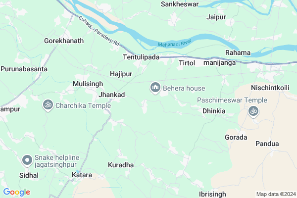
Alana
Alana Map
EDIT Map
Add Your House
 ..
..
Current Corona Virus Infected Patients Count in Jagatsinghapur District
| City Name | District Name | Total Covid cases |
|---|
Locality Name :
Alana
( ଅଲଣା )
Tehsil Name : Tirtol
District : Jagatsinghapur
State : Odisha
Language : Oriya and Hindi,
Current Time 10:38 AM
Date: Wednesday , Apr 30,2025 (IST)
Time zone: IST (UTC+5:30)
Elevation / Altitude: 8 meters. Above Seal level
Telephone Code / Std Code: 06725
Assembly constituency : Tirtol assembly constituency
Assembly MLA : rajashree mallick
Lok Sabha constituency : Jagatsinghpur parliamentary constituency
Parliament MP : RAJASHREE MALLICK
Serpanch Name :
Commodities Prices : Jagatsinghpur Market / Mandi
Alana Live Weather
Temperature: 31.2 °C
clear sky
Humidity: 58%
Wind : 3.5 mt/sec towards SW
StationName : "Jagatsinghapur"
observed on 2 Hours Back
Temperature: 31.2 °C
clear sky
Humidity: 58%
Wind : 3.5 mt/sec towards SW
StationName : "Jagatsinghapur"
observed on 2 Hours Back
Alana Weather Forecast for Next 5 days
01-05-2025
23.3°C to 35.2°C
clear sky, few clouds, moderate rain, broken clouds
23.3°C to 35.2°C
clear sky, few clouds, moderate rain, broken clouds
02-05-2025
22.0°C to 31.8°C
light rain, heavy intensity rain, few clouds
22.0°C to 31.8°C
light rain, heavy intensity rain, few clouds
03-05-2025
23.8°C to 32.3°C
clear sky, scattered clouds, light rain, broken clouds
23.8°C to 32.3°C
clear sky, scattered clouds, light rain, broken clouds
04-05-2025
26.7°C to 35.4°C
scattered clouds, clear sky, light rain
26.7°C to 35.4°C
scattered clouds, clear sky, light rain
05-05-2025
27.9°C to 36.8°C
scattered clouds, few clouds, clear sky
27.9°C to 36.8°C
scattered clouds, few clouds, clear sky
National Highways Reachable To Alana
Nationa High Way :NH316
Nationa High Way :NH53
Nationa High Way :NH316
Nationa High Way :NH53
Rivers Near Alana
Brahmani :Брагмані
Ramlala
Brahmani :Брагмані
Ramlala
About Alana
Correct below Info and add more info about AlanaAlana is a small Village/hamlet in Tirtol Tehsil in Jagatsinghapur District of Odisha State, India. It is located 17 KM towards East from District head quarters Jagatsinghpur. 58 KM from State capital Bhubaneswar
Alana is surrounded by Jagatsinghpur Tehsil towards west , Raghunathpur Tehsil towards west , Garadapur Tehsil towards North , Erasama Tehsil towards East .
Jagatsinghapur , Kendrapara , Paradip , Pattamundai are the near by Cities to Alana.
This Place is in the border of the Jagatsinghapur District and Kendrapara District. Kendrapara District Garadapur is North towards this place .
Alana 2011 Census Details
Alana Local Language is Oriya. Alana Village Total population is 814 and number of houses are 169. Female Population is 50.5%. Village literacy rate is 81.2% and the Female Literacy rate is 39.7%.
Population
| Census Parameter | Census Data |
| Total Population | 814 |
| Total No of Houses | 169 |
| Female Population % | 50.5 % ( 411) |
| Total Literacy rate % | 81.2 % ( 661) |
| Female Literacy rate | 39.7 % ( 323) |
| Scheduled Tribes Population % | 0.0 % ( 0) |
| Scheduled Caste Population % | 25.7 % ( 209) |
| Working Population % | 29.0 % |
| Child(0 -6) Population by 2011 | 79 |
| Girl Child(0 -6) Population % by 2011 | 43.0 % ( 34) |
Alana Census More Deatils.
Politics in Alana
BJD , INC are the major political parties in this area.Polling Stations /Booths near Alana
1)Anakhia Up. School Anakhia2)Sapneswar U.p. School Attamul (w)
3)Jagannathpur-2
4)Jagdish Panchagram U.p. School Khandasahi(w)
5)Bharati U.p. School Malanda
HOW TO REACH Alana
By Rail
Jhankad Sarala Road Rail Way Station , Gorakhnath Rail Way Station are the very nearby railway stations to Alana.Pincodes near Alana
754136 ( Kanakpur ) , 754137 ( Tirtol ) , 754138 ( Tiran )Colleges near Alana
Shree Jagannath Mohavidyalaya,naugaon Hat
Address :
Ssj Mahavidyalaya,erasama
Address :
B.b.mohavidyalaya,goda
Address : At.goda Ps,erasama Pan.754110
Sara Maha Vidyalaya,rahama
Address :
Sarala Maha Vidyalaya, Rahama
Address :
Schools in Alana
Satya Narayan High School,alana
Address : alana , tirtol , jagatsinghpur , Sikkim . PIN- 754136 , Post - Kanakpur
Alana Ugup School
Address : alana , tirtol , jagatsinghpur , Sikkim . PIN- 754138 , Post - Tiran
Satya Narayan Nodal Upper Pry. Scho
Address : alana , tirtol , jagatsinghpur , Sikkim . PIN- 754136 , Post - Kanakpur
Govt Health Centers near Alana
1) Gardapur PHC(N) , , Patkura , Near Patkura Block Office2) ORTI , , , Orti PHC (New)
3) NAGASPUR , , , Nagaspur Chhak
Petrol Bunks in Alana,Tirtol
Biswanath Filling Station Bharat Petroleum
Jagatsinghapur; SH-12; Cuttack Paradeep Road; Tirtol; Tirtol; Odisha 754137; India
3.5 KM distance Detail
more ..
Colleges in Alana,Tirtol
Brahmakumari Iswariya Viwabidyalaya
sarani bajar;near anandmandap; Tirtol; 754137; India
4.1 KM distance Detail
more ..
Super Markets in Alana,Tirtol
JAGANNATH &LAKANATH STORE
Cuttack - Paradeep Rd; Tirtol; Odisha 754160; India
6.8 KM distance Detail
Police Stations near Alana,Tirtol
Police Station Tirtol
Cuttack - Paradeep Rd; Survey & Agriculture Settlement Colony; Cuttack; Odisha 754137; India
5.6 KM distance Detail
Governement Offices near Alana,Tirtol
Block Education Office
Jagatsinghapur; SH-12; Cuttack Paradeep Road; Tirtol; Tirtol; Odisha 754137; India
3.7 KM distance Detail
About Alana &
History
How to reach Alana
Tourist Places Near By Alana
Schools in Alana
Colleges in Alana
Temperature & weather of Alana
places in Alana
Alana photos
More Information
How to reach Alana
Tourist Places Near By Alana
Schools in Alana
Colleges in Alana
Temperature & weather of Alana
places in Alana
Alana photos
More Information
Village Talk
Post News or Events about this Village
Near Cities
Jagatsinghapur 17 KM near
Kendrapara 29 KM near
Paradip 35 KM near
Pattamundai 47 KM near
Jagatsinghapur 17 KM near
Kendrapara 29 KM near
Paradip 35 KM near
Pattamundai 47 KM near
Near By Taluks
Tirtol 0 KM near
Jagatsinghpur 14 KM near
Raghunathpur 14 KM near
Garadapur 14 KM near
Tirtol 0 KM near
Jagatsinghpur 14 KM near
Raghunathpur 14 KM near
Garadapur 14 KM near
Near By Air Ports
Bhubaneswar Airport 58 KM near
Netaji Subhas Chandra Bose Airport 383 KM near
Ranchi Airport 395 KM near
Vishakhapatnam Airport 483 KM near
Bhubaneswar Airport 58 KM near
Netaji Subhas Chandra Bose Airport 383 KM near
Ranchi Airport 395 KM near
Vishakhapatnam Airport 483 KM near
Near By Tourist Places
Paradeep Beach 35 KM near
Konark 55 KM near
Cuttack 56 KM near
Bhubaneswar 57 KM near
Nandan Kanan National Park 60 KM near
Paradeep Beach 35 KM near
Konark 55 KM near
Cuttack 56 KM near
Bhubaneswar 57 KM near
Nandan Kanan National Park 60 KM near
Near By Districts
Jagatsinghapur 17 KM near
Kendrapara 30 KM near
Cuttack 56 KM near
Khordha 58 KM near
Jagatsinghapur 17 KM near
Kendrapara 30 KM near
Cuttack 56 KM near
Khordha 58 KM near
Near By RailWay Station
Jhankad Sarala Road Rail Way Station 2.3 KM near
Gorakhnath Rail Way Station 8.1 KM near
Cuttack Junction Rail Way Station 54 KM near
Mancheswar Rail Way Station 55 KM near
Jhankad Sarala Road Rail Way Station 2.3 KM near
Gorakhnath Rail Way Station 8.1 KM near
Cuttack Junction Rail Way Station 54 KM near
Mancheswar Rail Way Station 55 KM near