| Home | City Bus | Maps | Villages | Cities | Rail | Tourist Places | School | College | Pin Codes | Corona Cases Count |
| Distance Calculator Bus Services IFSC Codes Trace Mobile Number Weather Search Place Trace IP Available Cash ATM/Banks Locate Polling Booth Report an Error contact People |
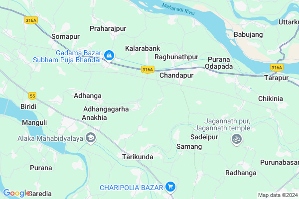
Baragola
Baragola Map
EDIT Map
Add Your House
 ..
..
Current Corona Virus Infected Patients Count in Jagatsinghapur District
| City Name | District Name | Total Covid cases |
|---|
Locality Name :
Baragola
( ବରଗଲା )
Tehsil Name : Raghunathpur
District : Jagatsinghapur
State : Odisha
Language : Oriya and Hindi,
Current Time 09:10 AM
Date: Wednesday , Apr 30,2025 (IST)
Time zone: IST (UTC+5:30)
Elevation / Altitude: 14 meters. Above Seal level
Telephone Code / Std Code: 06724
Assembly constituency : Tirtol assembly constituency
Assembly MLA : rajashree mallick
Lok Sabha constituency : Jagatsinghpur parliamentary constituency
Parliament MP : RAJASHREE MALLICK
Serpanch Name :
Pin Code : 754142
Post Office Name : Paradip
Commodities Prices : Jagatsinghpur Market / Mandi
Baragola Live Weather
Temperature: 31.3 °C
clear sky
Humidity: 59%
Wind : 3.34 mt/sec towards SW
StationName : "Jagatsinghapur"
observed on 1 Hours Back
Temperature: 31.3 °C
clear sky
Humidity: 59%
Wind : 3.34 mt/sec towards SW
StationName : "Jagatsinghapur"
observed on 1 Hours Back
Baragola Weather Forecast for Next 5 days
01-05-2025
23.8°C to 36.3°C
clear sky, few clouds, light rain, broken clouds
23.8°C to 36.3°C
clear sky, few clouds, light rain, broken clouds
02-05-2025
22.2°C to 33.3°C
light rain, heavy intensity rain, broken clouds, few clouds
22.2°C to 33.3°C
light rain, heavy intensity rain, broken clouds, few clouds
03-05-2025
24.1°C to 35.2°C
few clouds, clear sky, light rain, broken clouds, scattered clouds
24.1°C to 35.2°C
few clouds, clear sky, light rain, broken clouds, scattered clouds
04-05-2025
26.4°C to 35.6°C
scattered clouds, clear sky, light rain, broken clouds
26.4°C to 35.6°C
scattered clouds, clear sky, light rain, broken clouds
05-05-2025
27.6°C to 38.6°C
broken clouds, few clouds, clear sky
27.6°C to 38.6°C
broken clouds, few clouds, clear sky
National Highways Reachable To Baragola
Nationa High Way :NH316
Nationa High Way :NH53
Nationa High Way :NH316
Nationa High Way :NH53
Rivers Near Baragola
Brahmani :Брагмані
Rana
Brahmani :Брагмані
Rana
About Baragola
Correct below Info and add more info about BaragolaBaragola is a Village in Raghunathpur Tehsil in Jagatsinghapur District of Odisha State, India. It is located 10 KM towards North from District head quarters Jagatsinghpur. 8 KM from Raghunathpur. 37 KM from State capital Bhubaneswar
Baragola Pin code is 754142 and postal head office is Paradip .
Samanga ( 3 KM ) , Samanga ( 3 KM ) , Bodar ( 3 KM ) , Dharadharpur ( 3 KM ) , Jaisol ( 3 KM ) are the nearby Villages to Baragola. Baragola is surrounded by Raghunathpur Tehsil towards East , Jagatsinghpur Tehsil towards South , Nischinta Koili Tehsil towards North , Kantapada Tehsil towards west .
Jagatsinghapur , Cuttack , Kendrapara , Bhubaneswar are the near by Cities to Baragola.
This Place is in the border of the Jagatsinghapur District and Cuttack District. Cuttack District Nischinta Koili is North towards this place . Also it is in the Border of other district Kendrapara .
Demographics of Baragola
Oriya is the Local Language here.Politics in Baragola
BJD , INC are the major political parties in this area.Polling Stations /Booths near Baragola
1)Bhattagan Pry. School Bhattagan2)Shalamanga Up School Shalamanga
3)Sidheswari U.p. School
4)Kandarapati Gopal Pry. School
5)Baradia U.p School (w)
HOW TO REACH Baragola
By Rail
Raghunathpur Rail Way Station , Badakhandita Rail Way Station are the very nearby railway stations to Baragola.Colleges near Baragola
Shree Jagannath Mohavidyalaya,naugaon Hat
Address :
Ssj Mahavidyalaya,erasama
Address :
B.b.mohavidyalaya,goda
Address : At.goda Ps,erasama Pan.754110
Sara Maha Vidyalaya,rahama
Address :
Sarala Maha Vidyalaya, Rahama
Address :
Schools near Baragola
Swapneswar Vidya Mandir
Address : jaganathpur , raghunathpur , jagatsinghpur , Sikkim . PIN- 754132 , Post - Raghunathpur (Jagatsinghapur)
M.k.c. High School, Deuli
Address : deuli , raghunathpur , jagatsinghpur , Sikkim . PIN- 754132 , Post - Raghunathpur (Jagatsinghapur)
Maa Sarala Girls Hs
Address : jaipur , raghunathpur , jagatsinghpur , Sikkim . PIN- 754133 , Post - Tarpur
Palliprava Girls Hs
Address : tihada , raghunathpur , jagatsinghpur , Sikkim . PIN- 754132 , Post - Raghunathpur (Jagatsinghapur)
Govt Health Centers near Baragola
1) NAGASPUR , , , Nagaspur Chhak2) ORTI , , , Orti PHC (New)
3) Paribasudeipur , PARIBASUDEIPUR , PARIBASUDEIPUR , PARIBASUDEIPUR
Hospitals in Baragola,Raghunathpur
Government Hospital
Raghunathpur; Jagatsinghapur; SH-12; Cuttack Paradeep Road; Tirtol; Tirtol; Odisha 754132; India
3.3 KM distance Detail
more ..
Petrol Bunks in Baragola,Raghunathpur
Hindustan Petroleum
Raghunathpur; Jagatsinghapur; SH-12; Cuttack Paradeep Road; Tirtol; Tirtol; Odisha 754132; India
6.1 KM distance Detail
HP PETROL PUMP - NARAYANI FLG STN
Hpcl Dealer AT P.O Purana Odapada VIA Raghunathpur; Bhubaneshwar; Odisha 754132; India
6.2 KM distance Detail
more ..
Colleges in Baragola,Raghunathpur
CNCB Academy of Science and Technology
Anakhia - Nanapur Road; Patuari; Odisha 754102; India
2.8 KM distance Detail
Dr. Rushilkumar Institute of Education and Technology(DRIET)
DRIET Campus; Cuttack - Jagatsinghpur Rd; Tarikunda; Odisha 754114; India
5.2 KM distance Detail
more ..
Schools in Baragola,Raghunathpur
Sadeikana Upper Primary School
At- Sankarpur; Po- Gothina; Odisha 754132; India
1.7 KM distance Detail
Shibapur Up Grade High School
754132; Shibapur; Kothar; Solagan; Odisha; India
1.7 KM distance Detail
Local Parks in Baragola,Raghunathpur
Area of Baranga Bhoji
Bhokanji - Nuapola Rd; Jagatsinghpur; Odisha 754103; India
8.8 KM distance Detail
Police Stations near Baragola,Raghunathpur
Raghunathpur Police Station
Raghunathpur; Jagatsinghapur; SH-12; Cuttack Paradeep Road; Tirtol; Tirtol; Odisha 754132; India
2.9 KM distance Detail
Reserve Police Station; Jagatsinghpur
Bhokanji Nuapola Rd; Area of Baranga Bhoji; Bhokanji - Nuapola Rd; Jagatsinghpur; Odisha 754103; India
8.8 KM distance Detail
Governement Offices near Baragola,Raghunathpur
Raghunathpur Block Office
Raghunathpur - Jagatsinghpur Road; Chandapur; Odisha 754132; India
3.5 KM distance Detail
About Baragola &
History
How to reach Baragola
Tourist Places Near By Baragola
Schools in Baragola
Colleges in Baragola
Temperature & weather of Baragola
places in Baragola
Baragola photos
More Information
How to reach Baragola
Tourist Places Near By Baragola
Schools in Baragola
Colleges in Baragola
Temperature & weather of Baragola
places in Baragola
Baragola photos
More Information
Village Talk
Post News or Events about this Village
Near Cities
Jagatsinghapur 9 KM near
Cuttack 33 KM near
Kendrapara 38 KM near
Bhubaneswar 38 KM near
Jagatsinghapur 9 KM near
Cuttack 33 KM near
Kendrapara 38 KM near
Bhubaneswar 38 KM near
Near By Taluks
Biridi 7 KM near
Raghunathpur 8 KM near
Jagatsinghpur 12 KM near
Nischinta Koili 14 KM near
Biridi 7 KM near
Raghunathpur 8 KM near
Jagatsinghpur 12 KM near
Nischinta Koili 14 KM near
Near By Air Ports
Bhubaneswar Airport 39 KM near
Ranchi Airport 382 KM near
Netaji Subhas Chandra Bose Airport 391 KM near
Vishakhapatnam Airport 472 KM near
Bhubaneswar Airport 39 KM near
Ranchi Airport 382 KM near
Netaji Subhas Chandra Bose Airport 391 KM near
Vishakhapatnam Airport 472 KM near
Near By Tourist Places
Cuttack 34 KM near
Bhubaneswar 37 KM near
Nandan Kanan National Park 38 KM near
Konark 56 KM near
Paradeep Beach 56 KM near
Cuttack 34 KM near
Bhubaneswar 37 KM near
Nandan Kanan National Park 38 KM near
Konark 56 KM near
Paradeep Beach 56 KM near
Near By Districts
Jagatsinghapur 10 KM near
Cuttack 33 KM near
Khordha 38 KM near
Kendrapara 38 KM near
Jagatsinghapur 10 KM near
Cuttack 33 KM near
Khordha 38 KM near
Kendrapara 38 KM near
Near By RailWay Station
Raghunathpur Rail Way Station 2.0 KM near
Badakhandita Rail Way Station 7.6 KM near
Banbihari Gwalipur Rail Way Station 8.0 KM near
Cuttack Junction Rail Way Station 31 KM near
Mancheswar Rail Way Station 34 KM near
Raghunathpur Rail Way Station 2.0 KM near
Badakhandita Rail Way Station 7.6 KM near
Banbihari Gwalipur Rail Way Station 8.0 KM near
Cuttack Junction Rail Way Station 31 KM near
Mancheswar Rail Way Station 34 KM near