| Home | City Bus | Maps | Villages | Cities | Rail | Tourist Places | School | College | Pin Codes | Corona Cases Count |
| Distance Calculator Bus Services IFSC Codes Trace Mobile Number Weather Search Place Trace IP Available Cash ATM/Banks Locate Polling Booth Report an Error contact People |
Patapur
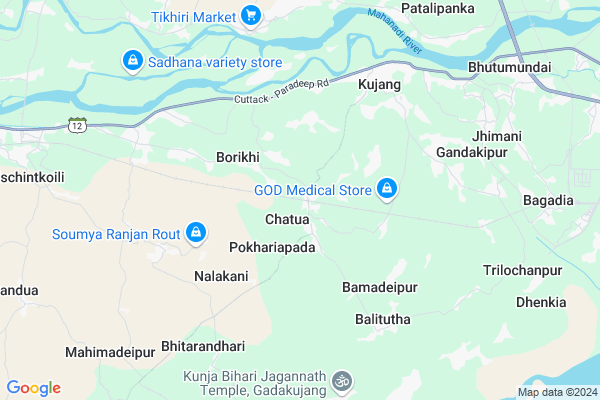
Patapur Map
EDIT Map
Add Your House
 ..
..
Current Corona Virus Infected Patients Count in Jagatsinghapur District
| City Name | District Name | Total Covid cases |
|---|
Locality Name :
Patapur
( ପାଟପୁର )
Tehsil Name : Kujang
District : Jagatsinghapur
State : Odisha
Language : Oriya and Hindi,
Current Time 11:42 AM
Date: Sunday , Apr 27,2025 (IST)
Time zone: IST (UTC+5:30)
Elevation / Altitude: 4 meters. Above Seal level
Telephone Code / Std Code: 06722
Assembly constituency : Paradeep assembly constituency
Assembly MLA : damodar rout
Lok Sabha constituency : Jagatsinghpur parliamentary constituency
Parliament MP : RAJASHREE MALLICK
Serpanch Name :
Pin Code : 754141
Post Office Name : Kujang
Alternate Village Name : Patapur , Patpur
Commodities Prices : Kendrapara(Marshaghai) Market / Mandi
Patapur Live Weather
Temperature: 38.4 °C
scattered clouds
Humidity: 23%
Wind : 1.95 mt/sec towards W
StationName : "Paradip"
observed on Now
Temperature: 38.4 °C
scattered clouds
Humidity: 23%
Wind : 1.95 mt/sec towards W
StationName : "Paradip"
observed on Now
Patapur Weather Forecast for Next 5 days
28-04-2025
28.3°C to 37.6°C
broken clouds, scattered clouds, clear sky, overcast clouds
28.3°C to 37.6°C
broken clouds, scattered clouds, clear sky, overcast clouds
29-04-2025
26.5°C to 34.8°C
broken clouds, overcast clouds, light rain
26.5°C to 34.8°C
broken clouds, overcast clouds, light rain
30-04-2025
26.4°C to 34.6°C
scattered clouds, clear sky, moderate rain, broken clouds
26.4°C to 34.6°C
scattered clouds, clear sky, moderate rain, broken clouds
01-05-2025
25.5°C to 34.2°C
scattered clouds, clear sky, light rain
25.5°C to 34.2°C
scattered clouds, clear sky, light rain
02-05-2025
20.2°C to 32.5°C
few clouds, clear sky, light rain, moderate rain, overcast clouds
20.2°C to 32.5°C
few clouds, clear sky, light rain, moderate rain, overcast clouds
National Highways Reachable To Patapur
Nationa High Way :NH53
Nationa High Way :NH16
Nationa High Way :NH53
Nationa High Way :NH16
Rivers Near Patapur
Brahmani :Брагмані
Salandi
Brahmani :Брагмані
Salandi
About Patapur
Correct below Info and add more info about PatapurPatapur is a Village in Kujang Tehsil in Jagatsinghapur District of Odisha State, India. It is located 40 KM towards East from District head quarters Jagatsinghpur. 3 KM from Kujanga. 81 KM from State capital Bhubaneswar
Patapur Pin code is 754141 and postal head office is Kujang .
Balia ( 2 KM ) , Bagoi ( 3 KM ) , Baleipur ( 4 KM ) , Bamadeipur ( 4 KM ) , Potanai ( 5 KM ) are the nearby Villages to Patapur. Patapur is surrounded by Paradip Tehsil towards East , Erasama Tehsil towards South , Marsaghai Tehsil towards North , Mahakalapada Tehsil towards North .
Paradip , Kendrapara , Pattamundai , Jagatsinghapur are the near by Cities to Patapur.
This Place is in the border of the Jagatsinghapur District and Kendrapara District. Kendrapara District Mahakalapada is North towards this place . It is near to bay of bengal. There is a chance of humidity in the weather.
Patapur 2011 Census Details
Patapur Local Language is Oriya. Patapur Village Total population is 752 and number of houses are 147. Female Population is 46.7%. Village literacy rate is 74.5% and the Female Literacy rate is 31.1%.
Population
| Census Parameter | Census Data |
| Total Population | 752 |
| Total No of Houses | 147 |
| Female Population % | 46.7 % ( 351) |
| Total Literacy rate % | 74.5 % ( 560) |
| Female Literacy rate | 31.1 % ( 234) |
| Scheduled Tribes Population % | 1.9 % ( 14) |
| Scheduled Caste Population % | 7.7 % ( 58) |
| Working Population % | 33.4 % |
| Child(0 -6) Population by 2011 | 63 |
| Girl Child(0 -6) Population % by 2011 | 44.4 % ( 28) |
Patapur Census More Deatils.
Politics in Patapur
BJD is the major political party in this area.Polling Stations /Booths near Patapur
1)Parianga Pry. School2)Pitambarapur U.p. School
3)Jogania Pry School
4)Arada Pry School
5)Badabalikani U.p School
HOW TO REACH Patapur
By Rail
Badabandha Road Rail Way Station , Bogada Rail Way Station are the very nearby railway stations to Patapur.Colleges near Patapur
Sara Maha Vidyalaya,rahama
Address :
Sarala Maha Vidyalaya, Rahama
Address :
Paradip College
Address : Dist.:jagatsinghpur Orissa
Schools in Patapur
Patapur Pry. School
Address : patapur , kujang , jagatsinghpur , Sikkim . PIN- 754141 , Post - Kujang
Govt Health Centers near Patapur
1) Jaichandrapur , , Jadupur Sector , Near Panchayat High School Jayachandrapur2) Tikhiri , , Patalipank Sector , Near Tikhiri Primary School
3) Rajgarh , , HQ Sector , Near Rajagarh Primary School
Petrol Bunks in Patapur,Kujang
HP PETROL PUMP - MAHABEER FILLING STATION
AT: Pokhariapada P.O.: Chatua VIA: Kujang; Bhubaneshwar; Odisha 754141; India
2.2 KM distance Detail
HP PETROL PUMP - DOLAGOBINDA NAIK & BROS
H P Dealers Kujang Dist.; Bhubaneshwar; Odisha 754141; India
7.2 KM distance Detail
D Naik and Baotha Filling Station Hindustan Petroleum
Krushna Chandan Pur; Jagatsinghapur; SH-12; Cuttack Paradeep Road; Kujanga; Kujanga; Odisha 754141; India
7.2 KM distance Detail
more ..
Schools in Patapur,Kujang
sri aurobindo purnanga sikshya kendra;karatutha
Karatutha; Odisha 754141; India
1.3 KM distance Detail
Electronic Shops in Patapur,Kujang
Ritika Video Shop
At-Baleipur;Po-S Nalakani;Ps-Kujang; Dist-Jagatsinghpur; Odisha; India
4.0 KM distance Detail
POP MUSIC KUJANG
JJ Nac Market Chowk; New Bank Colony; Gopabandhu Nagar; Chhend Colony; Rourkela; Odisha 769004; India
5.9 KM distance Detail
Local Parks in Patapur,Kujang
Childrens' Park.
Refinery Township; IOCL Township; Niharunikandha; Odisha 754141; India
14.0 KM distance Detail
About Patapur &
History
How to reach Patapur
Tourist Places Near By Patapur
Schools in Patapur
Colleges in Patapur
Temperature & weather of Patapur
places in Patapur
Patapur photos
More Information
How to reach Patapur
Tourist Places Near By Patapur
Schools in Patapur
Colleges in Patapur
Temperature & weather of Patapur
places in Patapur
Patapur photos
More Information
Village Talk
Post News or Events about this Village
Near Cities
Paradip 14 KM near
Kendrapara 28 KM near
Pattamundai 38 KM near
Jagatsinghapur 38 KM near
Paradip 14 KM near
Kendrapara 28 KM near
Pattamundai 38 KM near
Jagatsinghapur 38 KM near
Near By Taluks
Kujang 3 KM near
Erasama 14 KM near
Paradip 14 KM near
Marsaghai 19 KM near
Kujang 3 KM near
Erasama 14 KM near
Paradip 14 KM near
Marsaghai 19 KM near
Near By Air Ports
Bhubaneswar Airport 79 KM near
Netaji Subhas Chandra Bose Airport 370 KM near
Ranchi Airport 402 KM near
Vishakhapatnam Airport 499 KM near
Bhubaneswar Airport 79 KM near
Netaji Subhas Chandra Bose Airport 370 KM near
Ranchi Airport 402 KM near
Vishakhapatnam Airport 499 KM near
Near By Tourist Places
Paradeep Beach 14 KM near
Konark 67 KM near
Cuttack 76 KM near
Bhubaneswar 78 KM near
Nandan Kanan National Park 81 KM near
Paradeep Beach 14 KM near
Konark 67 KM near
Cuttack 76 KM near
Bhubaneswar 78 KM near
Nandan Kanan National Park 81 KM near
Near By Districts
Kendrapara 29 KM near
Jagatsinghapur 38 KM near
Jajapur 73 KM near
Cuttack 75 KM near
Kendrapara 29 KM near
Jagatsinghapur 38 KM near
Jajapur 73 KM near
Cuttack 75 KM near
Near By RailWay Station
Badabandha Road Rail Way Station 2.6 KM near
Cuttack Junction Rail Way Station 73 KM near
Mancheswar Rail Way Station 76 KM near
Badabandha Road Rail Way Station 2.6 KM near
Cuttack Junction Rail Way Station 73 KM near
Mancheswar Rail Way Station 76 KM near