| Home | City Bus | Maps | Villages | Cities | Rail | Tourist Places | School | College | Pin Codes | Corona Cases Count |
| Distance Calculator Bus Services IFSC Codes Trace Mobile Number Weather Search Place Trace IP Available Cash ATM/Banks Locate Polling Booth Report an Error contact People |
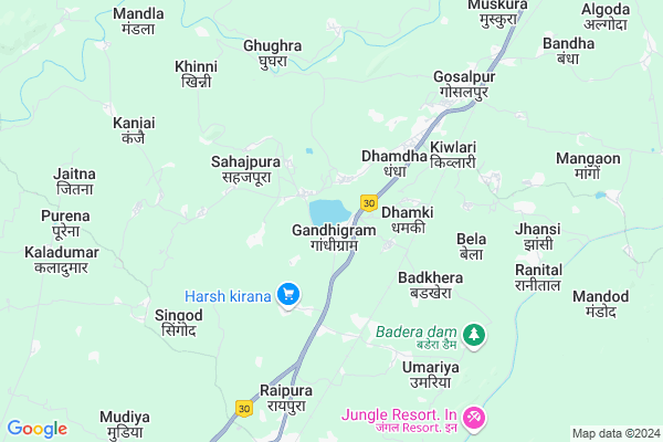
Gandhigram
Gandhigram Map
EDIT Map
Add Your House
 ..
..
Current Corona Virus Infected Patients Count in Jabalpur District
| City Name | District Name | Total Covid cases |
|---|---|---|
| Jabalpur District | Jabalpur | 51 |
| Jabalpur | Jabalpur | 8 |
Locality Name :
Gandhigram
( गांधीग्राम )
Tehsil Name : Sihora
District : Jabalpur
State : Madhya Pradesh
Division : Jabalpur
Language : Hindi and Urdu,bagheli,dravidian,devanagari
Current Time 08:34 AM
Date: Wednesday , Apr 30,2025 (IST)
Time zone: IST (UTC+5:30)
Elevation / Altitude: 388 meters. Above Seal level
Telephone Code / Std Code: 07624
Assembly constituency : Bahoriband assembly constituency
Assembly MLA : Pranay Prabhat Pandey (GUDDU BHAIYA)
Lok Sabha constituency : Khajuraho parliamentary constituency
Parliament MP : V.D. SHARMA (VISHNU DATT SHARMA)
Serpanch Name :
Pin Code : 483222
Post Office Name : Gosalpur
Alternate Village Name : Gandhihram
Commodities Prices : Sihora Market / Mandi
National Highways Reachable To Gandhigram
Nationa High Way :NH30
Nationa High Way :NH39
Nationa High Way :NH30
Nationa High Way :NH39
Rivers Near Gandhigram
Pariat Nadi
Bawanthadi River :बावनथडी नदी
Pariat Nadi
Bawanthadi River :बावनथडी नदी
About Gandhigram
Correct below Info and add more info about GandhigramGandhigram is a Village in Sihora Tehsil in Jabalpur District of Madhya Pradesh State, India. It belongs to Jabalpur Division . It is located 28 KM towards North from District head quarters Jabalpur. 15 KM from Sihora. 311 KM from State capital Bhopal
Gandhigram Pin code is 483222 and postal head office is Gosalpur .
Badkhera ( 4 KM ) , Dharampura ( 4 KM ) , Bela ( 5 KM ) , Channota ( 5 KM ) , Badkheri ( 5 KM ) are the nearby Villages to Gandhigram. Gandhigram is surrounded by Majhouli Tehsil towards North , Sihora Tehsil towards East , Jabalpur Tehsil towards South , Patan Tehsil towards west .
Panagar , Sihora , Jabalpur , Umaria are the near by Cities to Gandhigram.
Gandhigram 2011 Census Details
Gandhigram Local Language is Hindi. Gandhigram Village Total population is 6817 and number of houses are 1484. Female Population is 48.0%. Village literacy rate is 69.3% and the Female Literacy rate is 30.3%.
Population
| Census Parameter | Census Data |
| Total Population | 6817 |
| Total No of Houses | 1484 |
| Female Population % | 48.0 % ( 3269) |
| Total Literacy rate % | 69.3 % ( 4721) |
| Female Literacy rate | 30.3 % ( 2064) |
| Scheduled Tribes Population % | 16.6 % ( 1131) |
| Scheduled Caste Population % | 8.4 % ( 572) |
| Working Population % | 40.4 % |
| Child(0 -6) Population by 2011 | 908 |
| Girl Child(0 -6) Population % by 2011 | 48.6 % ( 441) |
Gandhigram Census More Deatils.
Politics in Gandhigram
Bharatiya Janata Party , BJP , INC are the major political parties in this area.Polling Stations /Booths near Gandhigram
1)Budha2)Pipariya
3)Andiya
4)Bachaiya
5)Bachaiya
HOW TO REACH Gandhigram
By Rail
Gosalpur Rail Way Station , Deori Rail Way Station are the very nearby railway stations to Gandhigram.Colleges near Gandhigram
Say Am Sundar College Sihora Kumhi Satdhara
Address : Sihora Mp
Schools in Gandhigram
Shubham Middle School
Address : gandhigram , sihora , jabalpur , Madhya Pradesh . PIN- 483222 , Post - Gosalpur
Saraswati Shishu Mandir School
Address : gandhigram , sihora , jabalpur , Madhya Pradesh . PIN- 483222 , Post - Gosalpur
Govt. Middle School Gandhigram
Address : gandhigram , sihora , jabalpur , Madhya Pradesh . PIN- 483222 , Post - Gosalpur
Govt Health Centers near Gandhigram
1) SHC Gandhigram (Budagar) , shc gandhigram , men bajar gandhigram , GRAM PACHYAT KE pas gandhigram2) SHC Imlai , VILLAGE IMLAI , VILLAGE IMLAI , VILLAGE IMLAI
3) SHC Bela , shc bela , gram panchyaat ke pas , govt. school bela
Petrol Bunks in Gandhigram,Sihora
Indian Oil Petrol Pump: Hari Heera Kisan Seva Kendra
Barnu Road; Village- Tikariya; Post Bela; Tehsil- Sihora; City- Jabalpur; Tikariya; Madhya Pradesh 483233; India
6.0 KM distance Detail
more ..
Colleges in Gandhigram,Sihora
Pashupalen Patropadhi Mahavidyalay
Imaliya; Katni Road; Jabalpur; Madhya Pradesh 482002; India
16.3 KM distance Detail
Nanaji Deashmukh Veterinary Polytechnic Center Imaliya Jabalpur
Pipariya; Madhya Pradesh 482004; India
16.4 KM distance Detail
more ..
Schools in Gandhigram,Sihora
Shubham Vidya Niketan M/S Gandhi Gram
Gandhigram; Madhya Pradesh 483222; India
0.6 KM distance Detail
Hss school gandhigram
Karondi Gram; Gandhi Vyayam Shala; Jabalpur; Madhya Pradesh 483222; India
0.8 KM distance Detail
About Gandhigram &
History
How to reach Gandhigram
Tourist Places Near By Gandhigram
Schools in Gandhigram
Colleges in Gandhigram
Temperature & weather of Gandhigram
places in Gandhigram
Gandhigram photos
More Information
How to reach Gandhigram
Tourist Places Near By Gandhigram
Schools in Gandhigram
Colleges in Gandhigram
Temperature & weather of Gandhigram
places in Gandhigram
Gandhigram photos
More Information
Village Talk
Post News or Events about this Village
Near Cities
Panagar 9 KM near
Sihora 17 KM near
Jabalpur 27 KM near
Umaria 29 KM near
Panagar 9 KM near
Sihora 17 KM near
Jabalpur 27 KM near
Umaria 29 KM near
Near By Taluks
Panagar 11 KM near
Majhouli 14 KM near
Sihora 14 KM near
Jabalpur 28 KM near
Panagar 11 KM near
Majhouli 14 KM near
Sihora 14 KM near
Jabalpur 28 KM near
Near By Air Ports
Jabalpur Airport 87 KM near
Khajuraho Airport 182 KM near
Sonegaon Airport 303 KM near
Bhopal Airport 306 KM near
Jabalpur Airport 87 KM near
Khajuraho Airport 182 KM near
Sonegaon Airport 303 KM near
Bhopal Airport 306 KM near
Near By Tourist Places
Jabalpur 26 KM near
Bhedaghat 37 KM near
Bandhavgarh National Park 52 KM near
Maihar 140 KM near
Kanha National park 150 KM near
Jabalpur 26 KM near
Bhedaghat 37 KM near
Bandhavgarh National Park 52 KM near
Maihar 140 KM near
Kanha National park 150 KM near
Near By Districts
Jabalpur 27 KM near
Katni 72 KM near
Damoh 88 KM near
Umaria 96 KM near
Jabalpur 27 KM near
Katni 72 KM near
Damoh 88 KM near
Umaria 96 KM near
Near By RailWay Station
Gosalpur Rail Way Station 5.4 KM near
Deori Rail Way Station 8.1 KM near
Sihora Road Rail Way Station 16 KM near
Jabalpur Junction Rail Way Station 25 KM near
Gosalpur Rail Way Station 5.4 KM near
Deori Rail Way Station 8.1 KM near
Sihora Road Rail Way Station 16 KM near
Jabalpur Junction Rail Way Station 25 KM near