| Home | City Bus | Maps | Villages | Cities | Rail | Tourist Places | School | College | Pin Codes | Corona Cases Count |
| Distance Calculator Bus Services IFSC Codes Trace Mobile Number Weather Search Place Trace IP Available Cash ATM/Banks Locate Polling Booth Report an Error contact People |
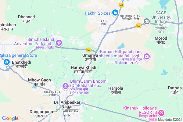
Umariya
Umariya Map
EDIT Map
Add Your House
 ..
..
Current Corona Virus Infected Patients Count in Indore District
| City Name | District Name | Total Covid cases |
|---|---|---|
| Indore District | Indore | 1167 |
| Indore | Indore | 9 |
Locality Name :
Umariya
( उमरिया )
Tehsil Name : Mhow
District : Indore
State : Madhya Pradesh
Division : Indore
Language : Hindi and Urdu
Current Time 11:21 AM
Date: Sunday , Apr 27,2025 (IST)
Time zone: IST (UTC+5:30)
Elevation / Altitude: 577 meters. Above Seal level
Telephone Code / Std Code: 07324
Assembly constituency : Dr. Ambedkar Nagar-Mh assembly constituency
Assembly MLA : Usha Babu Singh Thakur
Lok Sabha constituency : Dhar parliamentary constituency
Parliament MP : CHATTARSINGH DARBAR
Serpanch Name :
Pin Code : 453331
Post Office Name : Rao
Commodities Prices : Mhow Market / Mandi
Umariya Live Weather
Temperature: 35.6 °C
clear sky
Humidity: 17%
Wind : 5.16 mt/sec towards W
StationName : "Pithampur"
observed on 35 Mins Back
Temperature: 35.6 °C
clear sky
Humidity: 17%
Wind : 5.16 mt/sec towards W
StationName : "Pithampur"
observed on 35 Mins Back
Umariya Weather Forecast for Next 5 days
28-04-2025
30.0°C to 38.5°C
clear sky
30.0°C to 38.5°C
clear sky
29-04-2025
27.9°C to 40.3°C
clear sky
27.9°C to 40.3°C
clear sky
30-04-2025
28.3°C to 40.7°C
clear sky, few clouds
28.3°C to 40.7°C
clear sky, few clouds
01-05-2025
27.9°C to 41.1°C
scattered clouds, clear sky
27.9°C to 41.1°C
scattered clouds, clear sky
02-05-2025
27.0°C to 41.0°C
clear sky, few clouds
27.0°C to 41.0°C
clear sky, few clouds
National Highways Reachable To Umariya
Nationa High Way :NH347C
Nationa High Way :NH52
Nationa High Way :NH347C
Nationa High Way :NH52
Rivers Near Umariya
Kanar
Man
Kanar
Man
About Umariya
Correct below Info and add more info about UmariyaUmariya is a Village in Mhow Tehsil in Indore District of Madhya Pradesh State, India. It belongs to Indore Division . It is located 17 KM towards South from District head quarters Indore. 16 KM from Mhow. 212 KM from State capital Bhopal
Umariya Pin code is 453331 and postal head office is Rao .
Pigdamber ( 1 KM ) , Harnyakhedi ( 2 KM ) , Ashok Vatika ( 3 KM ) , Santer ( 3 KM ) , Sonway ( 3 KM ) are the nearby Villages to Umariya. Umariya is surrounded by Mhow Tehsil towards South , Indore Tehsil towards North , Depalpur Tehsil towards North , Sanwer Tehsil towards North .
Rau , Mhow Cantonment , Mhowgaon , Pithampur are the near by Cities to Umariya.
Umariya 2011 Census Details
Umariya Local Language is Hindi. Umariya Village Total population is 3355 and number of houses are 638. Female Population is 48.5%. Village literacy rate is 70.5% and the Female Literacy rate is 31.1%.
Population
| Census Parameter | Census Data |
| Total Population | 3355 |
| Total No of Houses | 638 |
| Female Population % | 48.5 % ( 1626) |
| Total Literacy rate % | 70.5 % ( 2364) |
| Female Literacy rate | 31.1 % ( 1044) |
| Scheduled Tribes Population % | 12.0 % ( 401) |
| Scheduled Caste Population % | 16.8 % ( 565) |
| Working Population % | 33.7 % |
| Child(0 -6) Population by 2011 | 481 |
| Girl Child(0 -6) Population % by 2011 | 52.4 % ( 252) |
Umariya Census More Deatils.
Politics in Umariya
Bharatiya Janata Party , BJP , INC are the major political parties in this area.Polling Stations /Booths near Umariya
1)Tihi2)Nanded
3)Pigadambar
4)Harasola
5)Avalay
HOW TO REACH Umariya
By Rail
Haranya Kheri Rail Way Station , Rau Rail Way Station are the very nearby railway stations to Umariya.Colleges near Umariya
Swami Vivekanand College Of Engineering Datoda ,indore
Address :
Military College Of Telecommunication Engineering,
Address : Military College Of Telecommunication Engineering,
Savnghvi Institute Of Management And Science
Address : Savnghvi Institute Of Management And Science Pigda
Subhdeep College Of Pharmacy
Address : Khasra No. 462, Village Datoda, Indore
Sanghvi Institute Of Management & Science
Address : Pigdamber Pithampur Bypass Roadbehind Indian Insti
Schools near Umariya
Manglam Vidya Niketan Simrol
Address : simrol , mhow , indore , Madhya Pradesh . PIN- 452020 , Post - Kasturbagram
New Velley Acadamy
Address : mhow gaon , mhow , indore , Madhya Pradesh . PIN- 453441 , Post - Mhow
Sanskar Acadamy Hasalpur
Address : hansalpur , mhow , indore , Madhya Pradesh . PIN- 453545
Shri Krisna Vidya Niketan
Address : lalgarh , mhow , indore , Madhya Pradesh . PIN- 453441 , Post - Mhow
Govt Health Centers near Umariya
1) SHC Umariya , SHC Umariya , Umariya ,2) SHC Pigdambar , SHC Pigdambar , Pigdambar ,
3) SHC Rangwasa , SHC Rangwasa , Rangwasa ,
Hospitals in Umariya,Mhow
Mewara Medicare & Eyecare Hospital
102; Mewara Garden; Old AB Road; Kisanganj; Dist. Indore; Mahow; Madhya Pradesh 453441; India
3.2 KM distance Detail
Sampurna Sodani Diagnostic Clinic
102 Mewara Hospital; Mewara Garden; Old AB Road; Kishanganj; Mhow; Mhow; Madhya Pradesh 453441; India
3.2 KM distance Detail
Dr.Piyush Bhargava Ayurvedic Cancer Specialist
1 B; Sai Vihar Colony; Kishanganj; Santer; Madhya Pradesh 453441; India
3.3 KM distance Detail
more ..
Petrol Bunks in Umariya,Mhow
M. P. BOMBAY AUTO SERVICE
UMARIYA; MHOW - INDORE RD;; INDORE; Madhya Pradesh 452001; India
1.4 KM distance Detail
more ..
Colleges in Umariya,Mhow
Sushila Devi Bansal College of Engineering
AB Road; Umaria; Near Rau; Indore; Madhya Pradesh 453331; India
0.4 KM distance Detail
Sushila Devi Bansal College Of Technology
Umaria; A. B. Road; Near Rau; Indore; Madhya Pradesh 484661; India
0.6 KM distance Detail
more ..
Schools in Umariya,Mhow
Government Higher Secondary School ; Umariya
Umariya; Madhya Pradesh 453331; India
0.2 KM distance Detail
Kinder Garten Play School Mhow
b25; Samarth Park; umariya; Mhow; Madhya Pradesh 453331; India
0.4 KM distance Detail
Electronic Shops in Umariya,Mhow
Pathak Computer
4; SAPNA complex near veterinary college A. B road mhow; Indore; Madhya Pradesh 453441; India
1.6 KM distance Detail
Patel Communication
Yadav complex; opposite shani mandir; veterinary college; harniya khedi; Mhow; Madhya Pradesh 453446; India
1.8 KM distance Detail
Super Markets in Umariya,Mhow
Best Choice Super Market
Mhow - Indore Highway; Kishanganj; Mhow; Madhya Pradesh 453441; India
3.2 KM distance Detail
Shradha Kirana Store
24 bhaskarvilla opp. rajput dhaba; Rau; Indore; Madhya Pradesh 453331; India
3.3 KM distance Detail
Police Stations near Umariya,Mhow
Police Chouki
Mahatma Gandhi Road; Dhan Mandi; Gokul Ganj; Hasalpur; Mhow; Madhya Pradesh 453441; India
6.1 KM distance Detail
About Umariya &
History
How to reach Umariya
Tourist Places Near By Umariya
Schools in Umariya
Colleges in Umariya
Temperature & weather of Umariya
places in Umariya
Umariya photos
More Information
How to reach Umariya
Tourist Places Near By Umariya
Schools in Umariya
Colleges in Umariya
Temperature & weather of Umariya
places in Umariya
Umariya photos
More Information
Village Talk
Post News or Events about this Village
Near Cities
Rau 4 KM near
Mhow Cantonment 7 KM near
Mhowgaon 7 KM near
Pithampur 11 KM near
Rau 4 KM near
Mhow Cantonment 7 KM near
Mhowgaon 7 KM near
Pithampur 11 KM near
Near By Taluks
Rau 4 KM near
Mhow 15 KM near
Indore 16 KM near
Depalpur 36 KM near
Rau 4 KM near
Mhow 15 KM near
Indore 16 KM near
Depalpur 36 KM near
Near By Air Ports
Indore Airport 16 KM near
Bhopal Airport 197 KM near
Vadodara Airport 298 KM near
Dabok Airport 331 KM near
Indore Airport 16 KM near
Bhopal Airport 197 KM near
Vadodara Airport 298 KM near
Dabok Airport 331 KM near
Near By Tourist Places
Indore 16 KM near
Maheshwar 57 KM near
Omkareshwar 59 KM near
Ujjain 71 KM near
Ratlam 120 KM near
Indore 16 KM near
Maheshwar 57 KM near
Omkareshwar 59 KM near
Ujjain 71 KM near
Ratlam 120 KM near
Near By Districts
Indore 17 KM near
Dewas 53 KM near
Dhar 55 KM near
Ujjain 71 KM near
Indore 17 KM near
Dewas 53 KM near
Dhar 55 KM near
Ujjain 71 KM near
Near By RailWay Station
Haranya Kheri Rail Way Station 2.5 KM near
Rau Rail Way Station 4.6 KM near
Mhow Rail Way Station 6.3 KM near
Indore Junction Rail Way Station 17 KM near
Dewas Junction Rail Way Station 55 KM near
Haranya Kheri Rail Way Station 2.5 KM near
Rau Rail Way Station 4.6 KM near
Mhow Rail Way Station 6.3 KM near
Indore Junction Rail Way Station 17 KM near
Dewas Junction Rail Way Station 55 KM near