| Home | City Bus | Maps | Villages | Cities | Rail | Tourist Places | School | College | Pin Codes | Corona Cases Count |
| Distance Calculator Bus Services IFSC Codes Trace Mobile Number Weather Search Place Trace IP Available Cash ATM/Banks Locate Polling Booth Report an Error contact People |
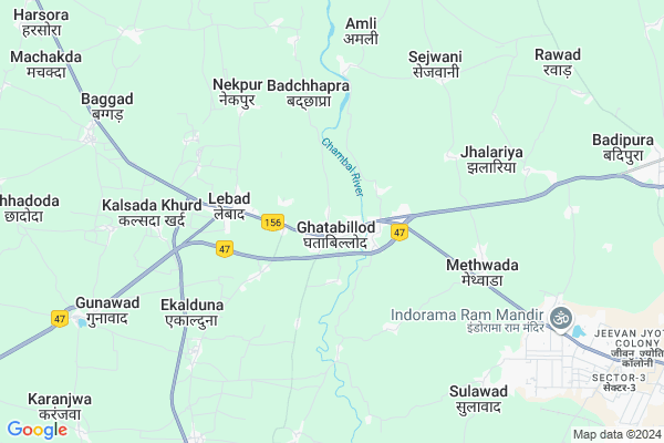
Ghatabillod
Ghatabillod Map
EDIT Map
Add Your House
 ..
..
Current Corona Virus Infected Patients Count in Indore District
| City Name | District Name | Total Covid cases |
|---|---|---|
| Indore District | Indore | 1167 |
| Indore | Indore | 9 |
Locality Name :
Ghatabillod
( घाटाबिल्लौद )
Tehsil Name : Depalpur
District : Indore
State : Madhya Pradesh
Division : Indore
Language : Hindi and Urdu
Current Time 06:02 AM
Date: Saturday , Apr 26,2025 (IST)
Time zone: IST (UTC+5:30)
Elevation / Altitude: 497 meters. Above Seal level
Telephone Code / Std Code: 07322
Assembly constituency : Dhar assembly constituency
Assembly MLA : Neena Vikram Verma
Lok Sabha constituency : Dhar parliamentary constituency
Parliament MP : CHATTARSINGH DARBAR
Serpanch Name :
Pin Code : 454773
Post Office Name : Dehri Ghata Billod
Commodities Prices : Dhar Market / Mandi
Ghatabillod Live Weather
Temperature: 27.8 °C
clear sky
Humidity: 25%
Wind : 4.28 mt/sec towards NW
StationName : "Betma"
observed on 1 Hours Back
Temperature: 27.8 °C
clear sky
Humidity: 25%
Wind : 4.28 mt/sec towards NW
StationName : "Betma"
observed on 1 Hours Back
Ghatabillod Weather Forecast for Next 5 days
27-04-2025
28.0°C to 38.7°C
few clouds, scattered clouds, clear sky
28.0°C to 38.7°C
few clouds, scattered clouds, clear sky
28-04-2025
26.6°C to 39.3°C
clear sky
26.6°C to 39.3°C
clear sky
29-04-2025
26.8°C to 41.0°C
clear sky
26.8°C to 41.0°C
clear sky
30-04-2025
27.4°C to 41.1°C
clear sky, few clouds, scattered clouds
27.4°C to 41.1°C
clear sky, few clouds, scattered clouds
National Highways Reachable To Ghatabillod
Nationa High Way :NH52
Nationa High Way :NH52
Rivers Near Ghatabillod
Gambhir
Mahi
Gambhir
Mahi
About Ghatabillod
Correct below Info and add more info about GhatabillodGhatabillod is a Village in Depalpur Tehsil in Indore District of Madhya Pradesh State, India. It belongs to Indore Division . It is located 43 KM towards west from District head quarters Indore. 22 KM from Depalpur. 240 KM from State capital Bhopal
Ghatabillod Pin code is 454773 and postal head office is Dehri Ghata Billod .
Methwada ( 5 KM ) , Sejwani ( 7 KM ) , Pirpipliya ( 8 KM ) , Shivgarh ( 10 KM ) , Rawad ( 10 KM ) are the nearby Villages to Ghatabillod. Ghatabillod is surrounded by Depalpur Tehsil towards North , Nalchha Tehsil towards South , Mhow Tehsil towards East , Rau Tehsil towards East .
Pithampur , Dhar , Mhowgaon , Nagda are the near by Cities to Ghatabillod.
Ghatabillod 2011 Census Details
Ghatabillod Local Language is Hindi. Ghatabillod Village Total population is 3877 and number of houses are 705. Female Population is 48.7%. Village literacy rate is 53.9% and the Female Literacy rate is 21.3%.
Population
| Census Parameter | Census Data |
| Total Population | 3877 |
| Total No of Houses | 705 |
| Female Population % | 48.7 % ( 1887) |
| Total Literacy rate % | 53.9 % ( 2088) |
| Female Literacy rate | 21.3 % ( 826) |
| Scheduled Tribes Population % | 7.1 % ( 275) |
| Scheduled Caste Population % | 19.4 % ( 752) |
| Working Population % | 42.5 % |
| Child(0 -6) Population by 2011 | 713 |
| Girl Child(0 -6) Population % by 2011 | 49.1 % ( 350) |
Ghatabillod Census More Deatils.
Politics in Ghatabillod
Bharatiya Janata Party , BJP , INC are the major political parties in this area.Polling Stations /Booths near Ghatabillod
1)Kiloli2)Pipalakheda/ Utavad
3)Gobindpura
4)Gunavad
5)Kalamkhedi
HOW TO REACH Ghatabillod
By Rail
There is no railway station near to Ghatabillod in less than 10 km.Colleges near Ghatabillod
Truba College Of Engineering & Technology, Indore
Address : Kailod Kartal Bypass Road, Indore, Madhya Pradesh
Mgm Medical College
Address : Agra Bombay Road Indore-452001
Schools near Ghatabillod
Saraswati Gyan Mandir Vidhyalay
Address : chander , depalpur , indore , Madhya Pradesh . PIN- 123456
Star Mekars Public School
Address : rawad , depalpur , indore , Madhya Pradesh . PIN- 453001 , Post - Betma
Brit Futher Public School
Address : depalpur , depalpur , indore , Madhya Pradesh . PIN- 453115 , Post - Depalpur
New Adarsh Sikcha Niketan
Address : gokulpur , depalpur , indore , Madhya Pradesh . PIN- 453115 , Post - Depalpur
Govt Health Centers near Ghatabillod
1) SHC Amli , SHC Amli , Amli ,2) SHC Ghata Billod , SHC Ghata Billod , Ghata Billod ,
3) SHC Maithwada , SHC Maithwada , Maithwada ,
Hospitals in Ghatabillod,Depalpur
Leabad Bose Clinic
Ghat Bilodh- Ghar Bypass stretch; Lebad; Madhya Pradesh 454773; India
3.9 KM distance Detail
more ..
Petrol Bunks in Ghatabillod,Depalpur
HP PETROL PUMP - GOPAL STORES
Mhow Neemuch Ghatabillod Dist; Indore Rd; Indore; Madhya Pradesh 454773; India
2.0 KM distance Detail
RV Agrawal Indian Oil Pump
NH 59; Indore-Ahmedabad Road; Dhar District; Lebad; Madhya Pradesh 454773; India
3.8 KM distance Detail
more ..
Colleges in Ghatabillod,Depalpur
Science classes betma
Dhar road betma; National Highway 59; Betma; Madhya Pradesh 453001; India
12.4 KM distance Detail
Choithram College Indore
Nh59 dhar road; Indore; Madhya Pradesh 452001; India
17.9 KM distance Detail
ITI Pithampur
Pithampur Industrial Area; Khandwa; Madhya Pradesh 454774; India
19.2 KM distance Detail
more ..
Schools in Ghatabillod,Depalpur
Mateshwari Vidhya Mandir Higher Secondry School
Dehrisaray; Madhya Pradesh 454773; India
0.5 KM distance Detail
Electronic Shops in Ghatabillod,Depalpur
Keshav Madhav Electrical & Electronic
Dehrisaray; Madhya Pradesh 454773; India
0.2 KM distance Detail
Keshav Madhav Electricals & Electronics
bajarag chopal get Malati roads sejawaya; Ghatabillod; Madhya Pradesh; India
0.2 KM distance Detail
Super Markets in Ghatabillod,Depalpur
Sonu Chicken Soap
Mhow-Ghatabillod Rd; Pithampur; Madhya Pradesh 454774; India
0.6 KM distance Detail
ViNAYAK Kirana
Ghat Bilodh- Ghar Bypass stretch; Lebad; Madhya Pradesh 454773; India
3.8 KM distance Detail
Local Parks in Ghatabillod,Depalpur
Ram Krishna Garden
454773; Mhow-Ghatabillod Rd; Pithampur; Madhya Pradesh 454774; India
0.9 KM distance Detail
Keshar Vatika
Depalpur Rd; Kushwah Mohalla; Betma; Madhya Pradesh 453001; India
12.5 KM distance Detail
Police Stations near Ghatabillod,Depalpur
Betma Police Station
National Highway 59; Kushwah Mohalla; Betma; Madhya Pradesh 453001; India
12.5 KM distance Detail
About Ghatabillod &
History
How to reach Ghatabillod
Tourist Places Near By Ghatabillod
Schools in Ghatabillod
Colleges in Ghatabillod
Temperature & weather of Ghatabillod
places in Ghatabillod
Ghatabillod photos
More Information
How to reach Ghatabillod
Tourist Places Near By Ghatabillod
Schools in Ghatabillod
Colleges in Ghatabillod
Temperature & weather of Ghatabillod
places in Ghatabillod
Ghatabillod photos
More Information
Village Talk
Post News or Events about this Village
Near Cities
Pithampur 21 KM near
Dhar 24 KM near
Mhowgaon 28 KM near
Nagda 30 KM near
Pithampur 21 KM near
Dhar 24 KM near
Mhowgaon 28 KM near
Nagda 30 KM near
Near By Taluks
Dhar 17 KM near
Depalpur 20 KM near
Nalchha 24 KM near
Mhow 34 KM near
Dhar 17 KM near
Depalpur 20 KM near
Nalchha 24 KM near
Mhow 34 KM near
Near By Air Ports
Indore Airport 35 KM near
Bhopal Airport 223 KM near
Vadodara Airport 267 KM near
Dabok Airport 304 KM near
Indore Airport 35 KM near
Bhopal Airport 223 KM near
Vadodara Airport 267 KM near
Dabok Airport 304 KM near
Near By Tourist Places
Indore 40 KM near
Maheshwar 62 KM near
Ujjain 70 KM near
Omkareshwar 89 KM near
Ratlam 94 KM near
Indore 40 KM near
Maheshwar 62 KM near
Ujjain 70 KM near
Omkareshwar 89 KM near
Ratlam 94 KM near
Near By Districts
Dhar 25 KM near
Indore 41 KM near
Ujjain 70 KM near
Dewas 71 KM near
Dhar 25 KM near
Indore 41 KM near
Ujjain 70 KM near
Dewas 71 KM near
Near By RailWay Station
Indore Junction Rail Way Station 41 KM near
Ujjain Junction Rail Way Station 70 KM near
Indore Junction Rail Way Station 41 KM near
Ujjain Junction Rail Way Station 70 KM near